![](/images/other/stat-length.png)
- Percorsi
- A piedi
- France
- Grande Est
- Haut-Rhin
- Soultzeren
Soultzeren, Haut-Rhin, A piedi : I migliori sentieri, percorsi e passeggiate
Soultzeren: Scopri i migliori percorsi: 7 a piedi, 131 marcia e 2 camminata nordica. Tutti questi percorsi, itinerari e attività outdoor sono disponibili nelle nostre app SityTrail per smartphone e tablet.
I percorsi migliori (0})
![Percorso Marcia Soultzeren - Tanet-Gazon du faing par lac vert et retour sommet du Tanet - Photo](https://media.geolcdn.com/t/350/260/ed68be74-246f-440b-833e-a0b4a96a4c20.jpg&format=jpg&maxdim=2)
![Marcia Marcia](https://static1.geolcdn.com/sitytour/trail-icons/101.png)
Km
Marcia
![](/images/other/stat-length.png)
![](https://static1.geolcdn.com/siteimages/upload/files/1508320355ic_sort_den_pos_24dp.png)
![](https://static1.geolcdn.com/siteimages/upload/files/1508320355ic_sort_den_neg_24dp.png)
![](https://static1.geolcdn.com/siteimages/upload/files/16400158638029165_repeat_loop_refresh_sync_direction_icon.png)
![Percorso Marcia Soultzeren - 2022-12-27 Marche Soultzeren Lac Forlet Hautes Huttes Glasborn - Photo](https://media.geolcdn.com/t/350/260/f0becfc0-aa32-4eb4-a6d5-1db6af5f7ece.jpg&format=jpg&maxdim=2)
![Marcia Marcia](https://static1.geolcdn.com/sitytour/trail-icons/101.png)
Km
Marcia
![](/images/other/stat-length.png)
![](https://static1.geolcdn.com/siteimages/upload/files/1508320355ic_sort_den_pos_24dp.png)
![](https://static1.geolcdn.com/siteimages/upload/files/1508320355ic_sort_den_neg_24dp.png)
![](https://static1.geolcdn.com/siteimages/upload/files/16400158638029165_repeat_loop_refresh_sync_direction_icon.png)
![Percorso Marcia Soultzeren - Parking du Tanet - Lac des Truites - AR - Photo](https://media.geolcdn.com/t/350/260/ext.jpg?maxdim=2&url=https%3A%2F%2Fstatic1.geolcdn.com%2Fsiteimages%2Fupload%2Ffiles%2F1553511878bg_sport_marche.png)
![Marcia Marcia](https://static1.geolcdn.com/sitytour/trail-icons/101.png)
Km
Marcia
![](/images/other/stat-length.png)
![](https://static1.geolcdn.com/siteimages/upload/files/1508320355ic_sort_den_pos_24dp.png)
![](https://static1.geolcdn.com/siteimages/upload/files/1508320355ic_sort_den_neg_24dp.png)
![](https://static1.geolcdn.com/siteimages/upload/files/16400158638029165_repeat_loop_refresh_sync_direction_icon.png)
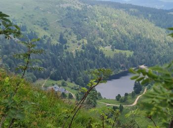
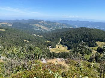
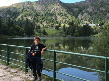
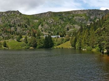
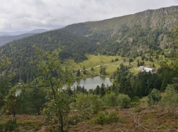
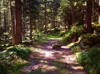
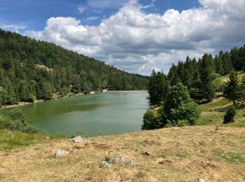
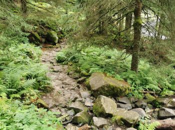
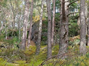
• Parcours boisé. Passage le long du lac Vert. Halte surprenante au refuge du Club Vosgien. Magnifique découverte du ci...
![Percorso Marcia Soultzeren - Soultzeren 4 lacs blanc vert noir truites 17kms 722m - Photo](https://media.geolcdn.com/t/350/260/ff5bb41d-b17c-4379-b46b-b1bb5c470910.jpg&format=jpg&maxdim=2)
![Marcia Marcia](https://static1.geolcdn.com/sitytour/trail-icons/101.png)
Km
Marcia
![](/images/other/stat-length.png)
![](https://static1.geolcdn.com/siteimages/upload/files/1508320355ic_sort_den_pos_24dp.png)
![](https://static1.geolcdn.com/siteimages/upload/files/1508320355ic_sort_den_neg_24dp.png)
![](https://static1.geolcdn.com/siteimages/upload/files/16400158638029165_repeat_loop_refresh_sync_direction_icon.png)
![Percorso Marcia Soultzeren - Lac Vert, lac du Forlet - Photo](https://media.geolcdn.com/t/350/260/61a8b097-66dd-4807-9168-c2638af6823c.jpg&format=jpg&maxdim=2)
![Marcia Marcia](https://static1.geolcdn.com/sitytour/trail-icons/101.png)
Km
Marcia
![](/images/other/stat-length.png)
![](https://static1.geolcdn.com/siteimages/upload/files/1508320355ic_sort_den_pos_24dp.png)
![](https://static1.geolcdn.com/siteimages/upload/files/1508320355ic_sort_den_neg_24dp.png)
![](https://static1.geolcdn.com/siteimages/upload/files/16400158638029165_repeat_loop_refresh_sync_direction_icon.png)
![Percorso Marcia Soultzeren - Rando des APAVIENS..28/06/2024 - Photo](https://media.geolcdn.com/t/350/260/198b043c-d98a-44e6-a519-01361735ed49.jpg&format=jpg&maxdim=2)
![Marcia Marcia](https://static1.geolcdn.com/sitytour/trail-icons/101.png)
Km
Marcia
![](/images/other/stat-length.png)
![](https://static1.geolcdn.com/siteimages/upload/files/1508320355ic_sort_den_pos_24dp.png)
![](https://static1.geolcdn.com/siteimages/upload/files/1508320355ic_sort_den_neg_24dp.png)
![](https://static1.geolcdn.com/siteimages/upload/files/16400158638029165_repeat_loop_refresh_sync_direction_icon.png)
![Percorso Marcia Soultzeren - 2023-09-17_07h45m18_Circuit des Quatre Lacs Lac Vert - Lac des Truites - Lac Noir - Lac Blanc-1 - Photo](https://media.geolcdn.com/t/350/260/ext.jpg?maxdim=2&url=https%3A%2F%2Fstatic1.geolcdn.com%2Fsiteimages%2Fupload%2Ffiles%2F1553511878bg_sport_marche.png)
![Marcia Marcia](https://static1.geolcdn.com/sitytour/trail-icons/101.png)
Km
Marcia
![](/images/other/stat-length.png)
![](https://static1.geolcdn.com/siteimages/upload/files/1508320355ic_sort_den_pos_24dp.png)
![](https://static1.geolcdn.com/siteimages/upload/files/1508320355ic_sort_den_neg_24dp.png)
![](https://static1.geolcdn.com/siteimages/upload/files/16400158638029165_repeat_loop_refresh_sync_direction_icon.png)
![Percorso Marcia Soultzeren - Tanet-Gazon du Fain-Tanet - Photo](https://media.geolcdn.com/t/350/260/fbc3d179-d09a-4b86-8f06-8da3f0d2090a.jpg&format=jpg&maxdim=2)
![Marcia Marcia](https://static1.geolcdn.com/sitytour/trail-icons/101.png)
Km
Marcia
![](/images/other/stat-length.png)
![](https://static1.geolcdn.com/siteimages/upload/files/1508320355ic_sort_den_pos_24dp.png)
![](https://static1.geolcdn.com/siteimages/upload/files/1508320355ic_sort_den_neg_24dp.png)
![](https://static1.geolcdn.com/siteimages/upload/files/16400158638029165_repeat_loop_refresh_sync_direction_icon.png)
![Percorso Marcia Soultzeren - Lac du forlet / lac noir - Photo](https://media.geolcdn.com/t/350/260/68e8c743-032f-4429-9718-85399438261b.jpg&format=jpg&maxdim=2)
![Marcia Marcia](https://static1.geolcdn.com/sitytour/trail-icons/101.png)
Km
Marcia
![](/images/other/stat-length.png)
![](https://static1.geolcdn.com/siteimages/upload/files/1508320355ic_sort_den_pos_24dp.png)
![](https://static1.geolcdn.com/siteimages/upload/files/1508320355ic_sort_den_neg_24dp.png)
![](https://static1.geolcdn.com/siteimages/upload/files/16400158638029165_repeat_loop_refresh_sync_direction_icon.png)
![Percorso Marcia Soultzeren - Lac des Truites - Sentier du Neunlist - Photo](https://media.geolcdn.com/t/350/260/d696f058-c5f0-4a46-b9db-b03c2d042e9d.jpg&format=jpg&maxdim=2)
![Marcia Marcia](https://static1.geolcdn.com/sitytour/trail-icons/101.png)
Km
Marcia
![](/images/other/stat-length.png)
![](https://static1.geolcdn.com/siteimages/upload/files/1508320355ic_sort_den_pos_24dp.png)
![](https://static1.geolcdn.com/siteimages/upload/files/1508320355ic_sort_den_neg_24dp.png)
![](https://static1.geolcdn.com/siteimages/upload/files/16400158638029165_repeat_loop_refresh_sync_direction_icon.png)
![Percorso Marcia Soultzeren - Petit tour des 4 lacs - Photo](https://media.geolcdn.com/t/350/260/1b4c4562-c0a6-4c85-afc9-a7eb133660ed.jpg&format=jpg&maxdim=2)
![Marcia Marcia](https://static1.geolcdn.com/sitytour/trail-icons/101.png)
Km
Marcia
![](/images/other/stat-length.png)
![](https://static1.geolcdn.com/siteimages/upload/files/1508320355ic_sort_den_pos_24dp.png)
![](https://static1.geolcdn.com/siteimages/upload/files/1508320355ic_sort_den_neg_24dp.png)
![](https://static1.geolcdn.com/siteimages/upload/files/16400158638029165_repeat_loop_refresh_sync_direction_icon.png)
![Percorso Marcia Soultzeren - Les 4 lacs entre le Tanet et le col du Calvaire - Photo](https://media.geolcdn.com/t/350/260/4fffcef0-b440-40e3-a57a-ecdb8dbf3cdd.jpg&format=jpg&maxdim=2)
![Marcia Marcia](https://static1.geolcdn.com/sitytour/trail-icons/101.png)
Km
Marcia
![](/images/other/stat-length.png)
![](https://static1.geolcdn.com/siteimages/upload/files/1508320355ic_sort_den_pos_24dp.png)
![](https://static1.geolcdn.com/siteimages/upload/files/1508320355ic_sort_den_neg_24dp.png)
![](https://static1.geolcdn.com/siteimages/upload/files/16400158638029165_repeat_loop_refresh_sync_direction_icon.png)
![Percorso Marcia Soultzeren - Lac Vert - Lac Forlet Sity - Photo](https://media.geolcdn.com/t/350/260/0390d887-a475-46ee-bdaa-45a8bd63aa41.jpg&format=jpg&maxdim=2)
![Marcia Marcia](https://static1.geolcdn.com/sitytour/trail-icons/101.png)
Km
Marcia
![](/images/other/stat-length.png)
![](https://static1.geolcdn.com/siteimages/upload/files/1508320355ic_sort_den_pos_24dp.png)
![](https://static1.geolcdn.com/siteimages/upload/files/1508320355ic_sort_den_neg_24dp.png)
![](https://static1.geolcdn.com/siteimages/upload/files/16400158638029165_repeat_loop_refresh_sync_direction_icon.png)
![Percorso Marcia Soultzeren - Boucle Schildmatt / Lac vert / Auberge du Tanet - Photo](https://media.geolcdn.com/t/350/260/4ff3fbd9-7950-4786-a772-7daff24c47a5.jpg&format=jpg&maxdim=2)
![Marcia Marcia](https://static1.geolcdn.com/sitytour/trail-icons/101.png)
Km
Marcia
![](/images/other/stat-length.png)
![](https://static1.geolcdn.com/siteimages/upload/files/1508320355ic_sort_den_pos_24dp.png)
![](https://static1.geolcdn.com/siteimages/upload/files/1508320355ic_sort_den_neg_24dp.png)
![](https://static1.geolcdn.com/siteimages/upload/files/16400158638029165_repeat_loop_refresh_sync_direction_icon.png)
![Percorso Marcia Soultzeren - Tour des Lacs - La Bresse - Photo](https://media.geolcdn.com/t/350/260/ext.jpg?maxdim=2&url=https%3A%2F%2Fservices.sitytrail.com%2FGeolivesWS%2FDownloadMedia.ashx%3FTrailID%3D107230%26Media%3D12097_6.jpg)
![Marcia Marcia](https://static1.geolcdn.com/sitytour/trail-icons/101.png)
Km
Marcia
![](/images/other/stat-length.png)
![](https://static1.geolcdn.com/siteimages/upload/files/1508320355ic_sort_den_pos_24dp.png)
![](https://static1.geolcdn.com/siteimages/upload/files/1508320355ic_sort_den_neg_24dp.png)
![](https://static1.geolcdn.com/siteimages/upload/files/16400158638029165_repeat_loop_refresh_sync_direction_icon.png)
![Percorso Marcia Soultzeren - Lac de Forlet Hohrodberg - Photo](https://media.geolcdn.com/t/350/260/c0b0f1ea-d3ea-4c53-8ae6-2913d15ad80b.jpg&format=jpg&maxdim=2)
![Marcia Marcia](https://static1.geolcdn.com/sitytour/trail-icons/101.png)
Km
Marcia
![](/images/other/stat-length.png)
![](https://static1.geolcdn.com/siteimages/upload/files/1508320355ic_sort_den_pos_24dp.png)
![](https://static1.geolcdn.com/siteimages/upload/files/1508320355ic_sort_den_neg_24dp.png)
![](https://static1.geolcdn.com/siteimages/upload/files/16400158638029165_repeat_loop_refresh_sync_direction_icon.png)
![Percorso Marcia Soultzeren - Parking Tanet Le Vorlet retour - Photo](https://media.geolcdn.com/t/350/260/2f0e4694-64f3-489e-8228-caaddc4fb158.jpg&format=jpg&maxdim=2)
![Marcia Marcia](https://static1.geolcdn.com/sitytour/trail-icons/101.png)
Km
Marcia
![](/images/other/stat-length.png)
![](https://static1.geolcdn.com/siteimages/upload/files/1508320355ic_sort_den_pos_24dp.png)
![](https://static1.geolcdn.com/siteimages/upload/files/1508320355ic_sort_den_neg_24dp.png)
![](https://static1.geolcdn.com/siteimages/upload/files/16400158638029165_repeat_loop_refresh_sync_direction_icon.png)
![Percorso Marcia Soultzeren - Lac vert forlet - Photo](https://media.geolcdn.com/t/350/260/68d04a73-20f8-4ba4-9ea3-c5f49db8fbcc.jpg&format=jpg&maxdim=2)
![Marcia Marcia](https://static1.geolcdn.com/sitytour/trail-icons/101.png)
Km
Marcia
![](/images/other/stat-length.png)
![](https://static1.geolcdn.com/siteimages/upload/files/1508320355ic_sort_den_pos_24dp.png)
![](https://static1.geolcdn.com/siteimages/upload/files/1508320355ic_sort_den_neg_24dp.png)
![](https://static1.geolcdn.com/siteimages/upload/files/16400158638029165_repeat_loop_refresh_sync_direction_icon.png)
![Percorso Marcia Soultzeren - lac vert, lac du forlet - Photo](https://media.geolcdn.com/t/350/260/8e67d5cb-f1c8-4aa9-852f-f105ce332871.jpg&format=jpg&maxdim=2)
![Marcia Marcia](https://static1.geolcdn.com/sitytour/trail-icons/101.png)
Km
Marcia
![](/images/other/stat-length.png)
![](https://static1.geolcdn.com/siteimages/upload/files/1508320355ic_sort_den_pos_24dp.png)
![](https://static1.geolcdn.com/siteimages/upload/files/1508320355ic_sort_den_neg_24dp.png)
![](https://static1.geolcdn.com/siteimages/upload/files/16400158638029165_repeat_loop_refresh_sync_direction_icon.png)
![Percorso Marcia Soultzeren - Glasborn Tour du linge - Photo](https://media.geolcdn.com/t/350/260/91c287bc-d214-41a4-9e72-62fbbc7634d4.jpg&format=jpg&maxdim=2)
![Marcia Marcia](https://static1.geolcdn.com/sitytour/trail-icons/101.png)
Km
Marcia
![](/images/other/stat-length.png)
![](https://static1.geolcdn.com/siteimages/upload/files/1508320355ic_sort_den_pos_24dp.png)
![](https://static1.geolcdn.com/siteimages/upload/files/1508320355ic_sort_den_neg_24dp.png)
![](https://static1.geolcdn.com/siteimages/upload/files/16400158638029165_repeat_loop_refresh_sync_direction_icon.png)
20 percorsi visualizzati su 140
Applicazione GPS da escursionismo GRATUITA