![](/images/other/stat-length.png)
- Percorsi
- A piedi
- Germany
- Renania-Palatinato
- Landkreis Südliche Weinstraße
- Annweiler am Trifels
Annweiler am Trifels, Landkreis Südliche Weinstraße, A piedi : I migliori sentieri, percorsi e passeggiate
Annweiler am Trifels: Scopri i migliori percorsi: 9 a piedi. Tutti questi percorsi, itinerari e attività outdoor sono disponibili nelle nostre app SityTrail per smartphone e tablet.
I percorsi migliori (0})
![Percorso A piedi Annweiler am Trifels - Rinnthal Höhenweg - Photo](https://media.geolcdn.com/t/350/260/4bac0467-12b4-4c92-b907-c762fdaccc68.jpeg&format=jpg&maxdim=2)
![A piedi A piedi](https://static1.geolcdn.com/sitytour/trail-icons/100.png)
Km
A piedi
![](/images/other/stat-length.png)
![](https://static1.geolcdn.com/siteimages/upload/files/1508320355ic_sort_den_pos_24dp.png)
![](https://static1.geolcdn.com/siteimages/upload/files/1508320355ic_sort_den_neg_24dp.png)
![](https://static1.geolcdn.com/siteimages/upload/files/16400158638029165_repeat_loop_refresh_sync_direction_icon.png)
• Symbol: Weiße Felsen-Silhouette auf blaum Grund
![Percorso A piedi Annweiler am Trifels - Kaiser-Friedrich-Weg - Photo](https://media.geolcdn.com/t/350/260/a938a1e5-fb59-4bcc-91dd-a7f4cd745e4c.jpeg&format=jpg&maxdim=2)
![A piedi A piedi](https://static1.geolcdn.com/sitytour/trail-icons/100.png)
Km
A piedi
![](/images/other/stat-length.png)
![](https://static1.geolcdn.com/siteimages/upload/files/1508320355ic_sort_den_pos_24dp.png)
![](https://static1.geolcdn.com/siteimages/upload/files/1508320355ic_sort_den_neg_24dp.png)
![](https://static1.geolcdn.com/siteimages/upload/files/16400158638029165_repeat_loop_refresh_sync_direction_icon.png)
• Trail created by Annweiler Tourismus. Symbol: gelb-braun mit Krone
![Percorso A piedi Annweiler am Trifels - Annweilerer Burgenweg - Photo](https://media.geolcdn.com/t/350/260/df65829b-6de0-448e-8ac8-6197fea3a905.jpeg&format=jpg&maxdim=2)
![A piedi A piedi](https://static1.geolcdn.com/sitytour/trail-icons/100.png)
Km
A piedi
![](/images/other/stat-length.png)
![](https://static1.geolcdn.com/siteimages/upload/files/1508320355ic_sort_den_pos_24dp.png)
![](https://static1.geolcdn.com/siteimages/upload/files/1508320355ic_sort_den_neg_24dp.png)
![](https://static1.geolcdn.com/siteimages/upload/files/16400158638029165_repeat_loop_refresh_sync_direction_icon.png)
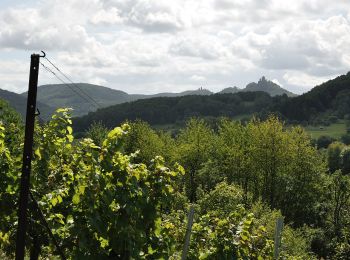
• Trail created by Verein Südliche Weinstraße Annweiler am Trifels.
![Percorso A piedi Annweiler am Trifels - Spirkelbacher Höhenweg - Photo](https://media.geolcdn.com/t/350/260/a1593497-8447-4a1a-96b6-6f6712de8378.jpeg&format=jpg&maxdim=2)
![A piedi A piedi](https://static1.geolcdn.com/sitytour/trail-icons/100.png)
Km
A piedi
![](/images/other/stat-length.png)
![](https://static1.geolcdn.com/siteimages/upload/files/1508320355ic_sort_den_pos_24dp.png)
![](https://static1.geolcdn.com/siteimages/upload/files/1508320355ic_sort_den_neg_24dp.png)
![](https://static1.geolcdn.com/siteimages/upload/files/16400158638029165_repeat_loop_refresh_sync_direction_icon.png)
• Symbol: Weiße Felsen-Silhouette auf rotem Grund
![Percorso A piedi Annweiler am Trifels - Burgunderweg - Photo](https://media.geolcdn.com/t/350/260/02d5aa06-3cf2-4766-baf6-35b1820b584d.jpeg&format=jpg&maxdim=2)
![A piedi A piedi](https://static1.geolcdn.com/sitytour/trail-icons/100.png)
Km
A piedi
![](/images/other/stat-length.png)
![](https://static1.geolcdn.com/siteimages/upload/files/1508320355ic_sort_den_pos_24dp.png)
![](https://static1.geolcdn.com/siteimages/upload/files/1508320355ic_sort_den_neg_24dp.png)
![](https://static1.geolcdn.com/siteimages/upload/files/16400158638029165_repeat_loop_refresh_sync_direction_icon.png)
• Trail created by Trifelsland. Symbol: Roter Mönch mit Weinglas und Reben auf weißem Grund
![Percorso A piedi Annweiler am Trifels - Wildsauweg - Photo](https://media.geolcdn.com/t/350/260/02d5aa06-3cf2-4766-baf6-35b1820b584d.jpeg&format=jpg&maxdim=2)
![A piedi A piedi](https://static1.geolcdn.com/sitytour/trail-icons/100.png)
Km
A piedi
![](/images/other/stat-length.png)
![](https://static1.geolcdn.com/siteimages/upload/files/1508320355ic_sort_den_pos_24dp.png)
![](https://static1.geolcdn.com/siteimages/upload/files/1508320355ic_sort_den_neg_24dp.png)
![](https://static1.geolcdn.com/siteimages/upload/files/16400158638029165_repeat_loop_refresh_sync_direction_icon.png)
• Symbol: two brown boars on green grass on white background
![Percorso A piedi Annweiler am Trifels - Pfälzerwald Weißer Punkt (Gräfenhausen-Rinnthal) - Photo](https://media.geolcdn.com/t/350/260/02d5aa06-3cf2-4766-baf6-35b1820b584d.jpeg&format=jpg&maxdim=2)
![A piedi A piedi](https://static1.geolcdn.com/sitytour/trail-icons/100.png)
Km
A piedi
![](/images/other/stat-length.png)
![](https://static1.geolcdn.com/siteimages/upload/files/1508320355ic_sort_den_pos_24dp.png)
![](https://static1.geolcdn.com/siteimages/upload/files/1508320355ic_sort_den_neg_24dp.png)
![](https://static1.geolcdn.com/siteimages/upload/files/16400158638029165_repeat_loop_refresh_sync_direction_icon.png)
• Trail created by Pfälzerwald-Verein. Symbol: weißer Punkt
![Percorso A piedi Annweiler am Trifels - Rundwanderweg Forsthaus Annweiler 5 - Photo](https://media.geolcdn.com/t/350/260/ext.jpg?maxdim=2&url=https%3A%2F%2Fstatic1.geolcdn.com%2Fsiteimages%2Fupload%2Ffiles%2F1545311037marcheuse_200dpi.jpg)
![A piedi A piedi](https://static1.geolcdn.com/sitytour/trail-icons/100.png)
Km
A piedi
![](/images/other/stat-length.png)
![](https://static1.geolcdn.com/siteimages/upload/files/1508320355ic_sort_den_pos_24dp.png)
![](https://static1.geolcdn.com/siteimages/upload/files/1508320355ic_sort_den_neg_24dp.png)
![](https://static1.geolcdn.com/siteimages/upload/files/16400158638029165_repeat_loop_refresh_sync_direction_icon.png)
• Symbol: Schwarze 5 in weißem Kreis
![Percorso A piedi Annweiler am Trifels - Rundwanderweg Forsthaus Annweiler 3 - Photo](https://media.geolcdn.com/t/350/260/ext.jpg?maxdim=2&url=https%3A%2F%2Fstatic1.geolcdn.com%2Fsiteimages%2Fupload%2Ffiles%2F1545311037marcheuse_200dpi.jpg)
![A piedi A piedi](https://static1.geolcdn.com/sitytour/trail-icons/100.png)
Km
A piedi
![](/images/other/stat-length.png)
![](https://static1.geolcdn.com/siteimages/upload/files/1508320355ic_sort_den_pos_24dp.png)
![](https://static1.geolcdn.com/siteimages/upload/files/1508320355ic_sort_den_neg_24dp.png)
![](https://static1.geolcdn.com/siteimages/upload/files/16400158638029165_repeat_loop_refresh_sync_direction_icon.png)
• Symbol: Schwarze 3 in weißem Kreis
9 percorsi visualizzati su 9
Applicazione GPS da escursionismo GRATUITA