![](/images/other/stat-length.png)
Braubach, Rhein-Lahn-Kreis, A piedi : I migliori sentieri, percorsi e passeggiate
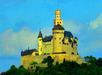
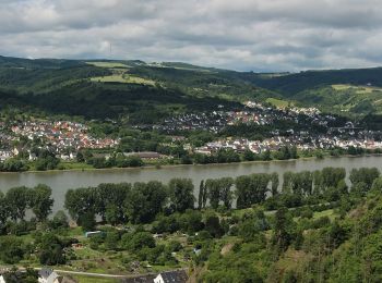
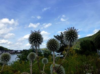
Braubach: Scopri i migliori percorsi: 9 a piedi. Tutti questi percorsi, itinerari e attività outdoor sono disponibili nelle nostre app SityTrail per smartphone e tablet.
I percorsi migliori (0})
![Percorso A piedi Braubach - Rundwanderweg Buchenweg Braubach - Photo](https://media.geolcdn.com/t/350/260/c27dfe35-82f6-4c02-82d8-7abf0a82d086.jpeg&format=jpg&maxdim=2)
![A piedi A piedi](https://static1.geolcdn.com/sitytour/trail-icons/100.png)
Km
A piedi
![](/images/other/stat-length.png)
![](https://static1.geolcdn.com/siteimages/upload/files/1508320355ic_sort_den_pos_24dp.png)
![](https://static1.geolcdn.com/siteimages/upload/files/1508320355ic_sort_den_neg_24dp.png)
![](https://static1.geolcdn.com/siteimages/upload/files/16400158638029165_repeat_loop_refresh_sync_direction_icon.png)
• Symbol: Hellgrünes aufrechtstehendes Buchenblatt mit Stiel
![Percorso A piedi Braubach - Rundwanderweg Braubach: B1 Kerkerts-Oberhohl-Schlierbachtal - Photo](https://media.geolcdn.com/t/350/260/a243512b-c818-48e4-9ce7-76c3d40ba99c.jpeg&format=jpg&maxdim=2)
![A piedi A piedi](https://static1.geolcdn.com/sitytour/trail-icons/100.png)
Km
A piedi
![](/images/other/stat-length.png)
![](https://static1.geolcdn.com/siteimages/upload/files/1508320355ic_sort_den_pos_24dp.png)
![](https://static1.geolcdn.com/siteimages/upload/files/1508320355ic_sort_den_neg_24dp.png)
![](https://static1.geolcdn.com/siteimages/upload/files/16400158638029165_repeat_loop_refresh_sync_direction_icon.png)
• Trail created by Forstrevier Braubach - Forstamt Lahnstein. Symbol: blaues "B1" auf weißem Grund.
![Percorso A piedi Braubach - Rundwanderweg Panoramaweg Braubach - Photo](https://media.geolcdn.com/t/350/260/796bd870-e05e-4ab5-8f33-3b442e1e4672.jpeg&format=jpg&maxdim=2)
![A piedi A piedi](https://static1.geolcdn.com/sitytour/trail-icons/100.png)
Km
A piedi
![](/images/other/stat-length.png)
![](https://static1.geolcdn.com/siteimages/upload/files/1508320355ic_sort_den_pos_24dp.png)
![](https://static1.geolcdn.com/siteimages/upload/files/1508320355ic_sort_den_neg_24dp.png)
![](https://static1.geolcdn.com/siteimages/upload/files/16400158638029165_repeat_loop_refresh_sync_direction_icon.png)
• Symbol: Dunkle orange Sonne mit Strahlen auf weißem Grund
![Percorso A piedi Braubach - Rundwanderweg Grubenweg (Bergwerkswanderweg) Braubach - Photo](https://media.geolcdn.com/t/350/260/796bd870-e05e-4ab5-8f33-3b442e1e4672.jpeg&format=jpg&maxdim=2)
![A piedi A piedi](https://static1.geolcdn.com/sitytour/trail-icons/100.png)
Km
A piedi
![](/images/other/stat-length.png)
![](https://static1.geolcdn.com/siteimages/upload/files/1508320355ic_sort_den_pos_24dp.png)
![](https://static1.geolcdn.com/siteimages/upload/files/1508320355ic_sort_den_neg_24dp.png)
![](https://static1.geolcdn.com/siteimages/upload/files/16400158638029165_repeat_loop_refresh_sync_direction_icon.png)
• Symbol: symbolisierte schwarze Lore auf weißem Grund (Schienenfahrzeug zum Transport und abkippen von Schüttgut)
![Percorso A piedi Braubach - Rundwanderweg Burgenweg Braubach - Photo](https://media.geolcdn.com/t/350/260/e6fd4102-f5e1-435b-bcfc-936c935ad7a7.jpeg&format=jpg&maxdim=2)
![A piedi A piedi](https://static1.geolcdn.com/sitytour/trail-icons/100.png)
Km
A piedi
![](/images/other/stat-length.png)
![](https://static1.geolcdn.com/siteimages/upload/files/1508320355ic_sort_den_pos_24dp.png)
![](https://static1.geolcdn.com/siteimages/upload/files/1508320355ic_sort_den_neg_24dp.png)
![](https://static1.geolcdn.com/siteimages/upload/files/16400158638029165_repeat_loop_refresh_sync_direction_icon.png)
• Dieser Rundwanderweg wurde original nach der Wegbeschreibung der Quelle angelegt (2019-12-08). Symbol: blaues Quadra...
![Percorso A piedi Braubach - Rundwanderweg Braubach: B7 Dinkholder Tal-Martinskapelle - Photo](https://media.geolcdn.com/t/350/260/f85ff589-f3ed-47ed-a3bd-a7d6b1f70528.jpeg&format=jpg&maxdim=2)
![A piedi A piedi](https://static1.geolcdn.com/sitytour/trail-icons/100.png)
Km
A piedi
![](/images/other/stat-length.png)
![](https://static1.geolcdn.com/siteimages/upload/files/1508320355ic_sort_den_pos_24dp.png)
![](https://static1.geolcdn.com/siteimages/upload/files/1508320355ic_sort_den_neg_24dp.png)
![](https://static1.geolcdn.com/siteimages/upload/files/16400158638029165_repeat_loop_refresh_sync_direction_icon.png)
• Trail created by Forstrevier Braubach - Forstamt Lahnstein. Symbol: gelbes "B7" auf weißem Grund.
![Percorso A piedi Braubach - Rundwanderweg Braubach: B6 Salzborn-Spalt-Luginsland - Photo](https://media.geolcdn.com/t/350/260/c27dfe35-82f6-4c02-82d8-7abf0a82d086.jpeg&format=jpg&maxdim=2)
![A piedi A piedi](https://static1.geolcdn.com/sitytour/trail-icons/100.png)
Km
A piedi
![](/images/other/stat-length.png)
![](https://static1.geolcdn.com/siteimages/upload/files/1508320355ic_sort_den_pos_24dp.png)
![](https://static1.geolcdn.com/siteimages/upload/files/1508320355ic_sort_den_neg_24dp.png)
![](https://static1.geolcdn.com/siteimages/upload/files/16400158638029165_repeat_loop_refresh_sync_direction_icon.png)
• Trail created by Forstrevier Braubach - Forstamt Lahnstein. Symbol: violette "B6" auf weißem Grund.
![Percorso A piedi Braubach - Rundwanderweg Braubach: B5 Pankert-Ermenstiel-Drei Kamine - Photo](https://media.geolcdn.com/t/350/260/f85ff589-f3ed-47ed-a3bd-a7d6b1f70528.jpeg&format=jpg&maxdim=2)
![A piedi A piedi](https://static1.geolcdn.com/sitytour/trail-icons/100.png)
Km
A piedi
![](/images/other/stat-length.png)
![](https://static1.geolcdn.com/siteimages/upload/files/1508320355ic_sort_den_pos_24dp.png)
![](https://static1.geolcdn.com/siteimages/upload/files/1508320355ic_sort_den_neg_24dp.png)
![](https://static1.geolcdn.com/siteimages/upload/files/16400158638029165_repeat_loop_refresh_sync_direction_icon.png)
• Trail created by Forstrevier Braubach - Forstamt Lahnstein. Symbol: orangenes "B5" auf weißem Grund.
![Percorso A piedi Braubach - Rheinsteig [Braubach - Kramp-Bornhofen] - Photo](https://media.geolcdn.com/t/350/260/ext.jpg?maxdim=2&url=https%3A%2F%2Fstatic1.geolcdn.com%2Fsiteimages%2Fupload%2Ffiles%2F1545311037marcheuse_200dpi.jpg)
![A piedi A piedi](https://static1.geolcdn.com/sitytour/trail-icons/100.png)
Km
A piedi
![](/images/other/stat-length.png)
![](https://static1.geolcdn.com/siteimages/upload/files/1508320355ic_sort_den_pos_24dp.png)
![](https://static1.geolcdn.com/siteimages/upload/files/1508320355ic_sort_den_neg_24dp.png)
![](https://static1.geolcdn.com/siteimages/upload/files/16400158638029165_repeat_loop_refresh_sync_direction_icon.png)
9 percorsi visualizzati su 9
Applicazione GPS da escursionismo GRATUITA