![](/images/other/stat-length.png)
Roetgen, Städteregion Aachen, A piedi : I migliori sentieri, percorsi e passeggiate
Roetgen: Scopri i migliori percorsi: 10 a piedi, 10 marcia e 1 camminata nordica. Tutti questi percorsi, itinerari e attività outdoor sono disponibili nelle nostre app SityTrail per smartphone e tablet.
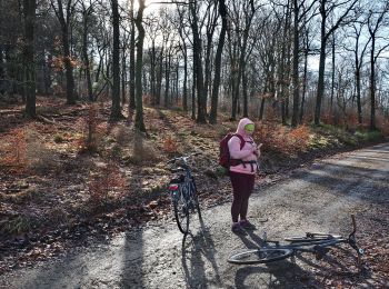
I percorsi migliori (0})
![Percorso A piedi Roetgen - Hahner Straße Rundweg A2 - Photo](https://media.geolcdn.com/t/350/260/ext.jpg?maxdim=2&url=https%3A%2F%2Fmedia.geolcdn.com%2Ff%2Fe319a090-49eb-475c-8cdf-c884ac2bc115.jpeg)
![A piedi A piedi](https://static1.geolcdn.com/sitytour/trail-icons/100.png)
Km
A piedi
![](/images/other/stat-length.png)
![](https://static1.geolcdn.com/siteimages/upload/files/1508320355ic_sort_den_pos_24dp.png)
![](https://static1.geolcdn.com/siteimages/upload/files/1508320355ic_sort_den_neg_24dp.png)
![](https://static1.geolcdn.com/siteimages/upload/files/16400158638029165_repeat_loop_refresh_sync_direction_icon.png)
• Symbol: A2
![Percorso A piedi Roetgen - Kall-Rur-Panorama-Route - Photo](https://media.geolcdn.com/t/350/260/ext.jpg?maxdim=2&url=https%3A%2F%2Fmedia.geolcdn.com%2Ff%2F79cfdf58-b035-4b32-b417-7c994ebf268e.jpeg)
![A piedi A piedi](https://static1.geolcdn.com/sitytour/trail-icons/100.png)
Km
A piedi
![](/images/other/stat-length.png)
![](https://static1.geolcdn.com/siteimages/upload/files/1508320355ic_sort_den_pos_24dp.png)
![](https://static1.geolcdn.com/siteimages/upload/files/1508320355ic_sort_den_neg_24dp.png)
![](https://static1.geolcdn.com/siteimages/upload/files/16400158638029165_repeat_loop_refresh_sync_direction_icon.png)
• Symbol: green:green:blue_bar:KRP:white
![Percorso A piedi Roetgen - Rott Rundweg A3 - Photo](https://media.geolcdn.com/t/350/260/ext.jpg?maxdim=2&url=https%3A%2F%2Fmedia.geolcdn.com%2Ff%2F68d54c01-37fc-4225-b77f-3c3692b6e11c.jpeg)
![A piedi A piedi](https://static1.geolcdn.com/sitytour/trail-icons/100.png)
Km
A piedi
![](/images/other/stat-length.png)
![](https://static1.geolcdn.com/siteimages/upload/files/1508320355ic_sort_den_pos_24dp.png)
![](https://static1.geolcdn.com/siteimages/upload/files/1508320355ic_sort_den_neg_24dp.png)
![](https://static1.geolcdn.com/siteimages/upload/files/16400158638029165_repeat_loop_refresh_sync_direction_icon.png)
• Symbol: weisses A3 auf natur (teilweise auf schwarz)
![Percorso A piedi Roetgen - Struffelt-Route (Eifel) - Photo](https://media.geolcdn.com/t/350/260/ext.jpg?maxdim=2&url=https%3A%2F%2Fmedia.geolcdn.com%2Ff%2Fe319a090-49eb-475c-8cdf-c884ac2bc115.jpeg)
![A piedi A piedi](https://static1.geolcdn.com/sitytour/trail-icons/100.png)
Km
A piedi
![](/images/other/stat-length.png)
![](https://static1.geolcdn.com/siteimages/upload/files/1508320355ic_sort_den_pos_24dp.png)
![](https://static1.geolcdn.com/siteimages/upload/files/1508320355ic_sort_den_neg_24dp.png)
![](https://static1.geolcdn.com/siteimages/upload/files/16400158638029165_repeat_loop_refresh_sync_direction_icon.png)
• Symbol: blue wave on green square
![Percorso A piedi Roetgen - Dorfrundgang Roetgen - Photo](https://media.geolcdn.com/t/350/260/ext.jpg?maxdim=2&url=https%3A%2F%2Fmedia.geolcdn.com%2Ff%2F6f9b91f1-4d12-490b-8774-c1691acc9755.jpeg)
![A piedi A piedi](https://static1.geolcdn.com/sitytour/trail-icons/100.png)
Km
A piedi
![](/images/other/stat-length.png)
![](https://static1.geolcdn.com/siteimages/upload/files/1508320355ic_sort_den_pos_24dp.png)
![](https://static1.geolcdn.com/siteimages/upload/files/1508320355ic_sort_den_neg_24dp.png)
![](https://static1.geolcdn.com/siteimages/upload/files/16400158638029165_repeat_loop_refresh_sync_direction_icon.png)
• Trail created by Roetgen Touristik.
![Percorso A piedi Roetgen - Roetgen Rundweg A3 - Photo](https://media.geolcdn.com/t/350/260/ext.jpg?maxdim=2&url=https%3A%2F%2Fmedia.geolcdn.com%2Ff%2Fe319a090-49eb-475c-8cdf-c884ac2bc115.jpeg)
![A piedi A piedi](https://static1.geolcdn.com/sitytour/trail-icons/100.png)
Km
A piedi
![](/images/other/stat-length.png)
![](https://static1.geolcdn.com/siteimages/upload/files/1508320355ic_sort_den_pos_24dp.png)
![](https://static1.geolcdn.com/siteimages/upload/files/1508320355ic_sort_den_neg_24dp.png)
![](https://static1.geolcdn.com/siteimages/upload/files/16400158638029165_repeat_loop_refresh_sync_direction_icon.png)
• Symbol: A3
![Percorso A piedi Roetgen - Petergensfeld (Grünes Rechteck) - Photo](https://media.geolcdn.com/t/350/260/ext.jpg?maxdim=2&url=https%3A%2F%2Fmedia.geolcdn.com%2Ff%2F6d47e495-26f7-4d6f-a0ab-10724fd4a2e7.jpeg)
![A piedi A piedi](https://static1.geolcdn.com/sitytour/trail-icons/100.png)
Km
A piedi
![](/images/other/stat-length.png)
![](https://static1.geolcdn.com/siteimages/upload/files/1508320355ic_sort_den_pos_24dp.png)
![](https://static1.geolcdn.com/siteimages/upload/files/1508320355ic_sort_den_neg_24dp.png)
![](https://static1.geolcdn.com/siteimages/upload/files/16400158638029165_repeat_loop_refresh_sync_direction_icon.png)
• Symbol: Grünes Rechteck auf weißem Grund
![Percorso A piedi Roetgen - Hahner Straße Rundweg A1 - Photo](https://media.geolcdn.com/t/350/260/ext.jpg?maxdim=2&url=https%3A%2F%2Fmedia.geolcdn.com%2Ff%2Ff5db5c9e-4bbd-4459-a48a-bec51cc8832c.jpeg)
![A piedi A piedi](https://static1.geolcdn.com/sitytour/trail-icons/100.png)
Km
A piedi
![](/images/other/stat-length.png)
![](https://static1.geolcdn.com/siteimages/upload/files/1508320355ic_sort_den_pos_24dp.png)
![](https://static1.geolcdn.com/siteimages/upload/files/1508320355ic_sort_den_neg_24dp.png)
![](https://static1.geolcdn.com/siteimages/upload/files/16400158638029165_repeat_loop_refresh_sync_direction_icon.png)
• Symbol: A1
![Percorso A piedi Roetgen - Mulartshütte A2 - Photo](https://media.geolcdn.com/t/350/260/ext.jpg?maxdim=2&url=https%3A%2F%2Fmedia.geolcdn.com%2Ff%2F88899e7d-f5cf-4aa4-8dfd-83c652889fdc.jpeg)
![A piedi A piedi](https://static1.geolcdn.com/sitytour/trail-icons/100.png)
Km
A piedi
![](/images/other/stat-length.png)
![](https://static1.geolcdn.com/siteimages/upload/files/1508320355ic_sort_den_pos_24dp.png)
![](https://static1.geolcdn.com/siteimages/upload/files/1508320355ic_sort_den_neg_24dp.png)
![](https://static1.geolcdn.com/siteimages/upload/files/16400158638029165_repeat_loop_refresh_sync_direction_icon.png)
• Symbol: weisses A2 auf natur (teilweise auf schwarz)
![Percorso A piedi Roetgen - Mulartshütte A1 - Photo](https://media.geolcdn.com/t/350/260/ext.jpg?maxdim=2&url=https%3A%2F%2Fstatic1.geolcdn.com%2Fsiteimages%2Fupload%2Ffiles%2F1545311037marcheuse_200dpi.jpg)
![A piedi A piedi](https://static1.geolcdn.com/sitytour/trail-icons/100.png)
Km
A piedi
![](/images/other/stat-length.png)
![](https://static1.geolcdn.com/siteimages/upload/files/1508320355ic_sort_den_pos_24dp.png)
![](https://static1.geolcdn.com/siteimages/upload/files/1508320355ic_sort_den_neg_24dp.png)
![](https://static1.geolcdn.com/siteimages/upload/files/16400158638029165_repeat_loop_refresh_sync_direction_icon.png)
• Symbol: weisses A1 auf natur (teilweise auf schwarz)
![Percorso Marcia Roetgen - Rott-Wahlwiller 2016 - Photo](https://media.geolcdn.com/t/350/260/ext.jpg?maxdim=2&url=https%3A%2F%2Fstatic1.geolcdn.com%2Fsiteimages%2Fupload%2Ffiles%2F1553511878bg_sport_marche.png)
![Marcia Marcia](https://static1.geolcdn.com/sitytour/trail-icons/101.png)
Km
Marcia
![](/images/other/stat-length.png)
![](https://static1.geolcdn.com/siteimages/upload/files/1508320355ic_sort_den_pos_24dp.png)
![](https://static1.geolcdn.com/siteimages/upload/files/1508320355ic_sort_den_neg_24dp.png)
![](https://static1.geolcdn.com/siteimages/upload/files/16400158638029165_repeat_loop_refresh_sync_direction_icon.png)
• Rott-Wahlwiller 2016
![Percorso Marcia Roetgen - Rott kort - Photo](https://media.geolcdn.com/t/350/260/ext.jpg?maxdim=2&url=https%3A%2F%2Fstatic1.geolcdn.com%2Fsiteimages%2Fupload%2Ffiles%2F1553511878bg_sport_marche.png)
![Marcia Marcia](https://static1.geolcdn.com/sitytour/trail-icons/101.png)
Km
Marcia
![](/images/other/stat-length.png)
![](https://static1.geolcdn.com/siteimages/upload/files/1508320355ic_sort_den_pos_24dp.png)
![](https://static1.geolcdn.com/siteimages/upload/files/1508320355ic_sort_den_neg_24dp.png)
![](https://static1.geolcdn.com/siteimages/upload/files/16400158638029165_repeat_loop_refresh_sync_direction_icon.png)
• Rondwandeling vanuit Rott. Mooie afwisselende wandeling Opmerkingen? flip96@home.nl
![Percorso Marcia Roetgen - Rott - Photo](https://media.geolcdn.com/t/350/260/ext.jpg?maxdim=2&url=https%3A%2F%2Fstatic1.geolcdn.com%2Fsiteimages%2Fupload%2Ffiles%2F1553511878bg_sport_marche.png)
![Marcia Marcia](https://static1.geolcdn.com/sitytour/trail-icons/101.png)
Km
Marcia
![](/images/other/stat-length.png)
![](https://static1.geolcdn.com/siteimages/upload/files/1508320355ic_sort_den_pos_24dp.png)
![](https://static1.geolcdn.com/siteimages/upload/files/1508320355ic_sort_den_neg_24dp.png)
![](https://static1.geolcdn.com/siteimages/upload/files/16400158638029165_repeat_loop_refresh_sync_direction_icon.png)
• Rondwandeling vanuit Rott. Mooie afwisselende wandeling Opmerkingen? flip96@home.nl
![Percorso Marcia Roetgen - Rott-Wahlwiller - Photo](https://media.geolcdn.com/t/350/260/ext.jpg?maxdim=2&url=https%3A%2F%2Fstatic1.geolcdn.com%2Fsiteimages%2Fupload%2Ffiles%2F1553511878bg_sport_marche.png)
![Marcia Marcia](https://static1.geolcdn.com/sitytour/trail-icons/101.png)
Km
Marcia
![](/images/other/stat-length.png)
![](https://static1.geolcdn.com/siteimages/upload/files/1508320355ic_sort_den_pos_24dp.png)
![](https://static1.geolcdn.com/siteimages/upload/files/1508320355ic_sort_den_neg_24dp.png)
![](https://static1.geolcdn.com/siteimages/upload/files/16400158638029165_repeat_loop_refresh_sync_direction_icon.png)
• Quirinustocht 7-9-2013. Pelgrimsroute van Rott (bij Roetgen) naar Wahlwiller. Lengte 30km, half verhard, half onverha...
![Percorso Marcia Roetgen - ESt-02 - Photo](https://media.geolcdn.com/t/350/260/ext.jpg?maxdim=2&url=https%3A%2F%2Fstatic1.geolcdn.com%2Fsiteimages%2Fupload%2Ffiles%2F1553511878bg_sport_marche.png)
![Marcia Marcia](https://static1.geolcdn.com/sitytour/trail-icons/101.png)
Km
Marcia
![](/images/other/stat-length.png)
![](https://static1.geolcdn.com/siteimages/upload/files/1508320355ic_sort_den_pos_24dp.png)
![](https://static1.geolcdn.com/siteimages/upload/files/1508320355ic_sort_den_neg_24dp.png)
![](https://static1.geolcdn.com/siteimages/upload/files/16400158638029165_repeat_loop_refresh_sync_direction_icon.png)
• Roetgen - Monschau
![Percorso Marcia Roetgen - petergrensfeld plus courte - Photo](https://media.geolcdn.com/t/350/260/ext.jpg?maxdim=2&url=https%3A%2F%2Fstatic1.geolcdn.com%2Fsiteimages%2Fupload%2Ffiles%2F1553511878bg_sport_marche.png)
![Marcia Marcia](https://static1.geolcdn.com/sitytour/trail-icons/101.png)
Km
Marcia
![](/images/other/stat-length.png)
![](https://static1.geolcdn.com/siteimages/upload/files/1508320355ic_sort_den_pos_24dp.png)
![](https://static1.geolcdn.com/siteimages/upload/files/1508320355ic_sort_den_neg_24dp.png)
![](https://static1.geolcdn.com/siteimages/upload/files/16400158638029165_repeat_loop_refresh_sync_direction_icon.png)
![Percorso Marcia Roetgen - Roetgen barrage 10.5 km - Photo](https://media.geolcdn.com/t/350/260/ext.jpg?maxdim=2&url=https%3A%2F%2Fstatic1.geolcdn.com%2Fsiteimages%2Fupload%2Ffiles%2F1553511878bg_sport_marche.png)
![Marcia Marcia](https://static1.geolcdn.com/sitytour/trail-icons/101.png)
Km
Marcia
![](/images/other/stat-length.png)
![](https://static1.geolcdn.com/siteimages/upload/files/1508320355ic_sort_den_pos_24dp.png)
![](https://static1.geolcdn.com/siteimages/upload/files/1508320355ic_sort_den_neg_24dp.png)
![](https://static1.geolcdn.com/siteimages/upload/files/16400158638029165_repeat_loop_refresh_sync_direction_icon.png)
![Percorso Marcia Roetgen - Pontons en bois - Eiffel - 9,3km -surtout faire struffelt, le reste osef - Photo](https://media.geolcdn.com/t/350/260/ext.jpg?maxdim=2&url=https%3A%2F%2Fstatic1.geolcdn.com%2Fsiteimages%2Fupload%2Ffiles%2F1553511878bg_sport_marche.png)
![Marcia Marcia](https://static1.geolcdn.com/sitytour/trail-icons/101.png)
Km
Marcia
![](/images/other/stat-length.png)
![](https://static1.geolcdn.com/siteimages/upload/files/1508320355ic_sort_den_pos_24dp.png)
![](https://static1.geolcdn.com/siteimages/upload/files/1508320355ic_sort_den_neg_24dp.png)
![](https://static1.geolcdn.com/siteimages/upload/files/16400158638029165_repeat_loop_refresh_sync_direction_icon.png)
![Percorso Marcia Roetgen - boucle Rott - Photo](https://media.geolcdn.com/t/350/260/ext.jpg?maxdim=2&url=https%3A%2F%2Fstatic1.geolcdn.com%2Fsiteimages%2Fupload%2Ffiles%2F1553511878bg_sport_marche.png)
![Marcia Marcia](https://static1.geolcdn.com/sitytour/trail-icons/101.png)
Km
Marcia
![](/images/other/stat-length.png)
![](https://static1.geolcdn.com/siteimages/upload/files/1508320355ic_sort_den_pos_24dp.png)
![](https://static1.geolcdn.com/siteimages/upload/files/1508320355ic_sort_den_neg_24dp.png)
![](https://static1.geolcdn.com/siteimages/upload/files/16400158638029165_repeat_loop_refresh_sync_direction_icon.png)
![Percorso Camminata nordica Roetgen - roetgen barrage - Photo](https://media.geolcdn.com/t/350/260/ext.jpg?maxdim=2&url=https%3A%2F%2Fstatic1.geolcdn.com%2Fsiteimages%2Fupload%2Ffiles%2F1545311037marcheuse_200dpi.jpg)
![Camminata nordica Camminata nordica](https://static1.geolcdn.com/sitytour/trail-icons/102.png)
Km
Camminata nordica
![](/images/other/stat-length.png)
![](https://static1.geolcdn.com/siteimages/upload/files/1508320355ic_sort_den_pos_24dp.png)
![](https://static1.geolcdn.com/siteimages/upload/files/1508320355ic_sort_den_neg_24dp.png)
![](https://static1.geolcdn.com/siteimages/upload/files/16400158638029165_repeat_loop_refresh_sync_direction_icon.png)
20 percorsi visualizzati su 21
Applicazione GPS da escursionismo GRATUITA