![](/images/other/stat-length.png)
- Percorsi
- A piedi
- Germany
- Sachsen-Anhalt
- Landkreis Harz
Landkreis Harz, Sachsen-Anhalt, A piedi : I migliori sentieri, percorsi e passeggiate
Landkreis Harz: Scopri i migliori percorsi: 67 a piedi e 2 marcia. Tutti questi percorsi, itinerari e attività outdoor sono disponibili nelle nostre app SityTrail per smartphone e tablet.
I percorsi migliori (0})
![Percorso A piedi Thale - Wanderweg Timmenrode - Todtenrode - Photo](https://media.geolcdn.com/t/350/260/589736a3-2bfc-48bb-9bd8-5f07ce8d4c2c.jpeg&format=jpg&maxdim=2)
![A piedi A piedi](https://static1.geolcdn.com/sitytour/trail-icons/100.png)
Km
A piedi
![](/images/other/stat-length.png)
![](https://static1.geolcdn.com/siteimages/upload/files/1508320355ic_sort_den_pos_24dp.png)
![](https://static1.geolcdn.com/siteimages/upload/files/1508320355ic_sort_den_neg_24dp.png)
![](https://static1.geolcdn.com/siteimages/upload/files/16400158638029165_repeat_loop_refresh_sync_direction_icon.png)
• Symbol: Gelber Balken
![Percorso A piedi Ballenstedt - DE-gelbes Dreieck - Photo](https://media.geolcdn.com/t/350/260/bdce9a46-6147-418a-9cfa-2bc0c0efe873.jpeg&format=jpg&maxdim=2)
![A piedi A piedi](https://static1.geolcdn.com/sitytour/trail-icons/100.png)
Km
A piedi
![](/images/other/stat-length.png)
![](https://static1.geolcdn.com/siteimages/upload/files/1508320355ic_sort_den_pos_24dp.png)
![](https://static1.geolcdn.com/siteimages/upload/files/1508320355ic_sort_den_neg_24dp.png)
![](https://static1.geolcdn.com/siteimages/upload/files/16400158638029165_repeat_loop_refresh_sync_direction_icon.png)
• Symbol: Gelbes Dreieck auf weißem Grund
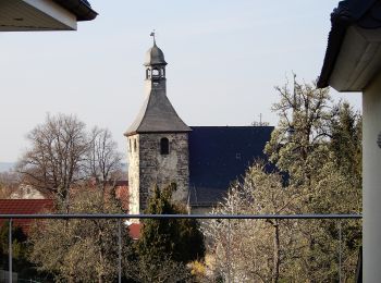
![Percorso A piedi Ballenstedt - Harzklub-Weg 50P - Photo](https://media.geolcdn.com/t/350/260/339ad39e-2cdd-4459-8dbc-b6b619ca417f.jpeg&format=jpg&maxdim=2)
![A piedi A piedi](https://static1.geolcdn.com/sitytour/trail-icons/100.png)
Km
A piedi
![](/images/other/stat-length.png)
![](https://static1.geolcdn.com/siteimages/upload/files/1508320355ic_sort_den_pos_24dp.png)
![](https://static1.geolcdn.com/siteimages/upload/files/1508320355ic_sort_den_neg_24dp.png)
![](https://static1.geolcdn.com/siteimages/upload/files/16400158638029165_repeat_loop_refresh_sync_direction_icon.png)
• Trail created by Harzklub e.V.. Symbol: blauer Punkt auf weißem Grund
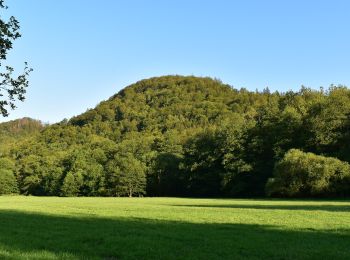
![Percorso A piedi Harzgerode - DE-grüner Punkt - Photo](https://media.geolcdn.com/t/350/260/c9c1dbe5-b594-432d-9562-bccbd43c6cc4.jpeg&format=jpg&maxdim=2)
![A piedi A piedi](https://static1.geolcdn.com/sitytour/trail-icons/100.png)
Km
A piedi
![](/images/other/stat-length.png)
![](https://static1.geolcdn.com/siteimages/upload/files/1508320355ic_sort_den_pos_24dp.png)
![](https://static1.geolcdn.com/siteimages/upload/files/1508320355ic_sort_den_neg_24dp.png)
![](https://static1.geolcdn.com/siteimages/upload/files/16400158638029165_repeat_loop_refresh_sync_direction_icon.png)
• Symbol: Grüner Punkt auf weißem Grund
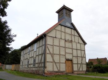
![Percorso A piedi Falkenstein/Harz - DE-Burg Anhalt - Konradsburg - Photo](https://media.geolcdn.com/t/350/260/91ef1199-d587-424b-8a4e-992583e10281.jpeg&format=jpg&maxdim=2)
![A piedi A piedi](https://static1.geolcdn.com/sitytour/trail-icons/100.png)
Km
A piedi
![](/images/other/stat-length.png)
![](https://static1.geolcdn.com/siteimages/upload/files/1508320355ic_sort_den_pos_24dp.png)
![](https://static1.geolcdn.com/siteimages/upload/files/1508320355ic_sort_den_neg_24dp.png)
![](https://static1.geolcdn.com/siteimages/upload/files/16400158638029165_repeat_loop_refresh_sync_direction_icon.png)
• Symbol: Grüner Balken auf weißem Grund
![Percorso A piedi Blankenburg - Harzklub-Weg 50J - Photo](https://media.geolcdn.com/t/350/260/5f983d5f-a7b5-463b-85a1-bf743ec1b76f.jpeg&format=jpg&maxdim=2)
![A piedi A piedi](https://static1.geolcdn.com/sitytour/trail-icons/100.png)
Km
A piedi
![](/images/other/stat-length.png)
![](https://static1.geolcdn.com/siteimages/upload/files/1508320355ic_sort_den_pos_24dp.png)
![](https://static1.geolcdn.com/siteimages/upload/files/1508320355ic_sort_den_neg_24dp.png)
![](https://static1.geolcdn.com/siteimages/upload/files/16400158638029165_repeat_loop_refresh_sync_direction_icon.png)
• Trail created by Harzklub e.V.. Symbol: blauer Punkt auf weißem Grund
![Percorso A piedi Harzgerode - Grünes Dreieck - Photo](https://media.geolcdn.com/t/350/260/8e87a517-1fe4-437e-801e-ca3c8385fcc6.jpeg&format=jpg&maxdim=2)
![A piedi A piedi](https://static1.geolcdn.com/sitytour/trail-icons/100.png)
Km
A piedi
![](/images/other/stat-length.png)
![](https://static1.geolcdn.com/siteimages/upload/files/1508320355ic_sort_den_pos_24dp.png)
![](https://static1.geolcdn.com/siteimages/upload/files/1508320355ic_sort_den_neg_24dp.png)
![](https://static1.geolcdn.com/siteimages/upload/files/16400158638029165_repeat_loop_refresh_sync_direction_icon.png)
• Symbol: Grünes Dreieck
![Percorso A piedi Thale - Harzklub-Weg 51A - Photo](https://media.geolcdn.com/t/350/260/7454b58c-c7f8-46c0-9df3-8282bbb0f979.jpeg&format=jpg&maxdim=2)
![A piedi A piedi](https://static1.geolcdn.com/sitytour/trail-icons/100.png)
Km
A piedi
![](/images/other/stat-length.png)
![](https://static1.geolcdn.com/siteimages/upload/files/1508320355ic_sort_den_pos_24dp.png)
![](https://static1.geolcdn.com/siteimages/upload/files/1508320355ic_sort_den_neg_24dp.png)
![](https://static1.geolcdn.com/siteimages/upload/files/16400158638029165_repeat_loop_refresh_sync_direction_icon.png)
• Trail created by Harzklub. Symbol: Rotes Quadrat auf weißem Grund
![Percorso A piedi Wernigerode - HK 9: Clausthal - Sonnenberg - Brocken - Ilsenburg - Photo](https://media.geolcdn.com/t/350/260/46aa350f-9ca7-4e48-ba6f-562beeebbacc.jpeg&format=jpg&maxdim=2)
![A piedi A piedi](https://static1.geolcdn.com/sitytour/trail-icons/100.png)
Km
A piedi
![](/images/other/stat-length.png)
![](https://static1.geolcdn.com/siteimages/upload/files/1508320355ic_sort_den_pos_24dp.png)
![](https://static1.geolcdn.com/siteimages/upload/files/1508320355ic_sort_den_neg_24dp.png)
![](https://static1.geolcdn.com/siteimages/upload/files/16400158638029165_repeat_loop_refresh_sync_direction_icon.png)
• Trail created by Harzklub.
![Percorso A piedi Thale - Harzklub-Weg 38C - Photo](https://media.geolcdn.com/t/350/260/5ee45589-03cc-4a21-aa95-377a6e02afaf.jpeg&format=jpg&maxdim=2)
![A piedi A piedi](https://static1.geolcdn.com/sitytour/trail-icons/100.png)
Km
A piedi
![](/images/other/stat-length.png)
![](https://static1.geolcdn.com/siteimages/upload/files/1508320355ic_sort_den_pos_24dp.png)
![](https://static1.geolcdn.com/siteimages/upload/files/1508320355ic_sort_den_neg_24dp.png)
![](https://static1.geolcdn.com/siteimages/upload/files/16400158638029165_repeat_loop_refresh_sync_direction_icon.png)
• Symbol: Blaues Dreieck auf weißem Grund
![Percorso A piedi Thale - Harzklub-Weg 38B - Photo](https://media.geolcdn.com/t/350/260/d2bcfd69-b94a-40d5-a203-56fe94caaaf9.jpeg&format=jpg&maxdim=2)
![A piedi A piedi](https://static1.geolcdn.com/sitytour/trail-icons/100.png)
Km
A piedi
![](/images/other/stat-length.png)
![](https://static1.geolcdn.com/siteimages/upload/files/1508320355ic_sort_den_pos_24dp.png)
![](https://static1.geolcdn.com/siteimages/upload/files/1508320355ic_sort_den_neg_24dp.png)
![](https://static1.geolcdn.com/siteimages/upload/files/16400158638029165_repeat_loop_refresh_sync_direction_icon.png)
• Symbol: Blaues Dreieck auf weißem Grund
![Percorso A piedi Thale - Harzklub-Weg 38A - Photo](https://media.geolcdn.com/t/350/260/4a4173db-b72e-41c1-88dd-1f358a1f1a38.jpeg&format=jpg&maxdim=2)
![A piedi A piedi](https://static1.geolcdn.com/sitytour/trail-icons/100.png)
Km
A piedi
![](/images/other/stat-length.png)
![](https://static1.geolcdn.com/siteimages/upload/files/1508320355ic_sort_den_pos_24dp.png)
![](https://static1.geolcdn.com/siteimages/upload/files/1508320355ic_sort_den_neg_24dp.png)
![](https://static1.geolcdn.com/siteimages/upload/files/16400158638029165_repeat_loop_refresh_sync_direction_icon.png)
• Symbol: Blaues Dreieck auf weißem Grund
![Percorso A piedi Thale - Harzklub-Weg 32D - Photo](https://media.geolcdn.com/t/350/260/a67b3167-ec31-41ea-af3c-d808dca0bbc6.jpeg&format=jpg&maxdim=2)
![A piedi A piedi](https://static1.geolcdn.com/sitytour/trail-icons/100.png)
Km
A piedi
![](/images/other/stat-length.png)
![](https://static1.geolcdn.com/siteimages/upload/files/1508320355ic_sort_den_pos_24dp.png)
![](https://static1.geolcdn.com/siteimages/upload/files/1508320355ic_sort_den_neg_24dp.png)
![](https://static1.geolcdn.com/siteimages/upload/files/16400158638029165_repeat_loop_refresh_sync_direction_icon.png)
• Symbol: Rote Kreisscheibe auf weißem Grund
![Percorso A piedi Thale - Harzklub-Weg 37G - Photo](https://media.geolcdn.com/t/350/260/a37ec671-c898-4026-a009-719ae8240bf3.jpeg&format=jpg&maxdim=2)
![A piedi A piedi](https://static1.geolcdn.com/sitytour/trail-icons/100.png)
Km
A piedi
![](/images/other/stat-length.png)
![](https://static1.geolcdn.com/siteimages/upload/files/1508320355ic_sort_den_pos_24dp.png)
![](https://static1.geolcdn.com/siteimages/upload/files/1508320355ic_sort_den_neg_24dp.png)
![](https://static1.geolcdn.com/siteimages/upload/files/16400158638029165_repeat_loop_refresh_sync_direction_icon.png)
• Symbol: Gelbes x auf weißem Grund
![Percorso A piedi Oberharz am Brocken - Wanderweg grünes X - Photo](https://media.geolcdn.com/t/350/260/a67b3167-ec31-41ea-af3c-d808dca0bbc6.jpeg&format=jpg&maxdim=2)
![A piedi A piedi](https://static1.geolcdn.com/sitytour/trail-icons/100.png)
Km
A piedi
![](/images/other/stat-length.png)
![](https://static1.geolcdn.com/siteimages/upload/files/1508320355ic_sort_den_pos_24dp.png)
![](https://static1.geolcdn.com/siteimages/upload/files/1508320355ic_sort_den_neg_24dp.png)
![](https://static1.geolcdn.com/siteimages/upload/files/16400158638029165_repeat_loop_refresh_sync_direction_icon.png)
• Symbol: grünes X auf weißem Grund
![Percorso A piedi Wernigerode - Harzklub-Weg 50H - Photo](https://media.geolcdn.com/t/350/260/e8080c41-5a09-431d-b315-d52f9e3ec26d.jpeg&format=jpg&maxdim=2)
![A piedi A piedi](https://static1.geolcdn.com/sitytour/trail-icons/100.png)
Km
A piedi
![](/images/other/stat-length.png)
![](https://static1.geolcdn.com/siteimages/upload/files/1508320355ic_sort_den_pos_24dp.png)
![](https://static1.geolcdn.com/siteimages/upload/files/1508320355ic_sort_den_neg_24dp.png)
![](https://static1.geolcdn.com/siteimages/upload/files/16400158638029165_repeat_loop_refresh_sync_direction_icon.png)
• Symbol: blauer Punkt auf weißem Grund
![Percorso A piedi Oberharz am Brocken - DE-grünes Dreieck - Photo](https://media.geolcdn.com/t/350/260/e8ea5a84-ed0f-4e9f-b309-f5fa991eb1ff.jpeg&format=jpg&maxdim=2)
![A piedi A piedi](https://static1.geolcdn.com/sitytour/trail-icons/100.png)
Km
A piedi
![](/images/other/stat-length.png)
![](https://static1.geolcdn.com/siteimages/upload/files/1508320355ic_sort_den_pos_24dp.png)
![](https://static1.geolcdn.com/siteimages/upload/files/1508320355ic_sort_den_neg_24dp.png)
![](https://static1.geolcdn.com/siteimages/upload/files/16400158638029165_repeat_loop_refresh_sync_direction_icon.png)
• Symbol: Grünes Dreieck auf weißem Grund
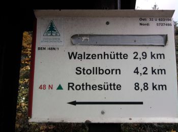
![Percorso A piedi Oberharz am Brocken - Harzklub-Weg 24E - Photo](https://media.geolcdn.com/t/350/260/4e88e806-f909-47ae-9dd8-4e5180bd33ea.jpeg&format=jpg&maxdim=2)
![A piedi A piedi](https://static1.geolcdn.com/sitytour/trail-icons/100.png)
Km
A piedi
![](/images/other/stat-length.png)
![](https://static1.geolcdn.com/siteimages/upload/files/1508320355ic_sort_den_pos_24dp.png)
![](https://static1.geolcdn.com/siteimages/upload/files/1508320355ic_sort_den_neg_24dp.png)
![](https://static1.geolcdn.com/siteimages/upload/files/16400158638029165_repeat_loop_refresh_sync_direction_icon.png)
• Symbol: Grünes X auf weißem Grund
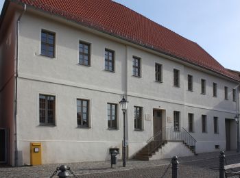
![Percorso A piedi Harzgerode - DE-Roter Punkt - Photo](https://media.geolcdn.com/t/350/260/ce3eae34-5c48-4f66-8a2d-91bc9353d084.jpeg&format=jpg&maxdim=2)
![A piedi A piedi](https://static1.geolcdn.com/sitytour/trail-icons/100.png)
Km
A piedi
![](/images/other/stat-length.png)
![](https://static1.geolcdn.com/siteimages/upload/files/1508320355ic_sort_den_pos_24dp.png)
![](https://static1.geolcdn.com/siteimages/upload/files/1508320355ic_sort_den_neg_24dp.png)
![](https://static1.geolcdn.com/siteimages/upload/files/16400158638029165_repeat_loop_refresh_sync_direction_icon.png)
• Trail created by Harzklub. Symbol: Roter Punkt auf weißem Grund
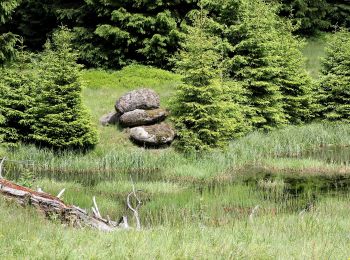
![Percorso A piedi Wernigerode - Rund um den Erdbeerkopf (1) - Photo](https://media.geolcdn.com/t/350/260/86c61394-1637-4baf-9349-c346048138df.jpeg&format=jpg&maxdim=2)
![A piedi A piedi](https://static1.geolcdn.com/sitytour/trail-icons/100.png)
Km
A piedi
![](/images/other/stat-length.png)
![](https://static1.geolcdn.com/siteimages/upload/files/1508320355ic_sort_den_pos_24dp.png)
![](https://static1.geolcdn.com/siteimages/upload/files/1508320355ic_sort_den_neg_24dp.png)
![](https://static1.geolcdn.com/siteimages/upload/files/16400158638029165_repeat_loop_refresh_sync_direction_icon.png)
• Trail created by Nationalpark Harz.
20 percorsi visualizzati su 69
Applicazione GPS da escursionismo GRATUITA