![](/images/other/stat-length.png)
- Percorsi
- A piedi
- Germany
- Baden-Württemberg
- Neckar-Odenwald-Kreis
Neckar-Odenwald-Kreis, Baden-Württemberg, A piedi : I migliori sentieri, percorsi e passeggiate
Neckar-Odenwald-Kreis: Scopri i migliori percorsi: 64 a piedi. Tutti questi percorsi, itinerari e attività outdoor sono disponibili nelle nostre app SityTrail per smartphone e tablet.
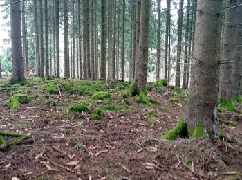
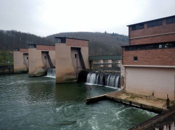
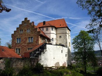
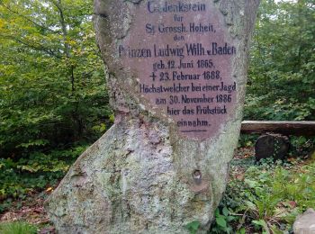
I percorsi migliori (0})
![Percorso A piedi Walldürn - Biotoplehrpfad - Variante 3 - Über die Eiderbach zum Fledermausturm - Photo](https://media.geolcdn.com/t/350/260/d331c0f5-fec8-4e9f-adaa-1f1b1a6d56c6.jpeg&format=jpg&maxdim=2)
![A piedi A piedi](https://static1.geolcdn.com/sitytour/trail-icons/100.png)
Km
A piedi
![](/images/other/stat-length.png)
![](https://static1.geolcdn.com/siteimages/upload/files/1508320355ic_sort_den_pos_24dp.png)
![](https://static1.geolcdn.com/siteimages/upload/files/1508320355ic_sort_den_neg_24dp.png)
![](https://static1.geolcdn.com/siteimages/upload/files/16400158638029165_repeat_loop_refresh_sync_direction_icon.png)
• Trail created by Biotopschutzbund Walldürn e. V..
![Percorso A piedi Walldürn - Biotoplehrpfad Walldürn - Photo](https://media.geolcdn.com/t/350/260/cfdbebf0-e900-484a-b402-9a1766e396d2.jpeg&format=jpg&maxdim=2)
![A piedi A piedi](https://static1.geolcdn.com/sitytour/trail-icons/100.png)
Km
A piedi
![](/images/other/stat-length.png)
![](https://static1.geolcdn.com/siteimages/upload/files/1508320355ic_sort_den_pos_24dp.png)
![](https://static1.geolcdn.com/siteimages/upload/files/1508320355ic_sort_den_neg_24dp.png)
![](https://static1.geolcdn.com/siteimages/upload/files/16400158638029165_repeat_loop_refresh_sync_direction_icon.png)
• Trail created by Biotopschutzbund Walldürn e. V..
![Percorso A piedi Buchen (Odenwald) - Rundwanderweg Waldhausen 4 Ortsrunde - Photo](https://media.geolcdn.com/t/350/260/65629220-5cbf-4990-91d4-da40696a3e23.jpeg&format=jpg&maxdim=2)
![A piedi A piedi](https://static1.geolcdn.com/sitytour/trail-icons/100.png)
Km
A piedi
![](/images/other/stat-length.png)
![](https://static1.geolcdn.com/siteimages/upload/files/1508320355ic_sort_den_pos_24dp.png)
![](https://static1.geolcdn.com/siteimages/upload/files/1508320355ic_sort_den_neg_24dp.png)
![](https://static1.geolcdn.com/siteimages/upload/files/16400158638029165_repeat_loop_refresh_sync_direction_icon.png)
• Symbol: Weiße 4 in einem oben offenen Kreis, darüber weißes W
![Percorso A piedi Buchen (Odenwald) - Rundwanderweg Waldhausen 1 Tannenbuckel-Weg - Photo](https://media.geolcdn.com/t/350/260/aba2c3f2-2747-4c23-8962-badc823c1b3b.jpeg&format=jpg&maxdim=2)
![A piedi A piedi](https://static1.geolcdn.com/sitytour/trail-icons/100.png)
Km
A piedi
![](/images/other/stat-length.png)
![](https://static1.geolcdn.com/siteimages/upload/files/1508320355ic_sort_den_pos_24dp.png)
![](https://static1.geolcdn.com/siteimages/upload/files/1508320355ic_sort_den_neg_24dp.png)
![](https://static1.geolcdn.com/siteimages/upload/files/16400158638029165_repeat_loop_refresh_sync_direction_icon.png)
• Symbol: Weiße 1 in einem oben offenen Kreis, darüber weißes W
![Percorso A piedi Buchen (Odenwald) - Rundwanderweg Waldhausen 2 Grauer-Forst-Weg - Photo](https://media.geolcdn.com/t/350/260/43f759de-271e-42a4-89f7-37a9e659078b.jpeg&format=jpg&maxdim=2)
![A piedi A piedi](https://static1.geolcdn.com/sitytour/trail-icons/100.png)
Km
A piedi
![](/images/other/stat-length.png)
![](https://static1.geolcdn.com/siteimages/upload/files/1508320355ic_sort_den_pos_24dp.png)
![](https://static1.geolcdn.com/siteimages/upload/files/1508320355ic_sort_den_neg_24dp.png)
![](https://static1.geolcdn.com/siteimages/upload/files/16400158638029165_repeat_loop_refresh_sync_direction_icon.png)
• Symbol: Weiße 2 in einem oben offenen Kreis, darüber weißes W
![Percorso A piedi Neckargerach - Mittelberg-Weg - Photo](https://media.geolcdn.com/t/350/260/1c3b814f-9e63-4bfe-b06f-f69211d7d50e.jpeg&format=jpg&maxdim=2)
![A piedi A piedi](https://static1.geolcdn.com/sitytour/trail-icons/100.png)
Km
A piedi
![](/images/other/stat-length.png)
![](https://static1.geolcdn.com/siteimages/upload/files/1508320355ic_sort_den_pos_24dp.png)
![](https://static1.geolcdn.com/siteimages/upload/files/1508320355ic_sort_den_neg_24dp.png)
![](https://static1.geolcdn.com/siteimages/upload/files/16400158638029165_repeat_loop_refresh_sync_direction_icon.png)
• Trail created by Naturpark Neckartal-Odenwald. Symbol: Weiße 3 in einem oben offenen Kreis, darüber weißes Gu
![Percorso A piedi Obrigheim - Rundwanderweg Bickeldorn 6: Schloss-Neuburg-Weg - Photo](https://media.geolcdn.com/t/350/260/e6a7cb37-4c4f-4a82-8abb-074a4b0015d6.jpeg&format=jpg&maxdim=2)
![A piedi A piedi](https://static1.geolcdn.com/sitytour/trail-icons/100.png)
Km
A piedi
![](/images/other/stat-length.png)
![](https://static1.geolcdn.com/siteimages/upload/files/1508320355ic_sort_den_pos_24dp.png)
![](https://static1.geolcdn.com/siteimages/upload/files/1508320355ic_sort_den_neg_24dp.png)
![](https://static1.geolcdn.com/siteimages/upload/files/16400158638029165_repeat_loop_refresh_sync_direction_icon.png)
• Trail created by Naturpark Neckartal-Odenwald. Symbol: Gelbe 6 im gelben Kreis
![Percorso A piedi - Rundwanderweg Neunkirchen 2: Kriegwald-Weg - Photo](https://media.geolcdn.com/t/350/260/6655163b-6f7f-47c1-aca6-64ca64187e9b.jpeg&format=jpg&maxdim=2)
![A piedi A piedi](https://static1.geolcdn.com/sitytour/trail-icons/100.png)
Km
A piedi
![](/images/other/stat-length.png)
![](https://static1.geolcdn.com/siteimages/upload/files/1508320355ic_sort_den_pos_24dp.png)
![](https://static1.geolcdn.com/siteimages/upload/files/1508320355ic_sort_den_neg_24dp.png)
![](https://static1.geolcdn.com/siteimages/upload/files/16400158638029165_repeat_loop_refresh_sync_direction_icon.png)
• Trail created by Naturpark Neckartal-Odenwald. Symbol: Weiße 2 in einem oben offenen Kreis, darüber weißes N
![Percorso A piedi - Rundwanderweg Neunkirchen 1: Krähenrain-Weg - Photo](https://media.geolcdn.com/t/350/260/0e84af7d-1af3-4281-b760-66f2f6bfc899.jpeg&format=jpg&maxdim=2)
![A piedi A piedi](https://static1.geolcdn.com/sitytour/trail-icons/100.png)
Km
A piedi
![](/images/other/stat-length.png)
![](https://static1.geolcdn.com/siteimages/upload/files/1508320355ic_sort_den_pos_24dp.png)
![](https://static1.geolcdn.com/siteimages/upload/files/1508320355ic_sort_den_neg_24dp.png)
![](https://static1.geolcdn.com/siteimages/upload/files/16400158638029165_repeat_loop_refresh_sync_direction_icon.png)
• Trail created by Naturpark Neckartal-Odenwald. Symbol: Weiße 1 in einem oben offenen Kreis, darüber weißes N
![Percorso A piedi Neckargerach - Rundwanderweg Guttenbach 1: Minneburg-Weg - Photo](https://media.geolcdn.com/t/350/260/7462177d-7f2d-4474-9df3-a262a431f4b9.jpeg&format=jpg&maxdim=2)
![A piedi A piedi](https://static1.geolcdn.com/sitytour/trail-icons/100.png)
Km
A piedi
![](/images/other/stat-length.png)
![](https://static1.geolcdn.com/siteimages/upload/files/1508320355ic_sort_den_pos_24dp.png)
![](https://static1.geolcdn.com/siteimages/upload/files/1508320355ic_sort_den_neg_24dp.png)
![](https://static1.geolcdn.com/siteimages/upload/files/16400158638029165_repeat_loop_refresh_sync_direction_icon.png)
• Trail created by Naturpark Neckartal-Odenwald. Symbol: Weiße 1 in einem oben offenen Kreis, darüber weißes Gu
![Percorso A piedi Neunkirchen - Neckarkatzenbach-Weg - Photo](https://media.geolcdn.com/t/350/260/48fbbeed-5cc9-4245-8949-4f236c16df53.jpeg&format=jpg&maxdim=2)
![A piedi A piedi](https://static1.geolcdn.com/sitytour/trail-icons/100.png)
Km
A piedi
![](/images/other/stat-length.png)
![](https://static1.geolcdn.com/siteimages/upload/files/1508320355ic_sort_den_pos_24dp.png)
![](https://static1.geolcdn.com/siteimages/upload/files/1508320355ic_sort_den_neg_24dp.png)
![](https://static1.geolcdn.com/siteimages/upload/files/16400158638029165_repeat_loop_refresh_sync_direction_icon.png)
• Trail created by Naturpark Neckartal-Odenwald. Symbol: Weiße 2 in einem oben offenen Kreis, darüber weißes Gu
![Percorso A piedi Binau - Rundwanderweg Binauer Forst 3: Rotenberg-Weg - Photo](https://media.geolcdn.com/t/350/260/38f13a3b-239c-476f-abb7-b8dbf48e515f.jpeg&format=jpg&maxdim=2)
![A piedi A piedi](https://static1.geolcdn.com/sitytour/trail-icons/100.png)
Km
A piedi
![](/images/other/stat-length.png)
![](https://static1.geolcdn.com/siteimages/upload/files/1508320355ic_sort_den_pos_24dp.png)
![](https://static1.geolcdn.com/siteimages/upload/files/1508320355ic_sort_den_neg_24dp.png)
![](https://static1.geolcdn.com/siteimages/upload/files/16400158638029165_repeat_loop_refresh_sync_direction_icon.png)
• Symbol: Gelbe 3 im gelben Kreis
![Percorso A piedi Osterburken - Rundwanderweg Barnholz 2: Bofsheimer-Weg - Photo](https://media.geolcdn.com/t/350/260/9ab795d1-f960-43a7-93e3-cb0778ff3681.jpeg&format=jpg&maxdim=2)
![A piedi A piedi](https://static1.geolcdn.com/sitytour/trail-icons/100.png)
Km
A piedi
![](/images/other/stat-length.png)
![](https://static1.geolcdn.com/siteimages/upload/files/1508320355ic_sort_den_pos_24dp.png)
![](https://static1.geolcdn.com/siteimages/upload/files/1508320355ic_sort_den_neg_24dp.png)
![](https://static1.geolcdn.com/siteimages/upload/files/16400158638029165_repeat_loop_refresh_sync_direction_icon.png)
• Trail created by Naturpark Neckartal-Odenwald. Symbol: Gelbe 2 im gelben Kreis
![Percorso A piedi Osterburken - Rundwanderweg Barnholz 1: Barnholz-Weg - Photo](https://media.geolcdn.com/t/350/260/217c7571-611f-4b0f-8514-f60fd45d7c2b.jpeg&format=jpg&maxdim=2)
![A piedi A piedi](https://static1.geolcdn.com/sitytour/trail-icons/100.png)
Km
A piedi
![](/images/other/stat-length.png)
![](https://static1.geolcdn.com/siteimages/upload/files/1508320355ic_sort_den_pos_24dp.png)
![](https://static1.geolcdn.com/siteimages/upload/files/1508320355ic_sort_den_neg_24dp.png)
![](https://static1.geolcdn.com/siteimages/upload/files/16400158638029165_repeat_loop_refresh_sync_direction_icon.png)
• Trail created by Naturpark Neckartal-Odenwald. Symbol: Gelbe 1 im gelben Kreis
![Percorso A piedi Osterburken - Rundwanderweg Osterburken 1: Nördlicher Limespark-Weg - Photo](https://media.geolcdn.com/t/350/260/7f41b704-fbb0-42b4-aa9e-c7dcdbc6950b.jpeg&format=jpg&maxdim=2)
![A piedi A piedi](https://static1.geolcdn.com/sitytour/trail-icons/100.png)
Km
A piedi
![](/images/other/stat-length.png)
![](https://static1.geolcdn.com/siteimages/upload/files/1508320355ic_sort_den_pos_24dp.png)
![](https://static1.geolcdn.com/siteimages/upload/files/1508320355ic_sort_den_neg_24dp.png)
![](https://static1.geolcdn.com/siteimages/upload/files/16400158638029165_repeat_loop_refresh_sync_direction_icon.png)
• Trail created by Naturpark Neckartal-Odenwald. Symbol: Weiße 1 in einem oben offenen Kreis, darüber weißes Ob
![Percorso A piedi Mudau - Rundwanderweg Hesseneck-Hesselbach 6 - Photo](https://media.geolcdn.com/t/350/260/b4917b54-7f9f-4868-b1e5-c84bd7700906.jpeg&format=jpg&maxdim=2)
![A piedi A piedi](https://static1.geolcdn.com/sitytour/trail-icons/100.png)
Km
A piedi
![](/images/other/stat-length.png)
![](https://static1.geolcdn.com/siteimages/upload/files/1508320355ic_sort_den_pos_24dp.png)
![](https://static1.geolcdn.com/siteimages/upload/files/1508320355ic_sort_den_neg_24dp.png)
![](https://static1.geolcdn.com/siteimages/upload/files/16400158638029165_repeat_loop_refresh_sync_direction_icon.png)
• Trail created by Naturpark Bergstraße-Odenwald. Symbol: Gelbe 6 in gelben Kreis
![Percorso A piedi Neckargerach - Rundwanderweg 54: Hohwald-Weg - Photo](https://media.geolcdn.com/t/350/260/aabf4cc7-ae47-46dd-9049-5682a1eb7820.jpeg&format=jpg&maxdim=2)
![A piedi A piedi](https://static1.geolcdn.com/sitytour/trail-icons/100.png)
Km
A piedi
![](/images/other/stat-length.png)
![](https://static1.geolcdn.com/siteimages/upload/files/1508320355ic_sort_den_pos_24dp.png)
![](https://static1.geolcdn.com/siteimages/upload/files/1508320355ic_sort_den_neg_24dp.png)
![](https://static1.geolcdn.com/siteimages/upload/files/16400158638029165_repeat_loop_refresh_sync_direction_icon.png)
• Symbol: Gelbe 54 im gelben Kreis
![Percorso A piedi Neckargerach - Rundwanderweg Neckargerach 1: Hohwald-Weg - Photo](https://media.geolcdn.com/t/350/260/7462177d-7f2d-4474-9df3-a262a431f4b9.jpeg&format=jpg&maxdim=2)
![A piedi A piedi](https://static1.geolcdn.com/sitytour/trail-icons/100.png)
Km
A piedi
![](/images/other/stat-length.png)
![](https://static1.geolcdn.com/siteimages/upload/files/1508320355ic_sort_den_pos_24dp.png)
![](https://static1.geolcdn.com/siteimages/upload/files/1508320355ic_sort_den_neg_24dp.png)
![](https://static1.geolcdn.com/siteimages/upload/files/16400158638029165_repeat_loop_refresh_sync_direction_icon.png)
• Trail created by Naturpark Neckartal-Odenwald. Symbol: Weiße 1 in einem oben offenen Kreis, darüber weißes NG
![Percorso A piedi Mosbach - Rundwanderweg Knopfwald 2: Galgenforlen-Weg - Photo](https://media.geolcdn.com/t/350/260/2ed8e035-54ab-4dea-9820-aee7be34ad14.jpeg&format=jpg&maxdim=2)
![A piedi A piedi](https://static1.geolcdn.com/sitytour/trail-icons/100.png)
Km
A piedi
![](/images/other/stat-length.png)
![](https://static1.geolcdn.com/siteimages/upload/files/1508320355ic_sort_den_pos_24dp.png)
![](https://static1.geolcdn.com/siteimages/upload/files/1508320355ic_sort_den_neg_24dp.png)
![](https://static1.geolcdn.com/siteimages/upload/files/16400158638029165_repeat_loop_refresh_sync_direction_icon.png)
• Trail created by Naturpark Neckartal-Odenwald. Symbol: Gelbe 2 im gelben Kreis
![Percorso A piedi Mosbach - Rundwanderweg Mosbach 4: Henschelberg-Weg - Photo](https://media.geolcdn.com/t/350/260/29a14c81-b371-42da-beb3-ba29d320a6ad.jpeg&format=jpg&maxdim=2)
![A piedi A piedi](https://static1.geolcdn.com/sitytour/trail-icons/100.png)
Km
A piedi
![](/images/other/stat-length.png)
![](https://static1.geolcdn.com/siteimages/upload/files/1508320355ic_sort_den_pos_24dp.png)
![](https://static1.geolcdn.com/siteimages/upload/files/1508320355ic_sort_den_neg_24dp.png)
![](https://static1.geolcdn.com/siteimages/upload/files/16400158638029165_repeat_loop_refresh_sync_direction_icon.png)
• Trail created by Naturpark Neckartal-Odenwald. Symbol: Weiße 4 in einem oben offenen, weißen Kreis, darüber weißes M
20 percorsi visualizzati su 64
Applicazione GPS da escursionismo GRATUITA