![](/images/other/stat-length.png)
- Percorsi
- A piedi
- Germany
- Baden-Württemberg
- Landkreis Esslingen
Landkreis Esslingen, Baden-Württemberg, A piedi : I migliori sentieri, percorsi e passeggiate
Landkreis Esslingen: Scopri i migliori percorsi: 54 a piedi. Tutti questi percorsi, itinerari e attività outdoor sono disponibili nelle nostre app SityTrail per smartphone e tablet.
I percorsi migliori (0})
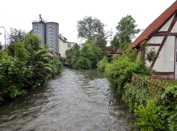
![Percorso A piedi Bempflingen - Eduard-Mörike-Weg - Photo](https://media.geolcdn.com/t/350/260/034f6f7f-462f-46de-8ce0-9962a05a20da.jpeg&format=jpg&maxdim=2)
![A piedi A piedi](https://static1.geolcdn.com/sitytour/trail-icons/100.png)
Km
A piedi
![](/images/other/stat-length.png)
![](https://static1.geolcdn.com/siteimages/upload/files/1508320355ic_sort_den_pos_24dp.png)
![](https://static1.geolcdn.com/siteimages/upload/files/1508320355ic_sort_den_neg_24dp.png)
![](https://static1.geolcdn.com/siteimages/upload/files/16400158638029165_repeat_loop_refresh_sync_direction_icon.png)
• Trail created by www.mythos-alb.de. Symbol: Symbol blaue Umrisse eines Kopf als Scherenschnitt.
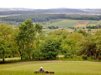
![Percorso A piedi Großbettlingen - blaue Raute Roßdorf - Großbettlingen - Grafenberg - Kapishäusern - Jusi - Photo](https://media.geolcdn.com/t/350/260/6aa37420-bdbb-4485-84bb-d6906a870965.jpeg&format=jpg&maxdim=2)
![A piedi A piedi](https://static1.geolcdn.com/sitytour/trail-icons/100.png)
Km
A piedi
![](/images/other/stat-length.png)
![](https://static1.geolcdn.com/siteimages/upload/files/1508320355ic_sort_den_pos_24dp.png)
![](https://static1.geolcdn.com/siteimages/upload/files/1508320355ic_sort_den_neg_24dp.png)
![](https://static1.geolcdn.com/siteimages/upload/files/16400158638029165_repeat_loop_refresh_sync_direction_icon.png)
• Trail created by Schwäbischer Albverein. Symbol: blaue Raute auf weißem Grund
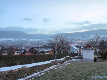
![Percorso A piedi Neuffen - blaues Dreieck Neuffen - Schillingskreuz - HW1 (Kniebrech) - Photo](https://media.geolcdn.com/t/350/260/1e89332f-37b7-4545-bb69-ff8450c03722.jpeg&format=jpg&maxdim=2)
![A piedi A piedi](https://static1.geolcdn.com/sitytour/trail-icons/100.png)
Km
A piedi
![](/images/other/stat-length.png)
![](https://static1.geolcdn.com/siteimages/upload/files/1508320355ic_sort_den_pos_24dp.png)
![](https://static1.geolcdn.com/siteimages/upload/files/1508320355ic_sort_den_neg_24dp.png)
![](https://static1.geolcdn.com/siteimages/upload/files/16400158638029165_repeat_loop_refresh_sync_direction_icon.png)
• Trail created by Schwäbischer Albverein. Symbol: blaues Dreieck auf weißem Grund
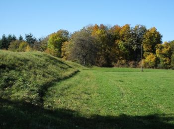
![Percorso A piedi Lenningen - Rote Gabel Sattelbogen - Erkenbrechtsweiler - Grabenstetten - Photo](https://media.geolcdn.com/t/350/260/2744b40e-5d98-4d86-8cf9-dfff79cb1b48.jpeg&format=jpg&maxdim=2)
![A piedi A piedi](https://static1.geolcdn.com/sitytour/trail-icons/100.png)
Km
A piedi
![](/images/other/stat-length.png)
![](https://static1.geolcdn.com/siteimages/upload/files/1508320355ic_sort_den_pos_24dp.png)
![](https://static1.geolcdn.com/siteimages/upload/files/1508320355ic_sort_den_neg_24dp.png)
![](https://static1.geolcdn.com/siteimages/upload/files/16400158638029165_repeat_loop_refresh_sync_direction_icon.png)
• Trail created by Schwäbischer Albverein. Symbol: rote Gabel auf weißem Grund
![Percorso A piedi Filderstadt - Neuhausen - Harthausen - Photo](https://media.geolcdn.com/t/350/260/43dc2856-587c-43e4-bf17-e996ea7cfb74.jpeg&format=jpg&maxdim=2)
![A piedi A piedi](https://static1.geolcdn.com/sitytour/trail-icons/100.png)
Km
A piedi
![](/images/other/stat-length.png)
![](https://static1.geolcdn.com/siteimages/upload/files/1508320355ic_sort_den_pos_24dp.png)
![](https://static1.geolcdn.com/siteimages/upload/files/1508320355ic_sort_den_neg_24dp.png)
![](https://static1.geolcdn.com/siteimages/upload/files/16400158638029165_repeat_loop_refresh_sync_direction_icon.png)
• Trail created by Schwäbischer Albverein. SAV Rotes Kreuz, Symbol: Rotes Kreuz auf weissem Grund
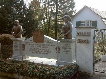
![Percorso A piedi Esslingen am Neckar - Esslingen (Bhf) - Mettingen - Katharinenlinde - Esslingen - Photo](https://media.geolcdn.com/t/350/260/e8b52767-4d5f-4e23-bdd3-690ff3766daf.jpeg&format=jpg&maxdim=2)
![A piedi A piedi](https://static1.geolcdn.com/sitytour/trail-icons/100.png)
Km
A piedi
![](/images/other/stat-length.png)
![](https://static1.geolcdn.com/siteimages/upload/files/1508320355ic_sort_den_pos_24dp.png)
![](https://static1.geolcdn.com/siteimages/upload/files/1508320355ic_sort_den_neg_24dp.png)
![](https://static1.geolcdn.com/siteimages/upload/files/16400158638029165_repeat_loop_refresh_sync_direction_icon.png)
• Trail created by Schwäbischer Albverein. SAV Rotes Kreuz, Esslingen Pliensauturm - Bahnhof - Mettingen - Katharinenl...
![Percorso A piedi Esslingen am Neckar - Berkheim (Freyaeiche) - Köngen - Photo](https://media.geolcdn.com/t/350/260/7fb6457f-3b83-4bf9-8349-71bc4d8ca1ea.jpeg&format=jpg&maxdim=2)
![A piedi A piedi](https://static1.geolcdn.com/sitytour/trail-icons/100.png)
Km
A piedi
![](/images/other/stat-length.png)
![](https://static1.geolcdn.com/siteimages/upload/files/1508320355ic_sort_den_pos_24dp.png)
![](https://static1.geolcdn.com/siteimages/upload/files/1508320355ic_sort_den_neg_24dp.png)
![](https://static1.geolcdn.com/siteimages/upload/files/16400158638029165_repeat_loop_refresh_sync_direction_icon.png)
• Trail created by Schwäbischer Albverein. SAV Blauer Balken, von - nach?
![Percorso A piedi Ostfildern - Denkendorf - Scharnhausen - Ruit - Photo](https://media.geolcdn.com/t/350/260/b5d049fb-9603-49ff-a05a-72b732cda968.jpeg&format=jpg&maxdim=2)
![A piedi A piedi](https://static1.geolcdn.com/sitytour/trail-icons/100.png)
Km
A piedi
![](/images/other/stat-length.png)
![](https://static1.geolcdn.com/siteimages/upload/files/1508320355ic_sort_den_pos_24dp.png)
![](https://static1.geolcdn.com/siteimages/upload/files/1508320355ic_sort_den_neg_24dp.png)
![](https://static1.geolcdn.com/siteimages/upload/files/16400158638029165_repeat_loop_refresh_sync_direction_icon.png)
• Trail created by Schwäbischer Albverein. SAV Rotes Kreuz, von - nach ? Symbol: Rotes Kreuz auf weißem Grund
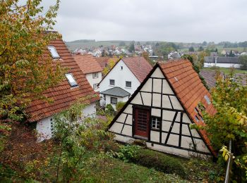
![Percorso A piedi Aichtal - Aich - Harthausen - Photo](https://media.geolcdn.com/t/350/260/4662f9dc-b204-46ce-a1c5-f422245548b1.jpeg&format=jpg&maxdim=2)
![A piedi A piedi](https://static1.geolcdn.com/sitytour/trail-icons/100.png)
Km
A piedi
![](/images/other/stat-length.png)
![](https://static1.geolcdn.com/siteimages/upload/files/1508320355ic_sort_den_pos_24dp.png)
![](https://static1.geolcdn.com/siteimages/upload/files/1508320355ic_sort_den_neg_24dp.png)
![](https://static1.geolcdn.com/siteimages/upload/files/16400158638029165_repeat_loop_refresh_sync_direction_icon.png)
• Trail created by Schwäbischer Albverein. SAV Rotes Kreuz, Aichtal - Neuhausen - ? Symbol: Rotes Kreuz auf weißem Gr...
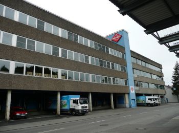
![Percorso A piedi Leinfelden-Echterdingen - Rotes Kreuz, Musberg - Waldenbuch - Photo](https://media.geolcdn.com/t/350/260/dc25545b-a174-4712-b742-568ca9a61f59.jpeg&format=jpg&maxdim=2)
![A piedi A piedi](https://static1.geolcdn.com/sitytour/trail-icons/100.png)
Km
A piedi
![](/images/other/stat-length.png)
![](https://static1.geolcdn.com/siteimages/upload/files/1508320355ic_sort_den_pos_24dp.png)
![](https://static1.geolcdn.com/siteimages/upload/files/1508320355ic_sort_den_neg_24dp.png)
![](https://static1.geolcdn.com/siteimages/upload/files/16400158638029165_repeat_loop_refresh_sync_direction_icon.png)
• Trail created by Schwäbischer Albverein. Symbol: Rotes Kreuz auf weißem Grund
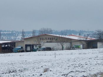
![Percorso A piedi Filderstadt - Echterdingen - Bernhausen - Photo](https://media.geolcdn.com/t/350/260/0e384c2f-408f-4099-8d53-fb76017fff51.jpeg&format=jpg&maxdim=2)
![A piedi A piedi](https://static1.geolcdn.com/sitytour/trail-icons/100.png)
Km
A piedi
![](/images/other/stat-length.png)
![](https://static1.geolcdn.com/siteimages/upload/files/1508320355ic_sort_den_pos_24dp.png)
![](https://static1.geolcdn.com/siteimages/upload/files/1508320355ic_sort_den_neg_24dp.png)
![](https://static1.geolcdn.com/siteimages/upload/files/16400158638029165_repeat_loop_refresh_sync_direction_icon.png)
• Trail created by Schwäbischer Albverein. SAV Blaues Kreuz, Oberaichen - Bernhausen ? Symbol: Blaues Kreuz auf weiße...
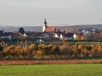
![Percorso A piedi Weilheim an der Teck - Weilheim Rundweg 42 - Photo](https://media.geolcdn.com/t/350/260/bd8e75b2-0229-41ef-8093-6e594e3c3309.jpeg&format=jpg&maxdim=2)
![A piedi A piedi](https://static1.geolcdn.com/sitytour/trail-icons/100.png)
Km
A piedi
![](/images/other/stat-length.png)
![](https://static1.geolcdn.com/siteimages/upload/files/1508320355ic_sort_den_pos_24dp.png)
![](https://static1.geolcdn.com/siteimages/upload/files/1508320355ic_sort_den_neg_24dp.png)
![](https://static1.geolcdn.com/siteimages/upload/files/16400158638029165_repeat_loop_refresh_sync_direction_icon.png)
• Trail created by Stadt Weilheim an der Teck. Symbol: quadratische blaue Fläche mit inneren weißen Kreis in dem wiede...
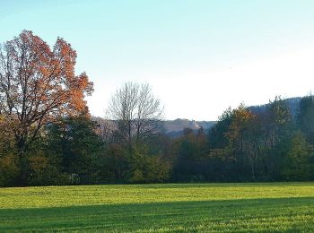
![Percorso A piedi Weilheim an der Teck - Weilheim Rundweg 61 - Photo](https://media.geolcdn.com/t/350/260/679afea4-736a-4a67-937c-c90f311162f8.jpeg&format=jpg&maxdim=2)
![A piedi A piedi](https://static1.geolcdn.com/sitytour/trail-icons/100.png)
Km
A piedi
![](/images/other/stat-length.png)
![](https://static1.geolcdn.com/siteimages/upload/files/1508320355ic_sort_den_pos_24dp.png)
![](https://static1.geolcdn.com/siteimages/upload/files/1508320355ic_sort_den_neg_24dp.png)
![](https://static1.geolcdn.com/siteimages/upload/files/16400158638029165_repeat_loop_refresh_sync_direction_icon.png)
• Trail created by Stadt Weilheim an der Teck. Symbol: quadratische blaue Fläche mit inneren weißen Kreis in dem wiede...
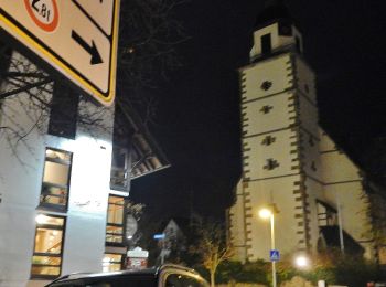
![Percorso A piedi Weilheim an der Teck - Weilheim Rundweg 51 - Photo](https://media.geolcdn.com/t/350/260/0d3610c9-b7b1-40ee-bea5-9f2144e1799d.jpeg&format=jpg&maxdim=2)
![A piedi A piedi](https://static1.geolcdn.com/sitytour/trail-icons/100.png)
Km
A piedi
![](/images/other/stat-length.png)
![](https://static1.geolcdn.com/siteimages/upload/files/1508320355ic_sort_den_pos_24dp.png)
![](https://static1.geolcdn.com/siteimages/upload/files/1508320355ic_sort_den_neg_24dp.png)
![](https://static1.geolcdn.com/siteimages/upload/files/16400158638029165_repeat_loop_refresh_sync_direction_icon.png)
• Trail created by Stadt Weilheim an der Teck. Symbol: quadratische blaue Fläche mit inneren weißen Kreis in dem wiede...
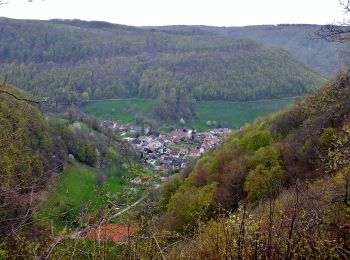
![Percorso A piedi Lenningen - Oberlenningen - Krebsstein - Photo](https://media.geolcdn.com/t/350/260/e6c5eb57-ed98-4693-ad72-9260e581c4ca.jpeg&format=jpg&maxdim=2)
![A piedi A piedi](https://static1.geolcdn.com/sitytour/trail-icons/100.png)
Km
A piedi
![](/images/other/stat-length.png)
![](https://static1.geolcdn.com/siteimages/upload/files/1508320355ic_sort_den_pos_24dp.png)
![](https://static1.geolcdn.com/siteimages/upload/files/1508320355ic_sort_den_neg_24dp.png)
![](https://static1.geolcdn.com/siteimages/upload/files/16400158638029165_repeat_loop_refresh_sync_direction_icon.png)
• Trail created by Schwäbischer Albverein.
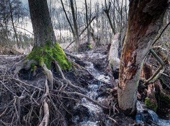
![Percorso A piedi Köngen - Köngen - Wolfschlugen - Photo](https://media.geolcdn.com/t/350/260/2dec52b2-cbdc-4fb4-951c-98e3f3a65a16.jpeg&format=jpg&maxdim=2)
![A piedi A piedi](https://static1.geolcdn.com/sitytour/trail-icons/100.png)
Km
A piedi
![](/images/other/stat-length.png)
![](https://static1.geolcdn.com/siteimages/upload/files/1508320355ic_sort_den_pos_24dp.png)
![](https://static1.geolcdn.com/siteimages/upload/files/1508320355ic_sort_den_neg_24dp.png)
![](https://static1.geolcdn.com/siteimages/upload/files/16400158638029165_repeat_loop_refresh_sync_direction_icon.png)
• Trail created by Schwäbischer Albverein. SAV Blauer Punkt, Köngen Symbol: Blauer Punkt auf weißem Grund
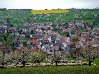
![Percorso A piedi Weilheim an der Teck - blaue Raute Hepsisau Bissingen - Photo](https://media.geolcdn.com/t/350/260/dab04fa3-7ee0-4b94-b99b-5ea34505111c.jpeg&format=jpg&maxdim=2)
![A piedi A piedi](https://static1.geolcdn.com/sitytour/trail-icons/100.png)
Km
A piedi
![](/images/other/stat-length.png)
![](https://static1.geolcdn.com/siteimages/upload/files/1508320355ic_sort_den_pos_24dp.png)
![](https://static1.geolcdn.com/siteimages/upload/files/1508320355ic_sort_den_neg_24dp.png)
![](https://static1.geolcdn.com/siteimages/upload/files/16400158638029165_repeat_loop_refresh_sync_direction_icon.png)
• Trail created by Schwäbischer Albverein.
![Percorso A piedi Weilheim an der Teck - Weilheim Rundweg 14 - Photo](https://media.geolcdn.com/t/350/260/bd8e75b2-0229-41ef-8093-6e594e3c3309.jpeg&format=jpg&maxdim=2)
![A piedi A piedi](https://static1.geolcdn.com/sitytour/trail-icons/100.png)
Km
A piedi
![](/images/other/stat-length.png)
![](https://static1.geolcdn.com/siteimages/upload/files/1508320355ic_sort_den_pos_24dp.png)
![](https://static1.geolcdn.com/siteimages/upload/files/1508320355ic_sort_den_neg_24dp.png)
![](https://static1.geolcdn.com/siteimages/upload/files/16400158638029165_repeat_loop_refresh_sync_direction_icon.png)
• Trail created by Stadt Weilheim an der Teck. Symbol: quadratische blaue Fläche mit inneren weißen Kreis in dem wiede...
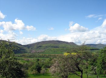
![Percorso A piedi Weilheim an der Teck - Weilheim Rundweg 41 - Photo](https://media.geolcdn.com/t/350/260/6557f730-895b-48e3-a5d3-a1c49952fc58.jpeg&format=jpg&maxdim=2)
![A piedi A piedi](https://static1.geolcdn.com/sitytour/trail-icons/100.png)
Km
A piedi
![](/images/other/stat-length.png)
![](https://static1.geolcdn.com/siteimages/upload/files/1508320355ic_sort_den_pos_24dp.png)
![](https://static1.geolcdn.com/siteimages/upload/files/1508320355ic_sort_den_neg_24dp.png)
![](https://static1.geolcdn.com/siteimages/upload/files/16400158638029165_repeat_loop_refresh_sync_direction_icon.png)
• Trail created by Stadt Weilheim an der Teck. Symbol: quadratische blaue Fläche mit innerem weißen Kreis in dem wiede...
![Percorso A piedi Kirchheim unter Teck - blaue Raute Tiefenbach Bürgerseen - Photo](https://media.geolcdn.com/t/350/260/afcc7769-5183-45a3-b418-f67b851ab0fc.jpeg&format=jpg&maxdim=2)
![A piedi A piedi](https://static1.geolcdn.com/sitytour/trail-icons/100.png)
Km
A piedi
![](/images/other/stat-length.png)
![](https://static1.geolcdn.com/siteimages/upload/files/1508320355ic_sort_den_pos_24dp.png)
![](https://static1.geolcdn.com/siteimages/upload/files/1508320355ic_sort_den_neg_24dp.png)
![](https://static1.geolcdn.com/siteimages/upload/files/16400158638029165_repeat_loop_refresh_sync_direction_icon.png)
• Trail created by Schwäbischer Albverein. Symbol: blaue Raute auf weißem Grund
20 percorsi visualizzati su 54
Applicazione GPS da escursionismo GRATUITA
Attività
Regioni vicine
- Aichtal
- Aichwald
- Bempflingen
- Beuren
- Denkendorf
- Dettingen unter Teck
- Esslingen am Neckar
- Filderstadt
- Frickenhausen
- Großbettlingen
- Kirchheim unter Teck
- Köngen
- Leinfelden-Echterdingen
- Lenningen
- Lichtenwald
- Neidlingen
- Neuffen
- Nürtingen
- Ostfildern
- Owen
- Plochingen
- Reichenbach an der Fils
- Unterensingen
- Weilheim an der Teck
- Wernau (Neckar)