![](/images/other/stat-length.png)
- Percorsi
- A piedi
- Germany
- Baden-Württemberg
- Heidelberg
- Sconosciuto
- Ziegelhausen
Ziegelhausen, Sconosciuto, A piedi : I migliori sentieri, percorsi e passeggiate
Ziegelhausen: Scopri i migliori percorsi: 10 a piedi. Tutti questi percorsi, itinerari e attività outdoor sono disponibili nelle nostre app SityTrail per smartphone e tablet.
I percorsi migliori (0})
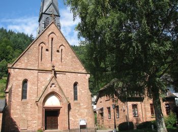
![Percorso A piedi Sconosciuto - Rundwanderweg Ziegelhausen 3: Rund um Peterstal - Photo](https://media.geolcdn.com/t/350/260/d115d575-c43e-4f58-8e54-d1667eccc4ec.jpeg&format=jpg&maxdim=2)
![A piedi A piedi](https://static1.geolcdn.com/sitytour/trail-icons/100.png)
Km
A piedi
![](/images/other/stat-length.png)
![](https://static1.geolcdn.com/siteimages/upload/files/1508320355ic_sort_den_pos_24dp.png)
![](https://static1.geolcdn.com/siteimages/upload/files/1508320355ic_sort_den_neg_24dp.png)
![](https://static1.geolcdn.com/siteimages/upload/files/16400158638029165_repeat_loop_refresh_sync_direction_icon.png)
• Trail created by Odenwaldklub. Symbol: 3 in oben offenen Kreis, in Öffnung ein Z
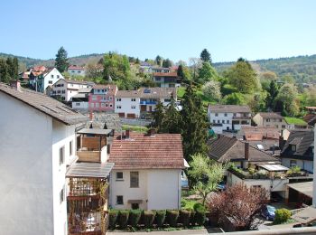
![Percorso A piedi Sconosciuto - Rundwanderweg Ziegelhausen 2: Rund um Ziegelhausen - Photo](https://media.geolcdn.com/t/350/260/9b393914-1b6b-4893-8dbe-fc3056f01cd9.jpeg&format=jpg&maxdim=2)
![A piedi A piedi](https://static1.geolcdn.com/sitytour/trail-icons/100.png)
Km
A piedi
![](/images/other/stat-length.png)
![](https://static1.geolcdn.com/siteimages/upload/files/1508320355ic_sort_den_pos_24dp.png)
![](https://static1.geolcdn.com/siteimages/upload/files/1508320355ic_sort_den_neg_24dp.png)
![](https://static1.geolcdn.com/siteimages/upload/files/16400158638029165_repeat_loop_refresh_sync_direction_icon.png)
• Trail created by Odenwaldklub. Symbol: 2 in oben offenen Kreis, in Öffnung ein Z
![Percorso A piedi Sconosciuto - Rundwanderweg Wilhelmsfeld 10 : Weißer-Stein-Weg - Photo](https://media.geolcdn.com/t/350/260/79375ba0-0b03-45c4-8a21-253e8f44d90f.jpeg&format=jpg&maxdim=2)
![A piedi A piedi](https://static1.geolcdn.com/sitytour/trail-icons/100.png)
Km
A piedi
![](/images/other/stat-length.png)
![](https://static1.geolcdn.com/siteimages/upload/files/1508320355ic_sort_den_pos_24dp.png)
![](https://static1.geolcdn.com/siteimages/upload/files/1508320355ic_sort_den_neg_24dp.png)
![](https://static1.geolcdn.com/siteimages/upload/files/16400158638029165_repeat_loop_refresh_sync_direction_icon.png)
• Trail created by Naturpark Neckartal-Odenwald. Symbol: 10 in einem oben offenen Kreis; in der Kreisöffnung ein W
![Percorso A piedi Sconosciuto - Rundwanderweg Wilhelmsfeld 9: Allmendwaldweg - Photo](https://media.geolcdn.com/t/350/260/79375ba0-0b03-45c4-8a21-253e8f44d90f.jpeg&format=jpg&maxdim=2)
![A piedi A piedi](https://static1.geolcdn.com/sitytour/trail-icons/100.png)
Km
A piedi
![](/images/other/stat-length.png)
![](https://static1.geolcdn.com/siteimages/upload/files/1508320355ic_sort_den_pos_24dp.png)
![](https://static1.geolcdn.com/siteimages/upload/files/1508320355ic_sort_den_neg_24dp.png)
![](https://static1.geolcdn.com/siteimages/upload/files/16400158638029165_repeat_loop_refresh_sync_direction_icon.png)
• Trail created by Naturpark Neckartal-Odenwald. Symbol: 9 in einem oben offenen Kreis; in der Kreisöffnung ein W
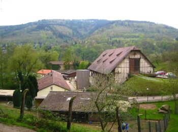
![Percorso A piedi Sconosciuto - Rundwanderweg Ziegelhausen 4: Mausbachwiesen-Weg - Photo](https://media.geolcdn.com/t/350/260/63b982da-0a44-4e7e-9ec0-ffd777547d3b.jpeg&format=jpg&maxdim=2)
![A piedi A piedi](https://static1.geolcdn.com/sitytour/trail-icons/100.png)
Km
A piedi
![](/images/other/stat-length.png)
![](https://static1.geolcdn.com/siteimages/upload/files/1508320355ic_sort_den_pos_24dp.png)
![](https://static1.geolcdn.com/siteimages/upload/files/1508320355ic_sort_den_neg_24dp.png)
![](https://static1.geolcdn.com/siteimages/upload/files/16400158638029165_repeat_loop_refresh_sync_direction_icon.png)
• Trail created by Naturpark Neckartal-Odenwald. Symbol: 4 in oben offenen Kreis, in Öffnung ein Z
![Percorso A piedi Sconosciuto - Rundwanderweg Ziegelhausen 5: Karlshütten-Weg - Photo](https://media.geolcdn.com/t/350/260/63b982da-0a44-4e7e-9ec0-ffd777547d3b.jpeg&format=jpg&maxdim=2)
![A piedi A piedi](https://static1.geolcdn.com/sitytour/trail-icons/100.png)
Km
A piedi
![](/images/other/stat-length.png)
![](https://static1.geolcdn.com/siteimages/upload/files/1508320355ic_sort_den_pos_24dp.png)
![](https://static1.geolcdn.com/siteimages/upload/files/1508320355ic_sort_den_neg_24dp.png)
![](https://static1.geolcdn.com/siteimages/upload/files/16400158638029165_repeat_loop_refresh_sync_direction_icon.png)
• Trail created by Naturpark Neckartal-Odenwald. Symbol: 5 in oben offenen Kreis, in Öffnung ein Z
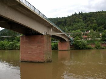
![Percorso A piedi Sconosciuto - Rundwanderweg Ziegelhausen 1: Münchel-Weg - Photo](https://media.geolcdn.com/t/350/260/eb065fec-fc89-4826-8094-4144597ecefa.jpeg&format=jpg&maxdim=2)
![A piedi A piedi](https://static1.geolcdn.com/sitytour/trail-icons/100.png)
Km
A piedi
![](/images/other/stat-length.png)
![](https://static1.geolcdn.com/siteimages/upload/files/1508320355ic_sort_den_pos_24dp.png)
![](https://static1.geolcdn.com/siteimages/upload/files/1508320355ic_sort_den_neg_24dp.png)
![](https://static1.geolcdn.com/siteimages/upload/files/16400158638029165_repeat_loop_refresh_sync_direction_icon.png)
• Trail created by Naturpark Neckartal-Odenwald. Symbol: Weiße 1 in einem oben offenen Kreis, darüber weißes Z
![Percorso A piedi Sconosciuto - Rundwanderweg Wilhelmsfeld 11: Dollenschlag-Weg - Photo](https://media.geolcdn.com/t/350/260/ext.jpg?maxdim=2&url=https%3A%2F%2Fstatic1.geolcdn.com%2Fsiteimages%2Fupload%2Ffiles%2F1545311037marcheuse_200dpi.jpg)
![A piedi A piedi](https://static1.geolcdn.com/sitytour/trail-icons/100.png)
Km
A piedi
![](/images/other/stat-length.png)
![](https://static1.geolcdn.com/siteimages/upload/files/1508320355ic_sort_den_pos_24dp.png)
![](https://static1.geolcdn.com/siteimages/upload/files/1508320355ic_sort_den_neg_24dp.png)
![](https://static1.geolcdn.com/siteimages/upload/files/16400158638029165_repeat_loop_refresh_sync_direction_icon.png)
• Trail created by Naturpark Neckartal-Odenwald. Symbol: 11 in einem oben offenen Kreis; in der Kreisöffnung ein W
![Percorso A piedi Sconosciuto - Rundwanderweg Ziegelhausen 6: Kreuzgrund-Weg - Photo](https://media.geolcdn.com/t/350/260/ext.jpg?maxdim=2&url=https%3A%2F%2Fstatic1.geolcdn.com%2Fsiteimages%2Fupload%2Ffiles%2F1545311037marcheuse_200dpi.jpg)
![A piedi A piedi](https://static1.geolcdn.com/sitytour/trail-icons/100.png)
Km
A piedi
![](/images/other/stat-length.png)
![](https://static1.geolcdn.com/siteimages/upload/files/1508320355ic_sort_den_pos_24dp.png)
![](https://static1.geolcdn.com/siteimages/upload/files/1508320355ic_sort_den_neg_24dp.png)
![](https://static1.geolcdn.com/siteimages/upload/files/16400158638029165_repeat_loop_refresh_sync_direction_icon.png)
• Trail created by Naturpark Neckartal-Odenwald. Symbol: 6 in einem oben offenen Kreis; in der Kreisöffnung ein Z
![Percorso A piedi Sconosciuto - Rundwanderweg Schönau 3: Lärchengarten-Weg - Photo](https://media.geolcdn.com/t/350/260/ext.jpg?maxdim=2&url=https%3A%2F%2Fstatic1.geolcdn.com%2Fsiteimages%2Fupload%2Ffiles%2F1545311037marcheuse_200dpi.jpg)
![A piedi A piedi](https://static1.geolcdn.com/sitytour/trail-icons/100.png)
Km
A piedi
![](/images/other/stat-length.png)
![](https://static1.geolcdn.com/siteimages/upload/files/1508320355ic_sort_den_pos_24dp.png)
![](https://static1.geolcdn.com/siteimages/upload/files/1508320355ic_sort_den_neg_24dp.png)
![](https://static1.geolcdn.com/siteimages/upload/files/16400158638029165_repeat_loop_refresh_sync_direction_icon.png)
• Trail created by Naturpark Neckartal-Odenwald. Symbol: Weiße 3 in einem oben offenen Kreis, darüber weißes S
10 percorsi visualizzati su 10
Applicazione GPS da escursionismo GRATUITA