![](/images/other/stat-length.png)
Berching, Landkreis Neumarkt in der Oberpfalz, A piedi : I migliori sentieri, percorsi e passeggiate
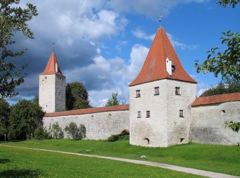
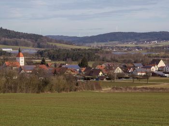
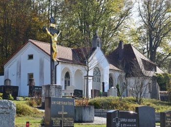
Berching: Scopri i migliori percorsi: 8 a piedi. Tutti questi percorsi, itinerari e attività outdoor sono disponibili nelle nostre app SityTrail per smartphone e tablet.
I percorsi migliori (0})
![Percorso A piedi Berching - Wasser- und Mühlenweg - Photo](https://media.geolcdn.com/t/350/260/0f30577b-cb8c-433c-9898-83c9e06a4cab.jpeg&format=jpg&maxdim=2)
![A piedi A piedi](https://static1.geolcdn.com/sitytour/trail-icons/100.png)
Km
A piedi
![](/images/other/stat-length.png)
![](https://static1.geolcdn.com/siteimages/upload/files/1508320355ic_sort_den_pos_24dp.png)
![](https://static1.geolcdn.com/siteimages/upload/files/1508320355ic_sort_den_neg_24dp.png)
![](https://static1.geolcdn.com/siteimages/upload/files/16400158638029165_repeat_loop_refresh_sync_direction_icon.png)
• Trail created by Landkreis Neumarkt i.d.OPf.. Symbol: braunes Mühlrad auf gelben Grund
![Percorso A piedi Berching - Plankstetten - Oening - Photo](https://media.geolcdn.com/t/350/260/24a9071a-4aed-476c-b913-466963111fef.jpeg&format=jpg&maxdim=2)
![A piedi A piedi](https://static1.geolcdn.com/sitytour/trail-icons/100.png)
Km
A piedi
![](/images/other/stat-length.png)
![](https://static1.geolcdn.com/siteimages/upload/files/1508320355ic_sort_den_pos_24dp.png)
![](https://static1.geolcdn.com/siteimages/upload/files/1508320355ic_sort_den_neg_24dp.png)
![](https://static1.geolcdn.com/siteimages/upload/files/16400158638029165_repeat_loop_refresh_sync_direction_icon.png)
• Trail created by Stadt Berching. Symbol: Schwarze W3 auf gelbem Grund
![Percorso A piedi Berching - Berching - Holnstein - Photo](https://media.geolcdn.com/t/350/260/70bc2a95-37ba-468c-83c7-8ce50370f65b.jpeg&format=jpg&maxdim=2)
![A piedi A piedi](https://static1.geolcdn.com/sitytour/trail-icons/100.png)
Km
A piedi
![](/images/other/stat-length.png)
![](https://static1.geolcdn.com/siteimages/upload/files/1508320355ic_sort_den_pos_24dp.png)
![](https://static1.geolcdn.com/siteimages/upload/files/1508320355ic_sort_den_neg_24dp.png)
![](https://static1.geolcdn.com/siteimages/upload/files/16400158638029165_repeat_loop_refresh_sync_direction_icon.png)
• Trail created by Stadt Berching. Symbol: Schwarze W1b auf gelbem Grund
![Percorso A piedi Berching - Benediktusweg - Photo](https://media.geolcdn.com/t/350/260/69d8dc5c-1e6d-4328-8342-6c70a13e7a2c.jpeg&format=jpg&maxdim=2)
![A piedi A piedi](https://static1.geolcdn.com/sitytour/trail-icons/100.png)
Km
A piedi
![](/images/other/stat-length.png)
![](https://static1.geolcdn.com/siteimages/upload/files/1508320355ic_sort_den_pos_24dp.png)
![](https://static1.geolcdn.com/siteimages/upload/files/1508320355ic_sort_den_neg_24dp.png)
![](https://static1.geolcdn.com/siteimages/upload/files/16400158638029165_repeat_loop_refresh_sync_direction_icon.png)
• Trail created by Stadt Berching. abgeschlossen (Januar 2014, cycling_zno) Symbol: Grüne 5 auf gelbem Grund
![Percorso A piedi Berching - Hoher Brunnen - Photo](https://media.geolcdn.com/t/350/260/55fecf17-a42a-4166-ac2b-1ad3b1fa7b1e.jpeg&format=jpg&maxdim=2)
![A piedi A piedi](https://static1.geolcdn.com/sitytour/trail-icons/100.png)
Km
A piedi
![](/images/other/stat-length.png)
![](https://static1.geolcdn.com/siteimages/upload/files/1508320355ic_sort_den_pos_24dp.png)
![](https://static1.geolcdn.com/siteimages/upload/files/1508320355ic_sort_den_neg_24dp.png)
![](https://static1.geolcdn.com/siteimages/upload/files/16400158638029165_repeat_loop_refresh_sync_direction_icon.png)
• Trail created by Stadt Berching. abgeschlossen (Januar 2014, cycling_zno) Symbol: Grüne 4 auf gelbem Grund
![Percorso A piedi Berching - Gluck-Wanderweg - Photo](https://media.geolcdn.com/t/350/260/61d64fda-cbb5-4346-aab2-2f4f615755d3.jpeg&format=jpg&maxdim=2)
![A piedi A piedi](https://static1.geolcdn.com/sitytour/trail-icons/100.png)
Km
A piedi
![](/images/other/stat-length.png)
![](https://static1.geolcdn.com/siteimages/upload/files/1508320355ic_sort_den_pos_24dp.png)
![](https://static1.geolcdn.com/siteimages/upload/files/1508320355ic_sort_den_neg_24dp.png)
![](https://static1.geolcdn.com/siteimages/upload/files/16400158638029165_repeat_loop_refresh_sync_direction_icon.png)
• Trail created by Stadt Berching. abgeschlossen (Januar 2014, cycling_zno) Symbol: Grüne 3 auf gelbem Grund
![Percorso A piedi Berching - Steinweg - Photo](https://media.geolcdn.com/t/350/260/718be3e5-e71f-4466-9c76-1b30cd02520a.jpeg&format=jpg&maxdim=2)
![A piedi A piedi](https://static1.geolcdn.com/sitytour/trail-icons/100.png)
Km
A piedi
![](/images/other/stat-length.png)
![](https://static1.geolcdn.com/siteimages/upload/files/1508320355ic_sort_den_pos_24dp.png)
![](https://static1.geolcdn.com/siteimages/upload/files/1508320355ic_sort_den_neg_24dp.png)
![](https://static1.geolcdn.com/siteimages/upload/files/16400158638029165_repeat_loop_refresh_sync_direction_icon.png)
• Trail created by Stadt Berching. abgeschlossen (Januar 2014, cycling_zno) Symbol: Grüne 1 auf gelbem Grund
![Percorso A piedi Berching - Jurasteig König-Ludwig-Schlaufe - Photo](https://media.geolcdn.com/t/350/260/70bc2a95-37ba-468c-83c7-8ce50370f65b.jpeg&format=jpg&maxdim=2)
![A piedi A piedi](https://static1.geolcdn.com/sitytour/trail-icons/100.png)
Km
A piedi
![](/images/other/stat-length.png)
![](https://static1.geolcdn.com/siteimages/upload/files/1508320355ic_sort_den_pos_24dp.png)
![](https://static1.geolcdn.com/siteimages/upload/files/1508320355ic_sort_den_neg_24dp.png)
![](https://static1.geolcdn.com/siteimages/upload/files/16400158638029165_repeat_loop_refresh_sync_direction_icon.png)
• Trail created by Gebietsgemeinschaft Bayerischer Jura. geprüft (März 2014, by cycling_zno) Symbol: Gelbe Schleife a...
8 percorsi visualizzati su 8
Applicazione GPS da escursionismo GRATUITA