![](/images/other/stat-length.png)
- Percorsi
- A piedi
- Germany
- Baviera
- Landkreis Neumarkt in der Oberpfalz
- Dietfurt an der Altmühl
Dietfurt an der Altmühl, Landkreis Neumarkt in der Oberpfalz, A piedi : I migliori sentieri, percorsi e passeggiate
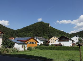
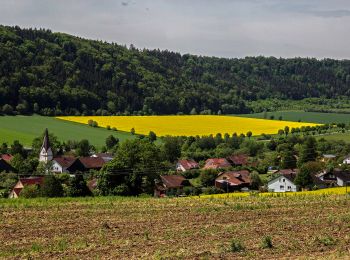
Dietfurt an der Altmühl: Scopri i migliori percorsi: 11 a piedi. Tutti questi percorsi, itinerari e attività outdoor sono disponibili nelle nostre app SityTrail per smartphone e tablet.
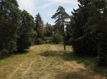
I percorsi migliori (0})
![Percorso A piedi Dietfurt an der Altmühl - Dietfurter Wasserwege (Technik & Natur) - Photo](https://media.geolcdn.com/t/350/260/7fa80b07-24d7-49ad-92b8-2004a04c8b75.jpeg&format=jpg&maxdim=2)
![A piedi A piedi](https://static1.geolcdn.com/sitytour/trail-icons/100.png)
Km
A piedi
![](/images/other/stat-length.png)
![](https://static1.geolcdn.com/siteimages/upload/files/1508320355ic_sort_den_pos_24dp.png)
![](https://static1.geolcdn.com/siteimages/upload/files/1508320355ic_sort_den_neg_24dp.png)
![](https://static1.geolcdn.com/siteimages/upload/files/16400158638029165_repeat_loop_refresh_sync_direction_icon.png)
• Trail created by Stadt Dietfurt. Symbol: Gelbes W2 auf blauem Grund
![Percorso A piedi Dietfurt an der Altmühl - Dietfurter Wasserwege (Zurück zur Quelle) - Photo](https://media.geolcdn.com/t/350/260/40261bff-4a38-444a-b7b0-328635d3bc0e.jpeg&format=jpg&maxdim=2)
![A piedi A piedi](https://static1.geolcdn.com/sitytour/trail-icons/100.png)
Km
A piedi
![](/images/other/stat-length.png)
![](https://static1.geolcdn.com/siteimages/upload/files/1508320355ic_sort_den_pos_24dp.png)
![](https://static1.geolcdn.com/siteimages/upload/files/1508320355ic_sort_den_neg_24dp.png)
![](https://static1.geolcdn.com/siteimages/upload/files/16400158638029165_repeat_loop_refresh_sync_direction_icon.png)
• Trail created by Stadt Dietfurt. abgeschlossen (Feb. 2014, by cycling_zno) Symbol: Gelbes W3 auf blauem Grund
![Percorso A piedi Dietfurt an der Altmühl - Dietfurter Wasserwege (Stadtspaziergang) - Photo](https://media.geolcdn.com/t/350/260/862dc7cb-c5b9-40c3-91cf-087ccb2e4660.jpeg&format=jpg&maxdim=2)
![A piedi A piedi](https://static1.geolcdn.com/sitytour/trail-icons/100.png)
Km
A piedi
![](/images/other/stat-length.png)
![](https://static1.geolcdn.com/siteimages/upload/files/1508320355ic_sort_den_pos_24dp.png)
![](https://static1.geolcdn.com/siteimages/upload/files/1508320355ic_sort_den_neg_24dp.png)
![](https://static1.geolcdn.com/siteimages/upload/files/16400158638029165_repeat_loop_refresh_sync_direction_icon.png)
• Trail created by Stadt Dietfurt. Symbol: Gelbes W1 auf blauem Grund
![Percorso A piedi Dietfurt an der Altmühl - QiGong-Weg - Photo](https://media.geolcdn.com/t/350/260/8a4e5930-d498-4004-bf3d-ec18db1eb5a0.jpeg&format=jpg&maxdim=2)
![A piedi A piedi](https://static1.geolcdn.com/sitytour/trail-icons/100.png)
Km
A piedi
![](/images/other/stat-length.png)
![](https://static1.geolcdn.com/siteimages/upload/files/1508320355ic_sort_den_pos_24dp.png)
![](https://static1.geolcdn.com/siteimages/upload/files/1508320355ic_sort_den_neg_24dp.png)
![](https://static1.geolcdn.com/siteimages/upload/files/16400158638029165_repeat_loop_refresh_sync_direction_icon.png)
• Trail created by Stadt Dietfurt. abgeschlossen (Januar 2014, cycling_zno) Symbol: Grüne 8 auf gelbem Grund
![Percorso A piedi Dietfurt an der Altmühl - Wildensteiner Steig - Photo](https://media.geolcdn.com/t/350/260/837f69fb-dc78-4893-9844-6bb2e70098cf.jpeg&format=jpg&maxdim=2)
![A piedi A piedi](https://static1.geolcdn.com/sitytour/trail-icons/100.png)
Km
A piedi
![](/images/other/stat-length.png)
![](https://static1.geolcdn.com/siteimages/upload/files/1508320355ic_sort_den_pos_24dp.png)
![](https://static1.geolcdn.com/siteimages/upload/files/1508320355ic_sort_den_neg_24dp.png)
![](https://static1.geolcdn.com/siteimages/upload/files/16400158638029165_repeat_loop_refresh_sync_direction_icon.png)
• Trail created by Stadt Dietfurt. abgeschlossen (Januar 2014, cycling_zno) Symbol: Grüne 5 auf gelbem Grund
![Percorso A piedi Dietfurt an der Altmühl - Walderlebnispfad Wolfsberg - Photo](https://media.geolcdn.com/t/350/260/cc3bc6e1-b2fc-4048-994a-81e61f02ba18.jpeg&format=jpg&maxdim=2)
![A piedi A piedi](https://static1.geolcdn.com/sitytour/trail-icons/100.png)
Km
A piedi
![](/images/other/stat-length.png)
![](https://static1.geolcdn.com/siteimages/upload/files/1508320355ic_sort_den_pos_24dp.png)
![](https://static1.geolcdn.com/siteimages/upload/files/1508320355ic_sort_den_neg_24dp.png)
![](https://static1.geolcdn.com/siteimages/upload/files/16400158638029165_repeat_loop_refresh_sync_direction_icon.png)
• Trail created by Stadt Dietfurt. abgeschlossen (Januar 2014, cycling_zno) Symbol: Grüne 4 auf gelbem Grund
![Percorso A piedi Dietfurt an der Altmühl - Altmühlbergweg - Photo](https://media.geolcdn.com/t/350/260/9fca1159-7b87-46e1-9972-29b961fbe478.jpeg&format=jpg&maxdim=2)
![A piedi A piedi](https://static1.geolcdn.com/sitytour/trail-icons/100.png)
Km
A piedi
![](/images/other/stat-length.png)
![](https://static1.geolcdn.com/siteimages/upload/files/1508320355ic_sort_den_pos_24dp.png)
![](https://static1.geolcdn.com/siteimages/upload/files/1508320355ic_sort_den_neg_24dp.png)
![](https://static1.geolcdn.com/siteimages/upload/files/16400158638029165_repeat_loop_refresh_sync_direction_icon.png)
• Trail created by Stadt Dietfurt. abgeschlossen (Januar 2014, cycling_zno) Symbol: Grüne 3 auf gelbem Grund
![Percorso A piedi Dietfurt an der Altmühl - Moosbärnweg - Photo](https://media.geolcdn.com/t/350/260/50a67f0a-37c2-4eba-8bbd-5e0e4fa1c835.jpeg&format=jpg&maxdim=2)
![A piedi A piedi](https://static1.geolcdn.com/sitytour/trail-icons/100.png)
Km
A piedi
![](/images/other/stat-length.png)
![](https://static1.geolcdn.com/siteimages/upload/files/1508320355ic_sort_den_pos_24dp.png)
![](https://static1.geolcdn.com/siteimages/upload/files/1508320355ic_sort_den_neg_24dp.png)
![](https://static1.geolcdn.com/siteimages/upload/files/16400158638029165_repeat_loop_refresh_sync_direction_icon.png)
• Trail created by Stadt Dietfurt. abgeschlossen (Januar 2014, cycling_zno) Symbol: Grüne 2 auf gelbem Grund
![Percorso A piedi Dietfurt an der Altmühl - Kreuzbergweg - Photo](https://media.geolcdn.com/t/350/260/6bb03e6d-2967-4549-a4ef-e5766f5a4c8c.jpeg&format=jpg&maxdim=2)
![A piedi A piedi](https://static1.geolcdn.com/sitytour/trail-icons/100.png)
Km
A piedi
![](/images/other/stat-length.png)
![](https://static1.geolcdn.com/siteimages/upload/files/1508320355ic_sort_den_pos_24dp.png)
![](https://static1.geolcdn.com/siteimages/upload/files/1508320355ic_sort_den_neg_24dp.png)
![](https://static1.geolcdn.com/siteimages/upload/files/16400158638029165_repeat_loop_refresh_sync_direction_icon.png)
• Trail created by Stadt Dietfurt. abgeschlossen (Januar 2014, cycling_zno) Symbol: Grüne 1 auf gelbem Grund
![Percorso A piedi Dietfurt an der Altmühl - Jurasteig Tillyland-Schlaufe - Photo](https://media.geolcdn.com/t/350/260/cc3bc6e1-b2fc-4048-994a-81e61f02ba18.jpeg&format=jpg&maxdim=2)
![A piedi A piedi](https://static1.geolcdn.com/sitytour/trail-icons/100.png)
Km
A piedi
![](/images/other/stat-length.png)
![](https://static1.geolcdn.com/siteimages/upload/files/1508320355ic_sort_den_pos_24dp.png)
![](https://static1.geolcdn.com/siteimages/upload/files/1508320355ic_sort_den_neg_24dp.png)
![](https://static1.geolcdn.com/siteimages/upload/files/16400158638029165_repeat_loop_refresh_sync_direction_icon.png)
• Trail created by Gebietsgemeinschaft Bayerischer Jura. geprüft (April 2014, by cycling_zno) Symbol: Gelbe Schleife ...
![Percorso A piedi Dietfurt an der Altmühl - Jurasteig Höhlenkundliche Schlaufe - Photo](https://media.geolcdn.com/t/350/260/0f70a6da-31b6-4eb2-8e53-6117b8cf15c2.jpeg&format=jpg&maxdim=2)
![A piedi A piedi](https://static1.geolcdn.com/sitytour/trail-icons/100.png)
Km
A piedi
![](/images/other/stat-length.png)
![](https://static1.geolcdn.com/siteimages/upload/files/1508320355ic_sort_den_pos_24dp.png)
![](https://static1.geolcdn.com/siteimages/upload/files/1508320355ic_sort_den_neg_24dp.png)
![](https://static1.geolcdn.com/siteimages/upload/files/16400158638029165_repeat_loop_refresh_sync_direction_icon.png)
• Trail created by Gebietsgemeinschaft Bayerischer Jura. geprüft (März 2104, by cycling_zno) Symbol: Gelbe Schleife a...
11 percorsi visualizzati su 11
Applicazione GPS da escursionismo GRATUITA