![](/images/other/stat-length.png)
- Percorsi
- A piedi
- Germany
- Baviera
- Landkreis Schweinfurt
- Schonungen
Schonungen, Landkreis Schweinfurt, A piedi : I migliori sentieri, percorsi e passeggiate
Schonungen: Scopri i migliori percorsi: 6 a piedi. Tutti questi percorsi, itinerari e attività outdoor sono disponibili nelle nostre app SityTrail per smartphone e tablet.
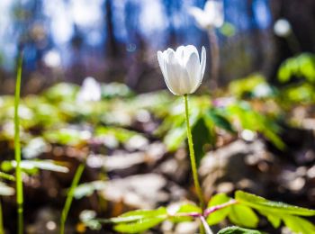
I percorsi migliori (0})
![Percorso A piedi Schonungen - Mainberger Runde - Photo](https://media.geolcdn.com/t/350/260/3caae30f-ac4c-4818-b9c4-74202d0a383e.jpeg&format=jpg&maxdim=2)
![A piedi A piedi](https://static1.geolcdn.com/sitytour/trail-icons/100.png)
Km
A piedi
![](/images/other/stat-length.png)
![](https://static1.geolcdn.com/siteimages/upload/files/1508320355ic_sort_den_pos_24dp.png)
![](https://static1.geolcdn.com/siteimages/upload/files/1508320355ic_sort_den_neg_24dp.png)
![](https://static1.geolcdn.com/siteimages/upload/files/16400158638029165_repeat_loop_refresh_sync_direction_icon.png)
• Symbol: letter 'M' in a circle with an arrowhead at NW position
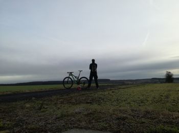
![Percorso A piedi Schonungen - Naturpfad - Photo](https://media.geolcdn.com/t/350/260/1ff501fe-19ba-4926-ab12-96f13199470a.jpeg&format=jpg&maxdim=2)
![A piedi A piedi](https://static1.geolcdn.com/sitytour/trail-icons/100.png)
Km
A piedi
![](/images/other/stat-length.png)
![](https://static1.geolcdn.com/siteimages/upload/files/1508320355ic_sort_den_pos_24dp.png)
![](https://static1.geolcdn.com/siteimages/upload/files/1508320355ic_sort_den_neg_24dp.png)
![](https://static1.geolcdn.com/siteimages/upload/files/16400158638029165_repeat_loop_refresh_sync_direction_icon.png)
• Trail created by Naturfreunde Ortsgruppe Schweinfurt. Symbol: Blaues "N" in schwarzem Kreis auf weißem Hintergrund
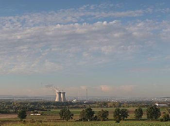
![Percorso A piedi Schonungen - Apfelweg - Photo](https://media.geolcdn.com/t/350/260/a34454d9-38d1-4173-b123-5cdf217ebc55.jpeg&format=jpg&maxdim=2)
![A piedi A piedi](https://static1.geolcdn.com/sitytour/trail-icons/100.png)
Km
A piedi
![](/images/other/stat-length.png)
![](https://static1.geolcdn.com/siteimages/upload/files/1508320355ic_sort_den_pos_24dp.png)
![](https://static1.geolcdn.com/siteimages/upload/files/1508320355ic_sort_den_neg_24dp.png)
![](https://static1.geolcdn.com/siteimages/upload/files/16400158638029165_repeat_loop_refresh_sync_direction_icon.png)
• Trail created by VGL Schonungen. Symbol: Ein grüner, blauer und gelber Apfel auf weißem Grund.
![Percorso A piedi Schonungen - AV Grün Route 3 - Photo](https://media.geolcdn.com/t/350/260/a34454d9-38d1-4173-b123-5cdf217ebc55.jpeg&format=jpg&maxdim=2)
![A piedi A piedi](https://static1.geolcdn.com/sitytour/trail-icons/100.png)
Km
A piedi
![](/images/other/stat-length.png)
![](https://static1.geolcdn.com/siteimages/upload/files/1508320355ic_sort_den_pos_24dp.png)
![](https://static1.geolcdn.com/siteimages/upload/files/1508320355ic_sort_den_neg_24dp.png)
![](https://static1.geolcdn.com/siteimages/upload/files/16400158638029165_repeat_loop_refresh_sync_direction_icon.png)
• Trail created by DAV Sektion Schweinfurt. Symbol: AV Grün auf Weiß
![Percorso A piedi Schonungen - Mainberger Jubiläumswanderweg - Photo](https://media.geolcdn.com/t/350/260/a34454d9-38d1-4173-b123-5cdf217ebc55.jpeg&format=jpg&maxdim=2)
![A piedi A piedi](https://static1.geolcdn.com/sitytour/trail-icons/100.png)
Km
A piedi
![](/images/other/stat-length.png)
![](https://static1.geolcdn.com/siteimages/upload/files/1508320355ic_sort_den_pos_24dp.png)
![](https://static1.geolcdn.com/siteimages/upload/files/1508320355ic_sort_den_neg_24dp.png)
![](https://static1.geolcdn.com/siteimages/upload/files/16400158638029165_repeat_loop_refresh_sync_direction_icon.png)
![Percorso A piedi Schonungen - Höllental und Mainblick - Photo](https://media.geolcdn.com/t/350/260/44954e7e-cc14-4e37-b588-ace6d2e3fc87.jpeg&format=jpg&maxdim=2)
![A piedi A piedi](https://static1.geolcdn.com/sitytour/trail-icons/100.png)
Km
A piedi
![](/images/other/stat-length.png)
![](https://static1.geolcdn.com/siteimages/upload/files/1508320355ic_sort_den_pos_24dp.png)
![](https://static1.geolcdn.com/siteimages/upload/files/1508320355ic_sort_den_neg_24dp.png)
![](https://static1.geolcdn.com/siteimages/upload/files/16400158638029165_repeat_loop_refresh_sync_direction_icon.png)
6 percorsi visualizzati su 6
Applicazione GPS da escursionismo GRATUITA