![](/images/other/stat-length.png)
- Percorsi
- A piedi
- Germany
- Baviera
- Landkreis Rosenheim
- Neubeuern
Neubeuern, Landkreis Rosenheim, A piedi : I migliori sentieri, percorsi e passeggiate
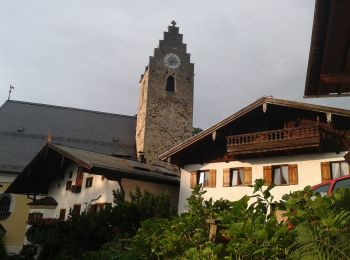
Neubeuern: Scopri i migliori percorsi: 9 a piedi. Tutti questi percorsi, itinerari e attività outdoor sono disponibili nelle nostre app SityTrail per smartphone e tablet.
I percorsi migliori (0})
![Percorso A piedi Neubeuern - Wanderweg 23 - Neubeuern - Photo](https://media.geolcdn.com/t/350/260/0ebcb92c-e2d3-47ba-a539-bba332a56891.jpeg&format=jpg&maxdim=2)
![A piedi A piedi](https://static1.geolcdn.com/sitytour/trail-icons/100.png)
Km
A piedi
![](/images/other/stat-length.png)
![](https://static1.geolcdn.com/siteimages/upload/files/1508320355ic_sort_den_pos_24dp.png)
![](https://static1.geolcdn.com/siteimages/upload/files/1508320355ic_sort_den_neg_24dp.png)
![](https://static1.geolcdn.com/siteimages/upload/files/16400158638029165_repeat_loop_refresh_sync_direction_icon.png)
• Trail created by Gemeinden Neubeuern, Nußdorf, Samerberg. Symbol: Grüne Schilder mit weißer Zahl
![Percorso A piedi Neubeuern - Seilenau - Photo](https://media.geolcdn.com/t/350/260/a1f643e0-e1c0-4031-9642-375bf2da164b.jpeg&format=jpg&maxdim=2)
![A piedi A piedi](https://static1.geolcdn.com/sitytour/trail-icons/100.png)
Km
A piedi
![](/images/other/stat-length.png)
![](https://static1.geolcdn.com/siteimages/upload/files/1508320355ic_sort_den_pos_24dp.png)
![](https://static1.geolcdn.com/siteimages/upload/files/1508320355ic_sort_den_neg_24dp.png)
![](https://static1.geolcdn.com/siteimages/upload/files/16400158638029165_repeat_loop_refresh_sync_direction_icon.png)
• Symbol: Weiße Schilder mit einem schwarzen Wanderer mit Stöcken und der Aufschrift "Route 2"
![Percorso A piedi Neubeuern - Neubeurer See - Photo](https://media.geolcdn.com/t/350/260/a1f643e0-e1c0-4031-9642-375bf2da164b.jpeg&format=jpg&maxdim=2)
![A piedi A piedi](https://static1.geolcdn.com/sitytour/trail-icons/100.png)
Km
A piedi
![](/images/other/stat-length.png)
![](https://static1.geolcdn.com/siteimages/upload/files/1508320355ic_sort_den_pos_24dp.png)
![](https://static1.geolcdn.com/siteimages/upload/files/1508320355ic_sort_den_neg_24dp.png)
![](https://static1.geolcdn.com/siteimages/upload/files/16400158638029165_repeat_loop_refresh_sync_direction_icon.png)
• Symbol: Weiße Schilder mit einem schwarzen Wanderer mit Stöcken und der Aufschrift "Route 1"
![Percorso A piedi Neubeuern - Neuner See - Photo](https://media.geolcdn.com/t/350/260/f37aa111-a33a-4866-9021-8c7d646e1e92.jpeg&format=jpg&maxdim=2)
![A piedi A piedi](https://static1.geolcdn.com/sitytour/trail-icons/100.png)
Km
A piedi
![](/images/other/stat-length.png)
![](https://static1.geolcdn.com/siteimages/upload/files/1508320355ic_sort_den_pos_24dp.png)
![](https://static1.geolcdn.com/siteimages/upload/files/1508320355ic_sort_den_neg_24dp.png)
![](https://static1.geolcdn.com/siteimages/upload/files/16400158638029165_repeat_loop_refresh_sync_direction_icon.png)
• Symbol: Weiße Schilder mit einem schwarzen Wanderer mit Stöcken und der Aufschrift "Route 3"
![Percorso A piedi Neubeuern - Wanderweg 24 - Neubeuern - Photo](https://media.geolcdn.com/t/350/260/64cc1371-16a9-4084-903a-196958f5b679.jpeg&format=jpg&maxdim=2)
![A piedi A piedi](https://static1.geolcdn.com/sitytour/trail-icons/100.png)
Km
A piedi
![](/images/other/stat-length.png)
![](https://static1.geolcdn.com/siteimages/upload/files/1508320355ic_sort_den_pos_24dp.png)
![](https://static1.geolcdn.com/siteimages/upload/files/1508320355ic_sort_den_neg_24dp.png)
![](https://static1.geolcdn.com/siteimages/upload/files/16400158638029165_repeat_loop_refresh_sync_direction_icon.png)
• Trail created by Gemeinden Neubeuern, Nußdorf, Samerberg. Symbol: Grüne Schilder mit weißer Zahl
![Percorso A piedi Neubeuern - Wanderweg 28 - Neubeuern - Photo](https://media.geolcdn.com/t/350/260/a1f643e0-e1c0-4031-9642-375bf2da164b.jpeg&format=jpg&maxdim=2)
![A piedi A piedi](https://static1.geolcdn.com/sitytour/trail-icons/100.png)
Km
A piedi
![](/images/other/stat-length.png)
![](https://static1.geolcdn.com/siteimages/upload/files/1508320355ic_sort_den_pos_24dp.png)
![](https://static1.geolcdn.com/siteimages/upload/files/1508320355ic_sort_den_neg_24dp.png)
![](https://static1.geolcdn.com/siteimages/upload/files/16400158638029165_repeat_loop_refresh_sync_direction_icon.png)
• Trail created by Gemeinden Neubeuern, Nußdorf, Samerberg. Symbol: Grüne Schilder mit weißer Zahl
![Percorso A piedi Neubeuern - Wanderweg 26 - Neubeuern - Photo](https://media.geolcdn.com/t/350/260/a1f643e0-e1c0-4031-9642-375bf2da164b.jpeg&format=jpg&maxdim=2)
![A piedi A piedi](https://static1.geolcdn.com/sitytour/trail-icons/100.png)
Km
A piedi
![](/images/other/stat-length.png)
![](https://static1.geolcdn.com/siteimages/upload/files/1508320355ic_sort_den_pos_24dp.png)
![](https://static1.geolcdn.com/siteimages/upload/files/1508320355ic_sort_den_neg_24dp.png)
![](https://static1.geolcdn.com/siteimages/upload/files/16400158638029165_repeat_loop_refresh_sync_direction_icon.png)
• Trail created by Gemeinden Neubeuern, Nußdorf, Samerberg. Symbol: Grüne Schilder mit weißer Zahl
![Percorso A piedi Neubeuern - Wanderweg 22 - Neubeuern - Photo](https://media.geolcdn.com/t/350/260/db7f4794-7cab-463b-ad1b-3eff1e8742ec.jpeg&format=jpg&maxdim=2)
![A piedi A piedi](https://static1.geolcdn.com/sitytour/trail-icons/100.png)
Km
A piedi
![](/images/other/stat-length.png)
![](https://static1.geolcdn.com/siteimages/upload/files/1508320355ic_sort_den_pos_24dp.png)
![](https://static1.geolcdn.com/siteimages/upload/files/1508320355ic_sort_den_neg_24dp.png)
![](https://static1.geolcdn.com/siteimages/upload/files/16400158638029165_repeat_loop_refresh_sync_direction_icon.png)
• Trail created by Gemeinden Neubeuern, Nußdorf, Samerberg. Symbol: Grüne Schilder mit weißer Zahl
![Percorso A piedi Neubeuern - Wanderweg 6 - Nußdorf - Photo](https://media.geolcdn.com/t/350/260/a1f643e0-e1c0-4031-9642-375bf2da164b.jpeg&format=jpg&maxdim=2)
![A piedi A piedi](https://static1.geolcdn.com/sitytour/trail-icons/100.png)
Km
A piedi
![](/images/other/stat-length.png)
![](https://static1.geolcdn.com/siteimages/upload/files/1508320355ic_sort_den_pos_24dp.png)
![](https://static1.geolcdn.com/siteimages/upload/files/1508320355ic_sort_den_neg_24dp.png)
![](https://static1.geolcdn.com/siteimages/upload/files/16400158638029165_repeat_loop_refresh_sync_direction_icon.png)
• Trail created by Gemeinden Neubeuern, Nußdorf, Samerberg. Symbol: Grüne Schilder mit weißer Zahl
9 percorsi visualizzati su 9
Applicazione GPS da escursionismo GRATUITA