![](/images/other/stat-length.png)
- Percorsi
- A piedi
- Germany
- Baviera
- Landkreis Regensburg
- Regenstauf
Regenstauf, Landkreis Regensburg, A piedi : I migliori sentieri, percorsi e passeggiate
Regenstauf: Scopri i migliori percorsi: 19 a piedi. Tutti questi percorsi, itinerari e attività outdoor sono disponibili nelle nostre app SityTrail per smartphone e tablet.
I percorsi migliori (0})
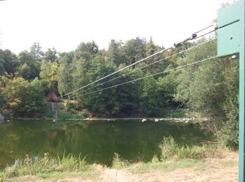
![Percorso A piedi Regenstauf - Tour 9 »Flusswanderung« - Photo](https://media.geolcdn.com/t/350/260/82c6bac3-13b2-423e-8be9-687a1b5300a6.jpeg&format=jpg&maxdim=2)
![A piedi A piedi](https://static1.geolcdn.com/sitytour/trail-icons/100.png)
Km
A piedi
![](/images/other/stat-length.png)
![](https://static1.geolcdn.com/siteimages/upload/files/1508320355ic_sort_den_pos_24dp.png)
![](https://static1.geolcdn.com/siteimages/upload/files/1508320355ic_sort_den_neg_24dp.png)
![](https://static1.geolcdn.com/siteimages/upload/files/16400158638029165_repeat_loop_refresh_sync_direction_icon.png)
• Trail created by Stadt Nittenau?. FIXME: Nicht alle Segmente erfaßt. Symbol: Weiße oder schwarze Wegnummer in einem...
![Percorso A piedi Regenstauf - Tour 6 »Schwarzbergtour« - Photo](https://media.geolcdn.com/t/350/260/82c6bac3-13b2-423e-8be9-687a1b5300a6.jpeg&format=jpg&maxdim=2)
![A piedi A piedi](https://static1.geolcdn.com/sitytour/trail-icons/100.png)
Km
A piedi
![](/images/other/stat-length.png)
![](https://static1.geolcdn.com/siteimages/upload/files/1508320355ic_sort_den_pos_24dp.png)
![](https://static1.geolcdn.com/siteimages/upload/files/1508320355ic_sort_den_neg_24dp.png)
![](https://static1.geolcdn.com/siteimages/upload/files/16400158638029165_repeat_loop_refresh_sync_direction_icon.png)
• Trail created by Stadt Nittenau?. FIXME: Nicht alle Segmente erfaßt. Symbol: Weiße oder schwarze Wegnummer in einem...
![Percorso A piedi Regenstauf - Wilder Mann 005, Naturpark Vorderer Bayerischer Wald - Photo](https://media.geolcdn.com/t/350/260/82c6bac3-13b2-423e-8be9-687a1b5300a6.jpeg&format=jpg&maxdim=2)
![A piedi A piedi](https://static1.geolcdn.com/sitytour/trail-icons/100.png)
Km
A piedi
![](/images/other/stat-length.png)
![](https://static1.geolcdn.com/siteimages/upload/files/1508320355ic_sort_den_pos_24dp.png)
![](https://static1.geolcdn.com/siteimages/upload/files/1508320355ic_sort_den_neg_24dp.png)
![](https://static1.geolcdn.com/siteimages/upload/files/16400158638029165_repeat_loop_refresh_sync_direction_icon.png)
• Trail created by Verein Naturpark Vorderer Bayerischer Wald. FIXME: Nicht alle Wegsegmente erfaßt. Symbol: Auf eine...
![Percorso A piedi Regenstauf - Wanderfreunde Regenstauf: Habichtweg - Photo](https://media.geolcdn.com/t/350/260/965b601b-d38d-476f-9054-9d9f39384a5c.jpeg&format=jpg&maxdim=2)
![A piedi A piedi](https://static1.geolcdn.com/sitytour/trail-icons/100.png)
Km
A piedi
![](/images/other/stat-length.png)
![](https://static1.geolcdn.com/siteimages/upload/files/1508320355ic_sort_den_pos_24dp.png)
![](https://static1.geolcdn.com/siteimages/upload/files/1508320355ic_sort_den_neg_24dp.png)
![](https://static1.geolcdn.com/siteimages/upload/files/16400158638029165_repeat_loop_refresh_sync_direction_icon.png)
• Trail created by Wanderfreunde Regenstauf. Symbol: Schwarzes Tiersymbol auf weißem, quadratischen Grund

![Percorso A piedi Regenstauf - Wanderfreunde Regenstauf: Spechtweg - Photo](https://media.geolcdn.com/t/350/260/8c817b41-b40d-4b37-8fe8-612a1d294dd7.jpeg&format=jpg&maxdim=2)
![A piedi A piedi](https://static1.geolcdn.com/sitytour/trail-icons/100.png)
Km
A piedi
![](/images/other/stat-length.png)
![](https://static1.geolcdn.com/siteimages/upload/files/1508320355ic_sort_den_pos_24dp.png)
![](https://static1.geolcdn.com/siteimages/upload/files/1508320355ic_sort_den_neg_24dp.png)
![](https://static1.geolcdn.com/siteimages/upload/files/16400158638029165_repeat_loop_refresh_sync_direction_icon.png)
• Trail created by Wanderfreunde Regenstauf. Symbol: Schwarzer Specht auf weißem Grund
![Percorso A piedi Regenstauf - Wanderwege rund um Nittenau - 02 - Wackelstein - Photo](https://media.geolcdn.com/t/350/260/82c6bac3-13b2-423e-8be9-687a1b5300a6.jpeg&format=jpg&maxdim=2)
![A piedi A piedi](https://static1.geolcdn.com/sitytour/trail-icons/100.png)
Km
A piedi
![](/images/other/stat-length.png)
![](https://static1.geolcdn.com/siteimages/upload/files/1508320355ic_sort_den_pos_24dp.png)
![](https://static1.geolcdn.com/siteimages/upload/files/1508320355ic_sort_den_neg_24dp.png)
![](https://static1.geolcdn.com/siteimages/upload/files/16400158638029165_repeat_loop_refresh_sync_direction_icon.png)
• Trail created by Stadt Nittenau. FIXME: Nicht alle Segmente erfaßt. Symbol: Auf weißem Grund unten in rot die Wegnu...
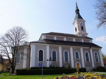
![Percorso A piedi Regenstauf - O 24 Regenstauf - Maad (Rotes Rechteck) - Photo](https://media.geolcdn.com/t/350/260/3050f69f-066f-4097-811c-3525193118d6.jpeg&format=jpg&maxdim=2)
![A piedi A piedi](https://static1.geolcdn.com/sitytour/trail-icons/100.png)
Km
A piedi
![](/images/other/stat-length.png)
![](https://static1.geolcdn.com/siteimages/upload/files/1508320355ic_sort_den_pos_24dp.png)
![](https://static1.geolcdn.com/siteimages/upload/files/1508320355ic_sort_den_neg_24dp.png)
![](https://static1.geolcdn.com/siteimages/upload/files/16400158638029165_repeat_loop_refresh_sync_direction_icon.png)
• Trail created by Waldverein Regensburg. FIXME: Nicht alle Segmente erfaßt. Symbol: Rotes Rechteck auf weißem Grund
![Percorso A piedi Regenstauf - Tour 8 »Waldwanderung« - Photo](https://media.geolcdn.com/t/350/260/82c6bac3-13b2-423e-8be9-687a1b5300a6.jpeg&format=jpg&maxdim=2)
![A piedi A piedi](https://static1.geolcdn.com/sitytour/trail-icons/100.png)
Km
A piedi
![](/images/other/stat-length.png)
![](https://static1.geolcdn.com/siteimages/upload/files/1508320355ic_sort_den_pos_24dp.png)
![](https://static1.geolcdn.com/siteimages/upload/files/1508320355ic_sort_den_neg_24dp.png)
![](https://static1.geolcdn.com/siteimages/upload/files/16400158638029165_repeat_loop_refresh_sync_direction_icon.png)
• Trail created by Stadt Nittenau?. Wegabschnitt ggü. Hirschling tlw. verwachsen, über Fahrradweg ausweichen Symbol: ...
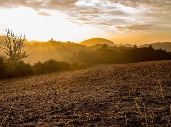
![Percorso A piedi Regenstauf - O 29 Karlstein - Jugenberg (Grünes Dreieck) - Photo](https://media.geolcdn.com/t/350/260/66a6c1e1-7d97-4b59-9962-aa13a46cfe97.jpeg&format=jpg&maxdim=2)
![A piedi A piedi](https://static1.geolcdn.com/sitytour/trail-icons/100.png)
Km
A piedi
![](/images/other/stat-length.png)
![](https://static1.geolcdn.com/siteimages/upload/files/1508320355ic_sort_den_pos_24dp.png)
![](https://static1.geolcdn.com/siteimages/upload/files/1508320355ic_sort_den_neg_24dp.png)
![](https://static1.geolcdn.com/siteimages/upload/files/16400158638029165_repeat_loop_refresh_sync_direction_icon.png)
• Trail created by Waldverein Regensburg. FIXME: Nicht alle Segmente erfaßt. Symbol: Grünes Dreieck auf weißem Grund ...
![Percorso A piedi Regenstauf - Wanderfreunde Regenstauf: Hasenweg - Photo](https://media.geolcdn.com/t/350/260/8c817b41-b40d-4b37-8fe8-612a1d294dd7.jpeg&format=jpg&maxdim=2)
![A piedi A piedi](https://static1.geolcdn.com/sitytour/trail-icons/100.png)
Km
A piedi
![](/images/other/stat-length.png)
![](https://static1.geolcdn.com/siteimages/upload/files/1508320355ic_sort_den_pos_24dp.png)
![](https://static1.geolcdn.com/siteimages/upload/files/1508320355ic_sort_den_neg_24dp.png)
![](https://static1.geolcdn.com/siteimages/upload/files/16400158638029165_repeat_loop_refresh_sync_direction_icon.png)
• Trail created by Wanderfreunde Regenstauf. Symbol: Schwarzer Hase auf weißem Grund
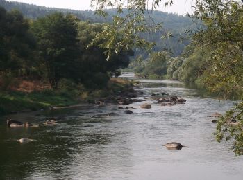
![Percorso A piedi Regenstauf - O 80 Hirschling - Theresienkapelle (Blaues Rechteck) - Photo](https://media.geolcdn.com/t/350/260/b11983bc-bc26-43bd-9762-2dddd756d7eb.jpeg&format=jpg&maxdim=2)
![A piedi A piedi](https://static1.geolcdn.com/sitytour/trail-icons/100.png)
Km
A piedi
![](/images/other/stat-length.png)
![](https://static1.geolcdn.com/siteimages/upload/files/1508320355ic_sort_den_pos_24dp.png)
![](https://static1.geolcdn.com/siteimages/upload/files/1508320355ic_sort_den_neg_24dp.png)
![](https://static1.geolcdn.com/siteimages/upload/files/16400158638029165_repeat_loop_refresh_sync_direction_icon.png)
• Trail created by Waldverein Regensburg. Symbol: Blaues Rechteck auf weißem Grund
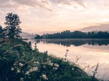
![Percorso A piedi Regenstauf - O 63 Ponholz - Karlstein (Grünes Rechteck) - Photo](https://media.geolcdn.com/t/350/260/29b953b4-0667-477d-9468-40f029d19d63.jpeg&format=jpg&maxdim=2)
![A piedi A piedi](https://static1.geolcdn.com/sitytour/trail-icons/100.png)
Km
A piedi
![](/images/other/stat-length.png)
![](https://static1.geolcdn.com/siteimages/upload/files/1508320355ic_sort_den_pos_24dp.png)
![](https://static1.geolcdn.com/siteimages/upload/files/1508320355ic_sort_den_neg_24dp.png)
![](https://static1.geolcdn.com/siteimages/upload/files/16400158638029165_repeat_loop_refresh_sync_direction_icon.png)
• Trail created by Waldverein Regensburg. Symbol: Grünes Rechteck auf weißem Grund
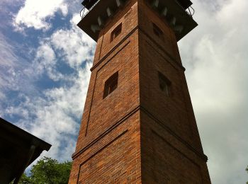
![Percorso A piedi Regenstauf - Wanderfreunde Regenstauf: Eichhornweg - Photo](https://media.geolcdn.com/t/350/260/41d5c31a-7970-49c8-9b9f-dabb8e5b6eef.jpeg&format=jpg&maxdim=2)
![A piedi A piedi](https://static1.geolcdn.com/sitytour/trail-icons/100.png)
Km
A piedi
![](/images/other/stat-length.png)
![](https://static1.geolcdn.com/siteimages/upload/files/1508320355ic_sort_den_pos_24dp.png)
![](https://static1.geolcdn.com/siteimages/upload/files/1508320355ic_sort_den_neg_24dp.png)
![](https://static1.geolcdn.com/siteimages/upload/files/16400158638029165_repeat_loop_refresh_sync_direction_icon.png)
• Trail created by Wanderfreunde Regenstauf. Symbol: Schwarzes Tiersymbol auf weißem, quadratischen Grund
![Percorso A piedi Regenstauf - Wanderfreunde Regenstauf: Amselweg - Photo](https://media.geolcdn.com/t/350/260/87c38e1a-bb50-4675-9eb4-41034da33a06.jpeg&format=jpg&maxdim=2)
![A piedi A piedi](https://static1.geolcdn.com/sitytour/trail-icons/100.png)
Km
A piedi
![](/images/other/stat-length.png)
![](https://static1.geolcdn.com/siteimages/upload/files/1508320355ic_sort_den_pos_24dp.png)
![](https://static1.geolcdn.com/siteimages/upload/files/1508320355ic_sort_den_neg_24dp.png)
![](https://static1.geolcdn.com/siteimages/upload/files/16400158638029165_repeat_loop_refresh_sync_direction_icon.png)
• Trail created by Wanderfreunde Regenstauf. Symbol: Schwarzes Tiersymbol auf weißem, quadratischen Grund
![Percorso A piedi Regenstauf - Tour 10 »Hennerlochtour« - Photo](https://media.geolcdn.com/t/350/260/b11983bc-bc26-43bd-9762-2dddd756d7eb.jpeg&format=jpg&maxdim=2)
![A piedi A piedi](https://static1.geolcdn.com/sitytour/trail-icons/100.png)
Km
A piedi
![](/images/other/stat-length.png)
![](https://static1.geolcdn.com/siteimages/upload/files/1508320355ic_sort_den_pos_24dp.png)
![](https://static1.geolcdn.com/siteimages/upload/files/1508320355ic_sort_den_neg_24dp.png)
![](https://static1.geolcdn.com/siteimages/upload/files/16400158638029165_repeat_loop_refresh_sync_direction_icon.png)
• Trail created by Stadt Nittenau?. FIXME: Nicht alle Segmente erfaßt. Symbol: Weiße Wegnummer mit orangefarbenem Rah...
![Percorso A piedi Regenstauf - O 79 Hirschling - Marienthal (Grünes Rechteck) - Photo](https://media.geolcdn.com/t/350/260/b11983bc-bc26-43bd-9762-2dddd756d7eb.jpeg&format=jpg&maxdim=2)
![A piedi A piedi](https://static1.geolcdn.com/sitytour/trail-icons/100.png)
Km
A piedi
![](/images/other/stat-length.png)
![](https://static1.geolcdn.com/siteimages/upload/files/1508320355ic_sort_den_pos_24dp.png)
![](https://static1.geolcdn.com/siteimages/upload/files/1508320355ic_sort_den_neg_24dp.png)
![](https://static1.geolcdn.com/siteimages/upload/files/16400158638029165_repeat_loop_refresh_sync_direction_icon.png)
• Trail created by Waldverein Regensburg. Symbol: Grünes Rechteck auf weißem Grund
![Percorso A piedi Regenstauf - O 42 Marienthal - Grafenwinn - Photo](https://media.geolcdn.com/t/350/260/82c6bac3-13b2-423e-8be9-687a1b5300a6.jpeg&format=jpg&maxdim=2)
![A piedi A piedi](https://static1.geolcdn.com/sitytour/trail-icons/100.png)
Km
A piedi
![](/images/other/stat-length.png)
![](https://static1.geolcdn.com/siteimages/upload/files/1508320355ic_sort_den_pos_24dp.png)
![](https://static1.geolcdn.com/siteimages/upload/files/1508320355ic_sort_den_neg_24dp.png)
![](https://static1.geolcdn.com/siteimages/upload/files/16400158638029165_repeat_loop_refresh_sync_direction_icon.png)
• Trail created by Waldverein Regensburg. Symbol: Rotes Dreieck auf weißem Grund, in der Natur in Richtung Süden weisend
![Percorso A piedi Regenstauf - Städtedreieck-Rundweg 4 (Schwarz) - Photo](https://media.geolcdn.com/t/350/260/ext.jpg?maxdim=2&url=https%3A%2F%2Fstatic1.geolcdn.com%2Fsiteimages%2Fupload%2Ffiles%2F1545311037marcheuse_200dpi.jpg)
![A piedi A piedi](https://static1.geolcdn.com/sitytour/trail-icons/100.png)
Km
A piedi
![](/images/other/stat-length.png)
![](https://static1.geolcdn.com/siteimages/upload/files/1508320355ic_sort_den_pos_24dp.png)
![](https://static1.geolcdn.com/siteimages/upload/files/1508320355ic_sort_den_neg_24dp.png)
![](https://static1.geolcdn.com/siteimages/upload/files/16400158638029165_repeat_loop_refresh_sync_direction_icon.png)
• Trail created by Städte Burglengenfeld/Maxhütte-Haidhof/Teublitz. Symbol: Schwarze 4
![Percorso A piedi Regenstauf - O 66 Stadel - Schneitweg (Blaues Rechteck) - Photo](https://media.geolcdn.com/t/350/260/ext.jpg?maxdim=2&url=https%3A%2F%2Fstatic1.geolcdn.com%2Fsiteimages%2Fupload%2Ffiles%2F1545311037marcheuse_200dpi.jpg)
![A piedi A piedi](https://static1.geolcdn.com/sitytour/trail-icons/100.png)
Km
A piedi
![](/images/other/stat-length.png)
![](https://static1.geolcdn.com/siteimages/upload/files/1508320355ic_sort_den_pos_24dp.png)
![](https://static1.geolcdn.com/siteimages/upload/files/1508320355ic_sort_den_neg_24dp.png)
![](https://static1.geolcdn.com/siteimages/upload/files/16400158638029165_repeat_loop_refresh_sync_direction_icon.png)
• Trail created by Waldverein Regensburg. Symbol: Blaues Rechteck auf weißem Grund
19 percorsi visualizzati su 19
Applicazione GPS da escursionismo GRATUITA