![](/images/other/stat-length.png)
Landkreis Bamberg, Baviera, A piedi : I migliori sentieri, percorsi e passeggiate
Landkreis Bamberg: Scopri i migliori percorsi: 153 a piedi. Tutti questi percorsi, itinerari e attività outdoor sono disponibili nelle nostre app SityTrail per smartphone e tablet.
I percorsi migliori (0})
![Percorso A piedi Ebrach - Rundweg E 6 - Photo](https://media.geolcdn.com/t/350/260/01437351-9703-4caf-b7ca-9a8a52aa6410.jpeg&format=jpg&maxdim=2)
![A piedi A piedi](https://static1.geolcdn.com/sitytour/trail-icons/100.png)
Km
A piedi
![](/images/other/stat-length.png)
![](https://static1.geolcdn.com/siteimages/upload/files/1508320355ic_sort_den_pos_24dp.png)
![](https://static1.geolcdn.com/siteimages/upload/files/1508320355ic_sort_den_neg_24dp.png)
![](https://static1.geolcdn.com/siteimages/upload/files/16400158638029165_repeat_loop_refresh_sync_direction_icon.png)
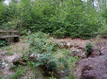
• Symbol: Schwarze E 6 auf gelbem Hintergrund
![Percorso A piedi Ebrach - Wanderweg Grüner Tropfen - Photo](https://media.geolcdn.com/t/350/260/5a4fd179-fb89-492a-b9e1-8de4527efff3.jpeg&format=jpg&maxdim=2)
![A piedi A piedi](https://static1.geolcdn.com/sitytour/trail-icons/100.png)
Km
A piedi
![](/images/other/stat-length.png)
![](https://static1.geolcdn.com/siteimages/upload/files/1508320355ic_sort_den_pos_24dp.png)
![](https://static1.geolcdn.com/siteimages/upload/files/1508320355ic_sort_den_neg_24dp.png)
![](https://static1.geolcdn.com/siteimages/upload/files/16400158638029165_repeat_loop_refresh_sync_direction_icon.png)
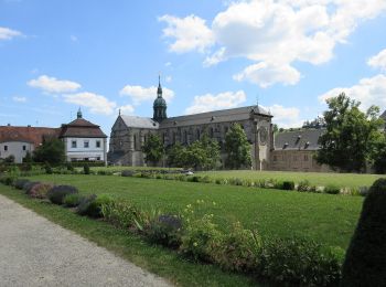
• Symbol: Liegender grüner Tropfen auf weißem Hintergrund
![Percorso A piedi Breitengüßbach - Breitengüßbacher Brauereienweg - Photo](https://media.geolcdn.com/t/350/260/4db1617b-c13e-497c-967a-b86c2c27f33d.jpeg&format=jpg&maxdim=2)
![A piedi A piedi](https://static1.geolcdn.com/sitytour/trail-icons/100.png)
Km
A piedi
![](/images/other/stat-length.png)
![](https://static1.geolcdn.com/siteimages/upload/files/1508320355ic_sort_den_pos_24dp.png)
![](https://static1.geolcdn.com/siteimages/upload/files/1508320355ic_sort_den_neg_24dp.png)
![](https://static1.geolcdn.com/siteimages/upload/files/16400158638029165_repeat_loop_refresh_sync_direction_icon.png)
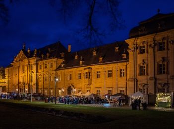
• Trail created by Gemeinde Breitengüßbach. Symbol: Brauerwappen auf weißem Hintergrund
![Percorso A piedi Breitengüßbach - Rundwanderweg Breitengüßbach 3 - Photo](https://media.geolcdn.com/t/350/260/8aab94c5-eaec-4ef4-a337-62ebe7b2873f.jpeg&format=jpg&maxdim=2)
![A piedi A piedi](https://static1.geolcdn.com/sitytour/trail-icons/100.png)
Km
A piedi
![](/images/other/stat-length.png)
![](https://static1.geolcdn.com/siteimages/upload/files/1508320355ic_sort_den_pos_24dp.png)
![](https://static1.geolcdn.com/siteimages/upload/files/1508320355ic_sort_den_neg_24dp.png)
![](https://static1.geolcdn.com/siteimages/upload/files/16400158638029165_repeat_loop_refresh_sync_direction_icon.png)
• Trail created by Gemeinde Breitengüßbach. Symbol: Breitengüßbacher Gemeindewappen auf weißem Hintergrund mit Ziffer 3
![Percorso A piedi Breitengüßbach - Rundwanderweg Breitengüßbach 1 - Photo](https://media.geolcdn.com/t/350/260/1e127657-2dbc-4690-b192-11c43dc43573.jpeg&format=jpg&maxdim=2)
![A piedi A piedi](https://static1.geolcdn.com/sitytour/trail-icons/100.png)
Km
A piedi
![](/images/other/stat-length.png)
![](https://static1.geolcdn.com/siteimages/upload/files/1508320355ic_sort_den_pos_24dp.png)
![](https://static1.geolcdn.com/siteimages/upload/files/1508320355ic_sort_den_neg_24dp.png)
![](https://static1.geolcdn.com/siteimages/upload/files/16400158638029165_repeat_loop_refresh_sync_direction_icon.png)
• Trail created by Gemeinde Breitengüßbach. Symbol: Breitengüßbacher Gemeindewappen auf weißem Hintergrund mit Ziffer 1
![Percorso A piedi Breitengüßbach - Rundwanderweg Breitengüßbach 2 - Photo](https://media.geolcdn.com/t/350/260/ee0ef4c4-9268-456c-8c45-fb0e42cd6c3a.jpeg&format=jpg&maxdim=2)
![A piedi A piedi](https://static1.geolcdn.com/sitytour/trail-icons/100.png)
Km
A piedi
![](/images/other/stat-length.png)
![](https://static1.geolcdn.com/siteimages/upload/files/1508320355ic_sort_den_pos_24dp.png)
![](https://static1.geolcdn.com/siteimages/upload/files/1508320355ic_sort_den_neg_24dp.png)
![](https://static1.geolcdn.com/siteimages/upload/files/16400158638029165_repeat_loop_refresh_sync_direction_icon.png)
• Trail created by Gemeinde Breitengüßbach. Symbol: Breitengüßbacher Gemeindewappen auf weißem Hintergrund mit Ziffer 2
![Percorso A piedi Heiligenstadt - Stefan-Lößlein-Weg - Photo](https://media.geolcdn.com/t/350/260/11fb87b8-08b8-49fc-84b2-aafb33faa743.jpeg&format=jpg&maxdim=2)
![A piedi A piedi](https://static1.geolcdn.com/sitytour/trail-icons/100.png)
Km
A piedi
![](/images/other/stat-length.png)
![](https://static1.geolcdn.com/siteimages/upload/files/1508320355ic_sort_den_pos_24dp.png)
![](https://static1.geolcdn.com/siteimages/upload/files/1508320355ic_sort_den_neg_24dp.png)
![](https://static1.geolcdn.com/siteimages/upload/files/16400158638029165_repeat_loop_refresh_sync_direction_icon.png)
• Symbol: grünes N mit Richtungspfeil
![Percorso A piedi Viereth-Trunstadt - Weg der Menschenrechte Viereth-Trunstadt - Photo](https://media.geolcdn.com/t/350/260/231b3eb0-b384-4fe1-8a61-af5191f93faa.jpeg&format=jpg&maxdim=2)
![A piedi A piedi](https://static1.geolcdn.com/sitytour/trail-icons/100.png)
Km
A piedi
![](/images/other/stat-length.png)
![](https://static1.geolcdn.com/siteimages/upload/files/1508320355ic_sort_den_pos_24dp.png)
![](https://static1.geolcdn.com/siteimages/upload/files/1508320355ic_sort_den_neg_24dp.png)
![](https://static1.geolcdn.com/siteimages/upload/files/16400158638029165_repeat_loop_refresh_sync_direction_icon.png)
• Trail created by Gemeinde Viereth-Trunstadt. Symbol: Schwarzes Paragraphenzeichen auf weißem Hintergrund
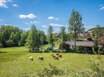
![Percorso A piedi Ebrach - Rundweg](https://media.geolcdn.com/t/350/260/96edf94f-2937-4db8-ba6c-5094fb597450.jpeg&format=jpg&maxdim=2)
![A piedi A piedi](https://static1.geolcdn.com/sitytour/trail-icons/100.png)
Km
A piedi
![](/images/other/stat-length.png)
![](https://static1.geolcdn.com/siteimages/upload/files/1508320355ic_sort_den_pos_24dp.png)
![](https://static1.geolcdn.com/siteimages/upload/files/1508320355ic_sort_den_neg_24dp.png)
![](https://static1.geolcdn.com/siteimages/upload/files/16400158638029165_repeat_loop_refresh_sync_direction_icon.png)
• Symbol: Schwarze E 11 auf gelbem Hintergrund
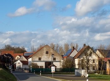
![Percorso A piedi Rattelsdorf - Wanderweg A - Photo](https://media.geolcdn.com/t/350/260/29748cfb-e7d8-4732-9426-38a4b7dd5188.jpeg&format=jpg&maxdim=2)
![A piedi A piedi](https://static1.geolcdn.com/sitytour/trail-icons/100.png)
Km
A piedi
![](/images/other/stat-length.png)
![](https://static1.geolcdn.com/siteimages/upload/files/1508320355ic_sort_den_pos_24dp.png)
![](https://static1.geolcdn.com/siteimages/upload/files/1508320355ic_sort_den_neg_24dp.png)
![](https://static1.geolcdn.com/siteimages/upload/files/16400158638029165_repeat_loop_refresh_sync_direction_icon.png)
• Symbol: Rotes A auf weißem Grund
![Percorso A piedi Baunach - Brauersteig - Photo](https://media.geolcdn.com/t/350/260/ae44bd57-8cd7-4971-bf16-723f9dd87ea4.jpeg&format=jpg&maxdim=2)
![A piedi A piedi](https://static1.geolcdn.com/sitytour/trail-icons/100.png)
Km
A piedi
![](/images/other/stat-length.png)
![](https://static1.geolcdn.com/siteimages/upload/files/1508320355ic_sort_den_pos_24dp.png)
![](https://static1.geolcdn.com/siteimages/upload/files/1508320355ic_sort_den_neg_24dp.png)
![](https://static1.geolcdn.com/siteimages/upload/files/16400158638029165_repeat_loop_refresh_sync_direction_icon.png)
• Trail created by Naturpark Haßberge. Symbol: Roter Burgturm auf weißem Hintergrund
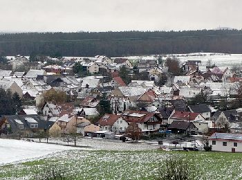
![Percorso A piedi Strullendorf - Zeegenbachtal Runde - Photo](https://media.geolcdn.com/t/350/260/1dfd3703-44c4-4235-ba3d-828a42c01887.jpeg&format=jpg&maxdim=2)
![A piedi A piedi](https://static1.geolcdn.com/sitytour/trail-icons/100.png)
Km
A piedi
![](/images/other/stat-length.png)
![](https://static1.geolcdn.com/siteimages/upload/files/1508320355ic_sort_den_pos_24dp.png)
![](https://static1.geolcdn.com/siteimages/upload/files/1508320355ic_sort_den_neg_24dp.png)
![](https://static1.geolcdn.com/siteimages/upload/files/16400158638029165_repeat_loop_refresh_sync_direction_icon.png)
• Trail created by Tourismusbüro "Fränkische Toskana". Symbol: Stilisierterote Ziege auf weißem Grund
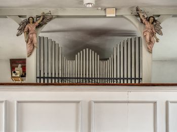
![Percorso A piedi Wattendorf - Wanderweg Wattendorf - Mährenhüll - Photo](https://media.geolcdn.com/t/350/260/1b898c9d-bcbe-4477-9499-648186ebd43d.jpeg&format=jpg&maxdim=2)
![A piedi A piedi](https://static1.geolcdn.com/sitytour/trail-icons/100.png)
Km
A piedi
![](/images/other/stat-length.png)
![](https://static1.geolcdn.com/siteimages/upload/files/1508320355ic_sort_den_pos_24dp.png)
![](https://static1.geolcdn.com/siteimages/upload/files/1508320355ic_sort_den_neg_24dp.png)
![](https://static1.geolcdn.com/siteimages/upload/files/16400158638029165_repeat_loop_refresh_sync_direction_icon.png)
• Trail created by Landkreis Lichtenfels. Symbol: Roter Punkt auf weißem Hintergrund
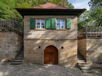
![Percorso A piedi Oberhaid - Rundwanderweg Oberhaid blau - Photo](https://media.geolcdn.com/t/350/260/ed2ebeff-3bec-4000-8fb0-5f4daf657688.jpeg&format=jpg&maxdim=2)
![A piedi A piedi](https://static1.geolcdn.com/sitytour/trail-icons/100.png)
Km
A piedi
![](/images/other/stat-length.png)
![](https://static1.geolcdn.com/siteimages/upload/files/1508320355ic_sort_den_pos_24dp.png)
![](https://static1.geolcdn.com/siteimages/upload/files/1508320355ic_sort_den_neg_24dp.png)
![](https://static1.geolcdn.com/siteimages/upload/files/16400158638029165_repeat_loop_refresh_sync_direction_icon.png)
• Trail created by Gemeinde Oberhaid. Symbol: weiße Beschreibung auf blauem Grund
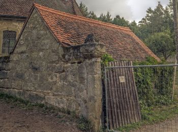
![Percorso A piedi Oberhaid - Rundwanderweg Oberhaid ocker - Photo](https://media.geolcdn.com/t/350/260/e6f35300-dfe0-44b3-a5a6-f96fc01001f7.jpeg&format=jpg&maxdim=2)
![A piedi A piedi](https://static1.geolcdn.com/sitytour/trail-icons/100.png)
Km
A piedi
![](/images/other/stat-length.png)
![](https://static1.geolcdn.com/siteimages/upload/files/1508320355ic_sort_den_pos_24dp.png)
![](https://static1.geolcdn.com/siteimages/upload/files/1508320355ic_sort_den_neg_24dp.png)
![](https://static1.geolcdn.com/siteimages/upload/files/16400158638029165_repeat_loop_refresh_sync_direction_icon.png)
• Trail created by Gemeinde Oberhaid. Symbol: weiße Beschreibung auf ocker Grund
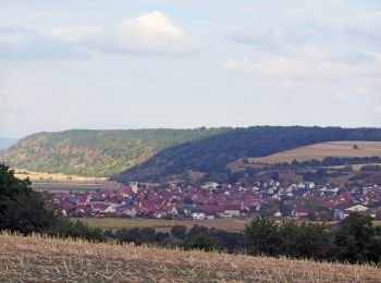
![Percorso A piedi Oberhaid - Rundwanderweg Oberhaid rot - Photo](https://media.geolcdn.com/t/350/260/92510cd9-964f-4b20-abec-e41395ff017e.jpeg&format=jpg&maxdim=2)
![A piedi A piedi](https://static1.geolcdn.com/sitytour/trail-icons/100.png)
Km
A piedi
![](/images/other/stat-length.png)
![](https://static1.geolcdn.com/siteimages/upload/files/1508320355ic_sort_den_pos_24dp.png)
![](https://static1.geolcdn.com/siteimages/upload/files/1508320355ic_sort_den_neg_24dp.png)
![](https://static1.geolcdn.com/siteimages/upload/files/16400158638029165_repeat_loop_refresh_sync_direction_icon.png)
• Trail created by Gemeinde Oberhaid. Symbol: weiße Beschreibung auf rotem Grund
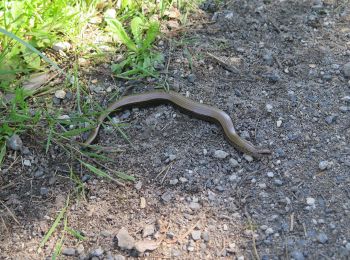
![Percorso A piedi Baunach - Querkeltour - Photo](https://media.geolcdn.com/t/350/260/caeb0628-07aa-48cc-9718-d1fd0de5c211.jpeg&format=jpg&maxdim=2)
![A piedi A piedi](https://static1.geolcdn.com/sitytour/trail-icons/100.png)
Km
A piedi
![](/images/other/stat-length.png)
![](https://static1.geolcdn.com/siteimages/upload/files/1508320355ic_sort_den_pos_24dp.png)
![](https://static1.geolcdn.com/siteimages/upload/files/1508320355ic_sort_den_neg_24dp.png)
![](https://static1.geolcdn.com/siteimages/upload/files/16400158638029165_repeat_loop_refresh_sync_direction_icon.png)
• Trail created by Naturpark Haßberge. Symbol: Roter Burgturm weißer Grund
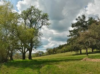
![Percorso A piedi Oberhaid - Rundwanderweg Oberhaid grün - Photo](https://media.geolcdn.com/t/350/260/97a5047a-3b10-422f-9c52-dda3ab242474.jpeg&format=jpg&maxdim=2)
![A piedi A piedi](https://static1.geolcdn.com/sitytour/trail-icons/100.png)
Km
A piedi
![](/images/other/stat-length.png)
![](https://static1.geolcdn.com/siteimages/upload/files/1508320355ic_sort_den_pos_24dp.png)
![](https://static1.geolcdn.com/siteimages/upload/files/1508320355ic_sort_den_neg_24dp.png)
![](https://static1.geolcdn.com/siteimages/upload/files/16400158638029165_repeat_loop_refresh_sync_direction_icon.png)
• Trail created by Gemeinde Oberhaid. Symbol: weiße Beschreibung auf grünem Grund
![Percorso A piedi Scheßlitz - Rundwanderweg Scheßlitz A 1](https://media.geolcdn.com/t/350/260/82e09cf4-97d2-4a45-94ce-a37459a3942d.jpeg&format=jpg&maxdim=2)
![A piedi A piedi](https://static1.geolcdn.com/sitytour/trail-icons/100.png)
Km
A piedi
![](/images/other/stat-length.png)
![](https://static1.geolcdn.com/siteimages/upload/files/1508320355ic_sort_den_pos_24dp.png)
![](https://static1.geolcdn.com/siteimages/upload/files/1508320355ic_sort_den_neg_24dp.png)
![](https://static1.geolcdn.com/siteimages/upload/files/16400158638029165_repeat_loop_refresh_sync_direction_icon.png)
• Trail created by Stadt Scheßlitz.
![Percorso A piedi Ebrach - Rundweg](https://media.geolcdn.com/t/350/260/5a4fd179-fb89-492a-b9e1-8de4527efff3.jpeg&format=jpg&maxdim=2)
![A piedi A piedi](https://static1.geolcdn.com/sitytour/trail-icons/100.png)
Km
A piedi
![](/images/other/stat-length.png)
![](https://static1.geolcdn.com/siteimages/upload/files/1508320355ic_sort_den_pos_24dp.png)
![](https://static1.geolcdn.com/siteimages/upload/files/1508320355ic_sort_den_neg_24dp.png)
![](https://static1.geolcdn.com/siteimages/upload/files/16400158638029165_repeat_loop_refresh_sync_direction_icon.png)
• Symbol: Schwarze E2 auf gelbem Hintergrund
20 percorsi visualizzati su 153
Applicazione GPS da escursionismo GRATUITA
Attività
Regioni vicine
- Baunach
- Breitengüßbach
- Burgebrach
- Burgwindheim
- Buttenheim
- Ebrach
- Ebracher Forst
- Gerach
- Gundelsheim
- Hallstadt
- Heiligenstadt
- Kemmern
- Königsfeld
- Lauter
- Lisberg
- Litzendorf
- Oberhaid
- Pommersfelden
- Priesendorf
- Rattelsdorf
- Reckendorf
- Scheßlitz
- Schlüsselfeld
- Schönbrunn i.Steigerwald
- Stadelhofen
- Stegaurach
- Strullendorf
- Viereth-Trunstadt
- Walsdorf
- Wattendorf
- Zapfendorf
- Zückshuter Forst