![](/images/other/stat-length.png)
- Percorsi
- A piedi
- Switzerland
- Zurigo
- Bezirk Pfäffikon
Bezirk Pfäffikon, Zurigo, A piedi : I migliori sentieri, percorsi e passeggiate
Bezirk Pfäffikon: Scopri i migliori percorsi: 25 a piedi e 1 marcia. Tutti questi percorsi, itinerari e attività outdoor sono disponibili nelle nostre app SityTrail per smartphone e tablet.
I percorsi migliori (0})
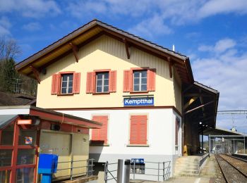
![Percorso A piedi Lindau - Kempthal - Winterthur - Photo](https://media.geolcdn.com/t/350/260/b46f637d-974f-48a1-98b4-7a6fcf478692.jpeg&format=jpg&maxdim=2)
![A piedi A piedi](https://static1.geolcdn.com/sitytour/trail-icons/100.png)
Km
A piedi
![](/images/other/stat-length.png)
![](https://static1.geolcdn.com/siteimages/upload/files/1508320355ic_sort_den_pos_24dp.png)
![](https://static1.geolcdn.com/siteimages/upload/files/1508320355ic_sort_den_neg_24dp.png)
![](https://static1.geolcdn.com/siteimages/upload/files/16400158638029165_repeat_loop_refresh_sync_direction_icon.png)
• Trail created by Zürcher Wanderwege ZAW. Symbol: gelbe Raute
![Percorso A piedi Lindau - Kempthal - Sennhof - Photo](https://media.geolcdn.com/t/350/260/b46f637d-974f-48a1-98b4-7a6fcf478692.jpeg&format=jpg&maxdim=2)
![A piedi A piedi](https://static1.geolcdn.com/sitytour/trail-icons/100.png)
Km
A piedi
![](/images/other/stat-length.png)
![](https://static1.geolcdn.com/siteimages/upload/files/1508320355ic_sort_den_pos_24dp.png)
![](https://static1.geolcdn.com/siteimages/upload/files/1508320355ic_sort_den_neg_24dp.png)
![](https://static1.geolcdn.com/siteimages/upload/files/16400158638029165_repeat_loop_refresh_sync_direction_icon.png)
• Trail created by Zürcher Wanderwege ZAW. Symbol: gelbe Raute
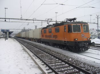
![Percorso A piedi Illnau-Effretikon - Effretikon - Winterthur - Photo](https://media.geolcdn.com/t/350/260/63404b86-8121-4e1e-949e-dd67169d2de0.jpeg&format=jpg&maxdim=2)
![A piedi A piedi](https://static1.geolcdn.com/sitytour/trail-icons/100.png)
Km
A piedi
![](/images/other/stat-length.png)
![](https://static1.geolcdn.com/siteimages/upload/files/1508320355ic_sort_den_pos_24dp.png)
![](https://static1.geolcdn.com/siteimages/upload/files/1508320355ic_sort_den_neg_24dp.png)
![](https://static1.geolcdn.com/siteimages/upload/files/16400158638029165_repeat_loop_refresh_sync_direction_icon.png)
• Trail created by Zürcher Wanderwege ZAW. Symbol: gelbe Raute
![Percorso A piedi Illnau-Effretikon - Effretikon - Oberillnau - Photo](https://media.geolcdn.com/t/350/260/63404b86-8121-4e1e-949e-dd67169d2de0.jpeg&format=jpg&maxdim=2)
![A piedi A piedi](https://static1.geolcdn.com/sitytour/trail-icons/100.png)
Km
A piedi
![](/images/other/stat-length.png)
![](https://static1.geolcdn.com/siteimages/upload/files/1508320355ic_sort_den_pos_24dp.png)
![](https://static1.geolcdn.com/siteimages/upload/files/1508320355ic_sort_den_neg_24dp.png)
![](https://static1.geolcdn.com/siteimages/upload/files/16400158638029165_repeat_loop_refresh_sync_direction_icon.png)
• Trail created by Zürcher Wanderwege ZAW. Symbol: gelbe Raute
![Percorso A piedi Fehraltorf - Fehraltorf - Nänikon-Greifensee - Photo](https://media.geolcdn.com/t/350/260/ab1872b2-06d8-4400-94ce-f71abf832d01.jpeg&format=jpg&maxdim=2)
![A piedi A piedi](https://static1.geolcdn.com/sitytour/trail-icons/100.png)
Km
A piedi
![](/images/other/stat-length.png)
![](https://static1.geolcdn.com/siteimages/upload/files/1508320355ic_sort_den_pos_24dp.png)
![](https://static1.geolcdn.com/siteimages/upload/files/1508320355ic_sort_den_neg_24dp.png)
![](https://static1.geolcdn.com/siteimages/upload/files/16400158638029165_repeat_loop_refresh_sync_direction_icon.png)
• Trail created by Zürcher Wanderwege ZAW. Symbol: gelbe Raute
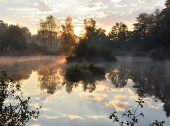
![Percorso A piedi Pfäffikon - Pfäffikon - Effretikon - Photo](https://media.geolcdn.com/t/350/260/80445370-b380-47af-b101-b0ae4bd55226.jpeg&format=jpg&maxdim=2)
![A piedi A piedi](https://static1.geolcdn.com/sitytour/trail-icons/100.png)
Km
A piedi
![](/images/other/stat-length.png)
![](https://static1.geolcdn.com/siteimages/upload/files/1508320355ic_sort_den_pos_24dp.png)
![](https://static1.geolcdn.com/siteimages/upload/files/1508320355ic_sort_den_neg_24dp.png)
![](https://static1.geolcdn.com/siteimages/upload/files/16400158638029165_repeat_loop_refresh_sync_direction_icon.png)
• Trail created by Zürcher Wanderwege ZAW. Symbol: gelbe Raute
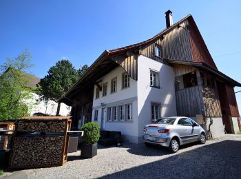
![Percorso A piedi Illnau-Effretikon - Illnau - Pfäffikon - Photo](https://media.geolcdn.com/t/350/260/cff26caa-0e47-4d6e-b2c0-e8575087a965.jpeg&format=jpg&maxdim=2)
![A piedi A piedi](https://static1.geolcdn.com/sitytour/trail-icons/100.png)
Km
A piedi
![](/images/other/stat-length.png)
![](https://static1.geolcdn.com/siteimages/upload/files/1508320355ic_sort_den_pos_24dp.png)
![](https://static1.geolcdn.com/siteimages/upload/files/1508320355ic_sort_den_neg_24dp.png)
![](https://static1.geolcdn.com/siteimages/upload/files/16400158638029165_repeat_loop_refresh_sync_direction_icon.png)
• Trail created by Zürcher Wanderwege ZAW. Symbol: gelbe Raute
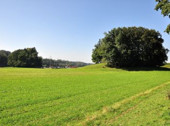
![Percorso A piedi Fehraltorf - Fehraltorf - Pfäffikon - Photo](https://media.geolcdn.com/t/350/260/fc8cc0ba-d2b7-4caf-bba1-15c76111c64b.jpeg&format=jpg&maxdim=2)
![A piedi A piedi](https://static1.geolcdn.com/sitytour/trail-icons/100.png)
Km
A piedi
![](/images/other/stat-length.png)
![](https://static1.geolcdn.com/siteimages/upload/files/1508320355ic_sort_den_pos_24dp.png)
![](https://static1.geolcdn.com/siteimages/upload/files/1508320355ic_sort_den_neg_24dp.png)
![](https://static1.geolcdn.com/siteimages/upload/files/16400158638029165_repeat_loop_refresh_sync_direction_icon.png)
• Trail created by Zürcher Wanderwege ZAW. Symbol: gelbe Raute
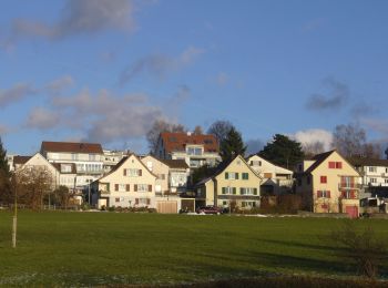
![Percorso A piedi Russikon - Rumlikon - Pfäffikon - Photo](https://media.geolcdn.com/t/350/260/af2b9092-a9a0-43da-a16a-c19c5132120c.jpeg&format=jpg&maxdim=2)
![A piedi A piedi](https://static1.geolcdn.com/sitytour/trail-icons/100.png)
Km
A piedi
![](/images/other/stat-length.png)
![](https://static1.geolcdn.com/siteimages/upload/files/1508320355ic_sort_den_pos_24dp.png)
![](https://static1.geolcdn.com/siteimages/upload/files/1508320355ic_sort_den_neg_24dp.png)
![](https://static1.geolcdn.com/siteimages/upload/files/16400158638029165_repeat_loop_refresh_sync_direction_icon.png)
• Trail created by Zürcher Wanderwege ZAW. Symbol: gelbe Raute
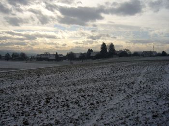
![Percorso A piedi Lindau - Kempthal - Rorbas - Photo](https://media.geolcdn.com/t/350/260/0952e2e4-f3ce-4b1a-8752-5684d81500cc.jpeg&format=jpg&maxdim=2)
![A piedi A piedi](https://static1.geolcdn.com/sitytour/trail-icons/100.png)
Km
A piedi
![](/images/other/stat-length.png)
![](https://static1.geolcdn.com/siteimages/upload/files/1508320355ic_sort_den_pos_24dp.png)
![](https://static1.geolcdn.com/siteimages/upload/files/1508320355ic_sort_den_neg_24dp.png)
![](https://static1.geolcdn.com/siteimages/upload/files/16400158638029165_repeat_loop_refresh_sync_direction_icon.png)
• Trail created by Zürcher Wanderwege ZAW. Symbol: gelbe Raute
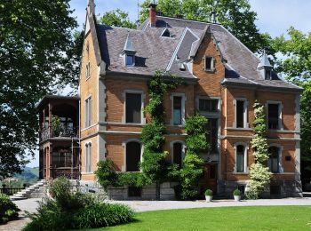
![Percorso A piedi Lindau - Effretikon - Pfungen - Photo](https://media.geolcdn.com/t/350/260/3bb5389e-269b-4f02-b8f4-467281419832.jpeg&format=jpg&maxdim=2)
![A piedi A piedi](https://static1.geolcdn.com/sitytour/trail-icons/100.png)
Km
A piedi
![](/images/other/stat-length.png)
![](https://static1.geolcdn.com/siteimages/upload/files/1508320355ic_sort_den_pos_24dp.png)
![](https://static1.geolcdn.com/siteimages/upload/files/1508320355ic_sort_den_neg_24dp.png)
![](https://static1.geolcdn.com/siteimages/upload/files/16400158638029165_repeat_loop_refresh_sync_direction_icon.png)
• Trail created by Zürcher Wanderwege ZAW. Symbol: gelbe Raute
![Percorso A piedi Lindau - Lindau - Brütten Bus - Photo](https://media.geolcdn.com/t/350/260/8b26b140-9885-4589-827d-97e263fdf3b0.jpeg&format=jpg&maxdim=2)
![A piedi A piedi](https://static1.geolcdn.com/sitytour/trail-icons/100.png)
Km
A piedi
![](/images/other/stat-length.png)
![](https://static1.geolcdn.com/siteimages/upload/files/1508320355ic_sort_den_pos_24dp.png)
![](https://static1.geolcdn.com/siteimages/upload/files/1508320355ic_sort_den_neg_24dp.png)
![](https://static1.geolcdn.com/siteimages/upload/files/16400158638029165_repeat_loop_refresh_sync_direction_icon.png)
• Trail created by Zürcher Wanderwege ZAW. Symbol: gelbe Raute
![Percorso A piedi Wila - Wila - Ottenhub - fixme - Photo](https://media.geolcdn.com/t/350/260/c2e79b52-ac1f-46f0-ae1d-039cfc5aba13.jpeg&format=jpg&maxdim=2)
![A piedi A piedi](https://static1.geolcdn.com/sitytour/trail-icons/100.png)
Km
A piedi
![](/images/other/stat-length.png)
![](https://static1.geolcdn.com/siteimages/upload/files/1508320355ic_sort_den_pos_24dp.png)
![](https://static1.geolcdn.com/siteimages/upload/files/1508320355ic_sort_den_neg_24dp.png)
![](https://static1.geolcdn.com/siteimages/upload/files/16400158638029165_repeat_loop_refresh_sync_direction_icon.png)
• Symbol: gelber Diamant
![Percorso A piedi Illnau-Effretikon - Illnau - Bisikon - Photo](https://media.geolcdn.com/t/350/260/cff26caa-0e47-4d6e-b2c0-e8575087a965.jpeg&format=jpg&maxdim=2)
![A piedi A piedi](https://static1.geolcdn.com/sitytour/trail-icons/100.png)
Km
A piedi
![](/images/other/stat-length.png)
![](https://static1.geolcdn.com/siteimages/upload/files/1508320355ic_sort_den_pos_24dp.png)
![](https://static1.geolcdn.com/siteimages/upload/files/1508320355ic_sort_den_neg_24dp.png)
![](https://static1.geolcdn.com/siteimages/upload/files/16400158638029165_repeat_loop_refresh_sync_direction_icon.png)
• Trail created by Zürcher Wanderwege ZAW. Symbol: gelbe Raute
![Percorso A piedi Illnau-Effretikon - Effretikon - Fluntern - Photo](https://media.geolcdn.com/t/350/260/cf0040ca-87a8-4ff1-90e1-d7d08eaff90e.jpeg&format=jpg&maxdim=2)
![A piedi A piedi](https://static1.geolcdn.com/sitytour/trail-icons/100.png)
Km
A piedi
![](/images/other/stat-length.png)
![](https://static1.geolcdn.com/siteimages/upload/files/1508320355ic_sort_den_pos_24dp.png)
![](https://static1.geolcdn.com/siteimages/upload/files/1508320355ic_sort_den_neg_24dp.png)
![](https://static1.geolcdn.com/siteimages/upload/files/16400158638029165_repeat_loop_refresh_sync_direction_icon.png)
• Trail created by Zürcher Wanderwege ZAW. Symbol: gelbe Raute
![Percorso A piedi Illnau-Effretikon - Effretikon - Oberwetzikon - Photo](https://media.geolcdn.com/t/350/260/83be27ed-9334-4c18-9a11-a195483a6ec9.jpeg&format=jpg&maxdim=2)
![A piedi A piedi](https://static1.geolcdn.com/sitytour/trail-icons/100.png)
Km
A piedi
![](/images/other/stat-length.png)
![](https://static1.geolcdn.com/siteimages/upload/files/1508320355ic_sort_den_pos_24dp.png)
![](https://static1.geolcdn.com/siteimages/upload/files/1508320355ic_sort_den_neg_24dp.png)
![](https://static1.geolcdn.com/siteimages/upload/files/16400158638029165_repeat_loop_refresh_sync_direction_icon.png)
• Trail created by Zürcher Wanderwege ZAW. Symbol: gelbe Raute
![Percorso A piedi Pfäffikon - Pfäffikon - Seegräben - Photo](https://media.geolcdn.com/t/350/260/6978bd42-5d50-4c23-9a12-e9b292824237.jpeg&format=jpg&maxdim=2)
![A piedi A piedi](https://static1.geolcdn.com/sitytour/trail-icons/100.png)
Km
A piedi
![](/images/other/stat-length.png)
![](https://static1.geolcdn.com/siteimages/upload/files/1508320355ic_sort_den_pos_24dp.png)
![](https://static1.geolcdn.com/siteimages/upload/files/1508320355ic_sort_den_neg_24dp.png)
![](https://static1.geolcdn.com/siteimages/upload/files/16400158638029165_repeat_loop_refresh_sync_direction_icon.png)
• Trail created by Zürcher Wanderwege ZAW. Symbol: gelbe Raute
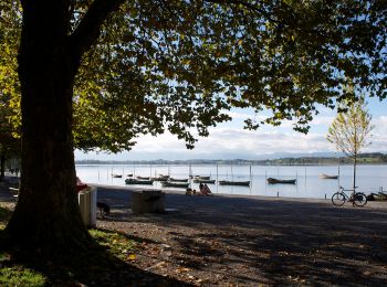
![Percorso A piedi Pfäffikon - Pfäffikersee-Rundweg - Photo](https://media.geolcdn.com/t/350/260/7aaa72d1-8e7f-459f-85ea-df7512a0df88.jpeg&format=jpg&maxdim=2)
![A piedi A piedi](https://static1.geolcdn.com/sitytour/trail-icons/100.png)
Km
A piedi
![](/images/other/stat-length.png)
![](https://static1.geolcdn.com/siteimages/upload/files/1508320355ic_sort_den_pos_24dp.png)
![](https://static1.geolcdn.com/siteimages/upload/files/1508320355ic_sort_den_neg_24dp.png)
![](https://static1.geolcdn.com/siteimages/upload/files/16400158638029165_repeat_loop_refresh_sync_direction_icon.png)
• Trail created by Wanderland Schweiz. Rollstuhlwanderweg Symbol: weisser Rollstuhl unten links, weisse 890 oben rech...
![Percorso A piedi Illnau-Effretikon - Effretikon - Kemptthal - Photo](https://media.geolcdn.com/t/350/260/63404b86-8121-4e1e-949e-dd67169d2de0.jpeg&format=jpg&maxdim=2)
![A piedi A piedi](https://static1.geolcdn.com/sitytour/trail-icons/100.png)
Km
A piedi
![](/images/other/stat-length.png)
![](https://static1.geolcdn.com/siteimages/upload/files/1508320355ic_sort_den_pos_24dp.png)
![](https://static1.geolcdn.com/siteimages/upload/files/1508320355ic_sort_den_neg_24dp.png)
![](https://static1.geolcdn.com/siteimages/upload/files/16400158638029165_repeat_loop_refresh_sync_direction_icon.png)
• Trail created by Zürcher Wanderwege ZAW. Symbol: gelbe Raute
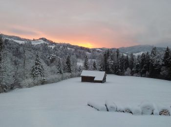
![Percorso A piedi Bauma - Tüfenbach - Sternenberg - Photo](https://media.geolcdn.com/t/350/260/8e14500a-9001-4016-a9bc-118b7acaf142.jpeg&format=jpg&maxdim=2)
![A piedi A piedi](https://static1.geolcdn.com/sitytour/trail-icons/100.png)
Km
A piedi
![](/images/other/stat-length.png)
![](https://static1.geolcdn.com/siteimages/upload/files/1508320355ic_sort_den_pos_24dp.png)
![](https://static1.geolcdn.com/siteimages/upload/files/1508320355ic_sort_den_neg_24dp.png)
![](https://static1.geolcdn.com/siteimages/upload/files/16400158638029165_repeat_loop_refresh_sync_direction_icon.png)
• Symbol: gelbe Raute
20 percorsi visualizzati su 26
Applicazione GPS da escursionismo GRATUITA