![](/images/other/stat-length.png)
- Percorsi
- A piedi
- Switzerland
- Zurigo
- Distretto di Zurigo
- Zurigo
- Schwamendingen
Schwamendingen, Zurigo, A piedi : I migliori sentieri, percorsi e passeggiate
Schwamendingen: Scopri i migliori percorsi: 6 a piedi. Tutti questi percorsi, itinerari e attività outdoor sono disponibili nelle nostre app SityTrail per smartphone e tablet.
I percorsi migliori (0})
![Percorso A piedi Zurigo - Familien-Wanderweg Schwamendingen - Zoo - Photo](https://media.geolcdn.com/t/350/260/483a0b6d-3593-4479-930b-c8ba6d051d85.jpeg&format=jpg&maxdim=2)
![A piedi A piedi](https://static1.geolcdn.com/sitytour/trail-icons/100.png)
Km
A piedi
![](/images/other/stat-length.png)
![](https://static1.geolcdn.com/siteimages/upload/files/1508320355ic_sort_den_pos_24dp.png)
![](https://static1.geolcdn.com/siteimages/upload/files/1508320355ic_sort_den_neg_24dp.png)
![](https://static1.geolcdn.com/siteimages/upload/files/16400158638029165_repeat_loop_refresh_sync_direction_icon.png)
• Trail created by Zürcher Wanderwege ZAW. Symbol: Text Familien-Wanderweg mit comicartigem Erwachsenem mit Kind in gr...
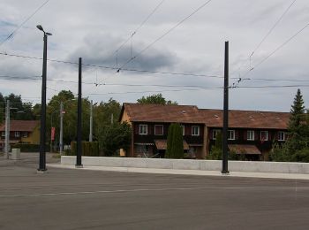
![Percorso A piedi Zurigo - Familien-Wanderweg Settbach - Zoo - Photo](https://media.geolcdn.com/t/350/260/454baeef-2017-489f-b0cc-d51ac7dc03f1.jpeg&format=jpg&maxdim=2)
![A piedi A piedi](https://static1.geolcdn.com/sitytour/trail-icons/100.png)
Km
A piedi
![](/images/other/stat-length.png)
![](https://static1.geolcdn.com/siteimages/upload/files/1508320355ic_sort_den_pos_24dp.png)
![](https://static1.geolcdn.com/siteimages/upload/files/1508320355ic_sort_den_neg_24dp.png)
![](https://static1.geolcdn.com/siteimages/upload/files/16400158638029165_repeat_loop_refresh_sync_direction_icon.png)
• Trail created by Zürcher Wanderwege ZAW. Symbol: Text Familien-Wanderweg mit comicartigem Erwachsenem mit Kind in gr...
![Percorso A piedi Zurigo - Stettbach Bahnhof - Milchbuck - Photo](https://media.geolcdn.com/t/350/260/454baeef-2017-489f-b0cc-d51ac7dc03f1.jpeg&format=jpg&maxdim=2)
![A piedi A piedi](https://static1.geolcdn.com/sitytour/trail-icons/100.png)
Km
A piedi
![](/images/other/stat-length.png)
![](https://static1.geolcdn.com/siteimages/upload/files/1508320355ic_sort_den_pos_24dp.png)
![](https://static1.geolcdn.com/siteimages/upload/files/1508320355ic_sort_den_neg_24dp.png)
![](https://static1.geolcdn.com/siteimages/upload/files/16400158638029165_repeat_loop_refresh_sync_direction_icon.png)
• Trail created by Zürcher Wanderwege. Symbol: gelbe Raute
![Percorso A piedi Zurigo - Waldgarten - Fluntern - Photo](https://media.geolcdn.com/t/350/260/3df06cfe-eaa0-40ad-a49e-33ed4664cbc3.jpeg&format=jpg&maxdim=2)
![A piedi A piedi](https://static1.geolcdn.com/sitytour/trail-icons/100.png)
Km
A piedi
![](/images/other/stat-length.png)
![](https://static1.geolcdn.com/siteimages/upload/files/1508320355ic_sort_den_pos_24dp.png)
![](https://static1.geolcdn.com/siteimages/upload/files/1508320355ic_sort_den_neg_24dp.png)
![](https://static1.geolcdn.com/siteimages/upload/files/16400158638029165_repeat_loop_refresh_sync_direction_icon.png)
• Trail created by Zürcher Wanderwege. Symbol: gelbe Raute
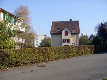
![Percorso A piedi Zurigo - Stettbach Bahnhof - Dietlikon - Photo](https://media.geolcdn.com/t/350/260/68122a24-f2d0-42a0-a57d-0974e5a400e2.jpeg&format=jpg&maxdim=2)
![A piedi A piedi](https://static1.geolcdn.com/sitytour/trail-icons/100.png)
Km
A piedi
![](/images/other/stat-length.png)
![](https://static1.geolcdn.com/siteimages/upload/files/1508320355ic_sort_den_pos_24dp.png)
![](https://static1.geolcdn.com/siteimages/upload/files/1508320355ic_sort_den_neg_24dp.png)
![](https://static1.geolcdn.com/siteimages/upload/files/16400158638029165_repeat_loop_refresh_sync_direction_icon.png)
• Trail created by Zürcher Wanderwege. Symbol: gelbe Raute
![Percorso A piedi Zurigo - Schwamendingerplatz - Zoo - Photo](https://media.geolcdn.com/t/350/260/483a0b6d-3593-4479-930b-c8ba6d051d85.jpeg&format=jpg&maxdim=2)
![A piedi A piedi](https://static1.geolcdn.com/sitytour/trail-icons/100.png)
Km
A piedi
![](/images/other/stat-length.png)
![](https://static1.geolcdn.com/siteimages/upload/files/1508320355ic_sort_den_pos_24dp.png)
![](https://static1.geolcdn.com/siteimages/upload/files/1508320355ic_sort_den_neg_24dp.png)
![](https://static1.geolcdn.com/siteimages/upload/files/16400158638029165_repeat_loop_refresh_sync_direction_icon.png)
• Trail created by Zürcher Wanderwege. Symbol: gelbe Raute
6 percorsi visualizzati su 6
Applicazione GPS da escursionismo GRATUITA