![](/images/other/stat-length.png)
- Percorsi
- A piedi
- Switzerland
- Zurigo
- Bezirk Affoltern
Bezirk Affoltern, Zurigo, A piedi : I migliori sentieri, percorsi e passeggiate
Bezirk Affoltern: Scopri i migliori percorsi: 29 a piedi, 1 marcia e 6 camminata nordica. Tutti questi percorsi, itinerari e attività outdoor sono disponibili nelle nostre app SityTrail per smartphone e tablet.
I percorsi migliori (0})
![Percorso A piedi Hedingen - Hedingen - Balderen - Photo](https://media.geolcdn.com/t/350/260/c89147c8-30a3-407f-b17c-acd1619669a1.jpeg&format=jpg&maxdim=2)
![A piedi A piedi](https://static1.geolcdn.com/sitytour/trail-icons/100.png)
Km
A piedi
![](/images/other/stat-length.png)
![](https://static1.geolcdn.com/siteimages/upload/files/1508320355ic_sort_den_pos_24dp.png)
![](https://static1.geolcdn.com/siteimages/upload/files/1508320355ic_sort_den_neg_24dp.png)
![](https://static1.geolcdn.com/siteimages/upload/files/16400158638029165_repeat_loop_refresh_sync_direction_icon.png)
• Hedingen - Balderen Symbol: gelbe Raute
![Percorso A piedi Stallikon - Uitikon Waldegg Station - Uetliberg Kulm - Photo](https://media.geolcdn.com/t/350/260/dev_a758ce6b-60a2-4471-b639-3fd48e07adc6.jpeg&format=jpg&maxdim=2)
![A piedi A piedi](https://static1.geolcdn.com/sitytour/trail-icons/100.png)
Km
A piedi
![](/images/other/stat-length.png)
![](https://static1.geolcdn.com/siteimages/upload/files/1508320355ic_sort_den_pos_24dp.png)
![](https://static1.geolcdn.com/siteimages/upload/files/1508320355ic_sort_den_neg_24dp.png)
![](https://static1.geolcdn.com/siteimages/upload/files/16400158638029165_repeat_loop_refresh_sync_direction_icon.png)
• Symbol: gelbe Raute
![Percorso A piedi Wettswil am Albis - Birmensdorf - Wettswil - Photo](https://media.geolcdn.com/t/350/260/6876b5bc-0e6c-4b4c-b57e-4dd6d3c1fb20.jpeg&format=jpg&maxdim=2)
![A piedi A piedi](https://static1.geolcdn.com/sitytour/trail-icons/100.png)
Km
A piedi
![](/images/other/stat-length.png)
![](https://static1.geolcdn.com/siteimages/upload/files/1508320355ic_sort_den_pos_24dp.png)
![](https://static1.geolcdn.com/siteimages/upload/files/1508320355ic_sort_den_neg_24dp.png)
![](https://static1.geolcdn.com/siteimages/upload/files/16400158638029165_repeat_loop_refresh_sync_direction_icon.png)
• Symbol: gelbe Raute
![Percorso A piedi Hedingen - Wettswil - Hedingen - Photo](https://media.geolcdn.com/t/350/260/656d954e-4ce0-4edd-89c4-b2ad79b590db.jpeg&format=jpg&maxdim=2)
![A piedi A piedi](https://static1.geolcdn.com/sitytour/trail-icons/100.png)
Km
A piedi
![](/images/other/stat-length.png)
![](https://static1.geolcdn.com/siteimages/upload/files/1508320355ic_sort_den_pos_24dp.png)
![](https://static1.geolcdn.com/siteimages/upload/files/1508320355ic_sort_den_neg_24dp.png)
![](https://static1.geolcdn.com/siteimages/upload/files/16400158638029165_repeat_loop_refresh_sync_direction_icon.png)
• Symbol: gelbe Raute
![Percorso A piedi Affoltern am Albis - Sunnenbüel - Türlen - Photo](https://media.geolcdn.com/t/350/260/0c99d133-ba74-4804-878b-d0c40a03a6e1.jpeg&format=jpg&maxdim=2)
![A piedi A piedi](https://static1.geolcdn.com/sitytour/trail-icons/100.png)
Km
A piedi
![](/images/other/stat-length.png)
![](https://static1.geolcdn.com/siteimages/upload/files/1508320355ic_sort_den_pos_24dp.png)
![](https://static1.geolcdn.com/siteimages/upload/files/1508320355ic_sort_den_neg_24dp.png)
![](https://static1.geolcdn.com/siteimages/upload/files/16400158638029165_repeat_loop_refresh_sync_direction_icon.png)
• Trail created by Zürcher Wanderwege. Symbol: gelbe Raute
![Percorso A piedi Affoltern am Albis - Affoltern a. A. - Hedingen - Photo](https://media.geolcdn.com/t/350/260/d1a8b094-e5dd-42b2-809e-cb6fed89b282.jpeg&format=jpg&maxdim=2)
![A piedi A piedi](https://static1.geolcdn.com/sitytour/trail-icons/100.png)
Km
A piedi
![](/images/other/stat-length.png)
![](https://static1.geolcdn.com/siteimages/upload/files/1508320355ic_sort_den_pos_24dp.png)
![](https://static1.geolcdn.com/siteimages/upload/files/1508320355ic_sort_den_neg_24dp.png)
![](https://static1.geolcdn.com/siteimages/upload/files/16400158638029165_repeat_loop_refresh_sync_direction_icon.png)
• Trail created by Zürcher Wanderwege. Symbol: gelbe Raute
![Percorso A piedi Mettmenstetten - Herferswil - Ober Mettmenstetten - Photo](https://media.geolcdn.com/t/350/260/7788aab6-2383-4472-885c-104ef1cb057c.jpeg&format=jpg&maxdim=2)
![A piedi A piedi](https://static1.geolcdn.com/sitytour/trail-icons/100.png)
Km
A piedi
![](/images/other/stat-length.png)
![](https://static1.geolcdn.com/siteimages/upload/files/1508320355ic_sort_den_pos_24dp.png)
![](https://static1.geolcdn.com/siteimages/upload/files/1508320355ic_sort_den_neg_24dp.png)
![](https://static1.geolcdn.com/siteimages/upload/files/16400158638029165_repeat_loop_refresh_sync_direction_icon.png)
• Herferswil - Ober Mettmenstetten Symbol: gelbe Raute
![Percorso A piedi Mettmenstetten - Herferswil - Türlen - Photo](https://media.geolcdn.com/t/350/260/7788aab6-2383-4472-885c-104ef1cb057c.jpeg&format=jpg&maxdim=2)
![A piedi A piedi](https://static1.geolcdn.com/sitytour/trail-icons/100.png)
Km
A piedi
![](/images/other/stat-length.png)
![](https://static1.geolcdn.com/siteimages/upload/files/1508320355ic_sort_den_pos_24dp.png)
![](https://static1.geolcdn.com/siteimages/upload/files/1508320355ic_sort_den_neg_24dp.png)
![](https://static1.geolcdn.com/siteimages/upload/files/16400158638029165_repeat_loop_refresh_sync_direction_icon.png)
• Symbol: gelbe Raute
![Percorso A piedi Maschwanden - Maschwanden - Knonau - Photo](https://media.geolcdn.com/t/350/260/aade6525-7d9e-4ca4-9280-dd84920afc1e.jpeg&format=jpg&maxdim=2)
![A piedi A piedi](https://static1.geolcdn.com/sitytour/trail-icons/100.png)
Km
A piedi
![](/images/other/stat-length.png)
![](https://static1.geolcdn.com/siteimages/upload/files/1508320355ic_sort_den_pos_24dp.png)
![](https://static1.geolcdn.com/siteimages/upload/files/1508320355ic_sort_den_neg_24dp.png)
![](https://static1.geolcdn.com/siteimages/upload/files/16400158638029165_repeat_loop_refresh_sync_direction_icon.png)
• Uerzlikon - Chlostermatt Symbol: gelber Rhombus
![Percorso A piedi Obfelden - Wolsen - Mettmenstetten - Photo](https://media.geolcdn.com/t/350/260/65288abe-15b8-4f3f-8efc-8d9ca0a90db5.jpeg&format=jpg&maxdim=2)
![A piedi A piedi](https://static1.geolcdn.com/sitytour/trail-icons/100.png)
Km
A piedi
![](/images/other/stat-length.png)
![](https://static1.geolcdn.com/siteimages/upload/files/1508320355ic_sort_den_pos_24dp.png)
![](https://static1.geolcdn.com/siteimages/upload/files/1508320355ic_sort_den_neg_24dp.png)
![](https://static1.geolcdn.com/siteimages/upload/files/16400158638029165_repeat_loop_refresh_sync_direction_icon.png)
• Trail created by Zürcher Wanderwege. Wolsen - Mettmenstetten Symbol: gelber Diamant
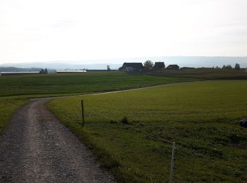
![Percorso A piedi Obfelden - Wolsen - Hinteruttenberg - Photo](https://media.geolcdn.com/t/350/260/ef75a33d-13f6-4513-918a-0d34a49f87fb.jpeg&format=jpg&maxdim=2)
![A piedi A piedi](https://static1.geolcdn.com/sitytour/trail-icons/100.png)
Km
A piedi
![](/images/other/stat-length.png)
![](https://static1.geolcdn.com/siteimages/upload/files/1508320355ic_sort_den_pos_24dp.png)
![](https://static1.geolcdn.com/siteimages/upload/files/1508320355ic_sort_den_neg_24dp.png)
![](https://static1.geolcdn.com/siteimages/upload/files/16400158638029165_repeat_loop_refresh_sync_direction_icon.png)
• Trail created by Zürcher Wanderwege. Wolsen - Mettmenstetten Symbol: gelber Diamant
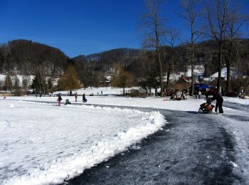
![Percorso A piedi Hausen am Albis - Türlerseerundweg - Photo](https://media.geolcdn.com/t/350/260/2926d786-3a82-48c6-bed6-006bc96f15a3.jpeg&format=jpg&maxdim=2)
![A piedi A piedi](https://static1.geolcdn.com/sitytour/trail-icons/100.png)
Km
A piedi
![](/images/other/stat-length.png)
![](https://static1.geolcdn.com/siteimages/upload/files/1508320355ic_sort_den_pos_24dp.png)
![](https://static1.geolcdn.com/siteimages/upload/files/1508320355ic_sort_den_neg_24dp.png)
![](https://static1.geolcdn.com/siteimages/upload/files/16400158638029165_repeat_loop_refresh_sync_direction_icon.png)
• Türlerseerundweg Symbol: gelber Rhombus
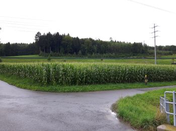
![Percorso A piedi Affoltern am Albis - Zwillikon - Kapelle Jonental - Photo](https://media.geolcdn.com/t/350/260/263c1675-0031-4279-9a61-89d46ebc3b39.jpeg&format=jpg&maxdim=2)
![A piedi A piedi](https://static1.geolcdn.com/sitytour/trail-icons/100.png)
Km
A piedi
![](/images/other/stat-length.png)
![](https://static1.geolcdn.com/siteimages/upload/files/1508320355ic_sort_den_pos_24dp.png)
![](https://static1.geolcdn.com/siteimages/upload/files/1508320355ic_sort_den_neg_24dp.png)
![](https://static1.geolcdn.com/siteimages/upload/files/16400158638029165_repeat_loop_refresh_sync_direction_icon.png)
• Zwillikon - Kapelle Jonental Symbol: gelber Rhombus
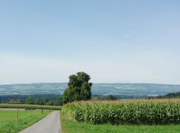
![Percorso A piedi Mettmenstetten - Affoltern a. A. - Paradis - Photo](https://media.geolcdn.com/t/350/260/ccaffb57-b917-42b0-9daa-5b317dbded3a.jpeg&format=jpg&maxdim=2)
![A piedi A piedi](https://static1.geolcdn.com/sitytour/trail-icons/100.png)
Km
A piedi
![](/images/other/stat-length.png)
![](https://static1.geolcdn.com/siteimages/upload/files/1508320355ic_sort_den_pos_24dp.png)
![](https://static1.geolcdn.com/siteimages/upload/files/1508320355ic_sort_den_neg_24dp.png)
![](https://static1.geolcdn.com/siteimages/upload/files/16400158638029165_repeat_loop_refresh_sync_direction_icon.png)
• Affoltern a. A. - Paradis Symbol: gelber Rhombus
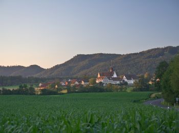
![Percorso A piedi Kappel am Albis - Chlostermatt - Ober Rifferswil - Photo](https://media.geolcdn.com/t/350/260/cd5c5d0d-2dfd-4075-a1cf-e61fa0297203.jpeg&format=jpg&maxdim=2)
![A piedi A piedi](https://static1.geolcdn.com/sitytour/trail-icons/100.png)
Km
A piedi
![](/images/other/stat-length.png)
![](https://static1.geolcdn.com/siteimages/upload/files/1508320355ic_sort_den_pos_24dp.png)
![](https://static1.geolcdn.com/siteimages/upload/files/1508320355ic_sort_den_neg_24dp.png)
![](https://static1.geolcdn.com/siteimages/upload/files/16400158638029165_repeat_loop_refresh_sync_direction_icon.png)
• Chlostermatt - Ober Rifferswil Symbol: gelber Rhombus
![Percorso A piedi Knonau - Frauental-Knonau - Photo](https://media.geolcdn.com/t/350/260/aade6525-7d9e-4ca4-9280-dd84920afc1e.jpeg&format=jpg&maxdim=2)
![A piedi A piedi](https://static1.geolcdn.com/sitytour/trail-icons/100.png)
Km
A piedi
![](/images/other/stat-length.png)
![](https://static1.geolcdn.com/siteimages/upload/files/1508320355ic_sort_den_pos_24dp.png)
![](https://static1.geolcdn.com/siteimages/upload/files/1508320355ic_sort_den_neg_24dp.png)
![](https://static1.geolcdn.com/siteimages/upload/files/16400158638029165_repeat_loop_refresh_sync_direction_icon.png)
• Frauental-Knonau Symbol: gelber Rhombus
![Percorso A piedi Mettmenstetten - Knonau - Mettmenstetten - Photo](https://media.geolcdn.com/t/350/260/65288abe-15b8-4f3f-8efc-8d9ca0a90db5.jpeg&format=jpg&maxdim=2)
![A piedi A piedi](https://static1.geolcdn.com/sitytour/trail-icons/100.png)
Km
A piedi
![](/images/other/stat-length.png)
![](https://static1.geolcdn.com/siteimages/upload/files/1508320355ic_sort_den_pos_24dp.png)
![](https://static1.geolcdn.com/siteimages/upload/files/1508320355ic_sort_den_neg_24dp.png)
![](https://static1.geolcdn.com/siteimages/upload/files/16400158638029165_repeat_loop_refresh_sync_direction_icon.png)
• Knonau - Mettmenstetten Symbol: gelber Rhombus
![Percorso A piedi Hedingen - Hedingen Station - Müliberg - Photo](https://media.geolcdn.com/t/350/260/c89147c8-30a3-407f-b17c-acd1619669a1.jpeg&format=jpg&maxdim=2)
![A piedi A piedi](https://static1.geolcdn.com/sitytour/trail-icons/100.png)
Km
A piedi
![](/images/other/stat-length.png)
![](https://static1.geolcdn.com/siteimages/upload/files/1508320355ic_sort_den_pos_24dp.png)
![](https://static1.geolcdn.com/siteimages/upload/files/1508320355ic_sort_den_neg_24dp.png)
![](https://static1.geolcdn.com/siteimages/upload/files/16400158638029165_repeat_loop_refresh_sync_direction_icon.png)
• Hedingen Station - Müliberg Symbol: gelber Rhombus
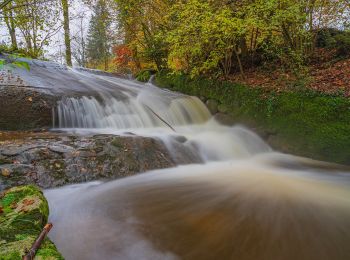
![Percorso A piedi Affoltern am Albis - Ottenbach - Affoltern a.A. - Photo](https://media.geolcdn.com/t/350/260/3a068ff4-ed4d-4f5a-901f-6699a765684d.jpeg&format=jpg&maxdim=2)
![A piedi A piedi](https://static1.geolcdn.com/sitytour/trail-icons/100.png)
Km
A piedi
![](/images/other/stat-length.png)
![](https://static1.geolcdn.com/siteimages/upload/files/1508320355ic_sort_den_pos_24dp.png)
![](https://static1.geolcdn.com/siteimages/upload/files/1508320355ic_sort_den_neg_24dp.png)
![](https://static1.geolcdn.com/siteimages/upload/files/16400158638029165_repeat_loop_refresh_sync_direction_icon.png)
• Trail created by Zürcher Wanderwege. Ottenbach - Affoltern a.A. Symbol: gelber Diamant
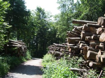
![Percorso A piedi Stallikon - Näferhüser - Müliberg - Photo](https://media.geolcdn.com/t/350/260/8ed39a5c-fbf4-4c9c-b346-9dd71a8a8979.jpeg&format=jpg&maxdim=2)
![A piedi A piedi](https://static1.geolcdn.com/sitytour/trail-icons/100.png)
Km
A piedi
![](/images/other/stat-length.png)
![](https://static1.geolcdn.com/siteimages/upload/files/1508320355ic_sort_den_pos_24dp.png)
![](https://static1.geolcdn.com/siteimages/upload/files/1508320355ic_sort_den_neg_24dp.png)
![](https://static1.geolcdn.com/siteimages/upload/files/16400158638029165_repeat_loop_refresh_sync_direction_icon.png)
• Symbol: gelbe Raute
20 percorsi visualizzati su 36
Applicazione GPS da escursionismo GRATUITA