


5,2 km | 6,1 km-effort
Aalter: Scopri i migliori percorsi: 7 a piedi, 16 marcia e 2 camminata nordica. Tutti questi percorsi, itinerari e attività outdoor sono disponibili nelle nostre app SityTrail per smartphone e tablet.
A piedi


• Trail created by Natuur en Bos. Pijltjes ontbreken vanaf Het Eilendje. Wellicht is de route nog niet volledig uitgez...
A piedi
• We kunnen het grote Keigatbosgebied beschouwen als een uitloper van het Drongengoedgebied, maar het Keigatbos heeft t...
A piedi
• Trail created by Natuurpunt. Symbol: rectangle
A piedi
• Trail created by Natuurpunt. Symbol: square Sito web: https://www.natuurpunt.be/natuurgebied/de-vaanders

Marcia

A piedi
• Het huidige neoclassicistische kerkje kwam er in 1842 nadat de oude gotische kerk er bouwvallig bijstond in het begin...
Marcia
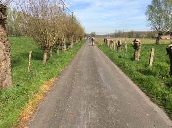
• campagne Flamande
Marcia
Marcia
Marcia
Marcia
• More information on : http://www.wandelroutes.org
Marcia
• More information on : http://www.wandelroutes.org
A piedi
A piedi
Marcia
Marcia
Marcia
Marcia
Marcia
Marcia
20 percorsi visualizzati su 25
Applicazione GPS da escursionismo GRATUITA
 SityTrail
IGN / Istituti geografici
SityTrail World
Il mondo è tuo