![](/images/other/stat-length.png)
- Percorsi
- A piedi
- Austria
- Bassa Austria
- Bezirk Baden
- Gemeinde Weissenbach an der Triesting
Gemeinde Weissenbach an der Triesting, Bezirk Baden, A piedi : I migliori sentieri, percorsi e passeggiate
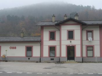
Gemeinde Weissenbach an der Triesting: Scopri i migliori percorsi: 3 a piedi. Tutti questi percorsi, itinerari e attività outdoor sono disponibili nelle nostre app SityTrail per smartphone e tablet.
I percorsi migliori (0})
![Percorso A piedi Gemeinde Weissenbach an der Triesting - Weissenbach-Raintal-Hafnerberg-Altenmarkt - Photo](https://media.geolcdn.com/t/350/260/c976ef6e-fcda-4e6b-b50f-9848b0fa630a.jpeg&format=jpg&maxdim=2)
![A piedi A piedi](https://static1.geolcdn.com/sitytour/trail-icons/100.png)
Km
A piedi
![](/images/other/stat-length.png)
![](https://static1.geolcdn.com/siteimages/upload/files/1508320355ic_sort_den_pos_24dp.png)
![](https://static1.geolcdn.com/siteimages/upload/files/1508320355ic_sort_den_neg_24dp.png)
![](https://static1.geolcdn.com/siteimages/upload/files/16400158638029165_repeat_loop_refresh_sync_direction_icon.png)
• Trail created by ÖTKÖsterreichischer Touristenklub Sektion Baden.
![Percorso A piedi Gemeinde Weissenbach an der Triesting - Weißenbacher Rundwanderweg 2 - Photo](https://media.geolcdn.com/t/350/260/c604b5a8-e17d-41a9-bb14-64cf5b920de3.jpeg&format=jpg&maxdim=2)
![A piedi A piedi](https://static1.geolcdn.com/sitytour/trail-icons/100.png)
Km
A piedi
![](/images/other/stat-length.png)
![](https://static1.geolcdn.com/siteimages/upload/files/1508320355ic_sort_den_pos_24dp.png)
![](https://static1.geolcdn.com/siteimages/upload/files/1508320355ic_sort_den_neg_24dp.png)
![](https://static1.geolcdn.com/siteimages/upload/files/16400158638029165_repeat_loop_refresh_sync_direction_icon.png)
• Trail created by FVV Weißenbach. Symbol: weißer Pfeil mit "FVV"
![Percorso A piedi Gemeinde Weissenbach an der Triesting - Weißenbach a.d. Triesting - Wolfsgrube - Veiglkogel - Photo](https://media.geolcdn.com/t/350/260/1d3cca04-4029-4278-8db8-e286692c38c1.jpeg&format=jpg&maxdim=2)
![A piedi A piedi](https://static1.geolcdn.com/sitytour/trail-icons/100.png)
Km
A piedi
![](/images/other/stat-length.png)
![](https://static1.geolcdn.com/siteimages/upload/files/1508320355ic_sort_den_pos_24dp.png)
![](https://static1.geolcdn.com/siteimages/upload/files/1508320355ic_sort_den_neg_24dp.png)
![](https://static1.geolcdn.com/siteimages/upload/files/16400158638029165_repeat_loop_refresh_sync_direction_icon.png)
• Der ÖTK gilt als Pionier des Fremdenverkehrs. Heute ist der ÖTK mit über 360 Kursen und geführten Touren in 50 Freize...
3 percorsi visualizzati su 3
Applicazione GPS da escursionismo GRATUITA