![](/images/other/stat-length.png)
- Percorsi
- A piedi
- Austria
- Bassa Austria
- Bezirk Neunkirchen
- Gemeinde Reichenau an der Rax
Gemeinde Reichenau an der Rax, Bezirk Neunkirchen, A piedi : I migliori sentieri, percorsi e passeggiate
Gemeinde Reichenau an der Rax: Scopri i migliori percorsi: 15 a piedi. Tutti questi percorsi, itinerari e attività outdoor sono disponibili nelle nostre app SityTrail per smartphone e tablet.
I percorsi migliori (0})
![Percorso A piedi Gemeinde Reichenau an der Rax - Miesleitensteig - Photo](https://media.geolcdn.com/t/350/260/94a78a72-401f-4035-8f29-45b74e3c167e.jpeg&format=jpg&maxdim=2)
![A piedi A piedi](https://static1.geolcdn.com/sitytour/trail-icons/100.png)
Km
A piedi
![](/images/other/stat-length.png)
![](https://static1.geolcdn.com/siteimages/upload/files/1508320355ic_sort_den_pos_24dp.png)
![](https://static1.geolcdn.com/siteimages/upload/files/1508320355ic_sort_den_neg_24dp.png)
![](https://static1.geolcdn.com/siteimages/upload/files/16400158638029165_repeat_loop_refresh_sync_direction_icon.png)
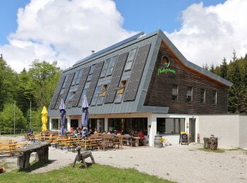
• Trail created by Naturfreunde Österreich.
![Percorso A piedi Gemeinde Reichenau an der Rax - Brandschneide - Photo](https://media.geolcdn.com/t/350/260/be8b0966-df41-423a-936d-9c7fa004abb9.jpeg&format=jpg&maxdim=2)
![A piedi A piedi](https://static1.geolcdn.com/sitytour/trail-icons/100.png)
Km
A piedi
![](/images/other/stat-length.png)
![](https://static1.geolcdn.com/siteimages/upload/files/1508320355ic_sort_den_pos_24dp.png)
![](https://static1.geolcdn.com/siteimages/upload/files/1508320355ic_sort_den_neg_24dp.png)
![](https://static1.geolcdn.com/siteimages/upload/files/16400158638029165_repeat_loop_refresh_sync_direction_icon.png)
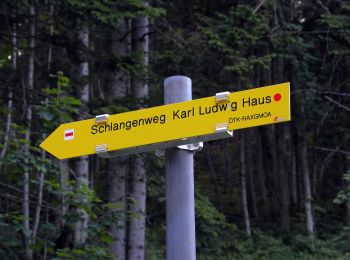
• Trail created by Österreichischer Touristenklub, Sektion Raxgmoa. Symbol: gelber, waagerechter Balken
![Percorso A piedi Gemeinde Reichenau an der Rax - Ottohaus - Neue Seehütte - Predigtstuhl - Karl-Ludwig-Haus - Photo](https://media.geolcdn.com/t/350/260/aa8eeb88-9dd4-4904-a15a-7a7bbc51b54e.jpeg&format=jpg&maxdim=2)
![A piedi A piedi](https://static1.geolcdn.com/sitytour/trail-icons/100.png)
Km
A piedi
![](/images/other/stat-length.png)
![](https://static1.geolcdn.com/siteimages/upload/files/1508320355ic_sort_den_pos_24dp.png)
![](https://static1.geolcdn.com/siteimages/upload/files/1508320355ic_sort_den_neg_24dp.png)
![](https://static1.geolcdn.com/siteimages/upload/files/16400158638029165_repeat_loop_refresh_sync_direction_icon.png)
• Trail created by Österreichischer Touristenklub. Symbol: roter, waagrechter Balken
![Percorso A piedi Gemeinde Reichenau an der Rax - Gaislochboden - Dirnbacherhütte - Seehütte - Photo](https://media.geolcdn.com/t/350/260/726b16de-5cc0-45c6-b1ef-046b03313ba1.jpeg&format=jpg&maxdim=2)
![A piedi A piedi](https://static1.geolcdn.com/sitytour/trail-icons/100.png)
Km
A piedi
![](/images/other/stat-length.png)
![](https://static1.geolcdn.com/siteimages/upload/files/1508320355ic_sort_den_pos_24dp.png)
![](https://static1.geolcdn.com/siteimages/upload/files/1508320355ic_sort_den_neg_24dp.png)
![](https://static1.geolcdn.com/siteimages/upload/files/16400158638029165_repeat_loop_refresh_sync_direction_icon.png)
• Trail created by ÖTK Sektion Raxgmoa. Symbol: gelber, waagerechter Balken
![Percorso A piedi Gemeinde Reichenau an der Rax - Weg PA 14 - Photo](https://media.geolcdn.com/t/350/260/94a78a72-401f-4035-8f29-45b74e3c167e.jpeg&format=jpg&maxdim=2)
![A piedi A piedi](https://static1.geolcdn.com/sitytour/trail-icons/100.png)
Km
A piedi
![](/images/other/stat-length.png)
![](https://static1.geolcdn.com/siteimages/upload/files/1508320355ic_sort_den_pos_24dp.png)
![](https://static1.geolcdn.com/siteimages/upload/files/1508320355ic_sort_den_neg_24dp.png)
![](https://static1.geolcdn.com/siteimages/upload/files/16400158638029165_repeat_loop_refresh_sync_direction_icon.png)
• Symbol: grünes Schild mit PA14 in weiß
![Percorso A piedi Gemeinde Reichenau an der Rax - Dörfl - Griesleiten - Photo](https://media.geolcdn.com/t/350/260/ee0b1f3f-b16c-4b9c-ad88-83470529c5de.jpeg&format=jpg&maxdim=2)
![A piedi A piedi](https://static1.geolcdn.com/sitytour/trail-icons/100.png)
Km
A piedi
![](/images/other/stat-length.png)
![](https://static1.geolcdn.com/siteimages/upload/files/1508320355ic_sort_den_pos_24dp.png)
![](https://static1.geolcdn.com/siteimages/upload/files/1508320355ic_sort_den_neg_24dp.png)
![](https://static1.geolcdn.com/siteimages/upload/files/16400158638029165_repeat_loop_refresh_sync_direction_icon.png)
• Trail created by Österreichischer Touristenklub. Symbol: gelber, waagerechter Balken
![Percorso A piedi Gemeinde Reichenau an der Rax - Griesleiten - Waxriegelhaus - Neue Seehütte - Photo](https://media.geolcdn.com/t/350/260/87b795ef-1673-4370-ab14-63b4ced2d014.jpeg&format=jpg&maxdim=2)
![A piedi A piedi](https://static1.geolcdn.com/sitytour/trail-icons/100.png)
Km
A piedi
![](/images/other/stat-length.png)
![](https://static1.geolcdn.com/siteimages/upload/files/1508320355ic_sort_den_pos_24dp.png)
![](https://static1.geolcdn.com/siteimages/upload/files/1508320355ic_sort_den_neg_24dp.png)
![](https://static1.geolcdn.com/siteimages/upload/files/16400158638029165_repeat_loop_refresh_sync_direction_icon.png)
• Trail created by ÖTK. Symbol: weiß-gelb-weiß
![Percorso A piedi Gemeinde Reichenau an der Rax - Gsolhirnsteig - Bergstation - Photo](https://media.geolcdn.com/t/350/260/0dc29493-98a5-4e07-ae64-147fecea4fbd.jpeg&format=jpg&maxdim=2)
![A piedi A piedi](https://static1.geolcdn.com/sitytour/trail-icons/100.png)
Km
A piedi
![](/images/other/stat-length.png)
![](https://static1.geolcdn.com/siteimages/upload/files/1508320355ic_sort_den_pos_24dp.png)
![](https://static1.geolcdn.com/siteimages/upload/files/1508320355ic_sort_den_neg_24dp.png)
![](https://static1.geolcdn.com/siteimages/upload/files/16400158638029165_repeat_loop_refresh_sync_direction_icon.png)
• Trail created by Österreichischer Alpenverein Sektion Reichenau. Symbol: blauer, waagrechter Balken
![Percorso A piedi Gemeinde Reichenau an der Rax - Seehütte - Preinerwand-Kreuz - Ottohaus - Photo](https://media.geolcdn.com/t/350/260/11e2593b-b776-4e23-86b0-5f74cf9280a4.jpeg&format=jpg&maxdim=2)
![A piedi A piedi](https://static1.geolcdn.com/sitytour/trail-icons/100.png)
Km
A piedi
![](/images/other/stat-length.png)
![](https://static1.geolcdn.com/siteimages/upload/files/1508320355ic_sort_den_pos_24dp.png)
![](https://static1.geolcdn.com/siteimages/upload/files/1508320355ic_sort_den_neg_24dp.png)
![](https://static1.geolcdn.com/siteimages/upload/files/16400158638029165_repeat_loop_refresh_sync_direction_icon.png)
• Symbol: blauer, waagrechter Balken
![Percorso A piedi Gemeinde Reichenau an der Rax - Schneedörfl - Waldburgangerhütte - Photo](https://media.geolcdn.com/t/350/260/93f5a7bf-efef-4a40-bf0c-8c0ed1f26f50.jpeg&format=jpg&maxdim=2)
![A piedi A piedi](https://static1.geolcdn.com/sitytour/trail-icons/100.png)
Km
A piedi
![](/images/other/stat-length.png)
![](https://static1.geolcdn.com/siteimages/upload/files/1508320355ic_sort_den_pos_24dp.png)
![](https://static1.geolcdn.com/siteimages/upload/files/1508320355ic_sort_den_neg_24dp.png)
![](https://static1.geolcdn.com/siteimages/upload/files/16400158638029165_repeat_loop_refresh_sync_direction_icon.png)
• Trail created by Österreichischer Alpenverein Sektion Reichenau. Symbol: gelber, waagerechter Balken
![Percorso A piedi Gemeinde Reichenau an der Rax - Hoyossteig - Photo](https://media.geolcdn.com/t/350/260/3de6bc46-5740-4afb-a90b-e5d0efd5e5dc.jpeg&format=jpg&maxdim=2)
![A piedi A piedi](https://static1.geolcdn.com/sitytour/trail-icons/100.png)
Km
A piedi
![](/images/other/stat-length.png)
![](https://static1.geolcdn.com/siteimages/upload/files/1508320355ic_sort_den_pos_24dp.png)
![](https://static1.geolcdn.com/siteimages/upload/files/1508320355ic_sort_den_neg_24dp.png)
![](https://static1.geolcdn.com/siteimages/upload/files/16400158638029165_repeat_loop_refresh_sync_direction_icon.png)
• Symbol: rot-weiß-rot 48
![Percorso A piedi Gemeinde Reichenau an der Rax - Weichtalhaus - Kientalerhütte - Edelweißhütte (Schneeberg) - Photo](https://media.geolcdn.com/t/350/260/c2b25f1d-8f5e-41f3-bb43-bdb00adf89c2.jpeg&format=jpg&maxdim=2)
![A piedi A piedi](https://static1.geolcdn.com/sitytour/trail-icons/100.png)
Km
A piedi
![](/images/other/stat-length.png)
![](https://static1.geolcdn.com/siteimages/upload/files/1508320355ic_sort_den_pos_24dp.png)
![](https://static1.geolcdn.com/siteimages/upload/files/1508320355ic_sort_den_neg_24dp.png)
![](https://static1.geolcdn.com/siteimages/upload/files/16400158638029165_repeat_loop_refresh_sync_direction_icon.png)
• Trail created by Österreichischer Touristenklub. Symbol: gelber, waagerechter Balken
![Percorso A piedi Gemeinde Reichenau an der Rax - Reichenau - Speckbacher Hütte - Photo](https://media.geolcdn.com/t/350/260/c2292006-2388-42b3-8b07-2dc04cf5d5c5.jpeg&format=jpg&maxdim=2)
![A piedi A piedi](https://static1.geolcdn.com/sitytour/trail-icons/100.png)
Km
A piedi
![](/images/other/stat-length.png)
![](https://static1.geolcdn.com/siteimages/upload/files/1508320355ic_sort_den_pos_24dp.png)
![](https://static1.geolcdn.com/siteimages/upload/files/1508320355ic_sort_den_neg_24dp.png)
![](https://static1.geolcdn.com/siteimages/upload/files/16400158638029165_repeat_loop_refresh_sync_direction_icon.png)
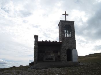
• Der ÖTK gilt als Pionier des Fremdenverkehrs. Heute ist der ÖTK mit über 360 Kursen und geführten Touren in 50 Freize...
![Percorso A piedi Gemeinde Reichenau an der Rax - Semperitweg - Photo](https://media.geolcdn.com/t/350/260/78ffc21d-4015-48f0-8e5e-de818aaa5bcc.jpeg&format=jpg&maxdim=2)
![A piedi A piedi](https://static1.geolcdn.com/sitytour/trail-icons/100.png)
Km
A piedi
![](/images/other/stat-length.png)
![](https://static1.geolcdn.com/siteimages/upload/files/1508320355ic_sort_den_pos_24dp.png)
![](https://static1.geolcdn.com/siteimages/upload/files/1508320355ic_sort_den_neg_24dp.png)
![](https://static1.geolcdn.com/siteimages/upload/files/16400158638029165_repeat_loop_refresh_sync_direction_icon.png)
![Percorso A piedi Gemeinde Reichenau an der Rax - Prein - Preiner Gschneid - Photo](https://media.geolcdn.com/t/350/260/f03803fb-4f51-459e-868c-c1493e0da3a7.jpeg&format=jpg&maxdim=2)
![A piedi A piedi](https://static1.geolcdn.com/sitytour/trail-icons/100.png)
Km
A piedi
![](/images/other/stat-length.png)
![](https://static1.geolcdn.com/siteimages/upload/files/1508320355ic_sort_den_pos_24dp.png)
![](https://static1.geolcdn.com/siteimages/upload/files/1508320355ic_sort_den_neg_24dp.png)
![](https://static1.geolcdn.com/siteimages/upload/files/16400158638029165_repeat_loop_refresh_sync_direction_icon.png)
15 percorsi visualizzati su 15
Applicazione GPS da escursionismo GRATUITA