![](/images/other/stat-length.png)
- Percorsi
- A piedi
- Austria
- Salisburgo
- Bezirk St. Johann im Pongau
Bezirk St. Johann im Pongau, Salisburgo, A piedi : I migliori sentieri, percorsi e passeggiate
Bezirk St. Johann im Pongau: Scopri i migliori percorsi: 85 a piedi e 15 marcia. Tutti questi percorsi, itinerari e attività outdoor sono disponibili nelle nostre app SityTrail per smartphone e tablet.
I percorsi migliori (0})
![Percorso A piedi Werfenweng - Raika Runde - Photo](https://media.geolcdn.com/t/350/260/257008a7-4c15-4626-b0bc-6b4df138b6c4.jpeg&format=jpg&maxdim=2)
![A piedi A piedi](https://static1.geolcdn.com/sitytour/trail-icons/100.png)
Km
A piedi
![](/images/other/stat-length.png)
![](https://static1.geolcdn.com/siteimages/upload/files/1508320355ic_sort_den_pos_24dp.png)
![](https://static1.geolcdn.com/siteimages/upload/files/1508320355ic_sort_den_neg_24dp.png)
![](https://static1.geolcdn.com/siteimages/upload/files/16400158638029165_repeat_loop_refresh_sync_direction_icon.png)
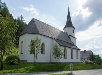
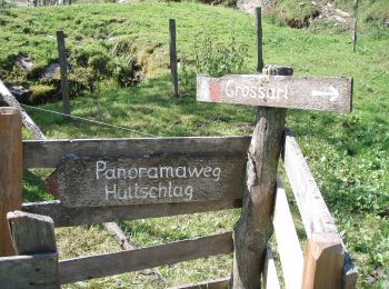
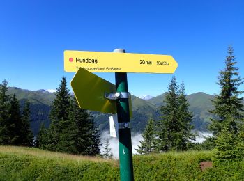
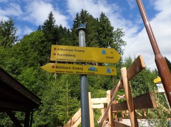
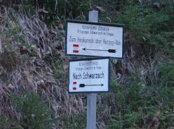
• Trail created by runnersfun.com. Symbol: Weiße Schilder mit gelbem Richtungspfeil und Beschriftung
![Percorso A piedi Altenmarkt im Pongau - Wanderweg 83 - Photo](https://media.geolcdn.com/t/350/260/86ecff27-c992-4df3-ac28-8716b17dab7d.jpeg&format=jpg&maxdim=2)
![A piedi A piedi](https://static1.geolcdn.com/sitytour/trail-icons/100.png)
Km
A piedi
![](/images/other/stat-length.png)
![](https://static1.geolcdn.com/siteimages/upload/files/1508320355ic_sort_den_pos_24dp.png)
![](https://static1.geolcdn.com/siteimages/upload/files/1508320355ic_sort_den_neg_24dp.png)
![](https://static1.geolcdn.com/siteimages/upload/files/16400158638029165_repeat_loop_refresh_sync_direction_icon.png)
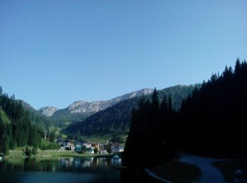
• Symbol: rot-weiss-rot 83
![Percorso A piedi Großarl - Wanderweg 42 - Photo](https://media.geolcdn.com/t/350/260/be988768-0360-491f-a435-7c35f861d662.jpeg&format=jpg&maxdim=2)
![A piedi A piedi](https://static1.geolcdn.com/sitytour/trail-icons/100.png)
Km
A piedi
![](/images/other/stat-length.png)
![](https://static1.geolcdn.com/siteimages/upload/files/1508320355ic_sort_den_pos_24dp.png)
![](https://static1.geolcdn.com/siteimages/upload/files/1508320355ic_sort_den_neg_24dp.png)
![](https://static1.geolcdn.com/siteimages/upload/files/16400158638029165_repeat_loop_refresh_sync_direction_icon.png)
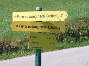
• Trail created by TVB Großarl. Symbol: rot-weiss-rot 42
![Percorso A piedi Großarl - Wanderweg 41 - Photo](https://media.geolcdn.com/t/350/260/273b3d23-808a-4c7d-881d-5907759d9183.jpeg&format=jpg&maxdim=2)
![A piedi A piedi](https://static1.geolcdn.com/sitytour/trail-icons/100.png)
Km
A piedi
![](/images/other/stat-length.png)
![](https://static1.geolcdn.com/siteimages/upload/files/1508320355ic_sort_den_pos_24dp.png)
![](https://static1.geolcdn.com/siteimages/upload/files/1508320355ic_sort_den_neg_24dp.png)
![](https://static1.geolcdn.com/siteimages/upload/files/16400158638029165_repeat_loop_refresh_sync_direction_icon.png)
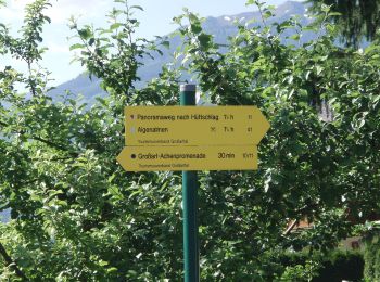
• Trail created by TVB Großarl. Symbol: rot-weiss-rot 41
![Percorso A piedi Großarl - Kapellenwanderweg 19 - Photo](https://media.geolcdn.com/t/350/260/ad06a6a0-2e57-4458-9ebd-e5ac49d684db.jpeg&format=jpg&maxdim=2)
![A piedi A piedi](https://static1.geolcdn.com/sitytour/trail-icons/100.png)
Km
A piedi
![](/images/other/stat-length.png)
![](https://static1.geolcdn.com/siteimages/upload/files/1508320355ic_sort_den_pos_24dp.png)
![](https://static1.geolcdn.com/siteimages/upload/files/1508320355ic_sort_den_neg_24dp.png)
![](https://static1.geolcdn.com/siteimages/upload/files/16400158638029165_repeat_loop_refresh_sync_direction_icon.png)
• Trail created by TVB Großarl. http://wiki.openstreetmap.org/wiki/WikiProject_Austria/Wanderwege Symbol: Chapell
![Percorso A piedi Großarl - Wanderweg 36 - Photo](https://media.geolcdn.com/t/350/260/1322788c-9e3e-41f9-9d8b-4051aaf50f68.jpeg&format=jpg&maxdim=2)
![A piedi A piedi](https://static1.geolcdn.com/sitytour/trail-icons/100.png)
Km
A piedi
![](/images/other/stat-length.png)
![](https://static1.geolcdn.com/siteimages/upload/files/1508320355ic_sort_den_pos_24dp.png)
![](https://static1.geolcdn.com/siteimages/upload/files/1508320355ic_sort_den_neg_24dp.png)
![](https://static1.geolcdn.com/siteimages/upload/files/16400158638029165_repeat_loop_refresh_sync_direction_icon.png)
• Trail created by TVB Großarl. http://wiki.openstreetmap.org/wiki/WikiProject_Austria/Wanderwege Symbol: rot-weiss-r...
![Percorso A piedi Großarl - Wanderweg 35 - Photo](https://media.geolcdn.com/t/350/260/9c42345f-ad86-4519-984d-7ce256242119.jpeg&format=jpg&maxdim=2)
![A piedi A piedi](https://static1.geolcdn.com/sitytour/trail-icons/100.png)
Km
A piedi
![](/images/other/stat-length.png)
![](https://static1.geolcdn.com/siteimages/upload/files/1508320355ic_sort_den_pos_24dp.png)
![](https://static1.geolcdn.com/siteimages/upload/files/1508320355ic_sort_den_neg_24dp.png)
![](https://static1.geolcdn.com/siteimages/upload/files/16400158638029165_repeat_loop_refresh_sync_direction_icon.png)
• Trail created by TVB Großarl. http://wiki.openstreetmap.org/wiki/WikiProject_Austria/Wanderwege Symbol: rot-weiss-r...
![Percorso A piedi Hüttschlag - Wanderweg 55a - Photo](https://media.geolcdn.com/t/350/260/ee4ce74a-bc65-451d-a999-e92ba5f805b6.jpeg&format=jpg&maxdim=2)
![A piedi A piedi](https://static1.geolcdn.com/sitytour/trail-icons/100.png)
Km
A piedi
![](/images/other/stat-length.png)
![](https://static1.geolcdn.com/siteimages/upload/files/1508320355ic_sort_den_pos_24dp.png)
![](https://static1.geolcdn.com/siteimages/upload/files/1508320355ic_sort_den_neg_24dp.png)
![](https://static1.geolcdn.com/siteimages/upload/files/16400158638029165_repeat_loop_refresh_sync_direction_icon.png)
• Trail created by TVB Großarltal. http://wiki.openstreetmap.org/wiki/WikiProject_Austria/Wanderwege Symbol: rot-weis...
![Percorso A piedi Großarl - Wanderweg 55 - Photo](https://media.geolcdn.com/t/350/260/16b0ac01-b1eb-43ff-ad32-19640b0f2a46.jpeg&format=jpg&maxdim=2)
![A piedi A piedi](https://static1.geolcdn.com/sitytour/trail-icons/100.png)
Km
A piedi
![](/images/other/stat-length.png)
![](https://static1.geolcdn.com/siteimages/upload/files/1508320355ic_sort_den_pos_24dp.png)
![](https://static1.geolcdn.com/siteimages/upload/files/1508320355ic_sort_den_neg_24dp.png)
![](https://static1.geolcdn.com/siteimages/upload/files/16400158638029165_repeat_loop_refresh_sync_direction_icon.png)
• Trail created by TVB Großarltal. http://wiki.openstreetmap.org/wiki/WikiProject_Austria/Wanderwege Symbol: rot-weis...
![Percorso A piedi Großarl - Wanderweg 56b - Photo](https://media.geolcdn.com/t/350/260/722002f9-98ee-43f7-b67a-3a7c7cffd6b9.jpeg&format=jpg&maxdim=2)
![A piedi A piedi](https://static1.geolcdn.com/sitytour/trail-icons/100.png)
Km
A piedi
![](/images/other/stat-length.png)
![](https://static1.geolcdn.com/siteimages/upload/files/1508320355ic_sort_den_pos_24dp.png)
![](https://static1.geolcdn.com/siteimages/upload/files/1508320355ic_sort_den_neg_24dp.png)
![](https://static1.geolcdn.com/siteimages/upload/files/16400158638029165_repeat_loop_refresh_sync_direction_icon.png)
• Trail created by TVB Großarltal. http://wiki.openstreetmap.org/wiki/WikiProject_Austria/Wanderwege Symbol: rot-weis...
![Percorso A piedi Großarl - Wanderweg 56a - Photo](https://media.geolcdn.com/t/350/260/ca891676-5d83-4dfa-ba61-29db0caa0b49.jpeg&format=jpg&maxdim=2)
![A piedi A piedi](https://static1.geolcdn.com/sitytour/trail-icons/100.png)
Km
A piedi
![](/images/other/stat-length.png)
![](https://static1.geolcdn.com/siteimages/upload/files/1508320355ic_sort_den_pos_24dp.png)
![](https://static1.geolcdn.com/siteimages/upload/files/1508320355ic_sort_den_neg_24dp.png)
![](https://static1.geolcdn.com/siteimages/upload/files/16400158638029165_repeat_loop_refresh_sync_direction_icon.png)
• Trail created by TVB Großarltal. http://wiki.openstreetmap.org/wiki/WikiProject_Austria/Wanderwege Symbol: rot-weis...
![Percorso A piedi Großarl - Wanderweg 56 - Photo](https://media.geolcdn.com/t/350/260/2f35a79d-4c29-41da-90d1-38bb7daf700f.jpeg&format=jpg&maxdim=2)
![A piedi A piedi](https://static1.geolcdn.com/sitytour/trail-icons/100.png)
Km
A piedi
![](/images/other/stat-length.png)
![](https://static1.geolcdn.com/siteimages/upload/files/1508320355ic_sort_den_pos_24dp.png)
![](https://static1.geolcdn.com/siteimages/upload/files/1508320355ic_sort_den_neg_24dp.png)
![](https://static1.geolcdn.com/siteimages/upload/files/16400158638029165_repeat_loop_refresh_sync_direction_icon.png)
• Trail created by TVB Großarltal. http://wiki.openstreetmap.org/wiki/WikiProject_Austria/Wanderwege Symbol: rot-weis...
![Percorso A piedi Mühlbach am Hochkönig - Mühlbach-Pronebenalm-Karbachalm - Photo](https://media.geolcdn.com/t/350/260/3d7a7ddf-10fa-4d47-a362-cb5930ed8e60.jpeg&format=jpg&maxdim=2)
![A piedi A piedi](https://static1.geolcdn.com/sitytour/trail-icons/100.png)
Km
A piedi
![](/images/other/stat-length.png)
![](https://static1.geolcdn.com/siteimages/upload/files/1508320355ic_sort_den_pos_24dp.png)
![](https://static1.geolcdn.com/siteimages/upload/files/1508320355ic_sort_den_neg_24dp.png)
![](https://static1.geolcdn.com/siteimages/upload/files/16400158638029165_repeat_loop_refresh_sync_direction_icon.png)
• Trail created by TVB Hochkönig. Symbol: rot-weiss-rot
![Percorso A piedi Mühlbach am Hochkönig - Mühlbach-Brennerköpfl - Photo](https://media.geolcdn.com/t/350/260/32854a2f-78da-46b2-8da7-784e392eed1d.jpeg&format=jpg&maxdim=2)
![A piedi A piedi](https://static1.geolcdn.com/sitytour/trail-icons/100.png)
Km
A piedi
![](/images/other/stat-length.png)
![](https://static1.geolcdn.com/siteimages/upload/files/1508320355ic_sort_den_pos_24dp.png)
![](https://static1.geolcdn.com/siteimages/upload/files/1508320355ic_sort_den_neg_24dp.png)
![](https://static1.geolcdn.com/siteimages/upload/files/16400158638029165_repeat_loop_refresh_sync_direction_icon.png)
• Trail created by TVB Hochkönig. Symbol: rot-weiss-rot
![Percorso A piedi Mühlbach am Hochkönig - Mühlbach-Althaussattel - Photo](https://media.geolcdn.com/t/350/260/3d7a7ddf-10fa-4d47-a362-cb5930ed8e60.jpeg&format=jpg&maxdim=2)
![A piedi A piedi](https://static1.geolcdn.com/sitytour/trail-icons/100.png)
Km
A piedi
![](/images/other/stat-length.png)
![](https://static1.geolcdn.com/siteimages/upload/files/1508320355ic_sort_den_pos_24dp.png)
![](https://static1.geolcdn.com/siteimages/upload/files/1508320355ic_sort_den_neg_24dp.png)
![](https://static1.geolcdn.com/siteimages/upload/files/16400158638029165_repeat_loop_refresh_sync_direction_icon.png)
• Trail created by TVB Hochkönig. Symbol: rot-weiss-rot
![Percorso A piedi Bad Gastein - Naturschauweg Naßfeld (kleine Runde) - Photo](https://media.geolcdn.com/t/350/260/91b15780-b8fe-4278-9d14-2330691dfa74.jpeg&format=jpg&maxdim=2)
![A piedi A piedi](https://static1.geolcdn.com/sitytour/trail-icons/100.png)
Km
A piedi
![](/images/other/stat-length.png)
![](https://static1.geolcdn.com/siteimages/upload/files/1508320355ic_sort_den_pos_24dp.png)
![](https://static1.geolcdn.com/siteimages/upload/files/1508320355ic_sort_den_neg_24dp.png)
![](https://static1.geolcdn.com/siteimages/upload/files/16400158638029165_repeat_loop_refresh_sync_direction_icon.png)
• Trail created by Nationalpark Hohe Tauern.
![Percorso A piedi Bad Gastein - Naturschauweg Naßfeld (große Runde) - Photo](https://media.geolcdn.com/t/350/260/91b15780-b8fe-4278-9d14-2330691dfa74.jpeg&format=jpg&maxdim=2)
![A piedi A piedi](https://static1.geolcdn.com/sitytour/trail-icons/100.png)
Km
A piedi
![](/images/other/stat-length.png)
![](https://static1.geolcdn.com/siteimages/upload/files/1508320355ic_sort_den_pos_24dp.png)
![](https://static1.geolcdn.com/siteimages/upload/files/1508320355ic_sort_den_neg_24dp.png)
![](https://static1.geolcdn.com/siteimages/upload/files/16400158638029165_repeat_loop_refresh_sync_direction_icon.png)
• Trail created by Nationalpark Hohe Tauern.
![Percorso A piedi Hüttschlag - Naturkundlicher Lehrweg ins Schödertal - Photo](https://media.geolcdn.com/t/350/260/289c2a07-1e7d-4085-8aa1-50e79ed55dea.jpeg&format=jpg&maxdim=2)
![A piedi A piedi](https://static1.geolcdn.com/sitytour/trail-icons/100.png)
Km
A piedi
![](/images/other/stat-length.png)
![](https://static1.geolcdn.com/siteimages/upload/files/1508320355ic_sort_den_pos_24dp.png)
![](https://static1.geolcdn.com/siteimages/upload/files/1508320355ic_sort_den_neg_24dp.png)
![](https://static1.geolcdn.com/siteimages/upload/files/16400158638029165_repeat_loop_refresh_sync_direction_icon.png)
• Trail created by Nationalpark Hohe Tauern.
![Percorso A piedi Bad Gastein - Kulturwanderweg Römerstraßen (Mallnitzer Tauern) - Photo](https://media.geolcdn.com/t/350/260/627eb614-3cc5-4f68-a84a-1a42a45959b2.jpeg&format=jpg&maxdim=2)
![A piedi A piedi](https://static1.geolcdn.com/sitytour/trail-icons/100.png)
Km
A piedi
![](/images/other/stat-length.png)
![](https://static1.geolcdn.com/siteimages/upload/files/1508320355ic_sort_den_pos_24dp.png)
![](https://static1.geolcdn.com/siteimages/upload/files/1508320355ic_sort_den_neg_24dp.png)
![](https://static1.geolcdn.com/siteimages/upload/files/16400158638029165_repeat_loop_refresh_sync_direction_icon.png)
• Trail created by Nationalpark Hohe Tauern.
![Percorso A piedi Sankt Veit im Pongau - Schwarzach Höhenweg - Photo](https://media.geolcdn.com/t/350/260/c021223c-b274-4996-9acf-64cf6390d87d.jpeg&format=jpg&maxdim=2)
![A piedi A piedi](https://static1.geolcdn.com/sitytour/trail-icons/100.png)
Km
A piedi
![](/images/other/stat-length.png)
![](https://static1.geolcdn.com/siteimages/upload/files/1508320355ic_sort_den_pos_24dp.png)
![](https://static1.geolcdn.com/siteimages/upload/files/1508320355ic_sort_den_neg_24dp.png)
![](https://static1.geolcdn.com/siteimages/upload/files/16400158638029165_repeat_loop_refresh_sync_direction_icon.png)
• Trail created by TVB St. Veit - Schwarzach. Symbol: rot-weiss-rot 43
20 percorsi visualizzati su 100
Applicazione GPS da escursionismo GRATUITA