Randonnées

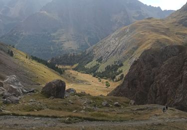
Randonnée Marche Eygliers - Guillestre maison du roy gros eygliers  - Photo
Marche
Evenc

Marche

Moyen
Eygliers, Provence-Alpes-Côte d'Azur, Hautes-Alpes, France
18,6 km | 31 km-effort
6h 21min
Oui
Randonnée Marche Névache - tete de la cassille  - Photo
Marche
Evenc

Marche

Difficile
Névache, Provence-Alpes-Côte d'Azur, Hautes-Alpes, France
17,1 km | 33 km-effort
8h 5min
Oui
Randonnée Marche Névache - roublion côté rouge buffere Chardonnet nevache  - Photo
Marche
Evenc

Marche

Difficile
Névache, Provence-Alpes-Côte d'Azur, Hautes-Alpes, France
19,4 km | 32 km-effort
7h 14min
Non
Randonnée Marche Pellafol - obiou  - Photo
Marche
Evenc

Marche

Difficile
Pellafol, Auvergne-Rhône-Alpes, Isère, France
11,7 km | 29 km-effort
7h 5min
Oui
Randonnée Marche Lus-la-Croix-Haute - grand Ferrand  - Photo
Marche
Evenc

Marche

Difficile
Lus-la-Croix-Haute, Auvergne-Rhône-Alpes, Drôme, France
16,2 km | 38 km-effort
7h 43min
Oui
Randonnée Marche Névache - plamplinet acles pas de l ours - Photo
Marche
Evenc

Marche

Moyen
Névache, Provence-Alpes-Côte d'Azur, Hautes-Alpes, France
18,3 km | 33 km-effort
5h 26min
Oui
Randonnée sport Le Monêtier-les-Bains - Col d’arsine - Photo
sport
Evenc

sport

Très facile
Le Monêtier-les-Bains, Provence-Alpes-Côte d'Azur, Hautes-Alpes, France
8 km | 16,5 km-effort
Inconnu
Non
Randonnée sport Cervières - Col de malt if - Photo
sport
Evenc

sport

Très facile
Cervières, Provence-Alpes-Côte d'Azur, Hautes-Alpes, France
26 km | 66 km-effort
Inconnu
Non
Randonnée Ski de randonnée Cervières - pic lombard vallée des fonts - Photo
Ski de randonnée
Evenc

Ski de randonnée

Très facile
Cervières, Provence-Alpes-Côte d'Azur, Hautes-Alpes, France
6,2 km | 15,2 km-effort
3h 35min
Oui
Randonnée Ski de randonnée Montgenèvre - Montgenèvre les Gondrans  - Photo
Ski de randonnée
Evenc

Ski de randonnée

Facile
Montgenèvre, Provence-Alpes-Côte d'Azur, Hautes-Alpes, France
9,8 km | 17,7 km-effort
2h 12min
Oui
Randonnée Ski de randonnée Vallouise-Pelvoux - la blanche randonnée ski - Photo
Ski de randonnée
Evenc

Ski de randonnée

Difficile
Vallouise-Pelvoux, Provence-Alpes-Côte d'Azur, Hautes-Alpes, France
10,5 km | 26 km-effort
5h 27min
Non
Randonnée Marche Névache - Thabor christine Journee 4 - Photo
Marche
Evenc

Marche

Difficile
Névache, Provence-Alpes-Côte d'Azur, Hautes-Alpes, France
13,6 km | 16,3 km-effort
3h 42min
Non
Randonnée Marche Modane - THabor christine journee 3 - Photo
Marche
Evenc

Marche

Très difficile
Modane, Auvergne-Rhône-Alpes, Savoie, France
14 km | 27 km-effort
6h 3min
Non
Randonnée Marche Névache - Thabor christine journee 1 - Photo
Marche
Evenc

Marche

Difficile
Névache, Provence-Alpes-Côte d'Azur, Hautes-Alpes, France
9,1 km | 16,6 km-effort
3h 46min
Non
Randonnée Marche Névache - mont thabor christine journee 2 - Photo
Marche
Evenc

Marche

Difficile
Névache, Provence-Alpes-Côte d'Azur, Hautes-Alpes, France
7,5 km | 14,7 km-effort
3h 20min
Non
Randonnée Marche Villar-Saint-Pancrace - fin de parcours Gr5 chapelle Saint Laurent /Villar saint pancrase - Photo
Marche
Evenc

Marche

Très facile
Villar-Saint-Pancrace, Provence-Alpes-Côte d'Azur, Hautes-Alpes, France
351 m | 487 m-effort
6min
Non
Randonnée Marche Briançon - Gr 5 porte de pignerol /chapelle saint Laurent  - Photo
Marche
Evenc

Marche

Très facile
Briançon, Provence-Alpes-Côte d'Azur, Hautes-Alpes, France
4,6 km | 6,3 km-effort
55min
Non
Randonnée Marche Freissinières - crête de la rocade freissinieres - Photo
Marche
Evenc

Marche

Difficile
Freissinières, Provence-Alpes-Côte d'Azur, Hautes-Alpes, France
10,7 km | 21 km-effort
3h 56min
Oui
Randonnée Marche Réotier - tête de vautisse  - Photo
Marche
Evenc

Marche

Difficile
Réotier, Provence-Alpes-Côte d'Azur, Hautes-Alpes, France
9,7 km | 19,7 km-effort
9h 1min
Non
Randonnée sport Darnieulles - Rando dans les Vosges - Photo
sport
Evenc

sport

Très facile
Darnieulles, Grand Est, Vosges, France
65 km | 105 km-effort
Inconnu
Non
Randonnée Marche Le Monêtier-les-Bains - lac Blanc alpe du lauzet grand lac - Photo
Marche
Evenc

Marche

Moyen
Le Monêtier-les-Bains, Provence-Alpes-Côte d'Azur, Hautes-Alpes, France
15,6 km | 29 km-effort
7h 41min
Oui

Fermer
Mes abonnements