

Guidel

CHEVE
Utilisateur

Longueur
22 km

Altitude max
55 m

Dénivelé positif
291 m

Km-Effort
26 km

Altitude min
2 m

Dénivelé négatif
292 m
Boucle
Oui
Date de création :
2014-12-10 00:00:00.0
Dernière modification :
2014-12-10 00:00:00.0
5h30
Difficulté : Moyen

Application GPS de randonnée GRATUITE
À propos
Randonnée Marche de 22 km à découvrir à Bretagne, Morbihan, Guidel. Cette randonnée est proposée par CHEVE.
Description
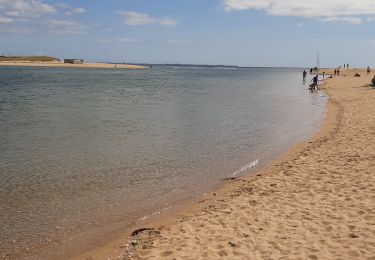
Marcher le long de la riviere La Laita qui separe le Finistere du Morbihan ; revenir par l'interieur en longeant l'etang du Loch et terminer les pieds dans l'ocean. Une rando aux mille facettes toujours au bord de l'eau.Circuit allonge de la rando No7 proposee par le pays de Lorient.
Localisation
Pays :
France
Région :
Bretagne
Département/Province :
Morbihan
Commune :
Guidel
Localité :
Unknown
Départ:(Dec)
Départ:(UTM)
460610 ; 5291140 (30T) N.
Commentaires
Randonnées à proximité
De la côte bleue aux collines blanches


A pied
Facile
Plœmeur,
Bretagne,
Morbihan,
France

9,1 km | 10 km-effort
2h 16min
Non
PR_56_Guidel_DA_04_Circuit3a_De-Guidel-Centre-Vers-La-Laita_20240510


Marche
Facile
Guidel,
Bretagne,
Morbihan,
France

14,7 km | 17,9 km-effort
4h 3min
Oui
PR_56_Guidel_CA_03_Circuit3a_Autour-De-L-Etang-De-Lannenec_20240428


Marche
Facile
Guidel,
Bretagne,
Morbihan,
France

10,2 km | 11,7 km-effort
2h 39min
Non
Guidel plage 7,6 km


Marche
Facile
Guidel,
Bretagne,
Morbihan,
France

7,6 km | 8,5 km-effort
2h 11min
Oui
Pouldu port peintres 6,3 km


Marche
Facile
Clohars-Carnoët,
Bretagne,
Finistère,
France

6,3 km | 7,2 km-effort
2h 12min
Oui
Pouldu Roche Percée et retour 9,5 km


Marche
Moyen
Clohars-Carnoët,
Bretagne,
Finistère,
France

9,5 km | 10,7 km-effort
2h 46min
Oui
PR_56_Guidel_BA_02_Circuit3b_Entre-Loch-Et-Laita_20231004


Marche
Facile
Guidel,
Bretagne,
Morbihan,
France

13,4 km | 15,7 km-effort
3h 34min
Oui


 SityTrail


