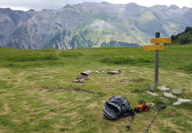
![](/images/other/stat-length.png)
![Randonnée Marche Livet-et-Gavet - Lac fourchu 2 - valette - Description et vidéo - Photo](https://media.geolcdn.com/t/1900/400/1d62a24d-e51f-47d7-993a-5af0f16e3641.jpg&format=pjpeg&maxdim=2)
Lac fourchu 2 - valette - Description et vidéo
bob2023
Utilisateur
![Longueur](/images/other/stat-length.png)
![Altitude max](https://static1.geolcdn.com/siteimages/upload/files/1508320355ic_sort_altitude_max_24dp.png)
![Dénivelé positif](https://static1.geolcdn.com/siteimages/upload/files/1508320355ic_sort_den_pos_24dp.png)
![Km-Effort](/images/other/stat-length.png)
![Altitude min](https://static1.geolcdn.com/siteimages/upload/files/1508320355ic_sort_altitude_min_24dp.png)
![Dénivelé négatif](https://static1.geolcdn.com/siteimages/upload/files/1508320355ic_sort_den_neg_24dp.png)
![Boucle](https://static1.geolcdn.com/siteimages/upload/files/16400158638029165_repeat_loop_refresh_sync_direction_icon.png)
![Marche](https://static1.geolcdn.com/sitytour/trail-icons/101.png)
3h56
Difficulté : Moyen
![Scannez ce code QR pour ouvrir la randonnée dans l'application SityTrail](https://capi.geolives.com/qq0zvz2zws4bq2lad0pu/sitytour/trails/988409/qr.png?size=200)
Application GPS de randonnée GRATUITE
À propos
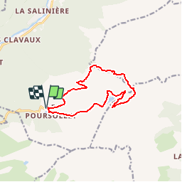
Randonnée Marche de 11,9 km à découvrir à Auvergne-Rhône-Alpes, Isère, Livet-et-Gavet. Cette randonnée est proposée par bob2023.
Description
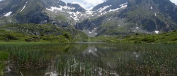
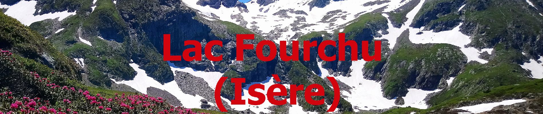
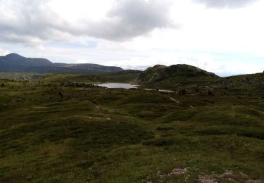
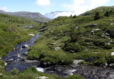
2ème rando au Lac Fourchu 38220 Livet-et-Gavet (région de Grenoble) . Petite modification de l'itinéraire pour voir le lac noir et le lac de l'agneau en plus du lac Fourchu.
Le retour se fait toujours par la Valette, très agréable descente.
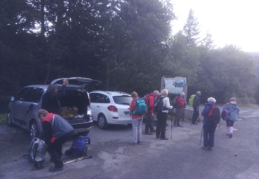
Pensez à partir tôt, les places de parking se remplissent très vite.
Pas de difficultés particulières, à part la montée du début qui peut être plus dur par forte chaleur.
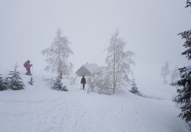
Localisation
Commentaires
Randonnées à proximité
![Randonnée Raquettes à neige La Morte - Belvedere et Balcon de La Romanche - Photo](https://media.geolcdn.com/t/375/260/ext.jpg?maxdim=2&url=https%3A%2F%2Fservices.sitytrail.com%2FGeolivesWS%2FDownloadMedia.ashx%3FTrailID%3D911113%26Media%3Dfix__20180222125140.jpg)
![Raquettes à neige Raquettes à neige](https://static1.geolcdn.com/sitytour/trail-icons/504.png)
Raquettes à neige
![](/images/other/stat-length.png)
![](https://static1.geolcdn.com/siteimages/upload/files/16400158638029165_repeat_loop_refresh_sync_direction_icon.png)
![Randonnée Marche Livet-et-Gavet - lac fourchu 2018 - Photo](https://media.geolcdn.com/t/375/260/ad4bb443-c49c-437b-9eee-0663c454dc43.jpg&format=jpg&maxdim=2)
![Marche Marche](https://static1.geolcdn.com/sitytour/trail-icons/101.png)
Marche
![](/images/other/stat-length.png)
![](https://static1.geolcdn.com/siteimages/upload/files/16400158638029165_repeat_loop_refresh_sync_direction_icon.png)
![Randonnée Marche Séchilienne - Lac de Luitel - Pic de l'oeilly - Photo](https://media.geolcdn.com/t/375/260/392243d2-0bef-4c0e-a978-68f4c5437966.jpg&format=jpg&maxdim=2)
![Marche Marche](https://static1.geolcdn.com/sitytour/trail-icons/101.png)
Marche
![](/images/other/stat-length.png)
![](https://static1.geolcdn.com/siteimages/upload/files/16400158638029165_repeat_loop_refresh_sync_direction_icon.png)
![Randonnée Marche Lavaldens - Plancol - Photo](https://media.geolcdn.com/t/375/260/63d19ae2-58d9-4dcc-8f14-cc96c9cea3ad.jpg&format=jpg&maxdim=2)
![Marche Marche](https://static1.geolcdn.com/sitytour/trail-icons/101.png)
Marche
![](/images/other/stat-length.png)
![](https://static1.geolcdn.com/siteimages/upload/files/16400158638029165_repeat_loop_refresh_sync_direction_icon.png)
![Randonnée A pied La Morte - Alpe de grand serre Taillefer Lac Fourchu Bivouac - Photo](https://media.geolcdn.com/t/375/260/fee688a5-cf4f-4fb1-bc93-d9849e085f50.jpg&format=jpg&maxdim=2)
![A pied A pied](https://static1.geolcdn.com/sitytour/trail-icons/100.png)
A pied
![](/images/other/stat-length.png)
![](https://static1.geolcdn.com/siteimages/upload/files/16400158638029165_repeat_loop_refresh_sync_direction_icon.png)
![Randonnée A pied Livet-et-Gavet - Lac Fourchu (14 juillet 2020) - Photo](https://media.geolcdn.com/t/375/260/68b7a545-d4a4-4dda-b71f-c9640a04cf53.jpg&format=jpg&maxdim=2)
![A pied A pied](https://static1.geolcdn.com/sitytour/trail-icons/100.png)
A pied
![](/images/other/stat-length.png)
![](https://static1.geolcdn.com/siteimages/upload/files/16400158638029165_repeat_loop_refresh_sync_direction_icon.png)
![Randonnée Marche Livet-et-Gavet - Plateau des lacs au pied du Taillefer - Photo](https://media.geolcdn.com/t/375/260/d8252743-d8bc-408a-a13e-9feda8f10a44.jpg&format=jpg&maxdim=2)
![Marche Marche](https://static1.geolcdn.com/sitytour/trail-icons/101.png)
Marche
![](/images/other/stat-length.png)
![](https://static1.geolcdn.com/siteimages/upload/files/16400158638029165_repeat_loop_refresh_sync_direction_icon.png)
![Randonnée Marche Livet-et-Gavet - Lac Fourchu via lac canard - Photo](https://media.geolcdn.com/t/375/260/ext.jpg?maxdim=2&url=https%3A%2F%2Fstatic1.geolcdn.com%2Fsiteimages%2Fupload%2Ffiles%2F1553511878bg_sport_marche.png)
![Marche Marche](https://static1.geolcdn.com/sitytour/trail-icons/101.png)
Marche
![](/images/other/stat-length.png)
![](https://static1.geolcdn.com/siteimages/upload/files/16400158638029165_repeat_loop_refresh_sync_direction_icon.png)
![Randonnée Marche Livet-et-Gavet - Untitled - Photo](https://media.geolcdn.com/t/375/260/ext.jpg?maxdim=2&url=https%3A%2F%2Fstatic1.geolcdn.com%2Fsiteimages%2Fupload%2Ffiles%2F1553511878bg_sport_marche.png)
![Marche Marche](https://static1.geolcdn.com/sitytour/trail-icons/101.png)
Marche
![](/images/other/stat-length.png)
![](https://static1.geolcdn.com/siteimages/upload/files/16400158638029165_repeat_loop_refresh_sync_direction_icon.png)