Randonnée Marche Torrent de la Cauba - AND ter Roc de la Cauba - Pic de Solà - Photo

AND ter Roc de la Cauba - Pic de Solà

 phidge
phidge

Utilisateur

© OpenStreetMap contributors
Longueur
Longueur
9,2 km
Altitude max
Altitude max
2044 m
Dénivelé positif
Dénivelé positif
915 m
Km-Effort
Km-Effort  
21 km
Altitude min
Altitude min
1256 m
Dénivelé négatif
Dénivelé négatif
730 m
Boucle
Boucle
Non
Date de création :
2019-01-20 16:38:51.939
Dernière modification :
2019-01-20 16:38:51.959

(0 Avis)

Marche
Marche
--
Difficulté : Difficile

Scannez ce code QR pour ouvrir la randonnée dans l'application SityTrail

Application GPS de randonnée GRATUITE

Logo SityTrail SityTrail

IGN / Instituts géographiques

Télécharger SityTrail sur l'App Store Télécharger SityTrail sur Google Play

Logo SityTrail SityTrail World

Le monde est à vous

Télécharger SityTrail sur l'App Store Télécharger SityTrail sur Google Play Télécharger SityTrail sur Huawei AppGallery

À propos

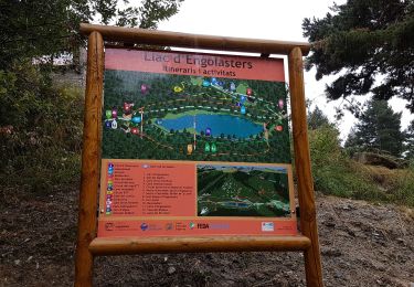
Randonnée Marche de 9,2 km à découvrir à Andorre. Cette randonnée est proposée par phidge.

Description

Copié sur Wikiloc
Longueur: 9,86 kilomètres
Altitude min: 1 252 mètres, max: 2 048 mètres
Dénivelé cum. montée: 862 mètres, descente: 686 mètres
Degré de difficulté: skill Modéré
Durée:   3 hours 16 minutes
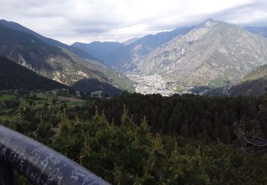
[EN]Route of about 3, 4 hours highly recommended, little crowded and with great views to the Andorra's valley. The trail starts from the town of la Massana, climbs up to the rocky hill called "Roc de la Cauba" (slippery and deathly dangerous if it's been raining or there's snow on the ground) it continues to the "Pic del Solà" summit and finally goes down through a beautiful forest to Arinsal. The tracklog ends in Arinsal in front of the bus station to return back to the start point in La Massana. If done by July/August, expect to take longer due to the frequent stops to eat delicious wild strawberries.

Profil altimétrique

Localisation

Pays :
Andorre
Région :
La Massana
Département/Province :
La Massana
Commune :
Torrent de la Cauba
Localité :
Unknown
Départ:(Dec)
Départ:(UTM)
377806 ; 4711895 (31T) N.

Randonnées à proximité

Randonnée Marche  - Andorre TSM groupe 2 mardi 10 septembre matin - Photo
Marche
zanogueb

Marche

Facile
, , , Andorre
4 km | 5,5 km-effort
1h 46min
Oui
Randonnée Marche  - chemin de la fontanas et bailmadriu - Photo
Marche
JEANJOSY

Marche

Moyen
, , , Andorre
14,2 km | 23 km-effort
5h 38min
Oui
Randonnée Marche  - Andorre Pic de Casamanya N et S depuis le col d'Ordino retour par le col d'Arenes - Photo
Marche
Maryma

Marche

Très difficile
, , , Andorre
11,2 km | 23 km-effort
5h 16min
Oui
Randonnée Autre activité  - Engolasters Ramió - Photo
Autre activité
elviking

Autre activité

Moyen
, , , Andorre
7,2 km | 11,2 km-effort
2h 50min
Non
Randonnée Marche  - 54 - Lac Blau - Photo
Marche
hbonnard

Marche

Difficile
, , , Andorre
14,9 km | 31 km-effort
6h 17min
Non
Randonnée Marche  - 8 - Pic de Casamanya - Photo
Marche
hbonnard

Marche

Facile
, , , Andorre
3,6 km | 10,9 km-effort
2h 29min
Non
Randonnée Moteur  - a-spanje-bergen-andorra-en-spanje - Photo
Moteur
gpstracks

Moteur

Très facile
, , , Andorre
219 km | 497 km-effort
Inconnu
Oui
Randonnée Marche  - Arinsal - Arans -Lliort - Photo
Marche
phidge

Marche

Moyen
, , , Andorre
16,1 km | 41 km-effort
Inconnu
Oui
Randonnée Marche  - 52 Itinerari fontverd - Photo
Marche
phidge

Marche

Très facile
, , , Andorre
8,1 km | 13,2 km-effort
Inconnu
Non


Fermer
Mes abonnements