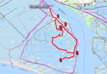
9,9 km | 10,1 km-effort
Randoguide
brunorelien
Utilisateur
Longueur
4,5 km
Altitude max
2 m
Dénivelé positif
2 m
Km-Effort
4,5 km
Altitude min
0 m
Dénivelé négatif
2 m
Boucle
Non
Date de création :
2014-12-10 00:00:00.0
Dernière modification :
2014-12-10 00:00:00.0
1h39
Difficulté : Facile
Application GPS de randonnée GRATUITE
À propos
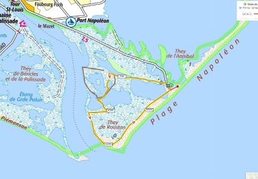
Randonnée Marche de 4,5 km à découvrir à Provence-Alpes-Côte d'Azur, Bouches-du-Rhône, Port-Saint-Louis-du-Rhône. Cette randonnée est proposée par brunorelien.
Localisation
Pays :
France
Région :
Provence-Alpes-Côte d'Azur
Département/Province :
Bouches-du-Rhône
Commune :
Port-Saint-Louis-du-Rhône
Localité :
Unknown
Départ:(Dec)
Départ:(UTM)
651204 ; 4800489 (31T) N.
Commentaires
Randonnées à proximité
They de Roustan + Plage Napoléon
Marche
Moyen
Port-Saint-Louis-du-Rhône,
Provence-Alpes-Côte d'Azur,
Bouches-du-Rhône,
France
2h 17min
Oui
Camargue They de la Palissade
Marche
Moyen
Arles,
Provence-Alpes-Côte d'Azur,
Bouches-du-Rhône,
France
8,3 km | 8,4 km-effort
1h 55min
Oui
Port saint Louis du Rhône
sport
Très facile
Port-Saint-Louis-du-Rhône,
Provence-Alpes-Côte d'Azur,
Bouches-du-Rhône,
France
8,4 km | 8,9 km-effort
Inconnu
Non
plage napoléon
Marche
Moyen
Port-Saint-Louis-du-Rhône,
Provence-Alpes-Côte d'Azur,
Bouches-du-Rhône,
France
10,2 km | 10,5 km-effort
2h 49min
Oui
port saint Louis du Rhône
Marche
Moyen
Port-Saint-Louis-du-Rhône,
Provence-Alpes-Côte d'Azur,
Bouches-du-Rhône,
France
6,7 km | 6,8 km-effort
2h 32min
Oui
port st Louis
Marche
Moyen
Port-Saint-Louis-du-Rhône,
Provence-Alpes-Côte d'Azur,
Bouches-du-Rhône,
France
6,7 km | 0 m-effort
1h 57min
Oui
Via Rhôna
Cyclotourisme
Difficile
Port-Saint-Louis-du-Rhône,
Provence-Alpes-Côte d'Azur,
Bouches-du-Rhône,
France
32 km | 33 km-effort
Inconnu
Non
plage Napoléon
Marche
Facile
Port-Saint-Louis-du-Rhône,
Provence-Alpes-Côte d'Azur,
Bouches-du-Rhône,
France
4,8 km | 4,8 km-effort
1h 30min
Oui
palissade
Marche
Très facile
Arles,
Provence-Alpes-Côte d'Azur,
Bouches-du-Rhône,
France
7,9 km | 8 km-effort
1h 58min
Oui