4,3 km | 5,8 km-effort
benoit denis
gazouille
Utilisateur
Longueur
23 km
Altitude max
244 m
Dénivelé positif
451 m
Km-Effort
29 km
Altitude min
128 m
Dénivelé négatif
451 m
Boucle
Oui
Date de création :
2014-12-10 00:00:00.0
Dernière modification :
2014-12-10 00:00:00.0
--
Difficulté : Difficile
Application GPS de randonnée GRATUITE
À propos
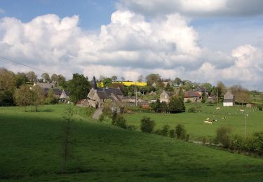
Randonnée V.T.T. de 23 km à découvrir à Normandie, Calvados, Condé-en-Normandie. Cette randonnée est proposée par gazouille.
Localisation
Pays :
France
Région :
Normandie
Département/Province :
Calvados
Commune :
Condé-en-Normandie
Localité :
Unknown
Départ:(Dec)
Départ:(UTM)
673678 ; 5422690 (30U) N.
Commentaires
Randonnées à proximité
mt pincon trois monts
Marche
Difficile
Les Monts d'Aunay,
Normandie,
Calvados,
France
29 km | 36 km-effort
6h 0min
Non
2022-02-25 balade nous samy danvou la ferrière gîte
Marche
Facile
Les Monts d'Aunay,
Normandie,
Calvados,
France
5,3 km | 6,6 km-effort
1h 29min
Oui
Le Mont Pinçon
A pied
Facile
Les Monts d'Aunay,
Normandie,
Calvados,
France
8,2 km | 10,2 km-effort
2h 18min
Oui
Le Moulin du Boeuf
A pied
Facile
Terres de Druance,
Normandie,
Calvados,
France
6,1 km | 7,9 km-effort
1h 47min
Oui
Tour du Bourg
A pied
Facile
Terres de Druance,
Normandie,
Calvados,
France
3,3 km | 4,2 km-effort
57min
Oui
Les Ferrières de Danvou
A pied
Facile
Les Monts d'Aunay,
Normandie,
Calvados,
France
6,4 km | 7,8 km-effort
1h 46min
Non
Chemins Creux E
A pied
Facile
Condé-en-Normandie,
Normandie,
Calvados,
France
6,6 km | 8,2 km-effort
1h 51min
Oui
Chemins Creux C
A pied
Facile
Périgny,
Normandie,
Calvados,
France
4,2 km | 5,1 km-effort
1h 10min
Oui