![](/images/other/stat-length.png)
![Randonnée Marche Héry-sur-Alby - Les Hauts d'Héry - Photo](https://media.geolcdn.com/t/1900/400/ext.pjpeg?maxdim=2&url=https%3A%2F%2Fservices.sitytrail.com%2FGeolivesWS%2FDownloadMedia.ashx%3FTrailID%3D959976%26Media%3D176a85ed-1de6-40ed-a0ca-4d079ee50053.jpg)
Les Hauts d'Héry
HERRY
Utilisateur GUIDE
![Longueur](/images/other/stat-length.png)
![Altitude max](https://static1.geolcdn.com/siteimages/upload/files/1508320355ic_sort_altitude_max_24dp.png)
![Dénivelé positif](https://static1.geolcdn.com/siteimages/upload/files/1508320355ic_sort_den_pos_24dp.png)
![Km-Effort](/images/other/stat-length.png)
![Altitude min](https://static1.geolcdn.com/siteimages/upload/files/1508320355ic_sort_altitude_min_24dp.png)
![Dénivelé négatif](https://static1.geolcdn.com/siteimages/upload/files/1508320355ic_sort_den_neg_24dp.png)
![Boucle](https://static1.geolcdn.com/siteimages/upload/files/16400158638029165_repeat_loop_refresh_sync_direction_icon.png)
![Marche](https://static1.geolcdn.com/sitytour/trail-icons/101.png)
1h31
Difficulté : Facile
![Scannez ce code QR pour ouvrir la randonnée dans l'application SityTrail](https://capi.geolives.com/qq0zvz2zws4bq2lad0pu/sitytour/trails/959976/qr.png?size=200)
Application GPS de randonnée GRATUITE
À propos
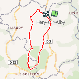
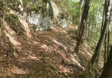
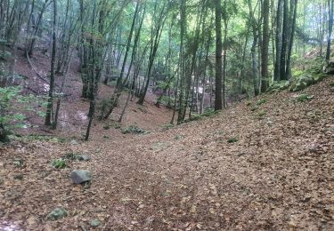
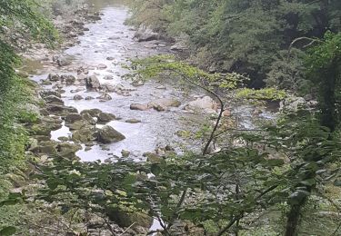
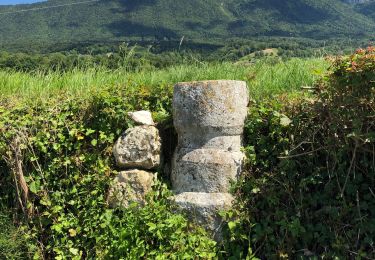
Randonnée Marche de 6,5 km à découvrir à Auvergne-Rhône-Alpes, Haute-Savoie, Héry-sur-Alby. Cette randonnée est proposée par HERRY.
Description
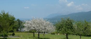
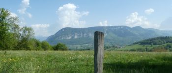
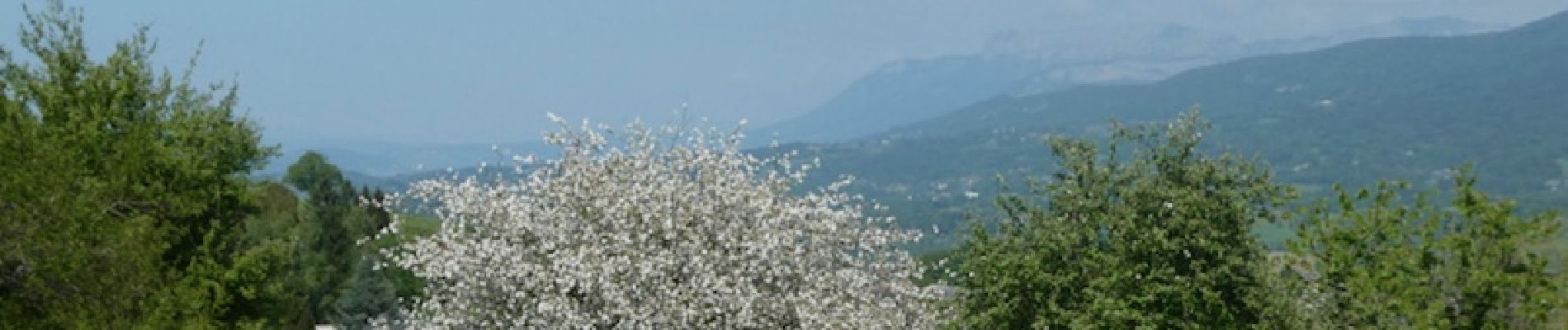
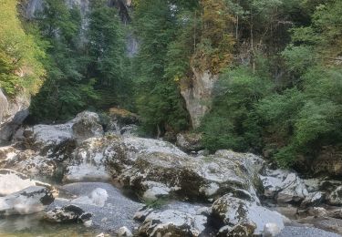
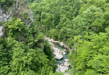
Marche sur les hauteurs d'héry où on peut apprécier les différents points de vue sur l'albanais et les bauges. Se garer à l'église puis suivre les panneaux en direction du cimetière.Au point 1 le panneau de signalisation est peu visible. Au point 2 laissez à gauche le retour vers le village et continuez sur la route jusqu'au point 3 où vous tournez légèrement à gauche.Descendre ensuite jusqu'au point 4 non balisé qui qui vous ramènera par les champs vers le village.
Localisation
Commentaires
Randonnées à proximité
![Randonnée Marche Cusy - 13-09-2022 La Grand-Raie au Col de la Cochette - Photo](https://media.geolcdn.com/t/375/260/6cba586f-c088-48b0-8a7d-67e2ef29bd8a.jpg&format=jpg&maxdim=2)
![Marche Marche](https://static1.geolcdn.com/sitytour/trail-icons/101.png)
Marche
![](/images/other/stat-length.png)
![](https://static1.geolcdn.com/siteimages/upload/files/16400158638029165_repeat_loop_refresh_sync_direction_icon.png)
![Randonnée Marche Allèves - 06-09-2022 Tours Saint Jacques-Grottes de Bange - Photo](https://media.geolcdn.com/t/375/260/7a87734e-615b-4914-a2f6-8cd0e03da331.jpg&format=jpg&maxdim=2)
![Marche Marche](https://static1.geolcdn.com/sitytour/trail-icons/101.png)
Marche
![](/images/other/stat-length.png)
![](https://static1.geolcdn.com/siteimages/upload/files/16400158638029165_repeat_loop_refresh_sync_direction_icon.png)
![Randonnée Marche Cusy - Les chaos de Cheran - Photo](https://media.geolcdn.com/t/375/260/7e19bf6d-564b-481b-864d-0e6de1762649.jpg&format=jpg&maxdim=2)
![Marche Marche](https://static1.geolcdn.com/sitytour/trail-icons/101.png)
Marche
![](/images/other/stat-length.png)
![](https://static1.geolcdn.com/siteimages/upload/files/16400158638029165_repeat_loop_refresh_sync_direction_icon.png)
![Randonnée Marche Viuz-la-Chiésaz - Circuit de Viuz La Chiesaz - Photo](https://media.geolcdn.com/t/375/260/5ec881e2-7522-436f-aeef-d18c681a45ff.jpg&format=jpg&maxdim=2)
![Marche Marche](https://static1.geolcdn.com/sitytour/trail-icons/101.png)
Marche
![](/images/other/stat-length.png)
![](https://static1.geolcdn.com/siteimages/upload/files/16400158638029165_repeat_loop_refresh_sync_direction_icon.png)
![Randonnée Marche Cusy - Chaos. du Cheran - Photo](https://media.geolcdn.com/t/375/260/ext.jpg?maxdim=2&url=https%3A%2F%2Fstatic1.geolcdn.com%2Fsiteimages%2Fupload%2Ffiles%2F1553511878bg_sport_marche.png)
![Marche Marche](https://static1.geolcdn.com/sitytour/trail-icons/101.png)
Marche
![](/images/other/stat-length.png)
![](https://static1.geolcdn.com/siteimages/upload/files/16400158638029165_repeat_loop_refresh_sync_direction_icon.png)
![Randonnée sport Saint-Ours - Saint-Ours/Choitelet - Photo](https://media.geolcdn.com/t/375/260/68734abc-b632-4e0f-a71f-87e6a6e70e99.jpg&format=jpg&maxdim=2)
sport
![](/images/other/stat-length.png)
![](https://static1.geolcdn.com/siteimages/upload/files/16400158638029165_repeat_loop_refresh_sync_direction_icon.png)
![Randonnée Marche Cusy - 14-08-2022 Pont de Cusy - Pont de l'abîme - Photo](https://media.geolcdn.com/t/375/260/afefb47b-f53a-4dff-bf88-24c102fec5de.jpg&format=jpg&maxdim=2)
![Marche Marche](https://static1.geolcdn.com/sitytour/trail-icons/101.png)
Marche
![](/images/other/stat-length.png)
![](https://static1.geolcdn.com/siteimages/upload/files/16400158638029165_repeat_loop_refresh_sync_direction_icon.png)
![Randonnée Marche Entrelacs - Ronde des fours Albens - Photo](https://media.geolcdn.com/t/375/260/f2666e0b-68cf-4aa4-9713-51600128943f.jpg&format=jpg&maxdim=2)
![Marche Marche](https://static1.geolcdn.com/sitytour/trail-icons/101.png)
Marche
![](/images/other/stat-length.png)
![](https://static1.geolcdn.com/siteimages/upload/files/16400158638029165_repeat_loop_refresh_sync_direction_icon.png)
![Randonnée Marche Cusy - Grosse balade du cheran - Photo](https://media.geolcdn.com/t/375/260/4b4c750e-7c06-406a-b59d-9d7896a078f2.jpg&format=jpg&maxdim=2)
![Marche Marche](https://static1.geolcdn.com/sitytour/trail-icons/101.png)
Marche
![](/images/other/stat-length.png)
![](https://static1.geolcdn.com/siteimages/upload/files/16400158638029165_repeat_loop_refresh_sync_direction_icon.png)