![](/images/other/stat-length.png)
![Randonnée Autre activité Liévin - boucle Liévin - Photo](https://media.geolcdn.com/t/1900/400/ext.pjpeg?maxdim=2&url=https%3A%2F%2Fservices.sitytrail.com%2FGeolivesWS%2FDownloadMedia.ashx%3FTrailID%3D953687%26Media%3D20180429102202.jpg)
boucle Liévin
crijack
Utilisateur
![Longueur](/images/other/stat-length.png)
Longueur
11 km
![Altitude max](https://static1.geolcdn.com/siteimages/upload/files/1508320355ic_sort_altitude_max_24dp.png)
Altitude max
50 m
![Dénivelé positif](https://static1.geolcdn.com/siteimages/upload/files/1508320355ic_sort_den_pos_24dp.png)
Dénivelé positif
98 m
![Km-Effort](/images/other/stat-length.png)
Km-Effort
12,3 km
![Altitude min](https://static1.geolcdn.com/siteimages/upload/files/1508320355ic_sort_altitude_min_24dp.png)
Altitude min
23 m
![Dénivelé négatif](https://static1.geolcdn.com/siteimages/upload/files/1508320355ic_sort_den_neg_24dp.png)
Dénivelé négatif
98 m
![Boucle](https://static1.geolcdn.com/siteimages/upload/files/16400158638029165_repeat_loop_refresh_sync_direction_icon.png)
Boucle
Oui
Date de création :
2018-06-26 12:42:23.587
Dernière modification :
2018-06-26 12:42:23.587
![Autre activité](https://static1.geolcdn.com/sitytour/trail-icons/900.png)
2h02
Difficulté : Très facile
![Scannez ce code QR pour ouvrir la randonnée dans l'application SityTrail](https://capi.geolives.com/qq0zvz2zws4bq2lad0pu/sitytour/trails/953687/qr.png?size=200)
Application GPS de randonnée GRATUITE
À propos
Randonnée Autre activité de 11 km à découvrir à Hauts-de-France, Pas-de-Calais, Liévin. Cette randonnée est proposée par crijack.
Description
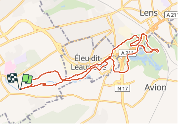
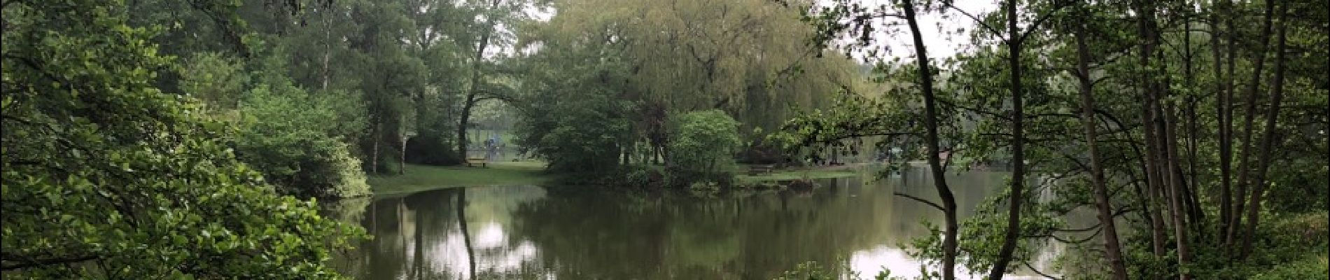
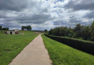
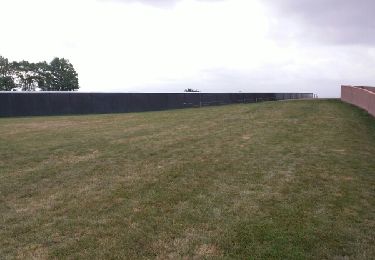
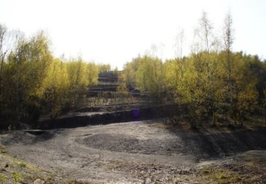
Circuit entre la ville de Liévin et Eleu-dit-Lauwette. Alterneront parcours dans les bois en plaine et autour de point d'eau avec très peu de passage en ville
Localisation
Pays :
France
Région :
Hauts-de-France
Département/Province :
Pas-de-Calais
Commune :
Liévin
Localité :
Unknown
Départ:(Dec)
Départ:(UTM)
484886 ; 5584474 (31U) N.
Commentaires
Randonnées à proximité
![Randonnée Marche Liévin - 50 km Lievin en nocturne - Photo](https://media.geolcdn.com/t/375/260/ext.jpg?maxdim=2&url=https%3A%2F%2Fstatic1.geolcdn.com%2Fsiteimages%2Fupload%2Ffiles%2F1553511878bg_sport_marche.png)
![Marche Marche](https://static1.geolcdn.com/sitytour/trail-icons/101.png)
50 km Lievin en nocturne
Marche
Très difficile
(1)
Liévin,
Hauts-de-France,
Pas-de-Calais,
France
![](/images/other/stat-length.png)
52 km | 61 km-effort
9h 0min
![](https://static1.geolcdn.com/siteimages/upload/files/16400158638029165_repeat_loop_refresh_sync_direction_icon.png)
Oui
![Randonnée Marche Lens - randonnée - Photo](https://media.geolcdn.com/t/375/260/4f8e0b82-df89-47b1-be2a-b1e08dad4aee.jpg&format=jpg&maxdim=2)
![Marche Marche](https://static1.geolcdn.com/sitytour/trail-icons/101.png)
randonnée
Marche
Difficile
Lens,
Hauts-de-France,
Pas-de-Calais,
France
![](/images/other/stat-length.png)
10,5 km | 13,4 km-effort
3h 41min
![](https://static1.geolcdn.com/siteimages/upload/files/16400158638029165_repeat_loop_refresh_sync_direction_icon.png)
Oui
![Randonnée Marche Angres - randonnée pinchonvalles - Photo](https://media.geolcdn.com/t/375/260/b2891722-43d7-4acf-b8f9-14f5909069c3.jpg&format=jpg&maxdim=2)
![Marche Marche](https://static1.geolcdn.com/sitytour/trail-icons/101.png)
randonnée pinchonvalles
Marche
Très difficile
Angres,
Hauts-de-France,
Pas-de-Calais,
France
![](/images/other/stat-length.png)
27 km | 0 m-effort
3h 24min
![](https://static1.geolcdn.com/siteimages/upload/files/16400158638029165_repeat_loop_refresh_sync_direction_icon.png)
Non
![Randonnée Autre activité Liévin - boucle Liévin - Photo](https://media.geolcdn.com/t/375/260/ext.jpg?maxdim=2&url=https%3A%2F%2Fservices.sitytrail.com%2FGeolivesWS%2FDownloadMedia.ashx%3FTrailID%3D956017%26Media%3D20180429102202.jpg)
![Autre activité Autre activité](https://static1.geolcdn.com/sitytour/trail-icons/900.png)
boucle Liévin
Autre activité
Très facile
Liévin,
Hauts-de-France,
Pas-de-Calais,
France
![](/images/other/stat-length.png)
11 km | 12,3 km-effort
2h 2min
![](https://static1.geolcdn.com/siteimages/upload/files/16400158638029165_repeat_loop_refresh_sync_direction_icon.png)
Oui
![Randonnée Marche Souchez - Souchez-Noulette-Lorette-Ablain - Photo](https://media.geolcdn.com/t/375/260/ext.jpg?maxdim=2&url=https%3A%2F%2Fservices.sitytrail.com%2FGeolivesWS%2FDownloadMedia.ashx%3FTrailID%3D173056%26Media%3D14580_6.jpg)
![Marche Marche](https://static1.geolcdn.com/sitytour/trail-icons/101.png)
Souchez-Noulette-Lorette-Ablain
Marche
Facile
Souchez,
Hauts-de-France,
Pas-de-Calais,
France
![](/images/other/stat-length.png)
6,7 km | 8,4 km-effort
1h 45min
![](https://static1.geolcdn.com/siteimages/upload/files/16400158638029165_repeat_loop_refresh_sync_direction_icon.png)
Oui
![Randonnée Marche Ablain-Saint-Nazaire - lorette août 23 - Photo](https://media.geolcdn.com/t/375/260/d5179cbf-eb3e-488a-9ec7-560d31757a4b.jpg&format=jpg&maxdim=2)
![Marche Marche](https://static1.geolcdn.com/sitytour/trail-icons/101.png)
lorette août 23
Marche
Difficile
Ablain-Saint-Nazaire,
Hauts-de-France,
Pas-de-Calais,
France
![](/images/other/stat-length.png)
11,8 km | 15,6 km-effort
2h 29min
![](https://static1.geolcdn.com/siteimages/upload/files/16400158638029165_repeat_loop_refresh_sync_direction_icon.png)
Non
![Randonnée Marche Ablain-Saint-Nazaire - autour d'Alain Saint nazaire - Photo](https://media.geolcdn.com/t/375/260/7e31f38f-bab6-47c8-ae7b-e7b39fa09888.jpg&format=jpg&maxdim=2)
![Marche Marche](https://static1.geolcdn.com/sitytour/trail-icons/101.png)
autour d'Alain Saint nazaire
Marche
Moyen
Ablain-Saint-Nazaire,
Hauts-de-France,
Pas-de-Calais,
France
![](/images/other/stat-length.png)
8,9 km | 11,1 km-effort
2h 4min
![](https://static1.geolcdn.com/siteimages/upload/files/16400158638029165_repeat_loop_refresh_sync_direction_icon.png)
Oui
![Randonnée Marche Souchez - Lorette et Carency CAF - Photo](https://media.geolcdn.com/t/375/260/ext.jpg?maxdim=2&url=https%3A%2F%2Fservices.sitytrail.com%2FGeolivesWS%2FDownloadMedia.ashx%3FTrailID%3D629786%26Media%3Dfix__20160911110430.jpg)
![Marche Marche](https://static1.geolcdn.com/sitytour/trail-icons/101.png)
Lorette et Carency CAF
Marche
Facile
Souchez,
Hauts-de-France,
Pas-de-Calais,
France
![](/images/other/stat-length.png)
21 km | 25 km-effort
5h 24min
![](https://static1.geolcdn.com/siteimages/upload/files/16400158638029165_repeat_loop_refresh_sync_direction_icon.png)
Oui
![Randonnée Marche Givenchy-en-Gohelle - Givenchy en Gohelle et le terril des Pinchonvalles - Photo](https://media.geolcdn.com/t/375/260/ext.jpg?maxdim=2&url=https%3A%2F%2Fservices.sitytrail.com%2FGeolivesWS%2FDownloadMedia.ashx%3FTrailID%3D172358%26Media%3D13697_1.jpg)
![Marche Marche](https://static1.geolcdn.com/sitytour/trail-icons/101.png)
Givenchy en Gohelle et le terril des Pinchonvalles
Marche
Moyen
Givenchy-en-Gohelle,
Hauts-de-France,
Pas-de-Calais,
France
![](/images/other/stat-length.png)
8,3 km | 10,3 km-effort
2h 0min
![](https://static1.geolcdn.com/siteimages/upload/files/16400158638029165_repeat_loop_refresh_sync_direction_icon.png)
Oui