![](/images/other/stat-length.png)
![Randonnée V.T.T. Tervueren - Tervueren (Parc et Champs) OK - Photo](https://media.geolcdn.com/t/1900/400/ext.pjpeg?maxdim=2&url=https%3A%2F%2Fstatic1.geolcdn.com%2Fsiteimages%2Fupload%2Ffiles%2F1524743154velo.jpg)
Tervueren (Parc et Champs) OK
michel.heusschen@skynet.be
Utilisateur
![Longueur](/images/other/stat-length.png)
Longueur
26 km
![Altitude max](https://static1.geolcdn.com/siteimages/upload/files/1508320355ic_sort_altitude_max_24dp.png)
Altitude max
102 m
![Dénivelé positif](https://static1.geolcdn.com/siteimages/upload/files/1508320355ic_sort_den_pos_24dp.png)
Dénivelé positif
307 m
![Km-Effort](/images/other/stat-length.png)
Km-Effort
30 km
![Altitude min](https://static1.geolcdn.com/siteimages/upload/files/1508320355ic_sort_altitude_min_24dp.png)
Altitude min
46 m
![Dénivelé négatif](https://static1.geolcdn.com/siteimages/upload/files/1508320355ic_sort_den_neg_24dp.png)
Dénivelé négatif
303 m
![Boucle](https://static1.geolcdn.com/siteimages/upload/files/16400158638029165_repeat_loop_refresh_sync_direction_icon.png)
Boucle
Oui
Date de création :
2014-12-10 00:00:00.0
Dernière modification :
2014-12-10 00:00:00.0
![V.T.T.](https://static1.geolcdn.com/sitytour/trail-icons/202.png)
2h00
Difficulté : Très facile
![Scannez ce code QR pour ouvrir la randonnée dans l'application SityTrail](https://capi.geolives.com/qq0zvz2zws4bq2lad0pu/sitytour/trails/94877/qr.png?size=200)
Application GPS de randonnée GRATUITE
À propos
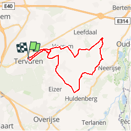
Randonnée V.T.T. de 26 km à découvrir à Flandre, Brabant flamand, Tervueren. Cette randonnée est proposée par michel.heusschen@skynet.be.
Description
Coeff. Dénivelé : 107m/10km.
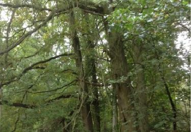
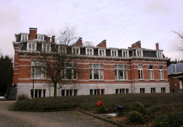
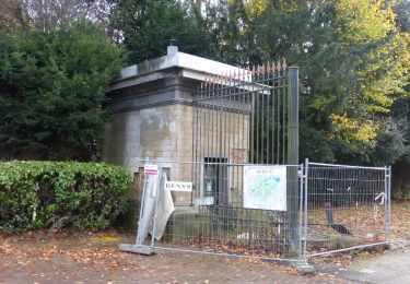
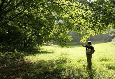
Parcours promenade au départ du parc, ensuite après un petit peu de route, parcours à travers champs avant de revenir sur le parc. Le retour au parc au soleil du soir est particulièrement agréable.
Localisation
Pays :
Belgique
Région :
Flandre
Département/Province :
Brabant flamand
Commune :
Tervueren
Localité :
Tervueren
Départ:(Dec)
Départ:(UTM)
606653 ; 5631459 (31U) N.
Commentaires
Randonnées à proximité
![Randonnée Marche Tervueren - #221017 - Duisburg, Wolfkensberg, Raffelberg***** - Photo](https://media.geolcdn.com/t/375/260/eb11e242-b355-4cb6-a158-313432558930.jpg&format=jpg&maxdim=2)
![Marche Marche](https://static1.geolcdn.com/sitytour/trail-icons/101.png)
#221017 - Duisburg, Wolfkensberg, Raffelberg*****
Marche
Moyen
(2)
Tervueren,
Flandre,
Brabant flamand,
Belgique
![](/images/other/stat-length.png)
8,3 km | 9,5 km-effort
2h 10min
![](https://static1.geolcdn.com/siteimages/upload/files/16400158638029165_repeat_loop_refresh_sync_direction_icon.png)
Oui
![Randonnée Marche Tervueren - Tervuren Leefdaal 22 km - Photo](https://media.geolcdn.com/t/375/260/ext.jpg?maxdim=2&url=https%3A%2F%2Fservices.sitytrail.com%2FGeolivesWS%2FDownloadMedia.ashx%3FTrailID%3D1084200%26Media%3D20181213150951.jpg)
![Marche Marche](https://static1.geolcdn.com/sitytour/trail-icons/101.png)
Tervuren Leefdaal 22 km
Marche
Facile
(1)
Tervueren,
Flandre,
Brabant flamand,
Belgique
![](/images/other/stat-length.png)
23 km | 27 km-effort
5h 24min
![](https://static1.geolcdn.com/siteimages/upload/files/16400158638029165_repeat_loop_refresh_sync_direction_icon.png)
Oui
![Randonnée Marche Tervueren - Arboretum - Kapucijnenbos - Photo](https://media.geolcdn.com/t/375/260/b9913596-de24-4332-b79b-b09410acdfbd.jpg&format=jpg&maxdim=2)
![Marche Marche](https://static1.geolcdn.com/sitytour/trail-icons/101.png)
Arboretum - Kapucijnenbos
Marche
Difficile
(1)
Tervueren,
Flandre,
Brabant flamand,
Belgique
![](/images/other/stat-length.png)
13,7 km | 16,3 km-effort
3h 41min
![](https://static1.geolcdn.com/siteimages/upload/files/16400158638029165_repeat_loop_refresh_sync_direction_icon.png)
Oui
![Randonnée Marche Tervueren - arboretum - Photo](https://media.geolcdn.com/t/375/260/ext.jpg?maxdim=2&url=https%3A%2F%2Fservices.sitytrail.com%2FGeolivesWS%2FDownloadMedia.ashx%3FTrailID%3D226959%26Media%3D20131013134220.jpg)
![Marche Marche](https://static1.geolcdn.com/sitytour/trail-icons/101.png)
arboretum
Marche
Très facile
(1)
Tervueren,
Flandre,
Brabant flamand,
Belgique
![](/images/other/stat-length.png)
8 km | 9,2 km-effort
2h 51min
![](https://static1.geolcdn.com/siteimages/upload/files/16400158638029165_repeat_loop_refresh_sync_direction_icon.png)
Oui
![Randonnée Vélo Wezembeek-Ophem - ox2 - Photo](https://media.geolcdn.com/t/375/260/ext.jpg?maxdim=2&url=https%3A%2F%2Fservices.sitytrail.com%2FGeolivesWS%2FDownloadMedia.ashx%3FTrailID%3D151603%26Media%3D20120904141505.jpg)
![Vélo Vélo](https://static1.geolcdn.com/sitytour/trail-icons/200.png)
ox2
Vélo
Facile
(1)
Wezembeek-Ophem,
Flandre,
Brabant flamand,
Belgique
![](/images/other/stat-length.png)
13,7 km | 15,2 km-effort
48min
![](https://static1.geolcdn.com/siteimages/upload/files/16400158638029165_repeat_loop_refresh_sync_direction_icon.png)
Oui
![Randonnée A pied Zaventem - Meester Crapswandeling - Photo](https://media.geolcdn.com/t/375/260/3dfabf4c-91ef-4e01-b655-1f27a780941d.jpeg&format=jpg&maxdim=2)
![A pied A pied](https://static1.geolcdn.com/sitytour/trail-icons/100.png)
Meester Crapswandeling
A pied
Facile
Zaventem,
Flandre,
Brabant flamand,
Belgique
![](/images/other/stat-length.png)
8,5 km | 9,4 km-effort
2h 7min
![](https://static1.geolcdn.com/siteimages/upload/files/16400158638029165_repeat_loop_refresh_sync_direction_icon.png)
Oui
![Randonnée A pied Huldenberg - Vossekouterwandeling - Photo](https://media.geolcdn.com/t/375/260/f9edc4ad-a3ef-4882-9a56-b4ff71f9dcfa.jpeg&format=jpg&maxdim=2)
![A pied A pied](https://static1.geolcdn.com/sitytour/trail-icons/100.png)
Vossekouterwandeling
A pied
Facile
Huldenberg,
Flandre,
Brabant flamand,
Belgique
![](/images/other/stat-length.png)
7,1 km | 8,7 km-effort
1h 58min
![](https://static1.geolcdn.com/siteimages/upload/files/16400158638029165_repeat_loop_refresh_sync_direction_icon.png)
Oui
![Randonnée A pied Tervueren - Warandewandeling - Photo](https://media.geolcdn.com/t/375/260/87c065a8-2320-4622-bcf3-9c4a54024d3f.jpeg&format=jpg&maxdim=2)
![A pied A pied](https://static1.geolcdn.com/sitytour/trail-icons/100.png)
Warandewandeling
A pied
Facile
Tervueren,
Flandre,
Brabant flamand,
Belgique
![](/images/other/stat-length.png)
4,9 km | 6 km-effort
1h 21min
![](https://static1.geolcdn.com/siteimages/upload/files/16400158638029165_repeat_loop_refresh_sync_direction_icon.png)
Non
![Randonnée A pied Tervueren - Kap(ucijnen)bos van Duisburgwandeling - Photo](https://media.geolcdn.com/t/375/260/716ca0df-5263-43cf-b6ba-7d16b36dfeb0.jpeg&format=jpg&maxdim=2)
![A pied A pied](https://static1.geolcdn.com/sitytour/trail-icons/100.png)
Kap(ucijnen)bos van Duisburgwandeling
A pied
Facile
Tervueren,
Flandre,
Brabant flamand,
Belgique
![](/images/other/stat-length.png)
6,2 km | 7,6 km-effort
1h 43min
![](https://static1.geolcdn.com/siteimages/upload/files/16400158638029165_repeat_loop_refresh_sync_direction_icon.png)
Non