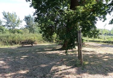
33 km | 37 km-effort
laluquegarevtt
mico40
Utilisateur
Longueur
29 km
Altitude max
69 m
Dénivelé positif
237 m
Km-Effort
32 km
Altitude min
8 m
Dénivelé négatif
237 m
Boucle
Oui
Date de création :
2018-11-30 17:29:34.715
Dernière modification :
2018-11-30 17:29:34.722
2h06
Difficulté : Inconnu
Application GPS de randonnée GRATUITE
À propos
Randonnée V.T.T. de 29 km à découvrir à Nouvelle-Aquitaine, Landes, Bégaar. Cette randonnée est proposée par mico40.
Localisation
Pays :
France
Région :
Nouvelle-Aquitaine
Département/Province :
Landes
Commune :
Bégaar
Localité :
Unknown
Départ:(Dec)
Départ:(UTM)
673315 ; 4853853 (30T) N.
Commentaires
Randonnées à proximité
Randonnée flore
Marche
Moyen
Pontonx-sur-l'Adour,
Nouvelle-Aquitaine,
Landes,
France
5,8 km | 6,5 km-effort
2h 47min
Oui
Tartas 20180626
Course à pied
Très facile
Tartas,
Nouvelle-Aquitaine,
Landes,
France
11,9 km | 13,4 km-effort
1h 16min
Non
Rando VTT autour de Tartas
V.T.T.
Difficile
Tartas,
Nouvelle-Aquitaine,
Landes,
France
45 km | 51 km-effort
3h 30min
Oui
Lesgor, pescador, perrichon, pont du coutet, luzou, claoury - 7
Marche
Moyen
Lesgor,
Nouvelle-Aquitaine,
Landes,
France
7 km | 8 km-effort
1h 48min
Oui
Lesgor boucle - 7.7 *
Marche
Moyen
Lesgor,
Nouvelle-Aquitaine,
Landes,
France
7,7 km | 8,8 km-effort
1h 59min
Oui
Lesgor boucle - 7.2
Marche
Moyen
Lesgor,
Nouvelle-Aquitaine,
Landes,
France
7,2 km | 8,1 km-effort
1h 50min
Oui
Lesgor - 7.5
Marche
Moyen
(1)
Lesgor,
Nouvelle-Aquitaine,
Landes,
France
7,5 km | 8,5 km-effort
1h 56min
Oui
lesgor - 6.3
Marche
Moyen
Lesgor,
Nouvelle-Aquitaine,
Landes,
France
6,3 km | 7,2 km-effort
1h 37min
Oui