![](/images/other/stat-length.png)
![Randonnée Marche Burnhaupt-le-Bas - Diefmaten Sentheim - Photo](https://media.geolcdn.com/t/1900/400/ext.pjpeg?maxdim=2&url=https%3A%2F%2Fstatic1.geolcdn.com%2Fsiteimages%2Fupload%2Ffiles%2F1553511878bg_sport_marche.png)
Diefmaten Sentheim
helmut68
Utilisateur
![Longueur](/images/other/stat-length.png)
Longueur
13,2 km
![Altitude max](https://static1.geolcdn.com/siteimages/upload/files/1508320355ic_sort_altitude_max_24dp.png)
Altitude max
366 m
![Dénivelé positif](https://static1.geolcdn.com/siteimages/upload/files/1508320355ic_sort_den_pos_24dp.png)
Dénivelé positif
126 m
![Km-Effort](/images/other/stat-length.png)
Km-Effort
14,8 km
![Altitude min](https://static1.geolcdn.com/siteimages/upload/files/1508320355ic_sort_altitude_min_24dp.png)
Altitude min
297 m
![Dénivelé négatif](https://static1.geolcdn.com/siteimages/upload/files/1508320355ic_sort_den_neg_24dp.png)
Dénivelé négatif
82 m
![Boucle](https://static1.geolcdn.com/siteimages/upload/files/16400158638029165_repeat_loop_refresh_sync_direction_icon.png)
Boucle
Non
Date de création :
2018-07-20 19:16:14.476
Dernière modification :
2018-07-20 19:16:14.476
![Marche](https://static1.geolcdn.com/sitytour/trail-icons/101.png)
2h43
Difficulté : Facile
![Scannez ce code QR pour ouvrir la randonnée dans l'application SityTrail](https://capi.geolives.com/qq0zvz2zws4bq2lad0pu/sitytour/trails/933249/qr.png?size=200)
Application GPS de randonnée GRATUITE
À propos
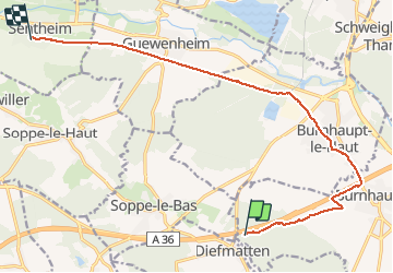
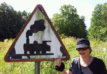
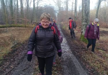
Randonnée Marche de 13,2 km à découvrir à Grand Est, Haut-Rhin, Burnhaupt-le-Bas. Cette randonnée est proposée par helmut68.
Description
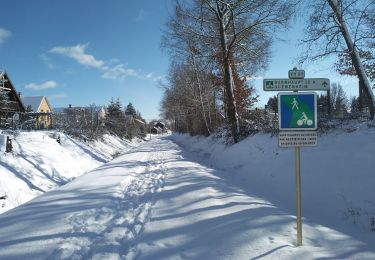
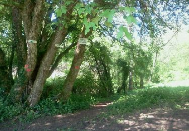
Suite du parcours GR531( Sentheim Diefmaten) pour revenir à Sentheim. On longe un peu l'autoroute pour arriver à Burnhaupt le Haut puis continuer par la piste cyclable jusqu'à Sentheim.
Localisation
Pays :
France
Région :
Grand Est
Département/Province :
Haut-Rhin
Commune :
Burnhaupt-le-Bas
Localité :
Unknown
Départ:(Dec)
Départ:(UTM)
358848 ; 5285918 (32T) N.
Commentaires
Randonnées à proximité
![Randonnée Marche Burnhaupt-le-Haut - Rando du 09/02/2024 par Alain...Pont d'Aspach - Photo](https://media.geolcdn.com/t/375/260/8bf78224-a247-4f67-bf02-5b95f58c9fa0.jpg&format=jpg&maxdim=2)
![Marche Marche](https://static1.geolcdn.com/sitytour/trail-icons/101.png)
Rando du 09/02/2024 par Alain...Pont d'Aspach
Marche
Très difficile
Burnhaupt-le-Haut,
Grand Est,
Haut-Rhin,
France
![](/images/other/stat-length.png)
22 km | 27 km-effort
5h 12min
![](https://static1.geolcdn.com/siteimages/upload/files/16400158638029165_repeat_loop_refresh_sync_direction_icon.png)
Oui
![Randonnée Marche Guewenheim - Circuit de la Doller - Photo](https://media.geolcdn.com/t/375/260/0d97bcea-149d-4dd3-ac1e-8ab97dd48e60.jpg&format=jpg&maxdim=2)
![Marche Marche](https://static1.geolcdn.com/sitytour/trail-icons/101.png)
Circuit de la Doller
Marche
Moyen
Guewenheim,
Grand Est,
Haut-Rhin,
France
![](/images/other/stat-length.png)
10,7 km | 12,2 km-effort
2h 24min
![](https://static1.geolcdn.com/siteimages/upload/files/16400158638029165_repeat_loop_refresh_sync_direction_icon.png)
Oui
![Randonnée Marche Le Haut-Soultzbach - Lac de la Seigneurie (10/01/2019) - Photo](https://media.geolcdn.com/t/375/260/be4d555f-483c-42ec-9887-1c88673495d3.jpg&format=jpg&maxdim=2)
![Marche Marche](https://static1.geolcdn.com/sitytour/trail-icons/101.png)
Lac de la Seigneurie (10/01/2019)
Marche
Facile
Le Haut-Soultzbach,
Grand Est,
Haut-Rhin,
France
![](/images/other/stat-length.png)
16,3 km | 19,5 km-effort
4h 24min
![](https://static1.geolcdn.com/siteimages/upload/files/16400158638029165_repeat_loop_refresh_sync_direction_icon.png)
Oui
![Randonnée Sports d'hiver Sentheim - SentheimGuewenheimSki - Photo](https://media.geolcdn.com/t/375/260/ext.jpg?maxdim=2&url=https%3A%2F%2Fservices.sitytrail.com%2FGeolivesWS%2FDownloadMedia.ashx%3FTrailID%3D1104306%26Media%3Dfix__20190131111514.jpg)
![Sports d'hiver Sports d'hiver](https://static1.geolcdn.com/sitytour/trail-icons/500.png)
SentheimGuewenheimSki
Sports d'hiver
Moyen
Sentheim,
Grand Est,
Haut-Rhin,
France
![](/images/other/stat-length.png)
6,1 km | 6,7 km-effort
1h 34min
![](https://static1.geolcdn.com/siteimages/upload/files/16400158638029165_repeat_loop_refresh_sync_direction_icon.png)
Non
![Randonnée Marche Burnhaupt-le-Bas - GR531 Diefmaten Gildwiller - Photo](https://media.geolcdn.com/t/375/260/ext.jpg?maxdim=2&url=https%3A%2F%2Fservices.sitytrail.com%2FGeolivesWS%2FDownloadMedia.ashx%3FTrailID%3D959196%26Media%3Dfix__20180506113930.jpg)
![Marche Marche](https://static1.geolcdn.com/sitytour/trail-icons/101.png)
GR531 Diefmaten Gildwiller
Marche
Facile
Burnhaupt-le-Bas,
Grand Est,
Haut-Rhin,
France
![](/images/other/stat-length.png)
6,1 km | 7,9 km-effort
1h 14min
![](https://static1.geolcdn.com/siteimages/upload/files/16400158638029165_repeat_loop_refresh_sync_direction_icon.png)
Non
![Randonnée Vélo Sentheim - ValléeDollerMulhouse - Photo](https://media.geolcdn.com/t/375/260/ext.jpg?maxdim=2&url=https%3A%2F%2Fservices.sitytrail.com%2FGeolivesWS%2FDownloadMedia.ashx%3FTrailID%3D274392%26Media%3Dfix__20140506084056.jpg)
![Vélo Vélo](https://static1.geolcdn.com/sitytour/trail-icons/200.png)
ValléeDollerMulhouse
Vélo
Facile
Sentheim,
Grand Est,
Haut-Rhin,
France
![](/images/other/stat-length.png)
31 km | 33 km-effort
1h 17min
![](https://static1.geolcdn.com/siteimages/upload/files/16400158638029165_repeat_loop_refresh_sync_direction_icon.png)
Non
![Randonnée Marche Sentheim - SentGuewSentheim - Photo](https://media.geolcdn.com/t/375/260/ext.jpg?maxdim=2&url=https%3A%2F%2Fservices.sitytrail.com%2FGeolivesWS%2FDownloadMedia.ashx%3FTrailID%3D273736%26Media%3Dfix__20140504115219.jpg)
![Marche Marche](https://static1.geolcdn.com/sitytour/trail-icons/101.png)
SentGuewSentheim
Marche
Facile
Sentheim,
Grand Est,
Haut-Rhin,
France
![](/images/other/stat-length.png)
9,5 km | 11,2 km-effort
2h 6min
![](https://static1.geolcdn.com/siteimages/upload/files/16400158638029165_repeat_loop_refresh_sync_direction_icon.png)
Non
![Randonnée Marche Guewenheim - Guewenheim. 68 - Photo](https://media.geolcdn.com/t/375/260/ext.jpg?maxdim=2&url=https%3A%2F%2Fservices.sitytrail.com%2FGeolivesWS%2FDownloadMedia.ashx%3FTrailID%3D143515%26Media%3D20120804113825.jpeg)
![Marche Marche](https://static1.geolcdn.com/sitytour/trail-icons/101.png)
Guewenheim. 68
Marche
Très facile
Guewenheim,
Grand Est,
Haut-Rhin,
France
![](/images/other/stat-length.png)
13,1 km | 15 km-effort
3h 14min
![](https://static1.geolcdn.com/siteimages/upload/files/16400158638029165_repeat_loop_refresh_sync_direction_icon.png)
Non
![Randonnée Marche Guewenheim - Randonnée CVG Guewenheim - Pont d'Aspach - retour - Photo](https://media.geolcdn.com/t/375/260/4874632b-42c9-40d6-aa85-ff9a371ccc76.jpg&format=jpg&maxdim=2)
![Marche Marche](https://static1.geolcdn.com/sitytour/trail-icons/101.png)
Randonnée CVG Guewenheim - Pont d'Aspach - retour
Marche
Facile
Guewenheim,
Grand Est,
Haut-Rhin,
France
![](/images/other/stat-length.png)
17,8 km | 19,9 km-effort
5h 46min
![](https://static1.geolcdn.com/siteimages/upload/files/16400158638029165_repeat_loop_refresh_sync_direction_icon.png)
Non