Randonnée Cheval La Panne - La Panne retour par intérieur  - Photo

La Panne retour par intérieur

 phdebrogniez
phdebrogniez

Utilisateur

© OpenStreetMap contributors
Longueur
Longueur
27 km
Altitude max
Altitude max
16 m
Dénivelé positif
Dénivelé positif
96 m
Km-Effort
Km-Effort  
28 km
Altitude min
Altitude min
-1 m
Dénivelé négatif
Dénivelé négatif
107 m
Boucle
Boucle
Non
Date de création :
2018-04-17 22:23:44.097
Dernière modification :
2018-04-17 22:23:44.097

(0 Avis)

Cheval
Cheval
4h03
Difficulté : Facile

Scannez ce code QR pour ouvrir la randonnée dans l'application SityTrail

Application GPS de randonnée GRATUITE

Logo SityTrail SityTrail

IGN / Instituts géographiques

Télécharger SityTrail sur l'App Store Télécharger SityTrail sur Google Play

Logo SityTrail SityTrail World

Le monde est à vous

Télécharger SityTrail sur l'App Store Télécharger SityTrail sur Google Play Télécharger SityTrail sur Huawei AppGallery

À propos

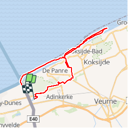
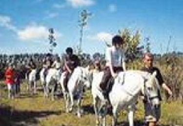
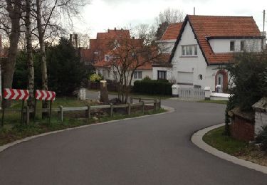
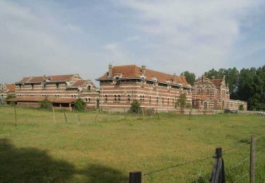
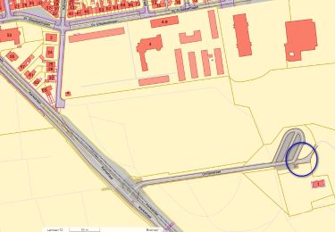
Randonnée Cheval de 27 km à découvrir à Flandre, Flandre-Occidentale, La Panne. Cette randonnée est proposée par phdebrogniez.

Profil altimétrique

Localisation

Pays :
Belgique
Région :
Flandre
Département/Province :
Flandre-Occidentale
Commune :
La Panne
Localité :
La Panne
Départ:(Dec)
Départ:(UTM)
468527 ; 5659077 (31U) N.

Randonnées à proximité

Randonnée Marche Ghyvelde - Circuit de la dune fossile - Photo
Marche

Marche

Très facile
(3)
Ghyvelde, Hauts-de-France, Nord, France
7,8 km | 8,4 km-effort
Inconnu
Oui
Randonnée Marche Coxyde - St. Idesbald et Noorduinen - Photo
Marche
cdeg62

Marche

Facile
(2)
Coxyde, Flandre, Flandre-Occidentale, Belgique
4,5 km | 4,8 km-effort
1h 4min
Oui
Randonnée Marche Zuydcoote - Circuit de l'Hôpital maritime - Zuydcoote - Photo
Marche
tracegps

Marche

Facile
(1)
Zuydcoote, Hauts-de-France, Nord, France
4,5 km | 4,9 km-effort
1h 15min
Oui
Randonnée V.T.T. La Panne - 20240613 - TOTEMUS partiel - DE PANNE 16 Km - Photo
V.T.T.
GUIDE
pierreh01

V.T.T.

Facile
La Panne, Flandre, Flandre-Occidentale, Belgique
15,9 km | 16,8 km-effort
2h 26min
Non
Randonnée Marche La Panne - 20240612 - TOTEMUS De Panne - 6.7 Km - Photo
Marche
GUIDE
pierreh01

Marche

Moyen
La Panne, Flandre, Flandre-Occidentale, Belgique
6,7 km | 7,3 km-effort
1h 39min
Oui
Randonnée Marche Bray-Dunes - Gr5A Bray-Dunes / Nieuport  - Photo
Marche

Marche

Moyen
(1)
Bray-Dunes, Hauts-de-France, Nord, France
28 km | 31 km-effort
6h 56min
Non
Randonnée A pied La Panne - Westhoek wandelroute - Photo
A pied
GUIDE+

A pied

Facile
(1)
La Panne, Flandre, Flandre-Occidentale, Belgique
11,2 km | 12,2 km-effort
2h 46min
Oui
Randonnée Marche La Panne - w-belgie-westhoekreservaat - Photo
Marche
gpstracks

Marche

Très facile
(1)
La Panne, Flandre, Flandre-Occidentale, Belgique
9,8 km | 10,6 km-effort
Inconnu
Oui
Randonnée Marche Bray-Dunes - dune Marchand - Photo
Marche
Bernard.voyageur

Marche

Moyen
(1)
Bray-Dunes, Hauts-de-France, Nord, France
9,1 km | 9,8 km-effort
2h 30min
Oui


Fermer
Mes abonnements