Randonnée Autre activité Villefort - 2018 J3 Villefort Le Bleymard_backup - Photo

2018 J3 Villefort Le Bleymard_backup

 thierryd
thierryd

Utilisateur

© OpenStreetMap contributors
Longueur
Longueur
32 km
Altitude max
Altitude max
1364 m
Dénivelé positif
Dénivelé positif
1165 m
Km-Effort
Km-Effort  
46 km
Altitude min
Altitude min
623 m
Dénivelé négatif
Dénivelé négatif
721 m
Boucle
Boucle
Non
Date de création :
2018-04-17 21:11:28.478
Dernière modification :
2018-04-17 21:11:28.478

(0 Avis)

Autre activité
Autre activité
6m
Difficulté : Difficile

Scannez ce code QR pour ouvrir la randonnée dans l'application SityTrail

Application GPS de randonnée GRATUITE

Logo SityTrail SityTrail

IGN / Instituts géographiques

Télécharger SityTrail sur l'App Store Télécharger SityTrail sur Google Play

Logo SityTrail SityTrail World

Le monde est à vous

Télécharger SityTrail sur l'App Store Télécharger SityTrail sur Google Play Télécharger SityTrail sur Huawei AppGallery

À propos

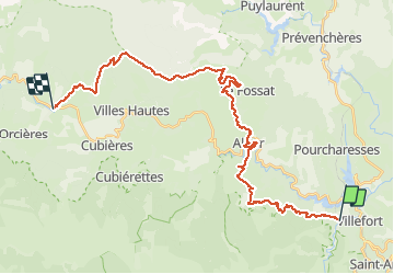
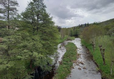
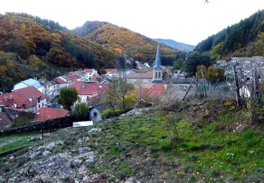
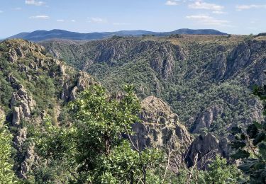
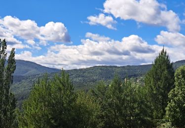
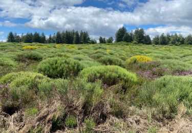
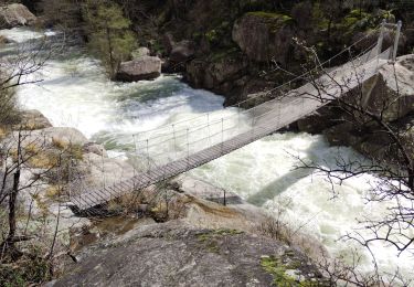
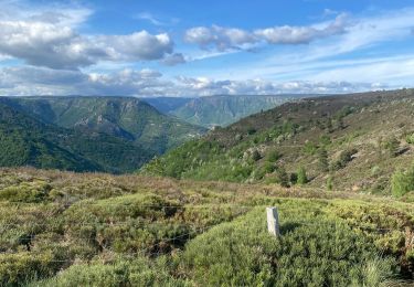
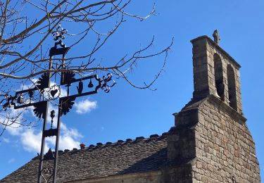
Randonnée Autre activité de 32 km à découvrir à Occitanie, Lozère, Villefort. Cette randonnée est proposée par thierryd.

Profil altimétrique

Localisation

Pays :
France
Région :
Occitanie
Département/Province :
Lozère
Commune :
Villefort
Localité :
Unknown
Départ:(Dec)
Départ:(UTM)
573139 ; 4921197 (31T) N.

Randonnées à proximité

Randonnée Marche Pied-de-Borne - GRP Tour du Chassezac en 2 jours - Photo
Marche
GUIDE
nadinebondoux

Marche

Difficile
Pied-de-Borne, Occitanie, Lozère, France
25 km | 36 km-effort
6h 50min
Non
Randonnée A pied Malons-et-Elze - GR 44 - Photo
A pied
GUIDE+

A pied

Facile
Malons-et-Elze, Occitanie, Gard, France
4,8 km | 6,4 km-effort
1h 26min
Non
Randonnée Marche Ponteils-et-Brésis - Nord haute Vallee de la Cèze - Photo
Marche
GUIDE
nadinebondoux

Marche

Difficile
Ponteils-et-Brésis, Occitanie, Gard, France
23 km | 34 km-effort
6h 50min
Oui
Randonnée Marche Ponteils-et-Brésis - Bour a es - Photo
Marche
GUIDE
Roger Philippe Wallez

Marche

Très difficile
Ponteils-et-Brésis, Occitanie, Gard, France
24 km | 36 km-effort
7h 37min
Oui
Randonnée Marche Prévenchères -  Gorges de Chassezac - Photo
Marche
cousam

Marche

Difficile
Prévenchères, Occitanie, Lozère, France
19 km | 30 km-effort
7h 33min
Oui
Randonnée Marche Pied-de-Borne - Le tour du Chassezac  - Photo
Marche
GUIDE
Roger Philippe Wallez

Marche

Très difficile
Pied-de-Borne, Occitanie, Lozère, France
49 km | 72 km-effort
37h 28min
Oui
Randonnée Marche Pied-de-Borne - Le tour du chassezac - Photo
Marche
GUIDE
Roger Philippe Wallez

Marche

Très difficile
Pied-de-Borne, Occitanie, Lozère, France
49 km | 72 km-effort
16h 34min
Oui
Randonnée Marche Prévenchères - La garde guerin  - Photo
Marche
GUIDE
antignacs

Marche

Très facile
Prévenchères, Occitanie, Lozère, France
6,1 km | 7,4 km-effort
1h 39min
Oui
Randonnée Marche Prévenchères - Gorges du Chassezac au départ de la Garde guérin  - Photo
Marche
GUIDE
nadinebondoux

Marche

Difficile
Prévenchères, Occitanie, Lozère, France
10 km | 17,2 km-effort
4h 3min
Oui


Fermer
Mes abonnements