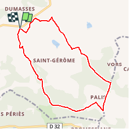
![](/images/other/stat-length.png)
![Randonnée Autre activité Castelnau-de-Montmiral - Chemin de Gradille - Photo](https://media.geolcdn.com/t/1900/400/ext.pjpeg?maxdim=2&url=https%3A%2F%2Fstatic1.geolcdn.com%2Fsiteimages%2Fupload%2Ffiles%2F1545311037marcheuse_200dpi.jpg)
Chemin de Gradille
papiou
Utilisateur
![Longueur](/images/other/stat-length.png)
![Altitude max](https://static1.geolcdn.com/siteimages/upload/files/1508320355ic_sort_altitude_max_24dp.png)
![Dénivelé positif](https://static1.geolcdn.com/siteimages/upload/files/1508320355ic_sort_den_pos_24dp.png)
![Km-Effort](/images/other/stat-length.png)
![Altitude min](https://static1.geolcdn.com/siteimages/upload/files/1508320355ic_sort_altitude_min_24dp.png)
![Dénivelé négatif](https://static1.geolcdn.com/siteimages/upload/files/1508320355ic_sort_den_neg_24dp.png)
![Boucle](https://static1.geolcdn.com/siteimages/upload/files/16400158638029165_repeat_loop_refresh_sync_direction_icon.png)
![Autre activité](https://static1.geolcdn.com/sitytour/trail-icons/900.png)
--
Difficulté : Inconnu
![Scannez ce code QR pour ouvrir la randonnée dans l'application SityTrail](https://capi.geolives.com/qq0zvz2zws4bq2lad0pu/sitytour/trails/913750/qr.png?size=200)
Application GPS de randonnée GRATUITE
À propos
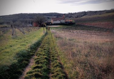
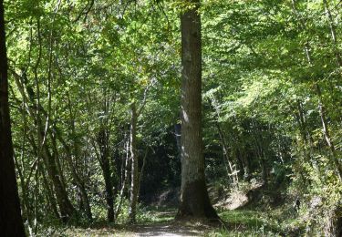
Randonnée Autre activité de 8,8 km à découvrir à Occitanie, Tarn, Castelnau-de-Montmiral. Cette randonnée est proposée par papiou.
Description
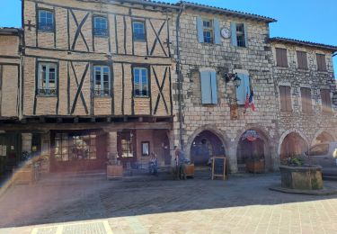
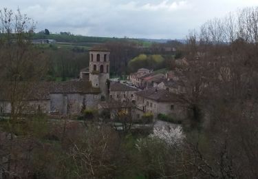
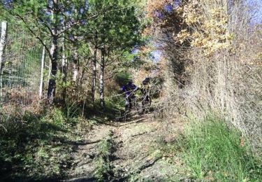
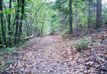
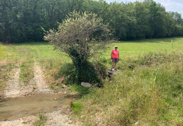
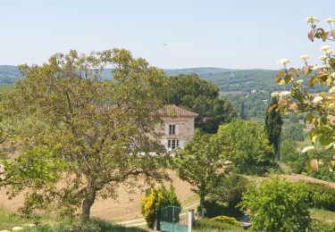
Panorama superbe sur la bastide de Castelnau de Montmiral, traversées de vignes, paysages de coteaux : cette randonnée vous offre toute la beauté du Gaillacois en un seul itinéraire.Le Chemin de Gradille, long de 8 kilomètres, traverse successivement des paysages composés de bois (chênes pubescents et d’érables) et de coteaux de vignes, pour le plus grand plaisir de vos yeux. Au cours de votre balade, vous pouvez admirer le panorama sur Castelnau-de-Montmiral, la chapelle de Gradille datant du 11ème siècle ou bien encore le petit pont qui permet de rejoindre Saint-Jérôme à Gradille.
Localisation
Commentaires
Randonnées à proximité
![Randonnée Marche Castelnau-de-Montmiral - boucle castelnau de montmiral - Photo](https://media.geolcdn.com/t/375/260/ab1644fc-a048-461d-b8c8-d5ccaee8ceb6.jpg&format=jpg&maxdim=2)
![Marche Marche](https://static1.geolcdn.com/sitytour/trail-icons/101.png)
Marche
![](/images/other/stat-length.png)
![](https://static1.geolcdn.com/siteimages/upload/files/16400158638029165_repeat_loop_refresh_sync_direction_icon.png)
![Randonnée Marche Lisle-sur-Tarn - sentier de Sivens et découverte - Photo](https://media.geolcdn.com/t/375/260/431d4d6f-42e6-4032-a3ed-18af95beef7e.jpg&format=jpg&maxdim=2)
![Marche Marche](https://static1.geolcdn.com/sitytour/trail-icons/101.png)
Marche
![](/images/other/stat-length.png)
![](https://static1.geolcdn.com/siteimages/upload/files/16400158638029165_repeat_loop_refresh_sync_direction_icon.png)
![Randonnée Marche Vieux - Boucle Vieux Le Verdier Cahuzac sur Vère Andillac - Photo](https://media.geolcdn.com/t/375/260/7faa45ff-a167-4a0a-8a9c-542f4112774f.jpg&format=jpg&maxdim=2)
![Marche Marche](https://static1.geolcdn.com/sitytour/trail-icons/101.png)
Marche
![](/images/other/stat-length.png)
![](https://static1.geolcdn.com/siteimages/upload/files/16400158638029165_repeat_loop_refresh_sync_direction_icon.png)
![Randonnée V.T.T. Lisle-sur-Tarn - Forêt de Sivens et alentours - Photo](https://media.geolcdn.com/t/375/260/ext.jpg?maxdim=2&url=https%3A%2F%2Fservices.sitytrail.com%2FGeolivesWS%2FDownloadMedia.ashx%3FTrailID%3D100982%26Media%3D481_3.jpg)
![V.T.T. V.T.T.](https://static1.geolcdn.com/sitytour/trail-icons/202.png)
V.T.T.
![](/images/other/stat-length.png)
![](https://static1.geolcdn.com/siteimages/upload/files/16400158638029165_repeat_loop_refresh_sync_direction_icon.png)
![Randonnée V.T.T. Lisle-sur-Tarn - Forêt de Sivens - Photo](https://media.geolcdn.com/t/375/260/ext.jpg?maxdim=2&url=https%3A%2F%2Fservices.sitytrail.com%2FGeolivesWS%2FDownloadMedia.ashx%3FTrailID%3D100907%26Media%3D407_3.jpg)
![V.T.T. V.T.T.](https://static1.geolcdn.com/sitytour/trail-icons/202.png)
V.T.T.
![](/images/other/stat-length.png)
![](https://static1.geolcdn.com/siteimages/upload/files/16400158638029165_repeat_loop_refresh_sync_direction_icon.png)
![Randonnée sport Castelnau-de-Montmiral - Chemin de Gradille avec chapelle - Photo](https://media.geolcdn.com/t/375/260/99c51347-1fd1-48da-9a5d-ffa33c25a059.jpg&format=jpg&maxdim=2)
sport
![](/images/other/stat-length.png)
![](https://static1.geolcdn.com/siteimages/upload/files/16400158638029165_repeat_loop_refresh_sync_direction_icon.png)
![Randonnée Marche Castelnau-de-Montmiral - Autour de Castelnau de Montmiral - Photo](https://media.geolcdn.com/t/375/260/b32e4fb5-a8d5-4ad8-9db6-9224893518aa.jpg&format=jpg&maxdim=2)
![Marche Marche](https://static1.geolcdn.com/sitytour/trail-icons/101.png)
Marche
![](/images/other/stat-length.png)
![](https://static1.geolcdn.com/siteimages/upload/files/16400158638029165_repeat_loop_refresh_sync_direction_icon.png)
![Randonnée Marche nordique Gaillac - Laborie Gaillac - Photo](https://media.geolcdn.com/t/375/260/f6846132-7dee-424a-ac96-0cfd1a9d9337.jpeg&format=jpg&maxdim=2)
![Marche nordique Marche nordique](https://static1.geolcdn.com/sitytour/trail-icons/102.png)
Marche nordique
![](/images/other/stat-length.png)
![](https://static1.geolcdn.com/siteimages/upload/files/16400158638029165_repeat_loop_refresh_sync_direction_icon.png)
![Randonnée Marche nordique Lisle-sur-Tarn - Sentier de Sivens - Photo](https://media.geolcdn.com/t/375/260/c6432d85-7d58-4c2c-8099-67a44bd6d4dc.jpg&format=jpg&maxdim=2)
![Marche nordique Marche nordique](https://static1.geolcdn.com/sitytour/trail-icons/102.png)
Marche nordique
![](/images/other/stat-length.png)
![](https://static1.geolcdn.com/siteimages/upload/files/16400158638029165_repeat_loop_refresh_sync_direction_icon.png)
balisage peu visible par endroit et entre 3 et 4 km chemins boueux et inondées ( fin février après nombreuses pluies du début d'année)