


14,1 km | 17,4 km-effort


Utilisateur


Application GPS de randonnée GRATUITE
 SityTrail
IGN / Instituts géographiques
SityTrail World
Le monde est à vous
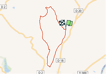
Randonnée Autre activité de 6,9 km à découvrir à Occitanie, Tarn, Rabastens. Cette randonnée est proposée par papiou.
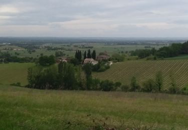
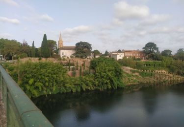
La boucle de Saint-Martin est une sympathique balade de 7 kilomètres qui vous est proposée au cœur du vignoble Rabastinois.La boucle de Saint-Martin est une sympathique balade de 7 kilomètres qui vous est proposée au cœur du vignoble Rabastinois. Découvrez tout le charme des paysages composés de cabanes de vignerons, de pigeonniers et qui témoignent des activités de nos ancêtres. L’église Saint-Martin (avec sa flèche gothique) et les tours de Notre-Dame-du-Bourg (ce dernier monument étant inscrit à l’UNESCO), entre autres, sont autant de monuments à ne pas rater au cours de votre excursion.

Marche
Marche
Course à pied

V.T.T.
Marche
Vélo de route

Marche nordique

Marche