![](/images/other/stat-length.png)
Les roches de l'aigle
Le_Grand
Utilisateur
![Longueur](/images/other/stat-length.png)
Longueur
11 km
![Altitude max](https://static1.geolcdn.com/siteimages/upload/files/1508320355ic_sort_altitude_max_24dp.png)
Altitude max
616 m
![Dénivelé positif](https://static1.geolcdn.com/siteimages/upload/files/1508320355ic_sort_den_pos_24dp.png)
Dénivelé positif
257 m
![Km-Effort](/images/other/stat-length.png)
Km-Effort
14,5 km
![Altitude min](https://static1.geolcdn.com/siteimages/upload/files/1508320355ic_sort_altitude_min_24dp.png)
Altitude min
463 m
![Dénivelé négatif](https://static1.geolcdn.com/siteimages/upload/files/1508320355ic_sort_den_neg_24dp.png)
Dénivelé négatif
257 m
![Boucle](https://static1.geolcdn.com/siteimages/upload/files/16400158638029165_repeat_loop_refresh_sync_direction_icon.png)
Boucle
Oui
Date de création :
2018-09-03 11:42:49.642
Dernière modification :
2021-03-29 11:33:04.08
![Marche](https://static1.geolcdn.com/sitytour/trail-icons/101.png)
3h04
Difficulté : Facile
![Scannez ce code QR pour ouvrir la randonnée dans l'application SityTrail](https://capi.geolives.com/qq0zvz2zws4bq2lad0pu/sitytour/trails/905611/qr.png?size=200)
Application GPS de randonnée GRATUITE
À propos
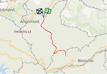
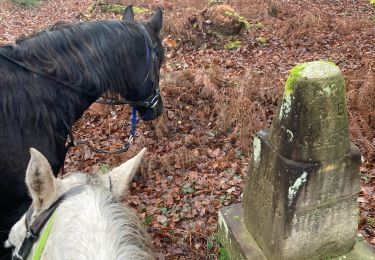
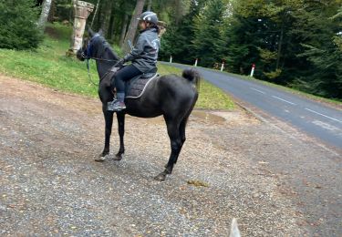
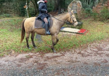
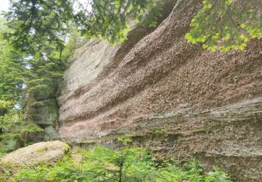
Randonnée Marche de 11 km à découvrir à Grand Est, Meurthe-et-Moselle, Angomont. Cette randonnée est proposée par Le_Grand.
Description
A partir de l'abri de la croix Bagué à Angomont aller-retour aux rocher de l'aigle an passant par le haut des planches
Localisation
Pays :
France
Région :
Grand Est
Département/Province :
Meurthe-et-Moselle
Commune :
Angomont
Localité :
Unknown
Départ:(Dec)
Départ:(UTM)
349588 ; 5375881 (32U) N.
Commentaires
Randonnées à proximité
![Randonnée Marche Badonviller - 2023-07-22 Marche Bivouac Lac de la pierre percee - Photo](https://media.geolcdn.com/t/375/260/122d3872-bd00-4b8d-bfcc-b1533062f5e9.jpg&format=jpg&maxdim=2)
![Marche Marche](https://static1.geolcdn.com/sitytour/trail-icons/101.png)
2023-07-22 Marche Bivouac Lac de la pierre percee
Marche
Facile
Badonviller,
Grand Est,
Meurthe-et-Moselle,
France
![](/images/other/stat-length.png)
21 km | 27 km-effort
6h 35min
![](https://static1.geolcdn.com/siteimages/upload/files/16400158638029165_repeat_loop_refresh_sync_direction_icon.png)
Non
![Randonnée Randonnée équestre Badonviller - Lac de Pierre Percée 25 km - Photo](https://media.geolcdn.com/t/375/260/ext.jpg?maxdim=2&url=https%3A%2F%2Fstatic1.geolcdn.com%2Fsiteimages%2Fupload%2Ffiles%2F1524743154cheval.jpg)
![Randonnée équestre Randonnée équestre](https://static1.geolcdn.com/sitytour/trail-icons/301.png)
Lac de Pierre Percée 25 km
Randonnée équestre
Difficile
(1)
Badonviller,
Grand Est,
Meurthe-et-Moselle,
France
![](/images/other/stat-length.png)
25 km | 32 km-effort
4h 13min
![](https://static1.geolcdn.com/siteimages/upload/files/16400158638029165_repeat_loop_refresh_sync_direction_icon.png)
Oui
![Randonnée Marche Allarmont - 2019-06-08 Marche Allarmont et ses rochers - Photo](https://media.geolcdn.com/t/375/260/b4eab987-1d3a-475a-8836-184432a12f13.jpg&format=jpg&maxdim=2)
![Marche Marche](https://static1.geolcdn.com/sitytour/trail-icons/101.png)
2019-06-08 Marche Allarmont et ses rochers
Marche
Très facile
Allarmont,
Grand Est,
Vosges,
France
![](/images/other/stat-length.png)
10,7 km | 16,5 km-effort
2h 55min
![](https://static1.geolcdn.com/siteimages/upload/files/16400158638029165_repeat_loop_refresh_sync_direction_icon.png)
Oui
![Randonnée Randonnée équestre Badonviller - Kalio joyeux - Photo](https://media.geolcdn.com/t/375/260/efdd057b-81ad-48f6-82c9-531661ce4000.jpg&format=jpg&maxdim=2)
![Randonnée équestre Randonnée équestre](https://static1.geolcdn.com/sitytour/trail-icons/301.png)
Kalio joyeux
Randonnée équestre
Facile
Badonviller,
Grand Est,
Meurthe-et-Moselle,
France
![](/images/other/stat-length.png)
11,9 km | 15,5 km-effort
2h 2min
![](https://static1.geolcdn.com/siteimages/upload/files/16400158638029165_repeat_loop_refresh_sync_direction_icon.png)
Oui
![Randonnée Randonnée équestre Badonviller - Kalio Joyeux chapelotte grotte des poilus - Photo](https://media.geolcdn.com/t/375/260/8c4c95f2-f113-422f-b0cb-11a8870ba14a.jpg&format=jpg&maxdim=2)
![Randonnée équestre Randonnée équestre](https://static1.geolcdn.com/sitytour/trail-icons/301.png)
Kalio Joyeux chapelotte grotte des poilus
Randonnée équestre
Moyen
Badonviller,
Grand Est,
Meurthe-et-Moselle,
France
![](/images/other/stat-length.png)
17,3 km | 22 km-effort
2h 55min
![](https://static1.geolcdn.com/siteimages/upload/files/16400158638029165_repeat_loop_refresh_sync_direction_icon.png)
Oui
![Randonnée Trail Angomont - thiaville, les hauts faîte planches vala des fous - Photo](https://media.geolcdn.com/t/375/260/ext.jpg?maxdim=2&url=https%3A%2F%2Fstatic1.geolcdn.com%2Fsiteimages%2Fupload%2Ffiles%2F1524743154running.jpg)
![Trail Trail](https://static1.geolcdn.com/sitytour/trail-icons/104.png)
thiaville, les hauts faîte planches vala des fous
Trail
Facile
(1)
Angomont,
Grand Est,
Meurthe-et-Moselle,
France
![](/images/other/stat-length.png)
12,9 km | 16,9 km-effort
Inconnu
![](https://static1.geolcdn.com/siteimages/upload/files/16400158638029165_repeat_loop_refresh_sync_direction_icon.png)
Oui
![Randonnée Randonnée équestre Badonviller - Yoigo uccello chapelotte poilus - Photo](https://media.geolcdn.com/t/375/260/b8baaf41-c4b3-430b-bcfc-bbe68b6457b3.jpg&format=jpg&maxdim=2)
![Randonnée équestre Randonnée équestre](https://static1.geolcdn.com/sitytour/trail-icons/301.png)
Yoigo uccello chapelotte poilus
Randonnée équestre
Moyen
Badonviller,
Grand Est,
Meurthe-et-Moselle,
France
![](/images/other/stat-length.png)
16,1 km | 21 km-effort
2h 45min
![](https://static1.geolcdn.com/siteimages/upload/files/16400158638029165_repeat_loop_refresh_sync_direction_icon.png)
Oui
![Randonnée Cyclotourisme Badonviller - Via Pax étape 2 - Manonviller / Bures - Photo](https://media.geolcdn.com/t/375/260/03cbbc3d-65ef-4acb-a4e8-6956ed65c7ac.png&format=jpg&maxdim=2)
![Cyclotourisme Cyclotourisme](https://static1.geolcdn.com/sitytour/trail-icons/204.png)
Via Pax étape 2 - Manonviller / Bures
Cyclotourisme
Moyen
Badonviller,
Grand Est,
Meurthe-et-Moselle,
France
![](/images/other/stat-length.png)
84 km | 99 km-effort
Inconnu
![](https://static1.geolcdn.com/siteimages/upload/files/16400158638029165_repeat_loop_refresh_sync_direction_icon.png)
Non
![Randonnée Marche Badonviller - La Vierge Clarisse VOSGES - Photo](https://media.geolcdn.com/t/375/260/01c61ca6-9318-47f6-a831-71e9e1e6ec09.jpg&format=jpg&maxdim=2)
![Marche Marche](https://static1.geolcdn.com/sitytour/trail-icons/101.png)
La Vierge Clarisse VOSGES
Marche
Difficile
Badonviller,
Grand Est,
Meurthe-et-Moselle,
France
![](/images/other/stat-length.png)
9,3 km | 13,8 km-effort
4h 31min
![](https://static1.geolcdn.com/siteimages/upload/files/16400158638029165_repeat_loop_refresh_sync_direction_icon.png)
Non