![](/images/other/stat-length.png)
![Randonnée Marche Stoumont - La Venne 1 - Photo](https://media.geolcdn.com/t/1900/400/ext.pjpeg?maxdim=2&url=https%3A%2F%2Fstatic1.geolcdn.com%2Fsiteimages%2Fupload%2Ffiles%2F1553511878bg_sport_marche.png)
La Venne 1
NickPluym
Utilisateur
![Longueur](/images/other/stat-length.png)
Longueur
7,2 km
![Altitude max](https://static1.geolcdn.com/siteimages/upload/files/1508320355ic_sort_altitude_max_24dp.png)
Altitude max
412 m
![Dénivelé positif](https://static1.geolcdn.com/siteimages/upload/files/1508320355ic_sort_den_pos_24dp.png)
Dénivelé positif
252 m
![Km-Effort](/images/other/stat-length.png)
Km-Effort
10,5 km
![Altitude min](https://static1.geolcdn.com/siteimages/upload/files/1508320355ic_sort_altitude_min_24dp.png)
Altitude min
211 m
![Dénivelé négatif](https://static1.geolcdn.com/siteimages/upload/files/1508320355ic_sort_den_neg_24dp.png)
Dénivelé négatif
249 m
![Boucle](https://static1.geolcdn.com/siteimages/upload/files/16400158638029165_repeat_loop_refresh_sync_direction_icon.png)
Boucle
Oui
Date de création :
2018-04-17 18:41:44.597
Dernière modification :
2018-04-17 18:41:44.597
![Marche](https://static1.geolcdn.com/sitytour/trail-icons/101.png)
2h30
Difficulté : Moyen
![Scannez ce code QR pour ouvrir la randonnée dans l'application SityTrail](https://capi.geolives.com/qq0zvz2zws4bq2lad0pu/sitytour/trails/904814/qr.png?size=200)
Application GPS de randonnée GRATUITE
À propos
Randonnée Marche de 7,2 km à découvrir à Wallonie, Liège, Stoumont. Cette randonnée est proposée par NickPluym.
Description
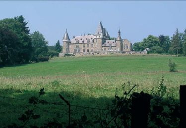
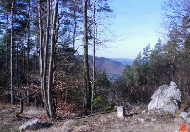
Een tourtje naar het wildpark waar je de witte wolven kan bewonderen, daarna een spectaculaire afdaling over een everzwijnen pad, te doen met sportieve kinderen vanaf 8 jaar. (Afkorting mogelijk)
Localisation
Pays :
Belgique
Région :
Wallonie
Département/Province :
Liège
Commune :
Stoumont
Localité :
La Gleize
Départ:(Dec)
Départ:(UTM)
702531 ; 5586966 (31U) N.
Commentaires
Randonnées à proximité
![Randonnée Marche Trois-Ponts - RB-Lg-27_Trois-Ponts - Photo](https://media.geolcdn.com/t/375/260/ext.jpg?maxdim=2&url=https%3A%2F%2Fservices.sitytrail.com%2FGeolivesWS%2FDownloadMedia.ashx%3FTrailID%3D402090%26Media%3Ddb9e80d9-8efc-4045-abb6-cee4f6885ea2.jpg)
![Marche Marche](https://static1.geolcdn.com/sitytour/trail-icons/101.png)
RB-Lg-27_Trois-Ponts
Marche
(7)
Trois-Ponts,
Wallonie,
Liège,
Belgique
![](/images/other/stat-length.png)
23 km | 33 km-effort
7h 30min
![](https://static1.geolcdn.com/siteimages/upload/files/16400158638029165_repeat_loop_refresh_sync_direction_icon.png)
Oui
![Randonnée Marche Stoumont - RB-Lg-13_Stoumont - Photo](https://media.geolcdn.com/t/375/260/ext.jpg?maxdim=2&url=https%3A%2F%2Fservices.sitytrail.com%2FGeolivesWS%2FDownloadMedia.ashx%3FTrailID%3D179571%26Media%3Dfca3b0ca-06fe-45d6-8ded-857ea27270cf.jpg)
![Marche Marche](https://static1.geolcdn.com/sitytour/trail-icons/101.png)
RB-Lg-13_Stoumont
Marche
Très difficile
(11)
Stoumont,
Wallonie,
Liège,
Belgique
![](/images/other/stat-length.png)
23 km | 32 km-effort
7h 19min
![](https://static1.geolcdn.com/siteimages/upload/files/16400158638029165_repeat_loop_refresh_sync_direction_icon.png)
Oui
![Randonnée Marche Stoumont - Stoumont - P14 Promenade des sommets de la Lienne - Photo](https://media.geolcdn.com/t/375/260/a2987c7f-4dfa-4904-87e7-be0c835ea8dd.jpg&format=jpg&maxdim=2)
![Marche Marche](https://static1.geolcdn.com/sitytour/trail-icons/101.png)
Stoumont - P14 Promenade des sommets de la Lienne
Marche
Moyen
(2)
Stoumont,
Wallonie,
Liège,
Belgique
![](/images/other/stat-length.png)
16,1 km | 23 km-effort
5h 11min
![](https://static1.geolcdn.com/siteimages/upload/files/16400158638029165_repeat_loop_refresh_sync_direction_icon.png)
Oui
![Randonnée Marche Stoumont - La Gleize - P3 - Tour du Mont Saint-Victor - Photo](https://media.geolcdn.com/t/375/260/eeda461f-0b98-4912-915c-63b0e2025382.jpg&format=jpg&maxdim=2)
![Marche Marche](https://static1.geolcdn.com/sitytour/trail-icons/101.png)
La Gleize - P3 - Tour du Mont Saint-Victor
Marche
Moyen
(3)
Stoumont,
Wallonie,
Liège,
Belgique
![](/images/other/stat-length.png)
15,8 km | 22 km-effort
5h 2min
![](https://static1.geolcdn.com/siteimages/upload/files/16400158638029165_repeat_loop_refresh_sync_direction_icon.png)
Oui
![Randonnée Marche Stavelot - Stavelot - Photo](https://media.geolcdn.com/t/375/260/8b34c446-55a9-478c-88d7-9cb986b390fb.jpg&format=jpg&maxdim=2)
![Marche Marche](https://static1.geolcdn.com/sitytour/trail-icons/101.png)
Stavelot
Marche
Difficile
(3)
Stavelot,
Wallonie,
Liège,
Belgique
![](/images/other/stat-length.png)
18,8 km | 26 km-effort
5h 53min
![](https://static1.geolcdn.com/siteimages/upload/files/16400158638029165_repeat_loop_refresh_sync_direction_icon.png)
Non
![Randonnée Marche Trois-Ponts - RB-Lg-27_Trois-Ponts_via-racc - Photo](https://media.geolcdn.com/t/375/260/ext.jpg?maxdim=2&url=https%3A%2F%2Fservices.sitytrail.com%2FGeolivesWS%2FDownloadMedia.ashx%3FTrailID%3D402091%26Media%3Ddb9e80d9-8efc-4045-abb6-cee4f6885ea2.jpg)
![Marche Marche](https://static1.geolcdn.com/sitytour/trail-icons/101.png)
RB-Lg-27_Trois-Ponts_via-racc
Marche
Très difficile
(1)
Trois-Ponts,
Wallonie,
Liège,
Belgique
![](/images/other/stat-length.png)
16,9 km | 25 km-effort
5h 36min
![](https://static1.geolcdn.com/siteimages/upload/files/16400158638029165_repeat_loop_refresh_sync_direction_icon.png)
Oui
![Randonnée Marche Stoumont - stoumont . corniche - congo . chateau froidcourt . ambleve . stoumont - Photo](https://media.geolcdn.com/t/375/260/e9a69a2e-c189-4076-b755-49e5203b8455.jpg&format=jpg&maxdim=2)
![Marche Marche](https://static1.geolcdn.com/sitytour/trail-icons/101.png)
stoumont . corniche - congo . chateau froidcourt . ambleve . stoumont
Marche
Très facile
(1)
Stoumont,
Wallonie,
Liège,
Belgique
![](/images/other/stat-length.png)
9,1 km | 12,1 km-effort
2h 44min
![](https://static1.geolcdn.com/siteimages/upload/files/16400158638029165_repeat_loop_refresh_sync_direction_icon.png)
Oui
![Randonnée Marche Theux - petit tour à Bronromme - Photo](https://media.geolcdn.com/t/375/260/3bde52fd-19d7-4e01-be15-97a6eaa8c76d.jpg&format=jpg&maxdim=2)
![Marche Marche](https://static1.geolcdn.com/sitytour/trail-icons/101.png)
petit tour à Bronromme
Marche
Très facile
(1)
Theux,
Wallonie,
Liège,
Belgique
![](/images/other/stat-length.png)
7,6 km | 9,1 km-effort
1h 53min
![](https://static1.geolcdn.com/siteimages/upload/files/16400158638029165_repeat_loop_refresh_sync_direction_icon.png)
Oui
![Randonnée Marche Stoumont - RB-Lg-13_Stoumont_via-racc - Photo](https://media.geolcdn.com/t/375/260/ext.jpg?maxdim=2&url=https%3A%2F%2Fservices.sitytrail.com%2FGeolivesWS%2FDownloadMedia.ashx%3FTrailID%3D179572%26Media%3Ddd649bf1-a115-4c1e-9e23-c1a80ab51103.jpg)
![Marche Marche](https://static1.geolcdn.com/sitytour/trail-icons/101.png)
RB-Lg-13_Stoumont_via-racc
Marche
Très difficile
(3)
Stoumont,
Wallonie,
Liège,
Belgique
![](/images/other/stat-length.png)
17,6 km | 24 km-effort
5h 25min
![](https://static1.geolcdn.com/siteimages/upload/files/16400158638029165_repeat_loop_refresh_sync_direction_icon.png)
Oui
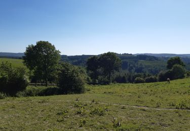
Généralement bons chemins, sauf la descente raide dont le chemin n'est pas référencé sur les cartes: suivre les traces de VTT et à la fin prendre à gauche du gros rocher pour atteindre le chemin de la carte: facile si on suit la trace de la balade. Passage le long de la cloture de la réserve animalière de Coo (biches, cerf, dingo). de très belles vues sur la vallée de l'Amblève (Stoumont-La Gleize). Possibilité d'allonger et d'aller jusque Coo