Randonnée Marche Bellefont-La Rauze - Nadillac  1 RT - Photo
 Ponche
Ponche

Utilisateur

© OpenStreetMap contributors
Longueur
Longueur
11,1 km
Altitude max
Altitude max
375 m
Dénivelé positif
Dénivelé positif
274 m
Km-Effort
Km-Effort  
14,8 km
Altitude min
Altitude min
192 m
Dénivelé négatif
Dénivelé négatif
274 m
Boucle
Boucle
Oui
Date de création :
2018-04-17 17:37:47.488
Dernière modification :
2023-01-30 07:49:24.911

(0 Avis)

Marche
Marche
3h15
Difficulté : Facile

Scannez ce code QR pour ouvrir la randonnée dans l'application SityTrail

Application GPS de randonnée GRATUITE

Logo SityTrail SityTrail

IGN / Instituts géographiques

Télécharger SityTrail sur l'App Store Télécharger SityTrail sur Google Play

Logo SityTrail SityTrail World

Le monde est à vous

Télécharger SityTrail sur l'App Store Télécharger SityTrail sur Google Play Télécharger SityTrail sur Huawei AppGallery

À propos

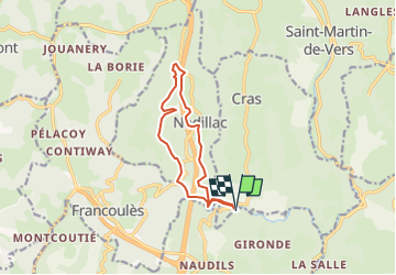
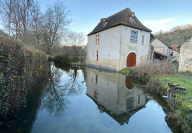
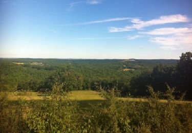
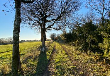
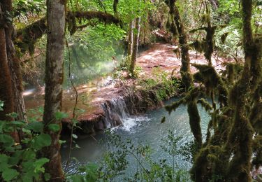
Randonnée Marche de 11,1 km à découvrir à Occitanie, Lot, Bellefont-La Rauze. Cette randonnée est proposée par Ponche.

Description

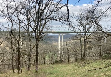
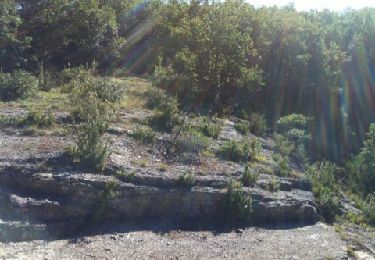
Tour du puech Raynal avec passage autoroute à Nadillac 8,5 km

Profil altimétrique

Localisation

Pays :
France
Région :
Occitanie
Département/Province :
Lot
Commune :
Bellefont-La Rauze
Localité :
Cours
Départ:(Dec)
Départ:(UTM)
383204 ; 4933208 (31T) N.

Randonnées à proximité

Randonnée Marche Les Pechs-du-Vers - Saint-Martin de Vers - Lauzès  - Photo
Marche
houbart

Marche

Très difficile
(1)
Les Pechs-du-Vers, Occitanie, Lot, France
13,6 km | 19 km-effort
4h 19min
Oui
Randonnée Marche Les Pechs-du-Vers - Saint Martin de vers  - Photo
Marche
GUIDE
antignacs

Marche

Très facile
Les Pechs-du-Vers, Occitanie, Lot, France
10,6 km | 13,4 km-effort
2h 30min
Oui
Randonnée Marche Cras - boucle mossoronniere oppidum murcens vallée de la rose - Photo
Marche
Glurps

Marche

Difficile
Cras, Occitanie, Lot, France
18,4 km | 25 km-effort
6h 25min
Oui
Randonnée Marche Cabrerets - Merlan c - Photo
Marche
GUIDE
antignacs

Marche

Très facile
Cabrerets, Occitanie, Lot, France
12 km | 14,4 km-effort
2h 33min
Oui
Randonnée Marche Cras - Guillot Gironde Cras Murcens  - Photo
Marche
GUIDE
antignacs

Marche

Facile
Cras, Occitanie, Lot, France
14 km | 19,3 km-effort
3h 16min
Oui
Randonnée Marche Francoulès - Francoules  - Photo
Marche
GUIDE
antignacs

Marche

Très facile
Francoulès, Occitanie, Lot, France
9 km | 11,9 km-effort
1h 57min
Oui
Randonnée Marche Cras - guillotine bout de la côté - Photo
Marche
GUIDE
antignacs

Marche

Très facile
Cras, Occitanie, Lot, France
7,1 km | 9,5 km-effort
1h 45min
Oui
Randonnée V.T.T. Cras - La Boucle du Vers en Géocaching - Photo
V.T.T.
sebcar

V.T.T.

Difficile
Cras, Occitanie, Lot, France
30 km | 38 km-effort
2h 36min
Oui
Randonnée Marche Cras - Cras - Oppidum de Murcens - Photo
Marche
houbart

Marche

Très difficile
Cras, Occitanie, Lot, France
15,4 km | 22 km-effort
4h 57min
Oui


Fermer
Mes abonnements