![](/images/other/stat-length.png)
![Randonnée Marche Montségur-sur-Lauzon - Montségur sur Lauzon - Photo](https://media.geolcdn.com/t/1900/400/ext.pjpeg?maxdim=2&url=https%3A%2F%2Fservices.sitytrail.com%2FGeolivesWS%2FDownloadMedia.ashx%3FTrailID%3D109876%26Media%3D4873_1.jpg)
Montségur sur Lauzon
Pacekall
Utilisateur
![Longueur](/images/other/stat-length.png)
Longueur
11 km
![Altitude max](https://static1.geolcdn.com/siteimages/upload/files/1508320355ic_sort_altitude_max_24dp.png)
Altitude max
300 m
![Dénivelé positif](https://static1.geolcdn.com/siteimages/upload/files/1508320355ic_sort_den_pos_24dp.png)
Dénivelé positif
178 m
![Km-Effort](/images/other/stat-length.png)
Km-Effort
13,3 km
![Altitude min](https://static1.geolcdn.com/siteimages/upload/files/1508320355ic_sort_altitude_min_24dp.png)
Altitude min
141 m
![Dénivelé négatif](https://static1.geolcdn.com/siteimages/upload/files/1508320355ic_sort_den_neg_24dp.png)
Dénivelé négatif
179 m
![Boucle](https://static1.geolcdn.com/siteimages/upload/files/16400158638029165_repeat_loop_refresh_sync_direction_icon.png)
Boucle
Oui
Date de création :
2018-04-17 16:48:59.031
Dernière modification :
2018-04-17 16:48:59.031
![Marche](https://static1.geolcdn.com/sitytour/trail-icons/101.png)
2h30
Difficulté : Moyen
![Scannez ce code QR pour ouvrir la randonnée dans l'application SityTrail](https://capi.geolives.com/qq0zvz2zws4bq2lad0pu/sitytour/trails/892422/qr.png?size=200)
Application GPS de randonnée GRATUITE
À propos
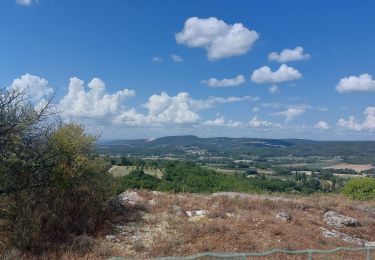
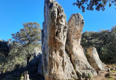
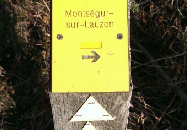
Randonnée Marche de 11 km à découvrir à Auvergne-Rhône-Alpes, Drôme, Montségur-sur-Lauzon. Cette randonnée est proposée par Pacekall.
Description
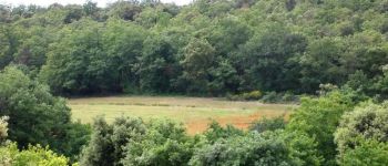
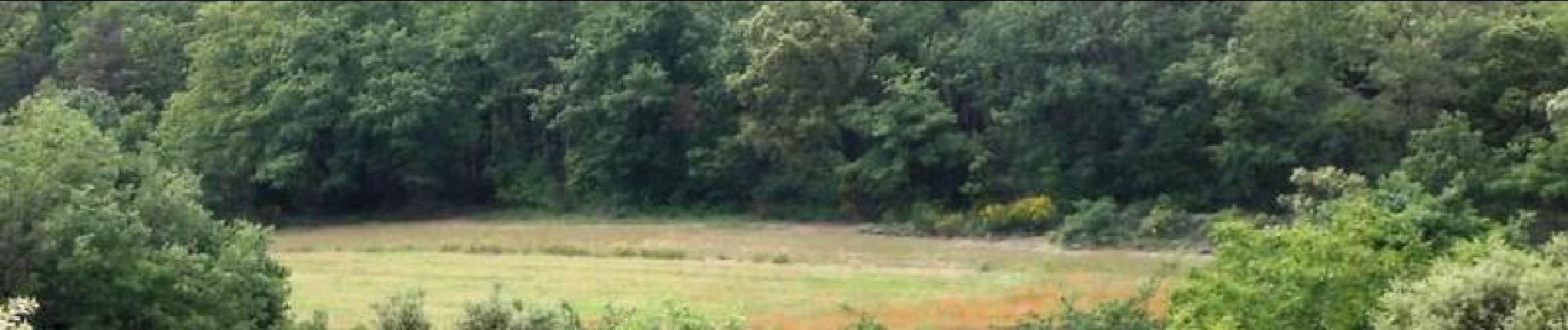
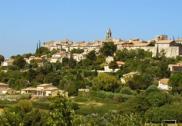
Situé au cœur de la vallée du Rhône, la commune de Montésgur a su préserver son charme naturel grâce à un patrimoine actif et confirmé. (source Wikipédia) D’autres informations et photos sur le site des Balades de Stéphane.
Localisation
Pays :
France
Région :
Auvergne-Rhône-Alpes
Département/Province :
Drôme
Commune :
Montségur-sur-Lauzon
Localité :
Unknown
Départ:(Dec)
Départ:(UTM)
648251 ; 4913645 (31T) N.
Commentaires
Randonnées à proximité
![Randonnée Marche Clansayes - Clansayes Le Rouvergue 7km - Photo](https://media.geolcdn.com/t/375/260/de3feb6f-5587-4e87-a580-1261cf3df48e.jpg&format=jpg&maxdim=2)
![Marche Marche](https://static1.geolcdn.com/sitytour/trail-icons/101.png)
Clansayes Le Rouvergue 7km
Marche
Facile
(2)
Clansayes,
Auvergne-Rhône-Alpes,
Drôme,
France
![](/images/other/stat-length.png)
7,2 km | 8,4 km-effort
2h 0min
![](https://static1.geolcdn.com/siteimages/upload/files/16400158638029165_repeat_loop_refresh_sync_direction_icon.png)
Oui
![Randonnée Marche Chantemerle-lès-Grignan - Chantemerle -lès-Grignan Les crevasses Le Rouvergue 14km - Photo](https://media.geolcdn.com/t/375/260/831a71a9-7103-4579-b58f-a481dab0e6f2.jpg&format=jpg&maxdim=2)
![Marche Marche](https://static1.geolcdn.com/sitytour/trail-icons/101.png)
Chantemerle -lès-Grignan Les crevasses Le Rouvergue 14km
Marche
Moyen
(1)
Chantemerle-lès-Grignan,
Auvergne-Rhône-Alpes,
Drôme,
France
![](/images/other/stat-length.png)
13,8 km | 16,9 km-effort
3h 50min
![](https://static1.geolcdn.com/siteimages/upload/files/16400158638029165_repeat_loop_refresh_sync_direction_icon.png)
Oui
![Randonnée Marche Chantemerle-lès-Grignan - Les Crevasses de Chantemerle Les Grignans 7Km5 - Photo](https://media.geolcdn.com/t/375/260/cedb0d20-c0ad-495a-acf8-00c291c6b1fd.jpg&format=jpg&maxdim=2)
![Marche Marche](https://static1.geolcdn.com/sitytour/trail-icons/101.png)
Les Crevasses de Chantemerle Les Grignans 7Km5
Marche
Moyen
(1)
Chantemerle-lès-Grignan,
Auvergne-Rhône-Alpes,
Drôme,
France
![](/images/other/stat-length.png)
7,4 km | 9,6 km-effort
2h 12min
![](https://static1.geolcdn.com/siteimages/upload/files/16400158638029165_repeat_loop_refresh_sync_direction_icon.png)
Oui
![Randonnée Marche Chantemerle-lès-Grignan - Chantemerle-Les Grignan Les jumelles du Rozet Clansayes 15km - Photo](https://media.geolcdn.com/t/375/260/e778a7ff-aae4-45e1-a529-5e7212fd1471.jpg&format=jpg&maxdim=2)
![Marche Marche](https://static1.geolcdn.com/sitytour/trail-icons/101.png)
Chantemerle-Les Grignan Les jumelles du Rozet Clansayes 15km
Marche
Très difficile
(3)
Chantemerle-lès-Grignan,
Auvergne-Rhône-Alpes,
Drôme,
France
![](/images/other/stat-length.png)
15 km | 19,7 km-effort
4h 28min
![](https://static1.geolcdn.com/siteimages/upload/files/16400158638029165_repeat_loop_refresh_sync_direction_icon.png)
Oui
![Randonnée Marche Montségur-sur-Lauzon - Bassin des druides. Montségur-lauzon - Photo](https://media.geolcdn.com/t/375/260/ext.jpg?maxdim=2&url=https%3A%2F%2Fservices.sitytrail.com%2FGeolivesWS%2FDownloadMedia.ashx%3FTrailID%3D892897%26Media%3Dfix__20180124152347.jpg)
![Marche Marche](https://static1.geolcdn.com/sitytour/trail-icons/101.png)
Bassin des druides. Montségur-lauzon
Marche
Facile
(1)
Montségur-sur-Lauzon,
Auvergne-Rhône-Alpes,
Drôme,
France
![](/images/other/stat-length.png)
10,7 km | 13,1 km-effort
3h 14min
![](https://static1.geolcdn.com/siteimages/upload/files/16400158638029165_repeat_loop_refresh_sync_direction_icon.png)
Oui
![Randonnée Marche Chantemerle-lès-Grignan - Crevasses de Chantemerle - Photo](https://media.geolcdn.com/t/375/260/ext.jpg?maxdim=2&url=https%3A%2F%2Fstatic1.geolcdn.com%2Fsiteimages%2Fupload%2Ffiles%2F1553511878bg_sport_marche.png)
![Marche Marche](https://static1.geolcdn.com/sitytour/trail-icons/101.png)
Crevasses de Chantemerle
Marche
Moyen
(1)
Chantemerle-lès-Grignan,
Auvergne-Rhône-Alpes,
Drôme,
France
![](/images/other/stat-length.png)
6,9 km | 9 km-effort
2h 2min
![](https://static1.geolcdn.com/siteimages/upload/files/16400158638029165_repeat_loop_refresh_sync_direction_icon.png)
Oui
![Randonnée Marche Suze-la-Rousse - soleirieu - Photo](https://media.geolcdn.com/t/375/260/ext.jpg?maxdim=2&url=https%3A%2F%2Fstatic1.geolcdn.com%2Fsiteimages%2Fupload%2Ffiles%2F1553511878bg_sport_marche.png)
![Marche Marche](https://static1.geolcdn.com/sitytour/trail-icons/101.png)
soleirieu
Marche
Facile
(1)
Suze-la-Rousse,
Auvergne-Rhône-Alpes,
Drôme,
France
![](/images/other/stat-length.png)
11,9 km | 14,7 km-effort
3h 8min
![](https://static1.geolcdn.com/siteimages/upload/files/16400158638029165_repeat_loop_refresh_sync_direction_icon.png)
Oui
![Randonnée Marche Clansayes - Clansayes Le Rouvergue 11km - Photo](https://media.geolcdn.com/t/375/260/89c952dc-9c57-4311-93c9-63263f0349ef.jpg&format=jpg&maxdim=2)
![Marche Marche](https://static1.geolcdn.com/sitytour/trail-icons/101.png)
Clansayes Le Rouvergue 11km
Marche
Difficile
Clansayes,
Auvergne-Rhône-Alpes,
Drôme,
France
![](/images/other/stat-length.png)
11,1 km | 14,5 km-effort
3h 21min
![](https://static1.geolcdn.com/siteimages/upload/files/16400158638029165_repeat_loop_refresh_sync_direction_icon.png)
Oui
![Randonnée Marche Clansayes - Clansayes Le Rouvergue 8km. - Photo](https://media.geolcdn.com/t/375/260/00183d4b-7799-462e-b9b9-5e3d9f7cb776.jpg&format=jpg&maxdim=2)
![Marche Marche](https://static1.geolcdn.com/sitytour/trail-icons/101.png)
Clansayes Le Rouvergue 8km.
Marche
Facile
Clansayes,
Auvergne-Rhône-Alpes,
Drôme,
France
![](/images/other/stat-length.png)
7,8 km | 9,3 km-effort
3h 15min
![](https://static1.geolcdn.com/siteimages/upload/files/16400158638029165_repeat_loop_refresh_sync_direction_icon.png)
Oui