Randonnée Marche Unknown - [Vallée de la Mort] Golden Canyon and Badlands - Photo

[Vallée de la Mort] Golden Canyon and Badlands

 lasvergn
lasvergn

Utilisateur

© OpenStreetMap contributors
Longueur
Longueur
11,9 km
Altitude max
Altitude max
202 m
Dénivelé positif
Dénivelé positif
363 m
Km-Effort
Km-Effort  
16,7 km
Altitude min
Altitude min
-53 m
Dénivelé négatif
Dénivelé négatif
368 m
Boucle
Boucle
Oui
Date de création :
2018-04-17 14:50:14.08
Dernière modification :
2018-04-17 14:50:14.08

(0 Avis)

Marche
Marche
3h36
Difficulté : Difficile

Scannez ce code QR pour ouvrir la randonnée dans l'application SityTrail

Application GPS de randonnée GRATUITE

Logo SityTrail SityTrail

IGN / Instituts géographiques

Télécharger SityTrail sur l'App Store Télécharger SityTrail sur Google Play

Logo SityTrail SityTrail World

Le monde est à vous

Télécharger SityTrail sur l'App Store Télécharger SityTrail sur Google Play Télécharger SityTrail sur Huawei AppGallery

À propos

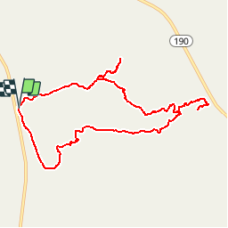
Randonnée Marche de 11,9 km à découvrir à Californie, Inyo County. Cette randonnée est proposée par lasvergn.

Description

A labyrinth landscape of golden colored hills and winding narrow canyons create hiking options ranging from easy strolls to strenuous adventures. The most popular routes listed here can be combined with one another for longer adventures.

Profil altimétrique

Localisation

Pays :
États-Unis
Région :
Californie
Département/Province :
Inyo County
Commune :
Unknown
Localité :
Unknown
Départ:(UTM)
513745 ; 4030599 (11S) N.

Randonnées à proximité

Randonnée Marche  - Golden-Canyon-etc - Photo
Marche
raymondfn

Marche

Difficile
, Californie, Inyo County, États-Unis
11,9 km | 16,8 km-effort
3h 36min
Oui


Fermer
Mes abonnements