![](/images/other/stat-length.png)
![Randonnée Marche Riva del Garda - Santa Barbara - Photo](https://media.geolcdn.com/t/1900/400/ext.pjpeg?maxdim=2&url=https%3A%2F%2Fstatic1.geolcdn.com%2Fsiteimages%2Fupload%2Ffiles%2F1553511878bg_sport_marche.png)
Santa Barbara
Dhendrickx71
Utilisateur
![Longueur](/images/other/stat-length.png)
![Altitude max](https://static1.geolcdn.com/siteimages/upload/files/1508320355ic_sort_altitude_max_24dp.png)
![Dénivelé positif](https://static1.geolcdn.com/siteimages/upload/files/1508320355ic_sort_den_pos_24dp.png)
![Km-Effort](/images/other/stat-length.png)
![Altitude min](https://static1.geolcdn.com/siteimages/upload/files/1508320355ic_sort_altitude_min_24dp.png)
![Dénivelé négatif](https://static1.geolcdn.com/siteimages/upload/files/1508320355ic_sort_den_neg_24dp.png)
![Boucle](https://static1.geolcdn.com/siteimages/upload/files/16400158638029165_repeat_loop_refresh_sync_direction_icon.png)
![Marche](https://static1.geolcdn.com/sitytour/trail-icons/101.png)
3h40
Difficulté : Difficile
![Scannez ce code QR pour ouvrir la randonnée dans l'application SityTrail](https://capi.geolives.com/qq0zvz2zws4bq2lad0pu/sitytour/trails/868023/qr.png?size=200)
Application GPS de randonnée GRATUITE
À propos
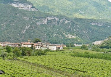
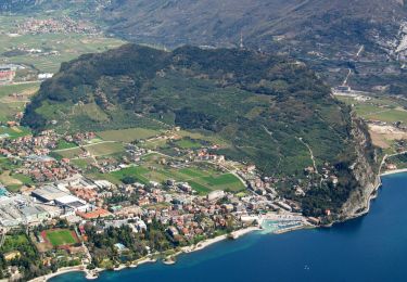
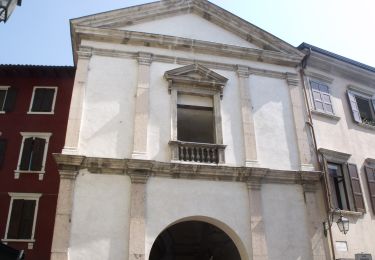
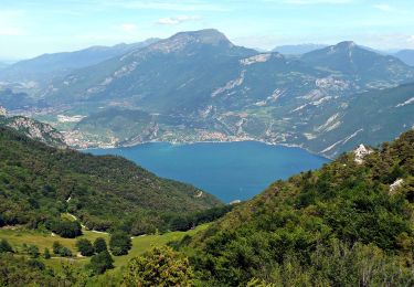
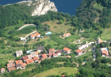
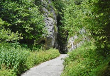
Randonnée Marche de 8,7 km à découvrir à Trentin-Haut-Adige, Provincia di Trento, Riva del Garda. Cette randonnée est proposée par Dhendrickx71.
Description
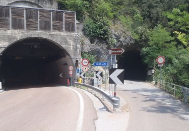
From Riva go up to the Bastione. Then take the path nr. 404 to Santa Barbara chapel.
The return will be done by the same path up to the crossing that goes down towards the Bastione. There, instead of going down, follow the forest path in the direction of Foci and San Giacomo. Return then to Riva del Garda.
Localisation
Commentaires
Randonnées à proximité
![Randonnée A pied Riva del Garda - Sentiero delle Laste basse - Berghem](https://media.geolcdn.com/t/375/260/e00a9dfa-9e4b-4fb9-ac77-31d044744a99.jpeg&format=jpg&maxdim=2)
![A pied A pied](https://static1.geolcdn.com/sitytour/trail-icons/100.png)
A pied
![](/images/other/stat-length.png)
![](https://static1.geolcdn.com/siteimages/upload/files/16400158638029165_repeat_loop_refresh_sync_direction_icon.png)
![Randonnée A pied Arco - Sentiero del Monte Colt - Photo](https://media.geolcdn.com/t/375/260/3edb8831-39c9-4610-a131-7d058c8d41f9.jpeg&format=jpg&maxdim=2)
![A pied A pied](https://static1.geolcdn.com/sitytour/trail-icons/100.png)
A pied
![](/images/other/stat-length.png)
![](https://static1.geolcdn.com/siteimages/upload/files/16400158638029165_repeat_loop_refresh_sync_direction_icon.png)
![Randonnée A pied Riva del Garda - Via ferrata](https://media.geolcdn.com/t/375/260/924836d8-b100-40e9-ab97-6e3c0247fb36.jpeg&format=jpg&maxdim=2)
![A pied A pied](https://static1.geolcdn.com/sitytour/trail-icons/100.png)
A pied
![](/images/other/stat-length.png)
![](https://static1.geolcdn.com/siteimages/upload/files/16400158638029165_repeat_loop_refresh_sync_direction_icon.png)
![Randonnée A pied Tenno - IT-O480 - Photo](https://media.geolcdn.com/t/375/260/09d96c99-5a90-43ce-9c2f-a9276d430601.jpeg&format=jpg&maxdim=2)
![A pied A pied](https://static1.geolcdn.com/sitytour/trail-icons/100.png)
A pied
![](/images/other/stat-length.png)
![](https://static1.geolcdn.com/siteimages/upload/files/16400158638029165_repeat_loop_refresh_sync_direction_icon.png)
![Randonnée A pied Ledro - Via ferrata del Bastione e della Rocchetta - Photo](https://media.geolcdn.com/t/375/260/a81e63e8-9f93-4a8e-a15c-f1a884a2b10c.jpeg&format=jpg&maxdim=2)
![A pied A pied](https://static1.geolcdn.com/sitytour/trail-icons/100.png)
A pied
![](/images/other/stat-length.png)
![](https://static1.geolcdn.com/siteimages/upload/files/16400158638029165_repeat_loop_refresh_sync_direction_icon.png)
![Randonnée A pied Ledro - Via de Ari e sentiero Rino Zanotti - Photo](https://media.geolcdn.com/t/375/260/51a77690-51e7-48ea-989c-3e39c718514c.jpeg&format=jpg&maxdim=2)
![A pied A pied](https://static1.geolcdn.com/sitytour/trail-icons/100.png)
A pied
![](/images/other/stat-length.png)
![](https://static1.geolcdn.com/siteimages/upload/files/16400158638029165_repeat_loop_refresh_sync_direction_icon.png)
![Randonnée A pied Riva del Garda - Sentér di Cima Nara - Photo](https://media.geolcdn.com/t/375/260/42befeb4-1be3-472e-b614-33994d4081d7.jpeg&format=jpg&maxdim=2)
![A pied A pied](https://static1.geolcdn.com/sitytour/trail-icons/100.png)
A pied
![](/images/other/stat-length.png)
![](https://static1.geolcdn.com/siteimages/upload/files/16400158638029165_repeat_loop_refresh_sync_direction_icon.png)
![Randonnée A pied Riva del Garda - Sentér de Palaer - Photo](https://media.geolcdn.com/t/375/260/f333d570-7d61-46f8-b37b-a1ef19502aa9.jpeg&format=jpg&maxdim=2)
![A pied A pied](https://static1.geolcdn.com/sitytour/trail-icons/100.png)
A pied
![](/images/other/stat-length.png)
![](https://static1.geolcdn.com/siteimages/upload/files/16400158638029165_repeat_loop_refresh_sync_direction_icon.png)
![Randonnée A pied Riva del Garda - IT-O422 - Photo](https://media.geolcdn.com/t/375/260/833639fd-6f4b-4cef-bb7e-2d9b7dcc2e07.jpeg&format=jpg&maxdim=2)
![A pied A pied](https://static1.geolcdn.com/sitytour/trail-icons/100.png)
A pied
![](/images/other/stat-length.png)
![](https://static1.geolcdn.com/siteimages/upload/files/16400158638029165_repeat_loop_refresh_sync_direction_icon.png)
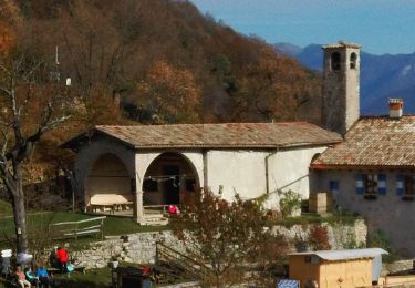
Belle balade assez dure. On la faisait en famille mais quand j'étais gamin. La vue sur Riva est magnifique.