


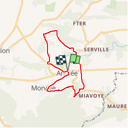

10,8 km | 13,8 km-effort


Utilisateur


Application GPS de randonnée GRATUITE
 SityTrail
IGN / Instituts géographiques
SityTrail World
Le monde est à vous
Randonnée Marche de 11,2 km à découvrir à Wallonie, Namur, Onhaye. Cette randonnée est proposée par GerardBouche.
Belle balade des trois Châteaux ... Château de la Forge, Château d'Ostemerée et le Château Fontaine.
Attention ... le sentier contournant le Château Fontaine est en propriété privée et soumis à autorisation. Si pas, longer la N915 sur qlq centaines de mètres jusque K1).
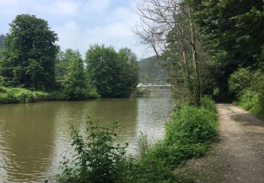
 - Photo 1")
 - Photo 2")

Marche

Marche

Marche

Marche

Marche

Marche
Marche
Marche