![](/images/other/stat-length.png)
![Randonnée Cheval Neufchâteau - Cousteumont et le bois d'Ospau 2 - Photo](https://media.geolcdn.com/t/1900/400/ext.pjpeg?maxdim=2&url=https%3A%2F%2Fservices.sitytrail.com%2FGeolivesWS%2FDownloadMedia.ashx%3FTrailID%3D856350%26Media%3D20171102161310.jpg)
Cousteumont et le bois d'Ospau 2
alfreson
Utilisateur
![Longueur](/images/other/stat-length.png)
Longueur
12,3 km
![Altitude max](https://static1.geolcdn.com/siteimages/upload/files/1508320355ic_sort_altitude_max_24dp.png)
Altitude max
485 m
![Dénivelé positif](https://static1.geolcdn.com/siteimages/upload/files/1508320355ic_sort_den_pos_24dp.png)
Dénivelé positif
234 m
![Km-Effort](/images/other/stat-length.png)
Km-Effort
15,4 km
![Altitude min](https://static1.geolcdn.com/siteimages/upload/files/1508320355ic_sort_altitude_min_24dp.png)
Altitude min
389 m
![Dénivelé négatif](https://static1.geolcdn.com/siteimages/upload/files/1508320355ic_sort_den_neg_24dp.png)
Dénivelé négatif
234 m
![Boucle](https://static1.geolcdn.com/siteimages/upload/files/16400158638029165_repeat_loop_refresh_sync_direction_icon.png)
Boucle
Oui
Date de création :
2018-04-17 12:03:02.411
Dernière modification :
2018-04-17 12:03:02.411
![Cheval](https://static1.geolcdn.com/sitytour/trail-icons/300.png)
2h25
Difficulté : Facile
![Scannez ce code QR pour ouvrir la randonnée dans l'application SityTrail](https://capi.geolives.com/qq0zvz2zws4bq2lad0pu/sitytour/trails/856350/qr.png?size=200)
Application GPS de randonnée GRATUITE
À propos
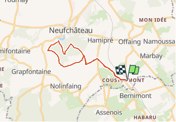
Randonnée Cheval de 12,3 km à découvrir à Wallonie, Luxembourg, Neufchâteau. Cette randonnée est proposée par alfreson.
Description
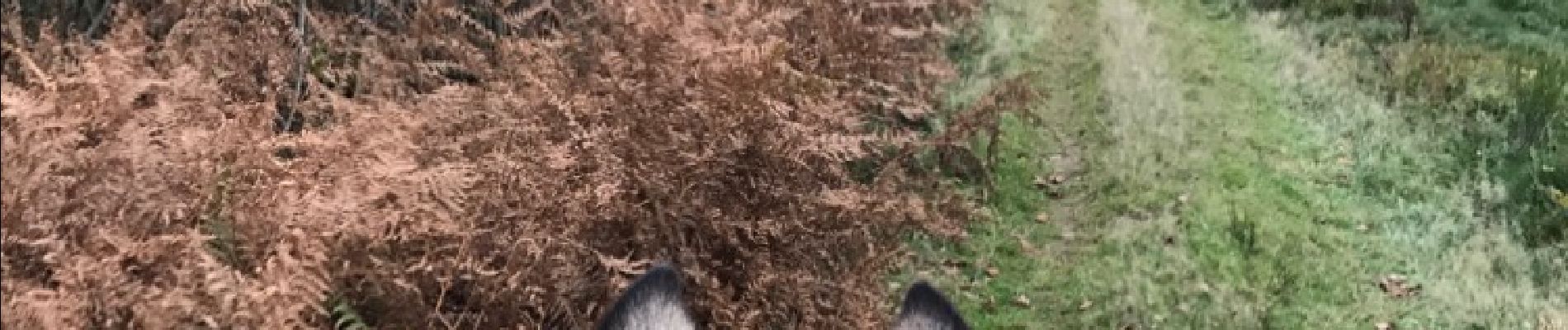
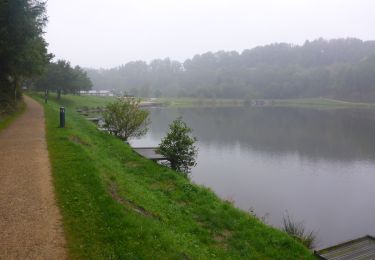
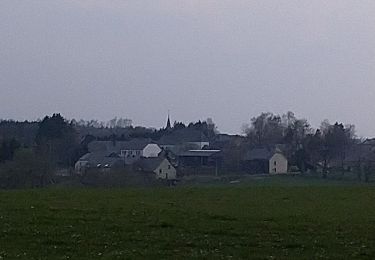
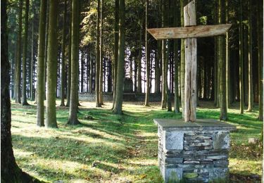
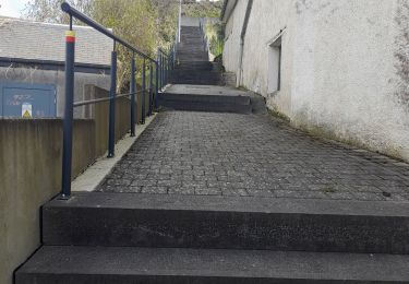
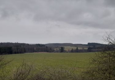
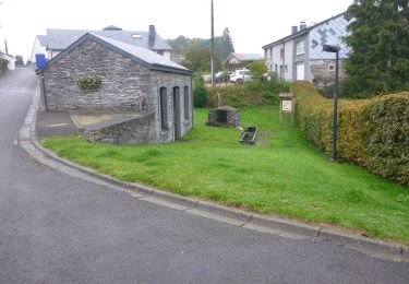
Campagne, bois et lac de Neufchâteau... un passage délicat le long de la rivière, sur une sente étroite avec de la rubalise qui indique le danger à gauche, avec le talus presque à pic qui surplombe la rivière...
Localisation
Pays :
Belgique
Région :
Wallonie
Département/Province :
Luxembourg
Commune :
Neufchâteau
Localité :
Hamipré
Départ:(Dec)
Départ:(UTM)
678069 ; 5521266 (31U) N.
Commentaires
Randonnées à proximité
![Marche Marche](https://static1.geolcdn.com/sitytour/trail-icons/101.png)
RB-Lu-21_Neufchâteau
Marche
Très facile
(8)
Neufchâteau,
Wallonie,
Luxembourg,
Belgique
![](/images/other/stat-length.png)
24 km | 31 km-effort
6h 29min
![](https://static1.geolcdn.com/siteimages/upload/files/16400158638029165_repeat_loop_refresh_sync_direction_icon.png)
Oui
![Marche Marche](https://static1.geolcdn.com/sitytour/trail-icons/101.png)
RB-Lu-21_Neufchâteau_via-racc-1
Marche
Très facile
(2)
Neufchâteau,
Wallonie,
Luxembourg,
Belgique
![](/images/other/stat-length.png)
11,2 km | 14,4 km-effort
3h 4min
![](https://static1.geolcdn.com/siteimages/upload/files/16400158638029165_repeat_loop_refresh_sync_direction_icon.png)
Oui
![Randonnée Marche Léglise - Ebly - Vaux-lez-Chêne - Photo](https://media.geolcdn.com/t/375/260/4443fdba-4049-42b8-95b3-28f013a869fb.jpg&format=jpg&maxdim=2)
![Marche Marche](https://static1.geolcdn.com/sitytour/trail-icons/101.png)
Ebly - Vaux-lez-Chêne
Marche
Facile
(1)
Léglise,
Wallonie,
Luxembourg,
Belgique
![](/images/other/stat-length.png)
3 km | 3,9 km-effort
45min
![](https://static1.geolcdn.com/siteimages/upload/files/16400158638029165_repeat_loop_refresh_sync_direction_icon.png)
Oui
![Randonnée Marche Neufchâteau - Le Sentier du Bois d'Ospôt - Photo](https://media.geolcdn.com/t/375/260/ext.jpg?maxdim=2&url=https%3A%2F%2Fservices.sitytrail.com%2FGeolivesWS%2FDownloadMedia.ashx%3FTrailID%3D314177%26Media%3Da3f0c943-b6aa-42ba-a976-375fc630bff4.jpg)
![Marche Marche](https://static1.geolcdn.com/sitytour/trail-icons/101.png)
Le Sentier du Bois d'Ospôt
Marche
Facile
(2)
Neufchâteau,
Wallonie,
Luxembourg,
Belgique
![](/images/other/stat-length.png)
6,6 km | 8,2 km-effort
1h 48min
![](https://static1.geolcdn.com/siteimages/upload/files/16400158638029165_repeat_loop_refresh_sync_direction_icon.png)
Oui
![Randonnée Marche Léglise - Marche ADEPS 10KM600 à Leglise. - Photo](https://media.geolcdn.com/t/375/260/22df4f57-b50c-4a03-931b-ccb162dab65d.jpg&format=jpg&maxdim=2)
![Marche Marche](https://static1.geolcdn.com/sitytour/trail-icons/101.png)
Marche ADEPS 10KM600 à Leglise.
Marche
Facile
Léglise,
Wallonie,
Luxembourg,
Belgique
![](/images/other/stat-length.png)
10,6 km | 13 km-effort
2h 8min
![](https://static1.geolcdn.com/siteimages/upload/files/16400158638029165_repeat_loop_refresh_sync_direction_icon.png)
Oui
![Randonnée Marche Neufchâteau - Marche ADEPS 8K500?? à (Namoussart) Neufchateau - Photo](https://media.geolcdn.com/t/375/260/394ab4a5-c5a6-43e2-b98b-c33bbaf2a33e.jpg&format=jpg&maxdim=2)
![Marche Marche](https://static1.geolcdn.com/sitytour/trail-icons/101.png)
Marche ADEPS 8K500?? à (Namoussart) Neufchateau
Marche
Facile
Neufchâteau,
Wallonie,
Luxembourg,
Belgique
![](/images/other/stat-length.png)
8,5 km | 10,4 km-effort
1h 43min
![](https://static1.geolcdn.com/siteimages/upload/files/16400158638029165_repeat_loop_refresh_sync_direction_icon.png)
Oui
![Randonnée A pied Neufchâteau - Promenade des Vannettes - Photo](https://media.geolcdn.com/t/375/260/c94cab10-49b6-4e98-8b22-803163741678.jpeg&format=jpg&maxdim=2)
![A pied A pied](https://static1.geolcdn.com/sitytour/trail-icons/100.png)
Promenade des Vannettes
A pied
Facile
Neufchâteau,
Wallonie,
Luxembourg,
Belgique
![](/images/other/stat-length.png)
12,4 km | 16 km-effort
3h 38min
![](https://static1.geolcdn.com/siteimages/upload/files/16400158638029165_repeat_loop_refresh_sync_direction_icon.png)
Oui
![Marche Marche](https://static1.geolcdn.com/sitytour/trail-icons/101.png)
RB-Lu-21_Neufchâteau_via-racc-2
Marche
Très facile
Neufchâteau,
Wallonie,
Luxembourg,
Belgique
![](/images/other/stat-length.png)
16,5 km | 21 km-effort
4h 32min
![](https://static1.geolcdn.com/siteimages/upload/files/16400158638029165_repeat_loop_refresh_sync_direction_icon.png)
Oui
![Randonnée V.T.T. Léglise - 41km autour de Léglise - Photo](https://media.geolcdn.com/t/375/260/ext.jpg?maxdim=2&url=https%3A%2F%2Fstatic1.geolcdn.com%2Fsiteimages%2Fupload%2Ffiles%2F1524743154velo.jpg)
![V.T.T. V.T.T.](https://static1.geolcdn.com/sitytour/trail-icons/202.png)
41km autour de Léglise
V.T.T.
Moyen
(2)
Léglise,
Wallonie,
Luxembourg,
Belgique
![](/images/other/stat-length.png)
41 km | 51 km-effort
2h 22min
![](https://static1.geolcdn.com/siteimages/upload/files/16400158638029165_repeat_loop_refresh_sync_direction_icon.png)
Oui