![](/images/other/stat-length.png)
![Randonnée Marche Malarce-sur-la-Thines - Thines 2017/10/16 - Photo](https://media.geolcdn.com/t/1900/400/ext.pjpeg?maxdim=2&url=https%3A%2F%2Fservices.sitytrail.com%2FGeolivesWS%2FDownloadMedia.ashx%3FTrailID%3D846816%26Media%3Dfix__20171015172524.jpg)
Thines 2017/10/16
fario
Utilisateur
![Longueur](/images/other/stat-length.png)
![Altitude max](https://static1.geolcdn.com/siteimages/upload/files/1508320355ic_sort_altitude_max_24dp.png)
![Dénivelé positif](https://static1.geolcdn.com/siteimages/upload/files/1508320355ic_sort_den_pos_24dp.png)
![Km-Effort](/images/other/stat-length.png)
![Altitude min](https://static1.geolcdn.com/siteimages/upload/files/1508320355ic_sort_altitude_min_24dp.png)
![Dénivelé négatif](https://static1.geolcdn.com/siteimages/upload/files/1508320355ic_sort_den_neg_24dp.png)
![Boucle](https://static1.geolcdn.com/siteimages/upload/files/16400158638029165_repeat_loop_refresh_sync_direction_icon.png)
![Marche](https://static1.geolcdn.com/sitytour/trail-icons/101.png)
6h06
Difficulté : Moyen
![Scannez ce code QR pour ouvrir la randonnée dans l'application SityTrail](https://capi.geolives.com/qq0zvz2zws4bq2lad0pu/sitytour/trails/846816/qr.png?size=200)
Application GPS de randonnée GRATUITE
À propos
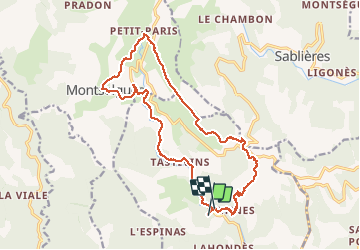
Randonnée Marche de 19,4 km à découvrir à Auvergne-Rhône-Alpes, Ardèche, Malarce-sur-la-Thines. Cette randonnée est proposée par fario.
Description
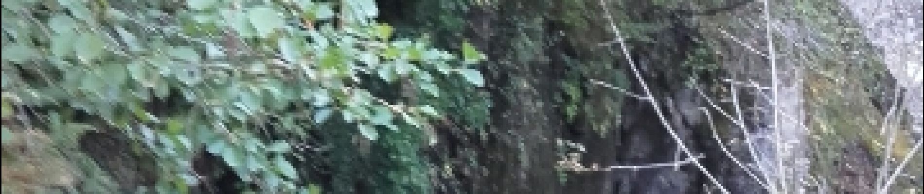
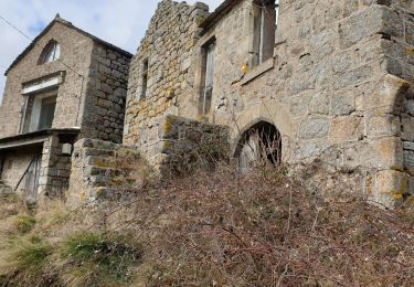
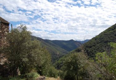
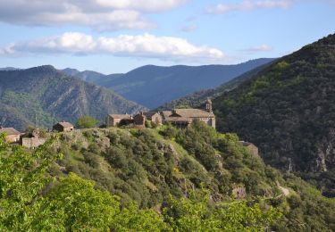
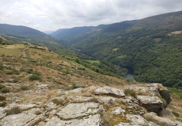
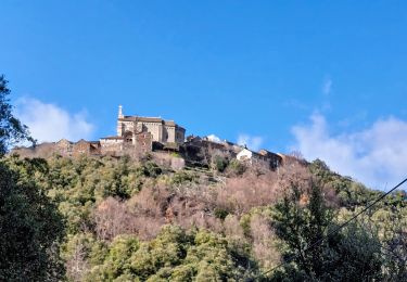
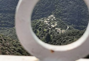
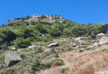
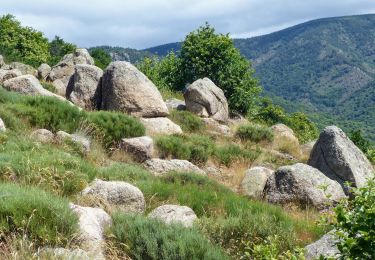
Arrivée par une petite route au pied du village de thines départ de la rando, Montée à Thines village attachant , plein de poésies, avec une très belle église. Chemins et paysage variés au travers de chaitaigneraie, plateaux dominants et gorge de la thines, très belle rivière. Tout le long un bel habitat typique. Chemin faisant nous avons été accompagné par une chien de chasse et un chien de berger et nous avons croisé des ânes, des moutons et des vaches. Très bonne journée entre amis.
Localisation
Commentaires
Randonnées à proximité
![Randonnée Marche Montselgues - Montselgues - Les chaos par les crètes-11km+219m - Photo](https://media.geolcdn.com/t/375/260/0482280d-355b-4aac-a4d8-303673dcfa53.jpg&format=jpg&maxdim=2)
![Marche Marche](https://static1.geolcdn.com/sitytour/trail-icons/101.png)
Marche
![](/images/other/stat-length.png)
![](https://static1.geolcdn.com/siteimages/upload/files/16400158638029165_repeat_loop_refresh_sync_direction_icon.png)
![Randonnée Marche Malarce-sur-la-Thines - Le pèlerinage des trois croix - Malarce-sur-la-Thines - Photo](https://media.geolcdn.com/t/375/260/ext.jpg?maxdim=2&url=https%3A%2F%2Fservices.sitytrail.com%2FGeolivesWS%2FDownloadMedia.ashx%3FTrailID%3D316874%26Media%3D15958_6.jpg)
![Marche Marche](https://static1.geolcdn.com/sitytour/trail-icons/101.png)
Marche
![](/images/other/stat-length.png)
![](https://static1.geolcdn.com/siteimages/upload/files/16400158638029165_repeat_loop_refresh_sync_direction_icon.png)
![Randonnée Marche Malarce-sur-la-Thines - Thines-Ranc Fournassier 11km - Photo](https://media.geolcdn.com/t/375/260/a811a20f-4e11-4e3d-bb5b-90bd14a80ef4.jpg&format=jpg&maxdim=2)
![Marche Marche](https://static1.geolcdn.com/sitytour/trail-icons/101.png)
Marche
![](/images/other/stat-length.png)
![](https://static1.geolcdn.com/siteimages/upload/files/16400158638029165_repeat_loop_refresh_sync_direction_icon.png)
![Randonnée Marche Montselgues - Etape2 Cévenne ardéchoise 17km - Photo](https://media.geolcdn.com/t/375/260/969831b8-bbd1-4f86-b20a-8870f6dd33b2.jpg&format=jpg&maxdim=2)
![Marche Marche](https://static1.geolcdn.com/sitytour/trail-icons/101.png)
Marche
![](/images/other/stat-length.png)
![](https://static1.geolcdn.com/siteimages/upload/files/16400158638029165_repeat_loop_refresh_sync_direction_icon.png)
![Randonnée Marche Malarce-sur-la-Thines - Thines-Peyre 10km - Photo](https://media.geolcdn.com/t/375/260/503418e2-988f-4773-8566-0c1b516bfb75.jpg&format=jpg&maxdim=2)
![Marche Marche](https://static1.geolcdn.com/sitytour/trail-icons/101.png)
Marche
![](/images/other/stat-length.png)
![](https://static1.geolcdn.com/siteimages/upload/files/16400158638029165_repeat_loop_refresh_sync_direction_icon.png)
![Randonnée Marche Malarce-sur-la-Thines - Thines Ranc - Fournassier 11km - Photo](https://media.geolcdn.com/t/375/260/26dbe7a7-37b4-4b33-8a3c-6f5f73efc18b.jpg&format=jpg&maxdim=2)
![Marche Marche](https://static1.geolcdn.com/sitytour/trail-icons/101.png)
Marche
![](/images/other/stat-length.png)
![](https://static1.geolcdn.com/siteimages/upload/files/16400158638029165_repeat_loop_refresh_sync_direction_icon.png)
![Randonnée Marche Malarce-sur-la-Thines - Thines et Peyre par GRP puis GR4. - Photo](https://media.geolcdn.com/t/375/260/72823850-00c2-422a-8128-8a52686bc6bc.jpg&format=jpg&maxdim=2)
![Marche Marche](https://static1.geolcdn.com/sitytour/trail-icons/101.png)
Marche
![](/images/other/stat-length.png)
![](https://static1.geolcdn.com/siteimages/upload/files/16400158638029165_repeat_loop_refresh_sync_direction_icon.png)
![Randonnée Marche Sablières - Pont Du Mas - Boules de Gargantua 14km - Photo](https://media.geolcdn.com/t/375/260/5cb15b8f-2fd3-4c0f-8366-db0eb66204b6.jpg&format=jpg&maxdim=2)
![Marche Marche](https://static1.geolcdn.com/sitytour/trail-icons/101.png)
Marche
![](/images/other/stat-length.png)
![](https://static1.geolcdn.com/siteimages/upload/files/16400158638029165_repeat_loop_refresh_sync_direction_icon.png)
![Randonnée Marche Sablières - Pont du Mas - Boules de Gargantua - Photo](https://media.geolcdn.com/t/375/260/69b54ccf-6786-4aa1-9bd6-872344d5a4d9.jpg&format=jpg&maxdim=2)
![Marche Marche](https://static1.geolcdn.com/sitytour/trail-icons/101.png)
Marche
![](/images/other/stat-length.png)
![](https://static1.geolcdn.com/siteimages/upload/files/16400158638029165_repeat_loop_refresh_sync_direction_icon.png)