![](/images/other/stat-length.png)
![Randonnée Marche Saint-Rémy-de-Chargnat - St_Remy_Pic_Usson - Photo](https://media.geolcdn.com/t/1900/400/04fb18f3-77d1-43e8-809b-31619340b4d8.jpg&format=pjpeg&maxdim=2)
St_Remy_Pic_Usson
jagarnier
Utilisateur GUIDE
![Longueur](/images/other/stat-length.png)
Longueur
10,2 km
![Altitude max](https://static1.geolcdn.com/siteimages/upload/files/1508320355ic_sort_altitude_max_24dp.png)
Altitude max
595 m
![Dénivelé positif](https://static1.geolcdn.com/siteimages/upload/files/1508320355ic_sort_den_pos_24dp.png)
Dénivelé positif
270 m
![Km-Effort](/images/other/stat-length.png)
Km-Effort
13,8 km
![Altitude min](https://static1.geolcdn.com/siteimages/upload/files/1508320355ic_sort_altitude_min_24dp.png)
Altitude min
379 m
![Dénivelé négatif](https://static1.geolcdn.com/siteimages/upload/files/1508320355ic_sort_den_neg_24dp.png)
Dénivelé négatif
270 m
![Boucle](https://static1.geolcdn.com/siteimages/upload/files/16400158638029165_repeat_loop_refresh_sync_direction_icon.png)
Boucle
Oui
Date de création :
2018-04-17 10:19:52.24
Dernière modification :
2022-09-05 05:58:14.922
![Marche](https://static1.geolcdn.com/sitytour/trail-icons/101.png)
3h00
Difficulté : Facile
![Scannez ce code QR pour ouvrir la randonnée dans l'application SityTrail](https://capi.geolives.com/qq0zvz2zws4bq2lad0pu/sitytour/trails/843062/qr.png?size=200)
Application GPS de randonnée GRATUITE
À propos
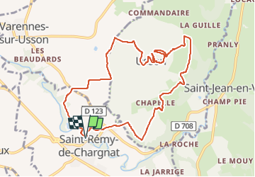
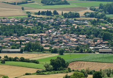
Randonnée Marche de 10,2 km à découvrir à Auvergne-Rhône-Alpes, Puy-de-Dôme, Saint-Rémy-de-Chargnat. Cette randonnée est proposée par jagarnier.
Description
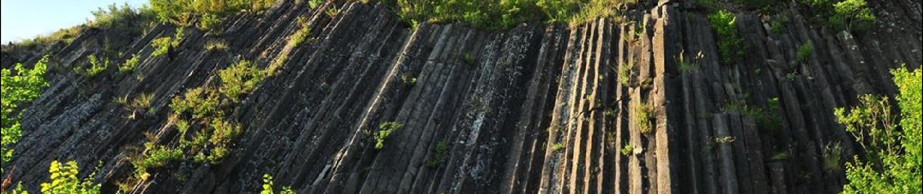
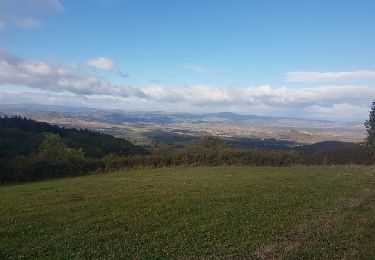
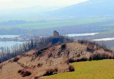
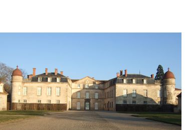
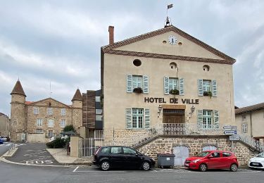
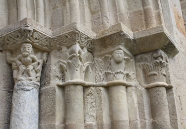
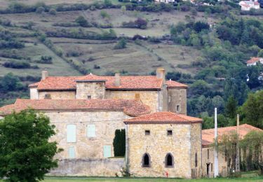
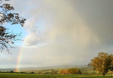
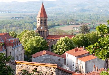
Usson village perché, son église, ses orgues basaltiques et son pic alimentent la curiosité des randonneurs. Les panoramas sur les monts Dore et la chaîne des Puys n’en sont pas moins remarquables.
Localisation
Pays :
France
Région :
Auvergne-Rhône-Alpes
Département/Province :
Puy-de-Dôme
Commune :
Saint-Rémy-de-Chargnat
Localité :
Unknown
Départ:(Dec)
Départ:(UTM)
525156 ; 5040120 (31T) N.
Commentaires
Randonnées à proximité
![Randonnée Moteur Issoire - monboissiers 2 - Photo](https://media.geolcdn.com/t/375/260/ext.jpg?maxdim=2&url=https%3A%2F%2Fservices.sitytrail.com%2FGeolivesWS%2FDownloadMedia.ashx%3FTrailID%3D987209%26Media%3Dfix__20171022103942.jpg)
![Moteur Moteur](https://static1.geolcdn.com/sitytour/trail-icons/400.png)
monboissiers 2
Moteur
Moyen
(1)
Issoire,
Auvergne-Rhône-Alpes,
Puy-de-Dôme,
France
![](/images/other/stat-length.png)
101 km | 129 km-effort
3h 0min
![](https://static1.geolcdn.com/siteimages/upload/files/16400158638029165_repeat_loop_refresh_sync_direction_icon.png)
Oui
![Randonnée Marche Brenat - Brenat_Tour_Gevillat - Photo](https://media.geolcdn.com/t/375/260/2b9dba0d-44c9-4336-a13d-50587f665150.jpg&format=jpg&maxdim=2)
![Marche Marche](https://static1.geolcdn.com/sitytour/trail-icons/101.png)
Brenat_Tour_Gevillat
Marche
Facile
(1)
Brenat,
Auvergne-Rhône-Alpes,
Puy-de-Dôme,
France
![](/images/other/stat-length.png)
9,3 km | 11,9 km-effort
2h 45min
![](https://static1.geolcdn.com/siteimages/upload/files/16400158638029165_repeat_loop_refresh_sync_direction_icon.png)
Oui
![Randonnée Marche Les Pradeaux - De l'Allier à l'Ailloux - Photo](https://media.geolcdn.com/t/375/260/ext.jpg?maxdim=2&url=https%3A%2F%2Fservices.sitytrail.com%2FGeolivesWS%2FDownloadMedia.ashx%3FTrailID%3D102201%26Media%3D2601_1.jpg)
![Marche Marche](https://static1.geolcdn.com/sitytour/trail-icons/101.png)
De l'Allier à l'Ailloux
Marche
Moyen
(1)
Les Pradeaux,
Auvergne-Rhône-Alpes,
Puy-de-Dôme,
France
![](/images/other/stat-length.png)
11,5 km | 13,1 km-effort
3h 0min
![](https://static1.geolcdn.com/siteimages/upload/files/16400158638029165_repeat_loop_refresh_sync_direction_icon.png)
Oui
![Randonnée A pied Sauxillanges - La Vallee de Civadoux - Photo](https://media.geolcdn.com/t/375/260/b4f7319b-3713-42b9-8b0d-6d7343ec86a5.jpeg&format=jpg&maxdim=2)
![A pied A pied](https://static1.geolcdn.com/sitytour/trail-icons/100.png)
La Vallee de Civadoux
A pied
Facile
Sauxillanges,
Auvergne-Rhône-Alpes,
Puy-de-Dôme,
France
![](/images/other/stat-length.png)
12,5 km | 19,5 km-effort
4h 26min
![](https://static1.geolcdn.com/siteimages/upload/files/16400158638029165_repeat_loop_refresh_sync_direction_icon.png)
Oui
![Randonnée A pied Lamontgie - Notre-Dame de Mailhat - Photo](https://media.geolcdn.com/t/375/260/8569347c-98a0-4a8f-9e69-27a1e8ebd4a8.jpeg&format=jpg&maxdim=2)
![A pied A pied](https://static1.geolcdn.com/sitytour/trail-icons/100.png)
Notre-Dame de Mailhat
A pied
Facile
Lamontgie,
Auvergne-Rhône-Alpes,
Puy-de-Dôme,
France
![](/images/other/stat-length.png)
8,4 km | 10,5 km-effort
2h 23min
![](https://static1.geolcdn.com/siteimages/upload/files/16400158638029165_repeat_loop_refresh_sync_direction_icon.png)
Oui
![Randonnée A pied Saint-Martin-des-Plains - Vallee de parcelles - Photo](https://media.geolcdn.com/t/375/260/c8678a81-89dc-4bd7-aa82-46bb9b00d226.jpeg&format=jpg&maxdim=2)
![A pied A pied](https://static1.geolcdn.com/sitytour/trail-icons/100.png)
Vallee de parcelles
A pied
Facile
Saint-Martin-des-Plains,
Auvergne-Rhône-Alpes,
Puy-de-Dôme,
France
![](/images/other/stat-length.png)
11,3 km | 13,8 km-effort
3h 8min
![](https://static1.geolcdn.com/siteimages/upload/files/16400158638029165_repeat_loop_refresh_sync_direction_icon.png)
Oui
![Randonnée A pied Usson - Le Pic d'Usson - Photo](https://media.geolcdn.com/t/375/260/6a96298d-c1d0-4fd4-b2cd-7460048c5b43.jpeg&format=jpg&maxdim=2)
![A pied A pied](https://static1.geolcdn.com/sitytour/trail-icons/100.png)
Le Pic d'Usson
A pied
Facile
Usson,
Auvergne-Rhône-Alpes,
Puy-de-Dôme,
France
![](/images/other/stat-length.png)
7,7 km | 9,6 km-effort
2h 11min
![](https://static1.geolcdn.com/siteimages/upload/files/16400158638029165_repeat_loop_refresh_sync_direction_icon.png)
Non
![Randonnée A pied Brenat - La Tour de Gevillat - Photo](https://media.geolcdn.com/t/375/260/12927b2d-86e8-4e4a-bbac-13d0164d4024.jpeg&format=jpg&maxdim=2)
![A pied A pied](https://static1.geolcdn.com/sitytour/trail-icons/100.png)
La Tour de Gevillat
A pied
Facile
Brenat,
Auvergne-Rhône-Alpes,
Puy-de-Dôme,
France
![](/images/other/stat-length.png)
9,8 km | 12,6 km-effort
2h 52min
![](https://static1.geolcdn.com/siteimages/upload/files/16400158638029165_repeat_loop_refresh_sync_direction_icon.png)
Oui
![Randonnée Marche Nonette-Orsonnette - Nonette_Val_Allier - Photo](https://media.geolcdn.com/t/375/260/6af492ac-412f-4f8d-b1d7-92987ee0d659.jpg&format=jpg&maxdim=2)
![Marche Marche](https://static1.geolcdn.com/sitytour/trail-icons/101.png)
Nonette_Val_Allier
Marche
Moyen
(1)
Nonette-Orsonnette,
Auvergne-Rhône-Alpes,
Puy-de-Dôme,
France
![](/images/other/stat-length.png)
9,9 km | 13,4 km-effort
3h 0min
![](https://static1.geolcdn.com/siteimages/upload/files/16400158638029165_repeat_loop_refresh_sync_direction_icon.png)
Oui