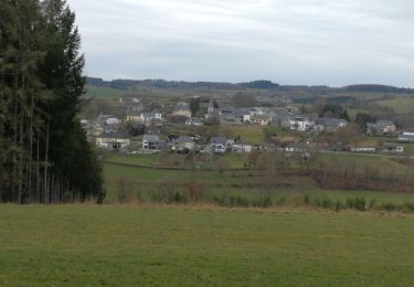
7,9 km | 9,6 km-effort
FFBMP Longvilly
fra_depoorter
Utilisateur
Longueur
13,6 km
Altitude max
517 m
Dénivelé positif
307 m
Km-Effort
17,6 km
Altitude min
376 m
Dénivelé négatif
305 m
Boucle
Oui
Date de création :
2018-04-17 10:06:13.979
Dernière modification :
2018-04-17 10:06:13.979
3h03
Difficulté : Inconnu
Application GPS de randonnée GRATUITE
À propos
Randonnée Marche de 13,6 km à découvrir à Wallonie, Luxembourg, Bastogne. Cette randonnée est proposée par fra_depoorter.
Description
e
Localisation
Pays :
Belgique
Région :
Wallonie
Département/Province :
Luxembourg
Commune :
Bastogne
Localité :
Longvilly
Départ:(Dec)
Départ:(UTM)
703091 ; 5545210 (31U) N.
Commentaires
Randonnées à proximité
Promenade du chemin des Pélerins
A pied
Facile
(1)
Bastogne,
Wallonie,
Luxembourg,
Belgique
2h 10min
Oui
Promenade du gros bois
A pied
Facile
Bastogne,
Wallonie,
Luxembourg,
Belgique
9,5 km | 11 km-effort
2h 29min
Oui
Du Chemin de Croix à La Mine
Marche
Facile
Bastogne,
Wallonie,
Luxembourg,
Belgique
7 km | 8,6 km-effort
2h 1min
Oui
Boursy (Bastogne)
Marche
Moyen
Bastogne,
Wallonie,
Luxembourg,
Belgique
8,3 km | 9,9 km-effort
2h 1min
Oui
Boucle Les paysages cachés - Tronçon 3 - Derenbach - Clervaux
Marche
Très facile
Wincrange,
Inconnu,
Canton Clervaux,
Luxembourg
19,7 km | 26 km-effort
Inconnu
Non
Autour de Wardin
Marche
Très facile
Bastogne,
Wallonie,
Luxembourg,
Belgique
3,7 km | 4,6 km-effort
1h 33min
Oui
Schimphcb
Marche
Moyen
Wincrange,
Inconnu,
Canton Clervaux,
Luxembourg
6,8 km | 9,1 km-effort
2h 15min
Oui
RB-PN-05A - Bourcy - Raccourci
Marche
Très difficile
Bastogne,
Wallonie,
Luxembourg,
Belgique
17,7 km | 21 km-effort
4h 47min
Oui