![](/images/other/stat-length.png)
![Randonnée Marche Barberey-Saint-Sulpice - Barberey voie verte canal de la Haute seine - Photo](https://media.geolcdn.com/t/1900/400/ext.pjpeg?maxdim=2&url=https%3A%2F%2Fservices.sitytrail.com%2FGeolivesWS%2FDownloadMedia.ashx%3FTrailID%3D834710%26Media%3Dfix__20170924171252.jpg)
Barberey voie verte canal de la Haute seine
gildascb
Utilisateur
![Longueur](/images/other/stat-length.png)
Longueur
9,9 km
![Altitude max](https://static1.geolcdn.com/siteimages/upload/files/1508320355ic_sort_altitude_max_24dp.png)
Altitude max
103 m
![Dénivelé positif](https://static1.geolcdn.com/siteimages/upload/files/1508320355ic_sort_den_pos_24dp.png)
Dénivelé positif
44 m
![Km-Effort](/images/other/stat-length.png)
Km-Effort
10,5 km
![Altitude min](https://static1.geolcdn.com/siteimages/upload/files/1508320355ic_sort_altitude_min_24dp.png)
Altitude min
90 m
![Dénivelé négatif](https://static1.geolcdn.com/siteimages/upload/files/1508320355ic_sort_den_neg_24dp.png)
Dénivelé négatif
44 m
![Boucle](https://static1.geolcdn.com/siteimages/upload/files/16400158638029165_repeat_loop_refresh_sync_direction_icon.png)
Boucle
Oui
Date de création :
2017-09-24 00:00:00.0
Dernière modification :
2021-08-12 16:23:26.985
![Marche](https://static1.geolcdn.com/sitytour/trail-icons/101.png)
2h10
Difficulté : Très facile
![Scannez ce code QR pour ouvrir la randonnée dans l'application SityTrail](https://capi.geolives.com/qq0zvz2zws4bq2lad0pu/sitytour/trails/834710/qr.png?size=200)
Application GPS de randonnée GRATUITE
À propos
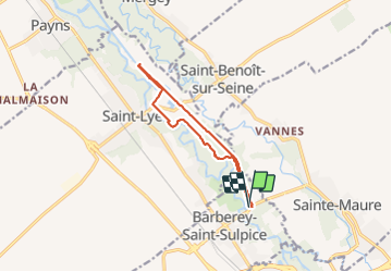
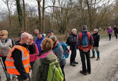
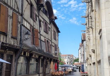
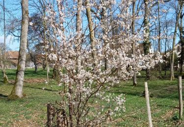
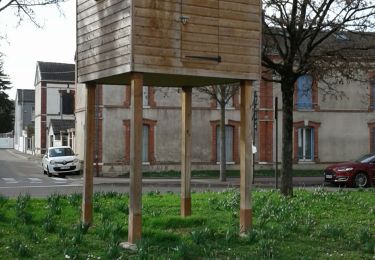
Randonnée Marche de 9,9 km à découvrir à Grand Est, Aube, Barberey-Saint-Sulpice. Cette randonnée est proposée par gildascb.
Description
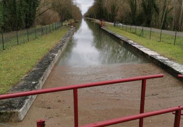
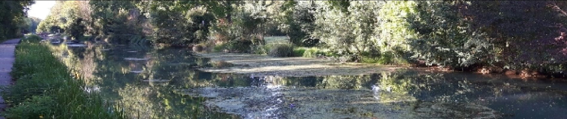
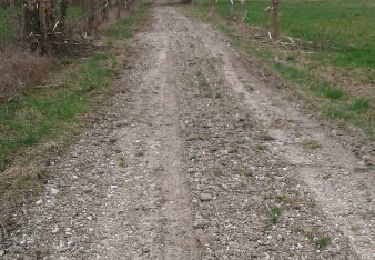
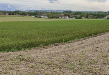
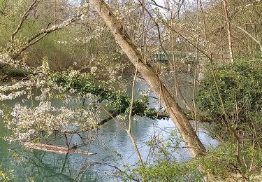
Promenade le long de l'ancien canal de la Haute Seine sur la voie Verte de Barberey-Saint-Sulpice à Saint-Oulph. Ideal pour promeneur, roller, vélo!
Localisation
Pays :
France
Région :
Grand Est
Département/Province :
Aube
Commune :
Barberey-Saint-Sulpice
Localité :
Unknown
Départ:(Dec)
Départ:(UTM)
576982 ; 5354884 (31U) N.
Commentaires
Randonnées à proximité
![Randonnée Marche Barberey-Saint-Sulpice - Montgueux Vignes et champs depuis la D 60 9,1 km - Photo](https://media.geolcdn.com/t/375/260/ext.jpg?maxdim=2&url=https%3A%2F%2Fstatic1.geolcdn.com%2Fsiteimages%2Fupload%2Ffiles%2F1553511878bg_sport_marche.png)
![Marche Marche](https://static1.geolcdn.com/sitytour/trail-icons/101.png)
Montgueux Vignes et champs depuis la D 60 9,1 km
Marche
Moyen
(1)
Barberey-Saint-Sulpice,
Grand Est,
Aube,
France
![](/images/other/stat-length.png)
9,1 km | 11,5 km-effort
2h 37min
![](https://static1.geolcdn.com/siteimages/upload/files/16400158638029165_repeat_loop_refresh_sync_direction_icon.png)
Oui
![Randonnée Marche Barberey-Saint-Sulpice - Barberey - Photo](https://media.geolcdn.com/t/375/260/3f335e63-ccc0-42cd-b543-63102f3e2b69.jpg&format=jpg&maxdim=2)
![Marche Marche](https://static1.geolcdn.com/sitytour/trail-icons/101.png)
Barberey
Marche
Moyen
Barberey-Saint-Sulpice,
Grand Est,
Aube,
France
![](/images/other/stat-length.png)
12,9 km | 13,9 km-effort
3h 6min
![](https://static1.geolcdn.com/siteimages/upload/files/16400158638029165_repeat_loop_refresh_sync_direction_icon.png)
Oui
![Randonnée Marche Barberey-Saint-Sulpice - Barberey 20,5km le 15-03-2019 - Photo](https://media.geolcdn.com/t/375/260/ext.jpg?maxdim=2&url=https%3A%2F%2Fservices.sitytrail.com%2FGeolivesWS%2FDownloadMedia.ashx%3FTrailID%3D1122585%26Media%3Dfix__20190315144709.jpg)
![Marche Marche](https://static1.geolcdn.com/sitytour/trail-icons/101.png)
Barberey 20,5km le 15-03-2019
Marche
Facile
Barberey-Saint-Sulpice,
Grand Est,
Aube,
France
![](/images/other/stat-length.png)
20 km | 22 km-effort
4h 55min
![](https://static1.geolcdn.com/siteimages/upload/files/16400158638029165_repeat_loop_refresh_sync_direction_icon.png)
Oui
![Randonnée Marche Troyes - troyes - Photo](https://media.geolcdn.com/t/375/260/d1bdc184-4bef-4fa6-8acc-7e2eef0d33ac.jpg&format=jpg&maxdim=2)
![Marche Marche](https://static1.geolcdn.com/sitytour/trail-icons/101.png)
![Randonnée Marche Pont-Sainte-Marie - PSM Villacerf 22,5km - Photo](https://media.geolcdn.com/t/375/260/78ad7f32-79ba-4f6c-a954-a8e5b0f19c40.jpg&format=jpg&maxdim=2)
![Marche Marche](https://static1.geolcdn.com/sitytour/trail-icons/101.png)
PSM Villacerf 22,5km
Marche
Difficile
Pont-Sainte-Marie,
Grand Est,
Aube,
France
![](/images/other/stat-length.png)
23 km | 24 km-effort
4h 6min
![](https://static1.geolcdn.com/siteimages/upload/files/16400158638029165_repeat_loop_refresh_sync_direction_icon.png)
Oui
![Randonnée Marche Mergey - Mergey - Photo](https://media.geolcdn.com/t/375/260/d7d95fed-3943-49e4-ab13-0e52c124f540.jpg&format=jpg&maxdim=2)
![Marche Marche](https://static1.geolcdn.com/sitytour/trail-icons/101.png)
![Randonnée Marche Barberey-Saint-Sulpice - Barberey st Lyé Pont canal 17,3km - Photo](https://media.geolcdn.com/t/375/260/fda5c776-6a52-4bbf-ad98-840b7d8d8dc2.jpg&format=jpg&maxdim=2)
![Marche Marche](https://static1.geolcdn.com/sitytour/trail-icons/101.png)
Barberey st Lyé Pont canal 17,3km
Marche
Facile
Barberey-Saint-Sulpice,
Grand Est,
Aube,
France
![](/images/other/stat-length.png)
17,3 km | 18,5 km-effort
3h 21min
![](https://static1.geolcdn.com/siteimages/upload/files/16400158638029165_repeat_loop_refresh_sync_direction_icon.png)
Oui
![Randonnée Marche Troyes - Troyes les 10 églises le 16/02/2020 - Photo](https://media.geolcdn.com/t/375/260/88bc82be-1fce-4638-a725-af0c74b92945.jpg&format=jpg&maxdim=2)
![Marche Marche](https://static1.geolcdn.com/sitytour/trail-icons/101.png)
Troyes les 10 églises le 16/02/2020
Marche
Facile
Troyes,
Grand Est,
Aube,
France
![](/images/other/stat-length.png)
12,5 km | 13,6 km-effort
2h 42min
![](https://static1.geolcdn.com/siteimages/upload/files/16400158638029165_repeat_loop_refresh_sync_direction_icon.png)
Oui
![Randonnée Marche Saint-Lyé - St Lye - Photo](https://media.geolcdn.com/t/375/260/88595de4-689e-4090-833f-03eec7f15d41.jpg&format=jpg&maxdim=2)
![Marche Marche](https://static1.geolcdn.com/sitytour/trail-icons/101.png)