![](/images/other/stat-length.png)
![Randonnée Marche Montflours - Tour du pays de Laval (Montflours Saint Germain le Fouilloux) - Photo](https://media.geolcdn.com/t/1900/400/ext.pjpeg?maxdim=2&url=https%3A%2F%2Fservices.sitytrail.com%2FGeolivesWS%2FDownloadMedia.ashx%3FTrailID%3D834664%26Media%3Dfix__20170924173701.jpg)
Tour du pays de Laval (Montflours Saint Germain le Fouilloux)
Axelloceane
Utilisateur
![Longueur](/images/other/stat-length.png)
![Altitude max](https://static1.geolcdn.com/siteimages/upload/files/1508320355ic_sort_altitude_max_24dp.png)
![Dénivelé positif](https://static1.geolcdn.com/siteimages/upload/files/1508320355ic_sort_den_pos_24dp.png)
![Km-Effort](/images/other/stat-length.png)
![Altitude min](https://static1.geolcdn.com/siteimages/upload/files/1508320355ic_sort_altitude_min_24dp.png)
![Dénivelé négatif](https://static1.geolcdn.com/siteimages/upload/files/1508320355ic_sort_den_neg_24dp.png)
![Boucle](https://static1.geolcdn.com/siteimages/upload/files/16400158638029165_repeat_loop_refresh_sync_direction_icon.png)
![Marche](https://static1.geolcdn.com/sitytour/trail-icons/101.png)
2h40
Difficulté : Facile
![Scannez ce code QR pour ouvrir la randonnée dans l'application SityTrail](https://capi.geolives.com/qq0zvz2zws4bq2lad0pu/sitytour/trails/834664/qr.png?size=200)
Application GPS de randonnée GRATUITE
À propos
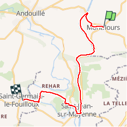
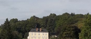
Randonnée Marche de 12,3 km à découvrir à Pays de la Loire, Mayenne, Montflours. Cette randonnée est proposée par Axelloceane.
Description
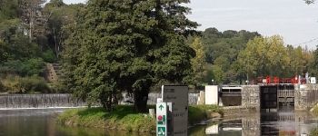
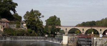
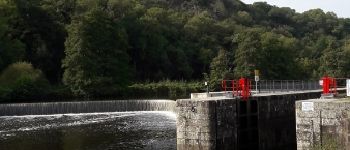
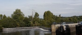
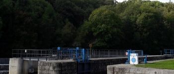
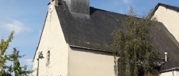
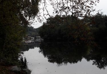
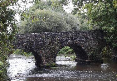
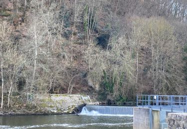
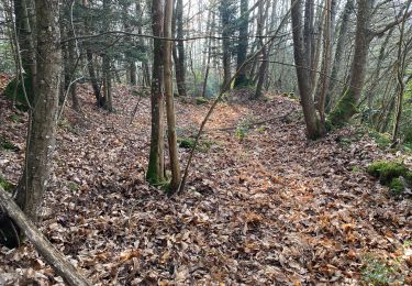
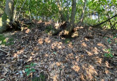
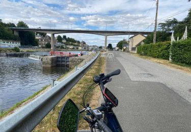
Départ de l'église de Montflours en passant derrière le lotissement pour rejoindre la D101 et ensuite tourner à gauche pour prendre le halage en passant
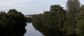
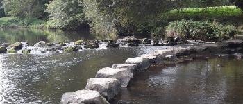
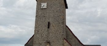
devant plusieurs écluses direction St Jean sur Mayenne. A St Jean passer sur le pont pour passer dans le village direction la route communale rejoignant St Germain le Fouilloux.A la Morinière prendre à gauche le chemin direction Quifeu en traversant l'Ernée sur des pas japonais(Si l'Ernée est en crue faire le détour par le château de Fouilloux 3km).Ensuite rejoindre Saint Germain le Fouilloux par une côte assez pentu.
Points d'intérêt
Localisation
Commentaires
Randonnées à proximité
![Randonnée Marche Andouillé - Base deCoupeau - Photo](https://media.geolcdn.com/t/375/260/55ca150e-75c2-4546-a76e-e4bd14a2b29a.jpg&format=jpg&maxdim=2)
![Marche Marche](https://static1.geolcdn.com/sitytour/trail-icons/101.png)
Marche
![](/images/other/stat-length.png)
![](https://static1.geolcdn.com/siteimages/upload/files/16400158638029165_repeat_loop_refresh_sync_direction_icon.png)
![Randonnée Marche Saint-Germain-le-Fouilloux - Tour du pays de Laval (Saint Germain le Fouilloux,Laval) - Photo](https://media.geolcdn.com/t/375/260/ext.jpg?maxdim=2&url=https%3A%2F%2Fservices.sitytrail.com%2FGeolivesWS%2FDownloadMedia.ashx%3FTrailID%3D846356%26Media%3Dfix__20171015170105.jpg)
![Marche Marche](https://static1.geolcdn.com/sitytour/trail-icons/101.png)
Marche
![](/images/other/stat-length.png)
![](https://static1.geolcdn.com/siteimages/upload/files/16400158638029165_repeat_loop_refresh_sync_direction_icon.png)
![Randonnée Marche Andouillé - Tour Andouillé - Photo](https://media.geolcdn.com/t/375/260/ext.jpg?maxdim=2&url=https%3A%2F%2Fservices.sitytrail.com%2FGeolivesWS%2FDownloadMedia.ashx%3FTrailID%3D649076%26Media%3Dfix__20161016173952.jpg)
![Marche Marche](https://static1.geolcdn.com/sitytour/trail-icons/101.png)
Marche
![](/images/other/stat-length.png)
![](https://static1.geolcdn.com/siteimages/upload/files/16400158638029165_repeat_loop_refresh_sync_direction_icon.png)
![Randonnée Marche Louverné - Louverné 7km600 - Photo](https://media.geolcdn.com/t/375/260/8edab6aa-0486-47d6-8886-dcd61084525a.jpg&format=jpg&maxdim=2)
![Marche Marche](https://static1.geolcdn.com/sitytour/trail-icons/101.png)
Marche
![](/images/other/stat-length.png)
![](https://static1.geolcdn.com/siteimages/upload/files/16400158638029165_repeat_loop_refresh_sync_direction_icon.png)
![Randonnée Marche Saint-Jean-sur-Mayenne - Le 19 02 2023 - Photo](https://media.geolcdn.com/t/375/260/3bed256a-6082-4013-9a01-bfed23329e82.jpg&format=jpg&maxdim=2)
![Marche Marche](https://static1.geolcdn.com/sitytour/trail-icons/101.png)
Marche
![](/images/other/stat-length.png)
![](https://static1.geolcdn.com/siteimages/upload/files/16400158638029165_repeat_loop_refresh_sync_direction_icon.png)
![Randonnée Marche Saint-Jean-sur-Mayenne - Chat meignan - Photo](https://media.geolcdn.com/t/375/260/2ac564fb-f045-4792-a7bb-06a94f786349.jpg&format=jpg&maxdim=2)
![Marche Marche](https://static1.geolcdn.com/sitytour/trail-icons/101.png)
Marche
![](/images/other/stat-length.png)
![](https://static1.geolcdn.com/siteimages/upload/files/16400158638029165_repeat_loop_refresh_sync_direction_icon.png)
![Randonnée Marche Saint-Jean-sur-Mayenne - Château Meignan - Photo](https://media.geolcdn.com/t/375/260/0560fdd3-5a58-4bb0-9ce4-7bd23d61c3c5.jpg&format=jpg&maxdim=2)
![Marche Marche](https://static1.geolcdn.com/sitytour/trail-icons/101.png)
Marche
![](/images/other/stat-length.png)
![](https://static1.geolcdn.com/siteimages/upload/files/16400158638029165_repeat_loop_refresh_sync_direction_icon.png)
![Randonnée Cyclotourisme Saint-Jean-sur-Mayenne - Saint Jean Mayenne - Photo](https://media.geolcdn.com/t/375/260/a5dd08bc-c437-47b2-82d9-0db74cacb4ba.jpg&format=jpg&maxdim=2)
![Cyclotourisme Cyclotourisme](https://static1.geolcdn.com/sitytour/trail-icons/204.png)
Cyclotourisme
![](/images/other/stat-length.png)
![](https://static1.geolcdn.com/siteimages/upload/files/16400158638029165_repeat_loop_refresh_sync_direction_icon.png)
![Randonnée Marche Saint-Jean-sur-Mayenne - St Jean louverné - Photo](https://media.geolcdn.com/t/375/260/ext.jpg?maxdim=2&url=https%3A%2F%2Fstatic1.geolcdn.com%2Fsiteimages%2Fupload%2Ffiles%2F1553511878bg_sport_marche.png)
![Marche Marche](https://static1.geolcdn.com/sitytour/trail-icons/101.png)
Marche
![](/images/other/stat-length.png)
![](https://static1.geolcdn.com/siteimages/upload/files/16400158638029165_repeat_loop_refresh_sync_direction_icon.png)