![](/images/other/stat-length.png)
![Randonnée Marche Vexaincourt - Col de Prayé - Photo](https://media.geolcdn.com/t/1900/400/ext.pjpeg?maxdim=2&url=https%3A%2F%2Fstatic1.geolcdn.com%2Fsiteimages%2Fupload%2Ffiles%2F1553511878bg_sport_marche.png)
Col de Prayé
Le_Grand
Utilisateur
![Longueur](/images/other/stat-length.png)
Longueur
6,1 km
![Altitude max](https://static1.geolcdn.com/siteimages/upload/files/1508320355ic_sort_altitude_max_24dp.png)
Altitude max
808 m
![Dénivelé positif](https://static1.geolcdn.com/siteimages/upload/files/1508320355ic_sort_den_pos_24dp.png)
Dénivelé positif
154 m
![Km-Effort](/images/other/stat-length.png)
Km-Effort
8,2 km
![Altitude min](https://static1.geolcdn.com/siteimages/upload/files/1508320355ic_sort_altitude_min_24dp.png)
Altitude min
683 m
![Dénivelé négatif](https://static1.geolcdn.com/siteimages/upload/files/1508320355ic_sort_den_neg_24dp.png)
Dénivelé négatif
159 m
![Boucle](https://static1.geolcdn.com/siteimages/upload/files/16400158638029165_repeat_loop_refresh_sync_direction_icon.png)
Boucle
Oui
Date de création :
2018-09-03 11:42:50.52
Dernière modification :
2018-09-03 11:42:50.529
![Marche](https://static1.geolcdn.com/sitytour/trail-icons/101.png)
1h52
Difficulté : Facile
![Scannez ce code QR pour ouvrir la randonnée dans l'application SityTrail](https://capi.geolives.com/qq0zvz2zws4bq2lad0pu/sitytour/trails/822792/qr.png?size=200)
Application GPS de randonnée GRATUITE
À propos
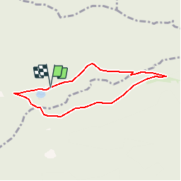
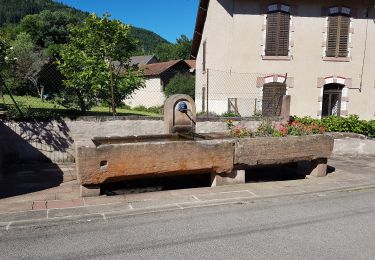
Randonnée Marche de 6,1 km à découvrir à Grand Est, Vosges, Vexaincourt. Cette randonnée est proposée par Le_Grand.
Description
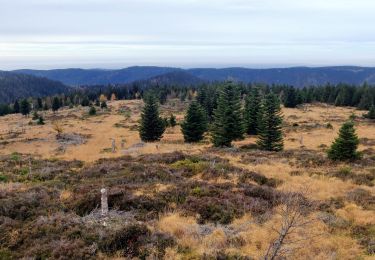
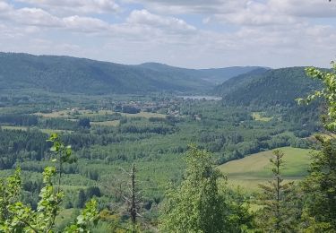
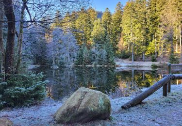
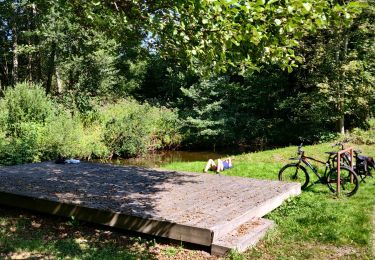
A partir du lac de la Maix montée vers le col du Prayé, la route du même nom en passant devant le refuge du club Alpin, retour par le Haut du Bon Dieu
Localisation
Pays :
France
Région :
Grand Est
Département/Province :
Vosges
Commune :
Vexaincourt
Localité :
Unknown
Départ:(Dec)
Départ:(UTM)
357914 ; 5371074 (32U) N.
Commentaires
Randonnées à proximité
![Randonnée Marche Grandfontaine - Donon sentier des casemates - sud - Photo](https://media.geolcdn.com/t/375/260/ext.jpg?maxdim=2&url=https%3A%2F%2Fservices.sitytrail.com%2FGeolivesWS%2FDownloadMedia.ashx%3FTrailID%3D425613%26Media%3Dfix__20150525151051.jpg)
![Marche Marche](https://static1.geolcdn.com/sitytour/trail-icons/101.png)
Donon sentier des casemates - sud
Marche
Moyen
(1)
Grandfontaine,
Grand Est,
Bas-Rhin,
France
![](/images/other/stat-length.png)
12,6 km | 16,9 km-effort
4h 13min
![](https://static1.geolcdn.com/siteimages/upload/files/16400158638029165_repeat_loop_refresh_sync_direction_icon.png)
Oui
![Randonnée Marche Moussey - Col de Prayé - Photo](https://media.geolcdn.com/t/375/260/ext.jpg?maxdim=2&url=https%3A%2F%2Fservices.sitytrail.com%2FGeolivesWS%2FDownloadMedia.ashx%3FTrailID%3D199313%26Media%3D9ff361be-ea22-414c-86b5-f009d7dbf8c7.jpeg)
![Marche Marche](https://static1.geolcdn.com/sitytour/trail-icons/101.png)
Col de Prayé
Marche
Difficile
(1)
Moussey,
Grand Est,
Vosges,
France
![](/images/other/stat-length.png)
16,8 km | 23 km-effort
6h 55min
![](https://static1.geolcdn.com/siteimages/upload/files/16400158638029165_repeat_loop_refresh_sync_direction_icon.png)
Oui
![Randonnée Marche Grandfontaine - 2022-11-12 Marche Grandfontaine Tête Mathis Col de Praye La Corbeille - Photo](https://media.geolcdn.com/t/375/260/b167e9d9-cb78-437f-9a9a-00585292dbd2.jpg&format=jpg&maxdim=2)
![Marche Marche](https://static1.geolcdn.com/sitytour/trail-icons/101.png)
2022-11-12 Marche Grandfontaine Tête Mathis Col de Praye La Corbeille
Marche
Moyen
Grandfontaine,
Grand Est,
Bas-Rhin,
France
![](/images/other/stat-length.png)
15,3 km | 23 km-effort
4h 34min
![](https://static1.geolcdn.com/siteimages/upload/files/16400158638029165_repeat_loop_refresh_sync_direction_icon.png)
Oui
![Randonnée Marche Allarmont - 2019-06-08 Marche Allarmont et ses rochers - Photo](https://media.geolcdn.com/t/375/260/b4eab987-1d3a-475a-8836-184432a12f13.jpg&format=jpg&maxdim=2)
![Marche Marche](https://static1.geolcdn.com/sitytour/trail-icons/101.png)
2019-06-08 Marche Allarmont et ses rochers
Marche
Très facile
Allarmont,
Grand Est,
Vosges,
France
![](/images/other/stat-length.png)
10,7 km | 16,5 km-effort
2h 55min
![](https://static1.geolcdn.com/siteimages/upload/files/16400158638029165_repeat_loop_refresh_sync_direction_icon.png)
Oui
![Randonnée Marche La Broque - Etang du Coucou - Château de Salm - Chatte pendue - Haute Loge - Chapelle Bipierre - Photo](https://media.geolcdn.com/t/375/260/3f3d8c9b-ee27-4b35-9475-9654f32e5716.jpg&format=jpg&maxdim=2)
![Marche Marche](https://static1.geolcdn.com/sitytour/trail-icons/101.png)
Etang du Coucou - Château de Salm - Chatte pendue - Haute Loge - Chapelle Bip...
Marche
Très difficile
La Broque,
Grand Est,
Bas-Rhin,
France
![](/images/other/stat-length.png)
19,9 km | 29 km-effort
6h 32min
![](https://static1.geolcdn.com/siteimages/upload/files/16400158638029165_repeat_loop_refresh_sync_direction_icon.png)
Oui
![Randonnée Marche Grandfontaine - Col du Donon-lac de la Maix - Photo](https://media.geolcdn.com/t/375/260/ext.jpg?maxdim=2&url=https%3A%2F%2Fstatic1.geolcdn.com%2Fsiteimages%2Fupload%2Ffiles%2F1553511878bg_sport_marche.png)
![Marche Marche](https://static1.geolcdn.com/sitytour/trail-icons/101.png)
Col du Donon-lac de la Maix
Marche
Très difficile
(2)
Grandfontaine,
Grand Est,
Bas-Rhin,
France
![](/images/other/stat-length.png)
16,3 km | 21 km-effort
4h 52min
![](https://static1.geolcdn.com/siteimages/upload/files/16400158638029165_repeat_loop_refresh_sync_direction_icon.png)
Oui
![Randonnée Marche Vexaincourt - Vexaincourt - lac et chapelle de la Maix - Photo](https://media.geolcdn.com/t/375/260/b6a0a555-0c6b-480c-999e-1bea2f6bffd7.jpg&format=jpg&maxdim=2)
![Marche Marche](https://static1.geolcdn.com/sitytour/trail-icons/101.png)
Vexaincourt - lac et chapelle de la Maix
Marche
Moyen
Vexaincourt,
Grand Est,
Vosges,
France
![](/images/other/stat-length.png)
16,3 km | 24 km-effort
3h 50min
![](https://static1.geolcdn.com/siteimages/upload/files/16400158638029165_repeat_loop_refresh_sync_direction_icon.png)
Oui
![Randonnée Randonnée équestre Moussey - fady col de praye - Photo](https://media.geolcdn.com/t/375/260/8e0e9e46-1ff5-4705-b615-c694bb127e7a.jpg&format=jpg&maxdim=2)
![Randonnée équestre Randonnée équestre](https://static1.geolcdn.com/sitytour/trail-icons/301.png)
fady col de praye
Randonnée équestre
Difficile
Moussey,
Grand Est,
Vosges,
France
![](/images/other/stat-length.png)
30 km | 41 km-effort
4h 58min
![](https://static1.geolcdn.com/siteimages/upload/files/16400158638029165_repeat_loop_refresh_sync_direction_icon.png)
Oui
![Randonnée V.T.T. Raon-sur-Plaine - 2021-09-06 Sortie VTT Raon sur Plaine Raon Etape - Photo](https://media.geolcdn.com/t/375/260/a2531a1f-db4b-4f93-bf93-5aa37474f2ca.jpg&format=jpg&maxdim=2)
![V.T.T. V.T.T.](https://static1.geolcdn.com/sitytour/trail-icons/202.png)
2021-09-06 Sortie VTT Raon sur Plaine Raon Etape
V.T.T.
Très difficile
Raon-sur-Plaine,
Grand Est,
Vosges,
France
![](/images/other/stat-length.png)
62 km | 73 km-effort
3h 34min
![](https://static1.geolcdn.com/siteimages/upload/files/16400158638029165_repeat_loop_refresh_sync_direction_icon.png)
Oui